Coal Hill

Hill, Mountain in Staffordshire East Staffordshire

England

Coal Hill

Duffield Lane Even the minor roads around here have some very straight stretches.
Duffield Lane Credit: Malcolm Neal

Coal Hill, located in Staffordshire, England, is a prominent hill that forms part of the picturesque landscape of the region. With an elevation of approximately 246 meters (807 feet), it stands as a notable feature in the Staffordshire Moorlands area. The hill derives its name from the rich coal deposits found in the area, which have played a significant role in shaping the local history and economy.

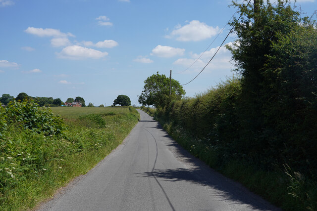
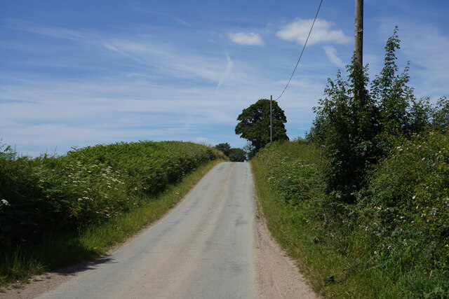
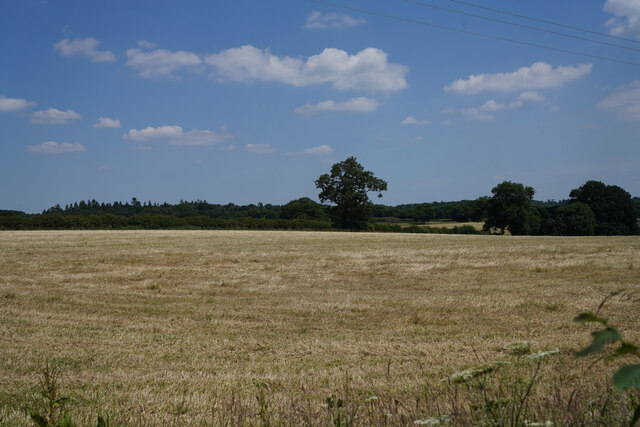
Coal Hill is characterized by its gently sloping sides, making it accessible to visitors who wish to explore its natural beauty. The hill is covered in lush vegetation, comprising a mix of grasses, shrubs, and trees, providing a habitat for a diverse range of flora and fauna. The landscape of Coal Hill is dotted with several footpaths and trails, allowing hikers and nature enthusiasts to enjoy the stunning views and observe the wildlife that inhabits the area.

Aside from its natural beauty, Coal Hill holds historical significance. In the past, coal mining was a major industry in this region, and the hill served as a source of valuable coal deposits. The mining activities have left their mark on the landscape, with remnants of old mine shafts and structures still visible today. These historical remnants serve as a reminder of the area's industrial past and offer insight into the lives of the miners who once worked there.

Overall, Coal Hill in Staffordshire is an intriguing destination, offering a blend of natural beauty, historical significance, and recreational opportunities for visitors to explore and appreciate.

If you have any feedback on the listing, please let us know in the comments section below.

Coal Hill Images

Images are sourced within 2km of 52.811937/-1.7899245 or Grid Reference SK1423. Thanks to Geograph Open Source API. All images are credited.

Duffield Lane Even the minor roads around here have some very straight stretches.
Duffield Lane
Even the minor roads around here have some very straight stretches.
Narrow and lined with hedges A good job this was a quiet road as there is hardly anywhere for cars to pass especially as I stop to take pictures.
Narrow and lined with hedges
A good job this was a quiet road as there is hardly anywhere for cars to pass especially as I stop to take pictures.
A healthy looking crop Looking across a field of wheat.
A healthy looking crop
Looking across a field of wheat.
Thorney Lanes Standing on a small triangle of grass looking along Thorney Lanes.
Thorney Lanes
Standing on a small triangle of grass looking along Thorney Lanes.
Thorney Lanes This is just before the junction with Abbots Bromley Road.
Thorney Lanes
This is just before the junction with Abbots Bromley Road.
Yoxall Road This road has recently been tar sprayed and covered in limestone chippings and has a 10 MPH speed limit to prevent damage to the paintwork.
Yoxall Road
This road has recently been tar sprayed and covered in limestone chippings and has a 10 MPH speed limit to prevent damage to the paintwork.
Approaching Hoar Cross Further along Yoxall Road near the cross roads with Hoar Cross just visible, not that it is a very big place.
Approaching Hoar Cross
Further along Yoxall Road near the cross roads with Hoar Cross just visible, not that it is a very big place.
Brakenhurst Road With deep shadow on one side and bright sunlight on the other, the camera has coped with the difference quite well.
Brakenhurst Road
With deep shadow on one side and bright sunlight on the other, the camera has coped with the difference quite well.
Scotch Hill Aptly named as the road is quite steep.
Scotch Hill
Aptly named as the road is quite steep.
The silage has been cut A very bare field with just the cut ends of dried grasses showing.
The silage has been cut
A very bare field with just the cut ends of dried grasses showing.
Direction Sign - Signpost in Hoar Cross Located on the southwest side of the crossroads of Newborough Road, Abbots Bromley Road and Hoar Cross Road in Hoar Cross parish. 3 arms and perforated disc finial. See also <a title="https://www.geograph.org.uk/photo/3555123" href="https://www.geograph.org.uk/photo/3555123">Link</a>.

Milestone Society National ID: ST_SK1323
Direction Sign - Signpost in Hoar Cross
Located on the southwest side of the crossroads of Newborough Road, Abbots Bromley Road and Hoar Cross Road in Hoar Cross parish. 3 arms and perforated disc finial. See also Link. Milestone Society National ID: ST_SK1323
Woodland at Roost Hill It is interesting to contrast the attitude of private forestry operators (as here, no public access) with that of the Forestry Commission who regard public access and recreation as part of their responsibilities.
Woodland at Roost Hill
It is interesting to contrast the attitude of private forestry operators (as here, no public access) with that of the Forestry Commission who regard public access and recreation as part of their responsibilities.
The "Noon Column" Jackson's Bank This is one of six noon columns created by the sculptor David Nash, one being located in each of the six main areas of the National Forest. The column is so positioned that a thin pencil of light will pass through the slot at true noon. <span class="nowrap"><a title="http://www.landshapes.org/newsandevents/news/Physicalprojects.php" rel="nofollow ugc noopener" href="http://www.landshapes.org/newsandevents/news/Physicalprojects.php">Link</a><img style="margin-left:2px;" alt="External link" title="External link - shift click to open in new window" src="https://s1.geograph.org.uk/img/external.png" width="10" height="10"/></span>
The "Noon Column" Jackson's Bank
This is one of six noon columns created by the sculptor David Nash, one being located in each of the six main areas of the National Forest. The column is so positioned that a thin pencil of light will pass through the slot at true noon. LinkExternal link
Hoar Cross A traditional signpost, topped with the Staffordshire knot, stands at this cross-roads. The Menell Ingram Arms public house is partially hidden behind the tree.
Hoar Cross
A traditional signpost, topped with the Staffordshire knot, stands at this cross-roads. The Menell Ingram Arms public house is partially hidden behind the tree.
Hay meadow and hay bales Seen from the road between Hoar Cross and Newborough
Hay meadow and hay bales
Seen from the road between Hoar Cross and Newborough
Needwood Jubilee Hall, Newchurch On the A515. Newchurch is scarcely a village, but this community hall serves the whole of the northern part of Needwood Forest.
Needwood Jubilee Hall, Newchurch
On the A515. Newchurch is scarcely a village, but this community hall serves the whole of the northern part of Needwood Forest.
The Sanctuary, Newchurch Although there are many chapels which have been converted into residences, it is comparatively rare for a full-blown church with tower to be given the same treatment. On the A515, Ashbourne to Lichfield road.
The Sanctuary, Newchurch
Although there are many chapels which have been converted into residences, it is comparatively rare for a full-blown church with tower to be given the same treatment. On the A515, Ashbourne to Lichfield road.
The switchback road between Scotch Hill and Newchurch Typical of the quiet straight roads which traverse Needwood Forest
The switchback road between Scotch Hill and Newchurch
Typical of the quiet straight roads which traverse Needwood Forest
Show me another place!

Coal Hill is located at Grid Ref: SK1423 (Lat: 52.811937, Lng: -1.7899245)

Administrative County: Staffordshire

District: East Staffordshire

Police Authority: Staffordshire

What 3 Words

///oiled.scratches.feed. Near Yoxall, Staffordshire

Related Wikis

Tatenhill Airfield

Tatenhill Airfield (ICAO: EGBM) is a licensed airfield operated by Tatenhill Aviation Ltd. Its CAA Ordinary Licence (Number P813) allows flights for the...

Newborough, Staffordshire

Newborough is a village and civil parish in the county of Staffordshire, England. It is located 3 miles (5 km) south west of Hanbury and 8 miles (13 km...

Church of the Holy Angels, Hoar Cross

The Church of the Holy Angels is an Anglican church in Hoar Cross, Staffordshire, England. It is a Grade I listed building. == History == It was built...

RAF Tatenhill

RAF Tatenhill is a former Royal Air Force satellite airfield in Tatenhill, Staffordshire, England, 4 NM (7.4 km; 4.6 mi) west of Burton on Trent. It was...

Nearby Amenities

Located within 500m of 52.811937,-1.7899245
Ford: yes
Lat/Long: 52.8121061/-1.7862674
Ford: yes
Lat/Long: 52.8117433/-1.7855539
Barrier: bollard
Lat/Long: 52.8115241/-1.7858551
The data included in this document is from www.openstreetmap.org. The data is made available under ODbL.

Have you been to Coal Hill?

Leave your review of Coal Hill below (or comments, questions and feedback).