Bent Hill

Hill, Mountain in Yorkshire Richmondshire

England

Bent Hill

West Applegarth Farm, Swaledale The crags at left guard the entrance to Deep Dale and Whitcliffe Scar lies half-hidden above the trees further to the right.
West Applegarth Farm, Swaledale Credit: Greg Fitchett

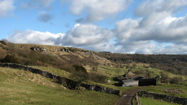
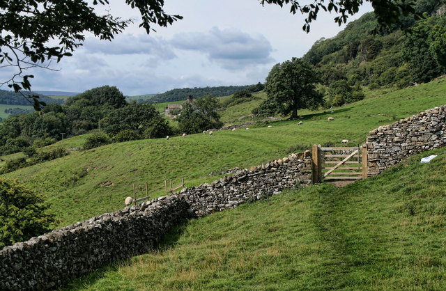
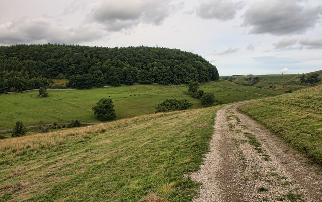
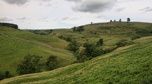
Bent Hill is a prominent geographical feature located in the county of Yorkshire, England. It is classified as a hill and is situated in the picturesque Yorkshire Dales National Park. With an elevation of approximately 400 meters (1,300 feet), Bent Hill offers breathtaking panoramic views of the surrounding landscape.

The hill is characterized by its gentle slopes and distinctive shape, which gives it its name. Its unique bend-like structure is a result of geological processes that have occurred over millions of years. The hill is predominantly covered in lush green vegetation, including grasses and shrubs, which add to its scenic beauty.

Bent Hill is a popular destination for outdoor enthusiasts and nature lovers alike. It offers a variety of recreational activities such as hiking, walking, and birdwatching. There are several well-marked trails that lead to the summit, providing visitors with an opportunity to explore the diverse flora and fauna of the area.

The hill is also home to an array of wildlife, including rabbits, deer, and various bird species. Nature enthusiasts can often spot kestrels and buzzards soaring in the skies above, adding to the enchanting atmosphere of Bent Hill.

Bent Hill is easily accessible, with nearby parking facilities and public transportation options available. It attracts visitors throughout the year, with each season offering a different charm. Whether it's the vibrant colors of spring, the golden hues of autumn, or the peaceful snow-covered slopes in winter, Bent Hill offers a truly memorable experience for all who visit.

If you have any feedback on the listing, please let us know in the comments section below.
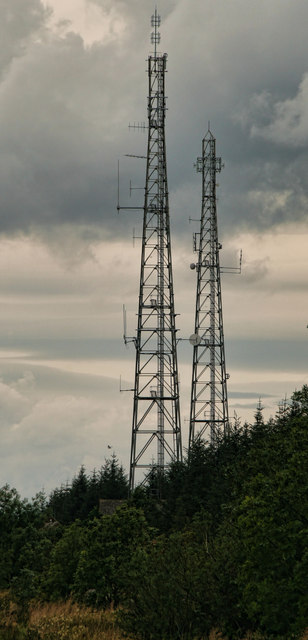
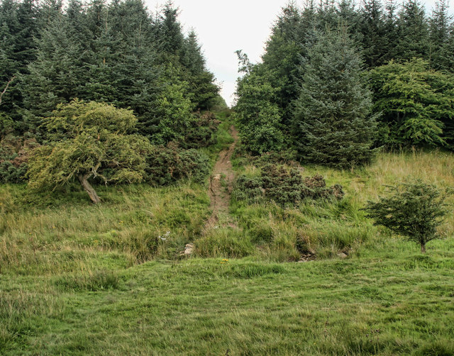
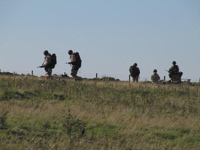
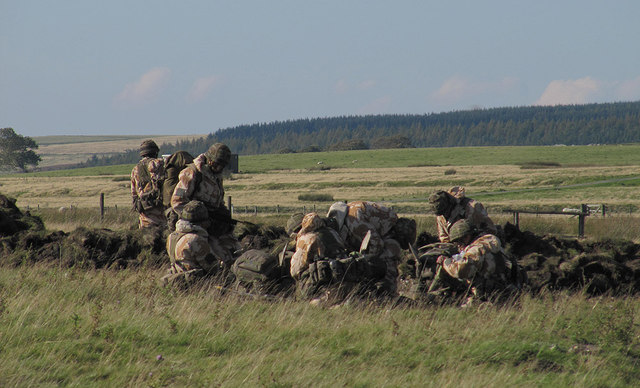
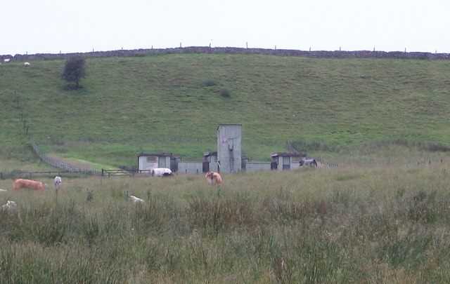
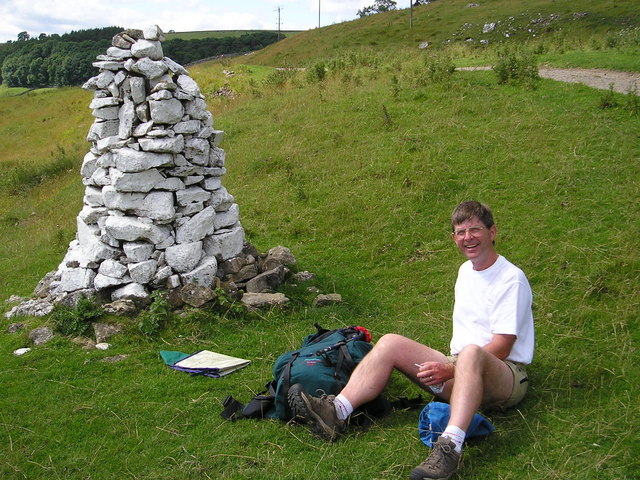
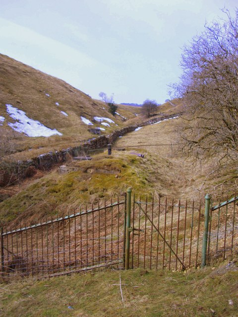
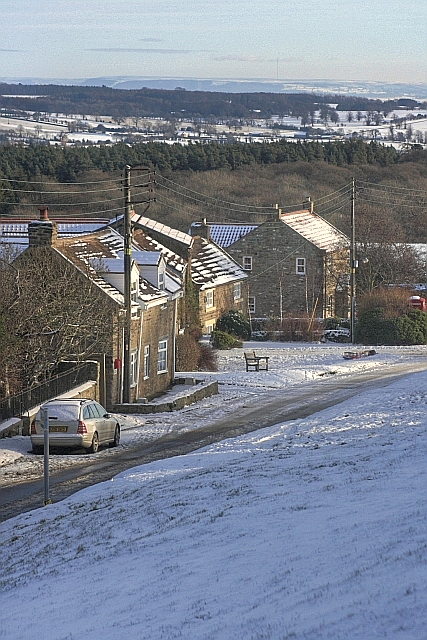
Bent Hill Images

Images are sourced within 2km of 54.426364/-1.8134369 or Grid Reference NZ1203. Thanks to Geograph Open Source API. All images are credited.

West Applegarth Farm, Swaledale The crags at left guard the entrance to Deep Dale and Whitcliffe Scar lies half-hidden above the trees further to the right.
West Applegarth Farm, Swaledale
The crags at left guard the entrance to Deep Dale and Whitcliffe Scar lies half-hidden above the trees further to the right.
Low Applegarth Looking along the bridleway towards West Applegarth.
Low Applegarth
Looking along the bridleway towards West Applegarth.
Clapgate Gill View looking across Clapgate Gill.
Clapgate Gill
View looking across Clapgate Gill.
Clapgate Gill View looking up Clapgate Gill.
Clapgate Gill
View looking up Clapgate Gill.
Richmond Out Moor North Yorkshire Police communications masts at Richmond Out Moor.
Richmond Out Moor
North Yorkshire Police communications masts at Richmond Out Moor.
Richmond Out Moor Track crossing Aske beck in the plantation on Richmond Out Moor.
Richmond Out Moor
Track crossing Aske beck in the plantation on Richmond Out Moor.
Trainee soldiers The rather startling sight of armed soldiers on Feldom Ranges.
Trainee soldiers
The rather startling sight of armed soldiers on Feldom Ranges.
Military Exercises By the road, Feldom Ranges.
Military Exercises
By the road, Feldom Ranges.
Lime Kiln on High Moor Shown in use up to 1884. But was marked as disused on the 1895 map.
Lime Kiln on High Moor
Shown in use up to 1884. But was marked as disused on the 1895 map.
MOD Buildings on High Hag Moor Eastern edge of the Feldom Ranges, an area of Ministry of Defence land with live firing on days when the red flags are flying.
MOD Buildings on High Hag Moor
Eastern edge of the Feldom Ranges, an area of Ministry of Defence land with live firing on days when the red flags are flying.
White Cairn on Applegarth Scar This cairn is on the route of the Dales Walk not far from Richmond.
White Cairn on Applegarth Scar
This cairn is on the route of the Dales Walk not far from Richmond.
Very muddy footpath in the woods, Richmond Out Moor The definitive rights-of-way map shows a bridleway some way west of this path, while this muddy horror show is also shown on OS maps with the old black dotted line symbol. However, in reality, only this route exists on (or should I say rapidly sinking into) the ground. At least it is easy enough to follow in the fog !
Very muddy footpath in the woods, Richmond Out Moor
The definitive rights-of-way map shows a bridleway some way west of this path, while this muddy horror show is also shown on OS maps with the old black dotted line symbol. However, in reality, only this route exists on (or should I say rapidly sinking into) the ground. At least it is easy enough to follow in the fog !
Mossy wall in the forest, Richmond Out Moor The weather on the day of this photograph does much to explain the amount of moss on the old wall as the humidity was high enough to keep it all very moist, even where not being dripped on by the overhanging trees. The forest will also protect it from all but late evening sun, too, in the summer when weather is less favourable (for aquatic life).
Mossy wall in the forest, Richmond Out Moor
The weather on the day of this photograph does much to explain the amount of moss on the old wall as the humidity was high enough to keep it all very moist, even where not being dripped on by the overhanging trees. The forest will also protect it from all but late evening sun, too, in the summer when weather is less favourable (for aquatic life).
Reservoir in Feldom Gill Covered reservoir and capped spring heads in Feldom Gill.
Reservoir in Feldom Gill
Covered reservoir and capped spring heads in Feldom Gill.
Scant remains of a level at Feldom Mine The veins at Feldom were mostly of lead (although some copper was found) and usually chased the vein with shallow shafts. This level is just below the main mining ground, and has a large spoil tip on the beck side.
Scant remains of a level at Feldom Mine
The veins at Feldom were mostly of lead (although some copper was found) and usually chased the vein with shallow shafts. This level is just below the main mining ground, and has a large spoil tip on the beck side.
Snow Cornices at Low Feldom
Hey Gill
Hey Gill
Feldom Gill
Feldom Gill
Show me another place!

Bent Hill is located at Grid Ref: NZ1203 (Lat: 54.426364, Lng: -1.8134369)

Division: North Riding

Administrative County: North Yorkshire

District: Richmondshire

Police Authority: North Yorkshire

What 3 Words

///intruding.excavated.decide. Near Richmond, North Yorkshire

Nearby Locations

High Hag Moor Bent Hill

Related Wikis

Applegarth, North Yorkshire

Applegarth is a historic settlement located north of the River Swale in Yorkshire, England. It lies about three-quarters of a mile north-east of the village...

Scott Trial

The Scott Trial is a British motorcycle trials competition dating from 1914 run over an off-road course of approximately 70 miles. One of the most challenging...

Marske, west North Yorkshire

Marske is a village and civil parish in the Richmondshire district of North Yorkshire, England, situated in lower Swaledale on the boundary of the Yorkshire...

Kirby Hill, Richmondshire

Kirby Hill, historically also known as Kirby-on-the-Hill, is a village and civil parish in the Richmondshire district of North Yorkshire, England. The...

Skelton, west North Yorkshire

Skelton is a small hamlet in the Richmondshire district of North Yorkshire, England. It is within the Yorkshire Dales National Park near the larger village...

Hudswell, North Yorkshire

Hudswell is a village and civil parish on the border of the Yorkshire Dales, in North Yorkshire, England. The population at the ONS Census 2011 was 353...

Whashton

Whashton is a village and civil parish in the Richmondshire district of North Yorkshire, England. == History == The name is of an uncertain origin and...

Gayles, North Yorkshire

Gayles is a village and civil parish in the Richmondshire district of North Yorkshire, England. Gayles is established in the district ward of Gilling West...

Have you been to Bent Hill?

Leave your review of Bent Hill below (or comments, questions and feedback).