Bramberry Hill

Hill, Mountain in Yorkshire Harrogate

England

Bramberry Hill

Farmland around Pace Gate Farm The road is the old A59, now bypassed by a new road just out of the photograph on the right. It's hard to imagine all the traffic and big trucks going along this narrow road.
Farmland around Pace Gate Farm Credit: Malcolm Street

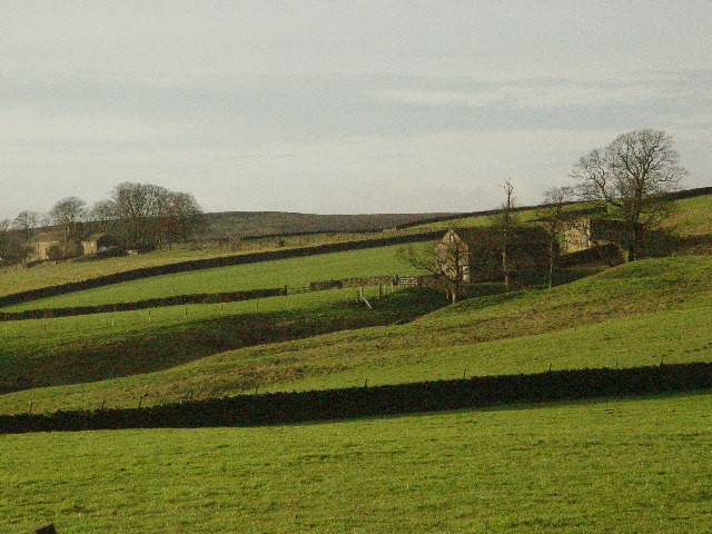
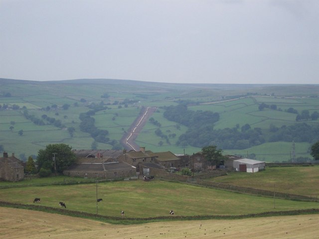
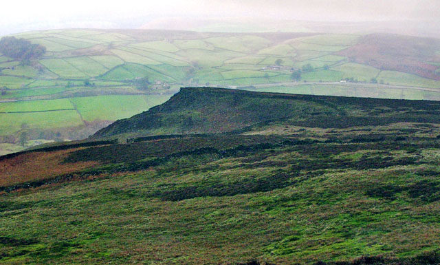
Bramberry Hill is a picturesque hill located in the county of Yorkshire, England. Standing at an elevation of approximately 500 meters, it is often described as a prominent landmark in the region. The hill is situated amidst the stunning natural beauty of the Yorkshire Dales, surrounded by rolling green fields and meandering rivers.

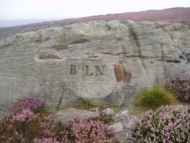
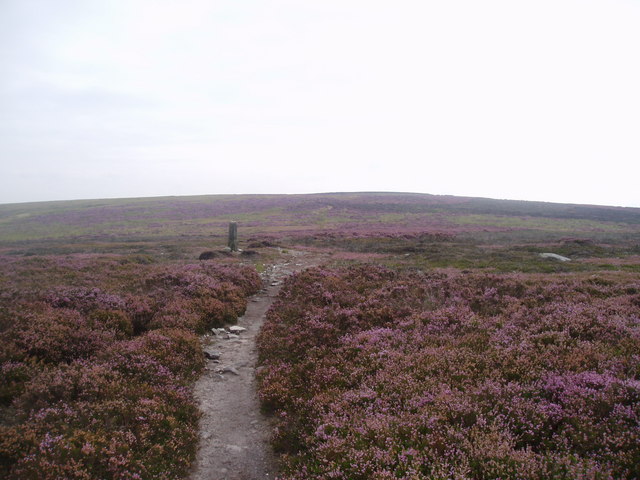
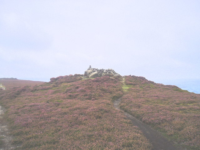
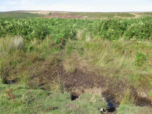
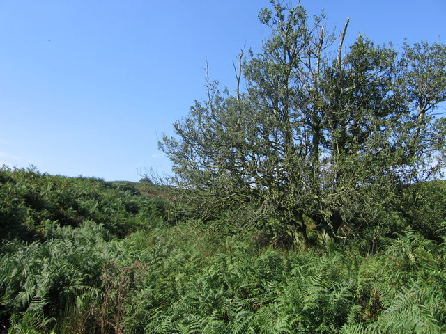
The summit of Bramberry Hill offers breathtaking panoramic views of the surrounding countryside, making it a popular destination for hikers and nature enthusiasts. On a clear day, one can see for miles, with sweeping vistas of the Dales and the distant peaks of the Pennines. The hill is adorned with a variety of flora and fauna, including heather, bracken, and wildflowers, adding to its charm and appeal.

Bramberry Hill is known for its diverse wildlife, with numerous species of birds, mammals, and insects calling it home. Birdwatchers often visit the hill in search of rare species, such as red kites and peregrine falcons, which nest in the rocky crevices.

The hill is also steeped in history, with traces of ancient settlements and farming practices evident in the surrounding landscape. Archaeological discoveries have revealed the presence of Neolithic and Bronze Age artifacts, providing insights into the early human habitation of the area.

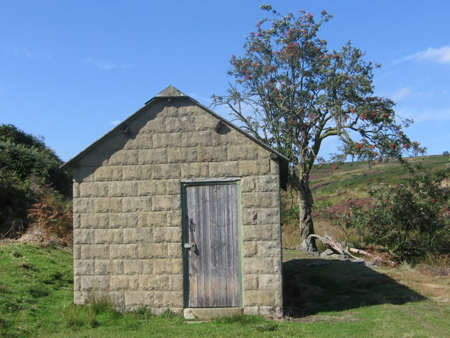
Access to Bramberry Hill is facilitated by a network of well-marked footpaths, making it easily accessible to visitors of all ages and abilities. The hill offers a peaceful and serene escape from the bustle of urban life, inviting individuals to immerse themselves in the tranquility and natural wonders of Yorkshire's countryside.

If you have any feedback on the listing, please let us know in the comments section below.

Bramberry Hill Images

Images are sourced within 2km of 53.976452/-1.8227224 or Grid Reference SE1153. Thanks to Geograph Open Source API. All images are credited.

Farmland around Pace Gate Farm The road is the old A59, now bypassed by a new road just out of the photograph on the right. It's hard to imagine all the traffic and big trucks going along this narrow road.
Farmland around Pace Gate Farm
The road is the old A59, now bypassed by a new road just out of the photograph on the right. It's hard to imagine all the traffic and big trucks going along this narrow road.
A59 on Kex Gill Moor
Badger Gill Beck and Farm With Bent Hill Farm in the distance (left).
Badger Gill Beck and Farm
With Bent Hill Farm in the distance (left).
Kexgill Farm
Kexgill Farm
Middleton Moor, Ilkley Actually taken from the other side of the Wharfe valley on Cocking Lane above Addingham. Picture shows construction of a pipeline across the moor. What is it - any ideas??
Middleton Moor, Ilkley
Actually taken from the other side of the Wharfe valley on Cocking Lane above Addingham. Picture shows construction of a pipeline across the moor. What is it - any ideas??
Milepost on Gawk Hall Ridge Stone pillar that indicates that Ilkley is 3 miles away, and Ripon is an indefinite distance as the writing has faded
Milepost on Gawk Hall Ridge
Stone pillar that indicates that Ilkley is 3 miles away, and Ripon is an indefinite distance as the writing has faded
High Moss Broad ridge of moorland to the south east of Round Hill and Gawk Hall
High Moss
Broad ridge of moorland to the south east of Round Hill and Gawk Hall
Boundary marker The boundary between the parishes of Beamsley and Langbar Nesfield marked on this large boulder instead of a normal stone boundary marker
Boundary marker
The boundary between the parishes of Beamsley and Langbar Nesfield marked on this large boulder instead of a normal stone boundary marker
Bramberry Hill Footpath leading through heather to Bramberry Hill with parish boundary marker.
Bramberry Hill
Footpath leading through heather to Bramberry Hill with parish boundary marker.
Boundary stone Boundary stone at Catholic Gate, near Round Hill
Boundary stone
Boundary stone at Catholic Gate, near Round Hill
Track on Gawk Hill Ridge Track leading from Catholic Gate towards Gawk Hill Gate and on to Lippersley Pike.
Track on Gawk Hill Ridge
Track leading from Catholic Gate towards Gawk Hill Gate and on to Lippersley Pike.
Detail of Mile Post on Gawk Hall Ridge 12 miles to Ripon. Ilkley 3 miles
Detail of Mile Post on Gawk Hall Ridge
12 miles to Ripon. Ilkley 3 miles
The Old Pike Cairn on the Beamsley Beacon Ridge.
The Old Pike
Cairn on the Beamsley Beacon Ridge.
Loftshaw Gill Shooting Shelter
ROMAN ROAD (course of), Middleton Moor Located using Garmin GPS! 
The point at which the course of the Roman road crosses the lower reaches of Loftshaw Gill.
ROMAN ROAD (course of), Middleton Moor
Located using Garmin GPS! The point at which the course of the Roman road crosses the lower reaches of Loftshaw Gill.
Middle Gill, Bracken Ridge The gill (to the left of the tree) can be heard but not seen, completely obscured by bracken!
Middle Gill, Bracken Ridge
The gill (to the left of the tree) can be heard but not seen, completely obscured by bracken!
Black Hill Farm
Black Hill Farm
Little Crag, Beamsley Moor Looking North to Little Crag with Summerscales and A59 beyond.
Little Crag, Beamsley Moor
Looking North to Little Crag with Summerscales and A59 beyond.
Show me another place!

Bramberry Hill is located at Grid Ref: SE1153 (Lat: 53.976452, Lng: -1.8227224)

Division: West Riding

Administrative County: North Yorkshire

District: Harrogate

Police Authority: North Yorkshire

What 3 Words

///failed.ironclad.rooting. Near Addingham, West Yorkshire

Related Wikis

Hazlewood with Storiths

Hazlewood with Storiths is a civil parish in the Craven district of North Yorkshire, England. The population of the civil parish as of the 2011 census...

Hazlewood

Hazlewood is a hamlet in the English county of North Yorkshire. Hazlewood lies to the east of the town of Skipton by 7.5 miles (12.1 km) and is located...

Kex Gill Bypass

The Kex Gill Bypass is a future stretch of A-road across Kex Gill Moor to Blubberhouses in North Yorkshire, England. The route is part of the A59 road...

Beamsley Hospital

Beamsley Hospital is an Almshouse building at Beamsley, near Skipton in North Yorkshire, and founded in 1593 by the Lady Margaret Russell, the Countess...

Nearby Amenities

Located within 500m of 53.976452,-1.8227224
Bramberry Hill
Natural: ridge
Source: OS 1:25k
Lat/Long: 53.9754413/-1.8231878
Popple Well Ridge
Natural: ridge
Source: OS 1:25k
Lat/Long: 53.9731822/-1.822351
Popple Well
Source: NLS-OS-NatGrid-110k-1940-60
Lat/Long: 53.9725973/-1.8192674
Barrier: stile
Stile: stepover
Lat/Long: 53.9773818/-1.8153013
Historic: boundary_stone
Source: NLS-OS-1st_Series
Lat/Long: 53.9767713/-1.8228346
Historic: boundary_stone
Source: NLS-OS-1st_Series
Lat/Long: 53.9776799/-1.8181783
Historic: boundary_stone
Source: NLS-OS-1st_Series
Lat/Long: 53.9736542/-1.8194014
Historic: boundary_stone
Source: NLS-OS-1st_Series
Lat/Long: 53.9773373/-1.8155229
Historic: boundary_stone
Source: NLS-OS-1st_Series
Lat/Long: 53.9760015/-1.8169767
Historic: boundary_stone
Source: NLS-OS-1st_Series
Lat/Long: 53.9762293/-1.8247658
Historic: boundary_stone
Source: NLS-OS-1st_Series
Lat/Long: 53.975144/-1.8272549
The data included in this document is from www.openstreetmap.org. The data is made available under ODbL.

Have you been to Bramberry Hill?

Leave your review of Bramberry Hill below (or comments, questions and feedback).