Barkway

Settlement in Hertfordshire North Hertfordshire

England

Barkway

Barkway Freshly pollarded trees with church in the village of Barkway in the background.
Barkway Credit: Paul Dixon

Barkway is a small village located in the county of Hertfordshire, England. Situated about 40 miles north of London, it falls within the district of North Hertfordshire and is part of the civil parish of Barkway.

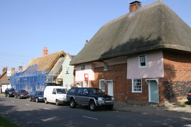
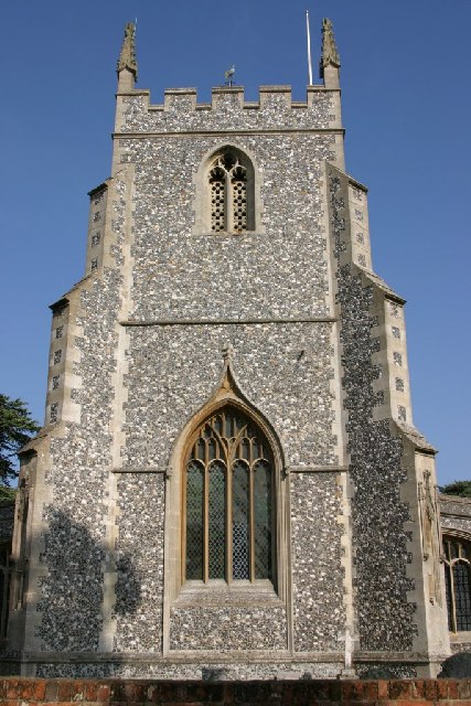
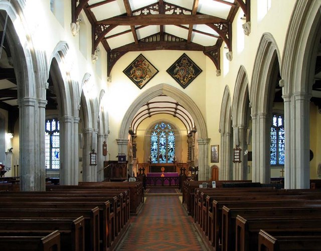
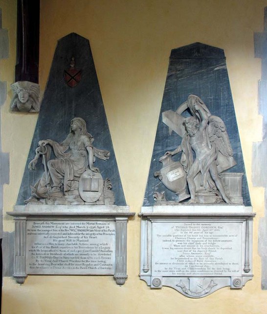
The village is rich in history, with its roots dating back to the medieval period. Its name, derived from the Old English words "bere" (barley) and "wæge" (way), suggests that it was once an important route for transporting barley. Today, Barkway retains much of its historic charm, with many picturesque timber-framed houses and thatched cottages lining its streets.

The village is home to a close-knit community that prides itself on its strong local identity. It offers a range of amenities, including a village hall, a primary school, and a post office. The local pub, The Tally Ho, is a popular gathering spot for residents and visitors alike.

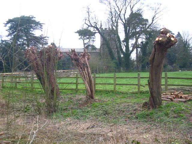
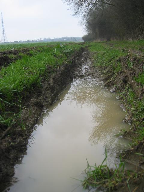
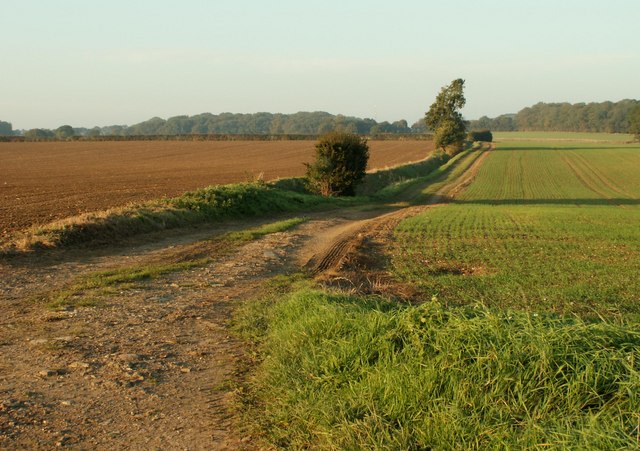
Surrounded by beautiful countryside, Barkway provides ample opportunities for outdoor activities. The area is crisscrossed by footpaths and bridleways, making it a haven for walkers, cyclists, and horse riders. The nearby Barkway Park Golf Club offers a challenging 18-hole course for golf enthusiasts.

Barkway also enjoys convenient transport links. The village is located near the A505 road, providing easy access to nearby towns such as Royston and Buntingford. The closest train station is Royston, which offers regular services to London and Cambridge.

Overall, Barkway is a charming village that combines its rich history with a strong sense of community. Its idyllic setting and range of amenities make it an attractive place to live or visit for those seeking a peaceful rural retreat.

If you have any feedback on the listing, please let us know in the comments section below.
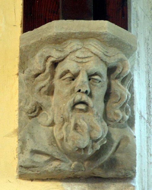
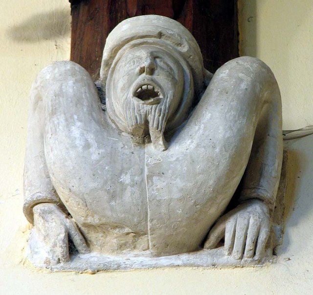
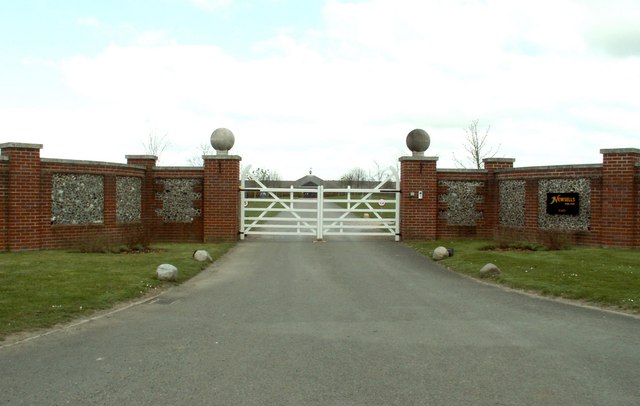
Barkway Images

Images are sourced within 2km of 52.001811/0.015402 or Grid Reference TL3835. Thanks to Geograph Open Source API. All images are credited.

Barkway Freshly pollarded trees with church in the village of Barkway in the background.
Barkway
Freshly pollarded trees with church in the village of Barkway in the background.
Rokey Wood This is the edge of Rokey Wood looking towards the village of Barkway. The mud and puddles are very typical of this area, trust me on this.
Rokey Wood
This is the edge of Rokey Wood looking towards the village of Barkway. The mud and puddles are very typical of this area, trust me on this.
Thatch Old and New Renewing the thatch on a cottage in Barkway, next doors still seems ok!
Thatch Old and New
Renewing the thatch on a cottage in Barkway, next doors still seems ok!
MOD Mast The M.O.D. mast at Barkway, don't know what it does but many signs saying Keep Out.
MOD Mast
The M.O.D. mast at Barkway, don't know what it does but many signs saying Keep Out.
St. Mary Magdalene's - Barkway The Church of St. Mary Magdalene's in Barkway.
St. Mary Magdalene's - Barkway
The Church of St. Mary Magdalene's in Barkway.
Bogmoor Road Bogmoor Road leaves the B1368 Cambridge Road at Barkway Hill
Bogmoor Road
Bogmoor Road leaves the B1368 Cambridge Road at Barkway Hill
Public Footpath between Buckland and Barkway, Herts.
Communications tower near Reed Communications tower on the ridge between Barkway and reed - believed to be operated by NTL.
Communications tower near Reed
Communications tower on the ridge between Barkway and reed - believed to be operated by NTL.
St Mary Magdalene, Barkway, Hertfordshire
St Mary Magdalene, Barkway, Hertfordshire - East end
St Mary Magdalene, Barkway, Hertfordshire - Wall monuments
St Mary Magdalene, Barkway, Hertfordshire - Corbel
St Mary Magdalene, Barkway, Hertfordshire - West end
St Mary Magdalene, Barkway, Hertfordshire
Show me another place!

Barkway is located at Grid Ref: TL3835 (Lat: 52.001811, Lng: 0.015402)

Administrative County: Hertfordshire

District: North Hertfordshire

Police Authority: Hertfordshire

What 3 Words

///clotting.movies.plea. Near Royston, Hertfordshire

Related Wikis

River Quin

The River Quin is a small watercourse which rises near Barkway in north east Hertfordshire, England. The river is fed by a number of sources including...

Barkway

Barkway is a long-established village and civil parish in the North Hertfordshire district of Hertfordshire, England, about five miles south-east of...

RAF Barkway

Royal Air Force Barkway or more simply RAF Barkway was one of the smallest Royal Air Force stations in the United Kingdom. It was a Communications Station...

Barkway Chalk Pit

Barkway Chalk Pit is a small (0.3 hectare) nature reserve in Barkway in North Hertfordshire. It was managed by the Herts and Middlesex Wildlife Trust...

Nuthampstead

Nuthampstead is a small village and civil parish in North East Hertfordshire located a few miles south of the town of Royston. In the 2001 census the parish...

Reed, Hertfordshire

Reed is a small village and civil parish in North Hertfordshire. It is situated on a chalk ridge, approximately 3 miles (4.8 km) south of the market town...

Newsells Park

Newsells Park is a country house and estate at Barkway in Hertfordshire. == History == The estate and the original manor house, built in the late 17th...

St Andrew's Church, Buckland

St Andrew's Church is a redundant Anglican church in the village of Buckland, Hertfordshire, England. It is recorded in the National Heritage List for...

Nearby Amenities

Located within 500m of 52.001811,0.015402
Barkway
Created By: Potlatch 0.4a
Is In: Hertfordshire,England,UK
Place: village
Source: npe
Wikidata: Q785229
Lat/Long: 52.0029874/0.0160942
Bus Stop
Townsend Close
Bench: no
Bin: no
Bus: yes
Lit: no
Naptan AtcoCode: 210021103850
Naptan Bearing: N
Naptan BusStopType: CUS
Naptan CommonName: Townsend Close
Naptan Indicator: opp
Naptan Landmark: Unknown
Naptan NaptanCode: hrtgjpwt
Naptan ShortCommonName: NA
Naptan Street: High Street
Naptan Verified: no
Public Transport: platform
Shelter: no
Source: naptan_import
Tactile Paving: no
Lat/Long: 51.9980064/0.013874
Bus Stop
Windmill Close
Bench: yes
Bin: yes
Bus: yes
Naptan AtcoCode: 210021103865
Naptan Bearing: N
Naptan CommonName: Windmill Close
Naptan Indicator: adj
Naptan Landmark: Unknown
Naptan NaptanCode: hrtgjtaj
Naptan ShortCommonName: NA
Naptan Street: Royston Road
Naptan Verified: no
Public Transport: platform
Shelter: yes
Source: naptan_import
Tactile Paving: no
Lat/Long: 52.0054503/0.0135338
Bus Stop
Village Hall
Bus: yes
Naptan AtcoCode: 210021103900
Naptan Bearing: NE
Naptan CommonName: Village Hall
Naptan Crossing: Telephone Exchange
Naptan Indicator: o/s
Naptan Landmark: Telephone Exchange
Naptan NaptanCode: hrtgjtap
Naptan ShortCommonName: NA
Naptan Street: Cambridge Road
Naptan Verified: no
Public Transport: platform
Source: naptan_import
Lat/Long: 52.0056017/0.0177411
Bus Stop
Village Hall
Bus: yes
Naptan AtcoCode: 210021104480
Naptan Bearing: SW
Naptan BusStopType: CUS
Naptan CommonName: Village Hall
Naptan Crossing: Recreation Ground
Naptan Indicator: opp
Naptan Landmark: Recreation Ground
Naptan NaptanCode: hrtgjpta
Naptan ShortCommonName: NA
Naptan Street: Cambridge Road
Naptan Verified: no
Public Transport: platform
Source: naptan_import
Lat/Long: 52.0055335/0.017857
Bus Stop
Windmill Close
Bench: yes
Bin: yes
Bus: yes
Naptan AtcoCode: 210021104510
Naptan Bearing: S
Naptan CommonName: Windmill Close
Naptan Crossing: Periwinkle Close
Naptan Indicator: opp
Naptan Landmark: Periwinkle Close
Naptan NaptanCode: hrtgjpdw
Naptan ShortCommonName: NA
Naptan Street: Royston Road
Naptan Verified: no
Public Transport: platform
Shelter: yes
Source: naptan_import
Tactile Paving: yes
Lat/Long: 52.0054889/0.0137144
Bus Stop
Townsend Close
Bench: yes
Bin: yes
Bus: yes
Lit: no
Local Ref: NR
Naptan AtcoCode: 210021104530
Naptan Bearing: S
Naptan CommonName: Townsend Close
Naptan Indicator: nr
Naptan Landmark: Unknown
Naptan NaptanCode: hrtgjpgd
Naptan ShortCommonName: NA
Naptan Street: High Street
Naptan Verified: no
Public Transport: platform
Shelter: yes
Source: naptan_import
Tactile Paving: no
Lat/Long: 51.9977883/0.0140099
Bench
Lat/Long: 52.0055791/0.0139752
Post Box
Operator: Royal Mail
Operator Wikidata: Q638098
Post Box Mounting: pier
Post Box Type: lamp
Ref: SG8 438
Lat/Long: 52.0055839/0.0140073
Historic: memorial
Memorial: war_memorial
Lat/Long: 52.0046103/0.0163334
Bench
Backrest: yes
Check Date: 2021-08-15
Lat/Long: 51.9978677/0.0140503
Material: wood
Power: pole
Lat/Long: 51.9995613/0.0209614
Material: wood
Power: pole
Lat/Long: 52.0007371/0.0186225
Power: pole
Lat/Long: 52.0013373/0.017382
Material: wood
Power: pole
Lat/Long: 51.9999329/0.0202158
Material: wood
Power: pole
Lat/Long: 52.0003259/0.019446
Power: pole
Lat/Long: 52.00364/0.0090067
Power: pole
Lat/Long: 52.0034039/0.0094439
Telephone
Defibrillator
Booth: K6
Covered: booth
Defibrillator Location: in old red phone box, High Street, Barkway
Emergency: defibrillator
Listed Status: Grade II
Man Made: telephone_box
Wikidata: Q26630855
Lat/Long: 52.0013861/0.0153523
Post Box
High Street, Barkway
Collection Times: Mo-Fr 16:00; Sa 09:45
Post Box Type: pillar
Ref: SG8 415
Royal Cypher: EIIR
Royal Cypher Wikidata: Q33102113
Lat/Long: 52.0013695/0.0153463
Power: pole
Lat/Long: 52.0038333/0.0128183
Power: pole
Lat/Long: 52.0030681/0.0124669
Power: pole
Lat/Long: 52.004753/0.013234
Direction: 105
Information: board
Tourism: information
Lat/Long: 52.0010561/0.0150409
Bench
Lat/Long: 52.0010083/0.0150087
Bench
Lat/Long: 52.0050339/0.0180928
Leisure: playground
Lat/Long: 52.005133/0.0181706
Bench
Lat/Long: 52.0050603/0.0179962
Turning Loop
Lat/Long: 52.002176/0.0104247
Storey Homes
Office: estate_agent
Lat/Long: 52.0053267/0.0170924
Bench
Backrest: yes
Lat/Long: 52.0038565/0.0193953
Cafe
September Flowers and coffee bar
Lat/Long: 52.00447/0.0159502
September Flowers and coffee bar
Shop: florist
Lat/Long: 52.0044621/0.0159311
Milestone
Historic: milestone
Note Ref: 16 miles to Cambridge.
Operator: Trinity Hall, Cambridge
Ref: 16
Source: survey
Wikidata: Q26469086
Lat/Long: 52.0024924/0.0155435
Crossing
Lat/Long: 52.0054612/0.014086
Information: guidepost
Tourism: information
Lat/Long: 52.0048898/0.0136549
Bench
Backrest: no
Lat/Long: 52.0048997/0.0136066
Tourism: village_sign
Lat/Long: 52.0010592/0.0149777
Waste Basket
Lat/Long: 52.0010014/0.015026
Defibrillator
Defibrillator Location: outsider Barkway Pavilion
Emergency: defibrillator
Indoor: no
Lat/Long: 52.0052784/0.0182568
The data included in this document is from www.openstreetmap.org. The data is made available under ODbL.

Have you been to Barkway?

Leave your review of Barkway below (or comments, questions and feedback).