Bee Low
Hill, Mountain in Derbyshire High Peak
England
Bee Low

Bee Low is a small hill located in the beautiful Peak District National Park in Derbyshire, England. Rising to an elevation of 408 meters (1,339 feet), it is considered more of a hill than a mountain. Despite its modest height, Bee Low offers breathtaking panoramic views of the surrounding countryside.
Situated near the village of Tideswell, Bee Low is a popular destination for hikers and nature enthusiasts. Its gentle slopes and well-maintained footpaths make it an accessible hill for people of all ages and fitness levels. The terrain is mostly grassy, with patches of heather and bracken dotting the landscape.
At the summit of Bee Low, visitors are rewarded with stunning vistas of the rolling hills, verdant valleys, and picturesque villages that characterize the Peak District. On a clear day, it is even possible to see as far as the cities of Manchester and Sheffield, which lie in the distance.
Aside from its natural beauty, Bee Low is also known for its rich biodiversity. The hill is home to a variety of plant species, including heather, bilberry, and gorse. It provides habitat for numerous bird species, such as skylarks and meadow pipits, and is a haven for wildlife like rabbits and hares.
Overall, Bee Low offers a tranquil escape from the hustle and bustle of urban life, providing visitors with the opportunity to immerse themselves in the stunning natural landscapes of Derbyshire's Peak District.
If you have any feedback on the listing, please let us know in the comments section below.
Bee Low Images
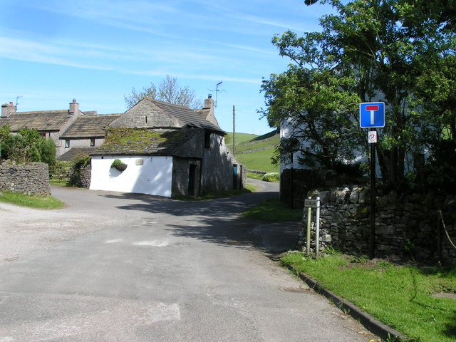
Images are sourced within 2km of 53.310685/-1.8618236 or Grid Reference SK0979. Thanks to Geograph Open Source API. All images are credited.


Bee Low is located at Grid Ref: SK0979 (Lat: 53.310685, Lng: -1.8618236)
Administrative County: Derbyshire
District: High Peak
Police Authority: Derbyshire
What 3 Words
///helped.jump.bumps. Near Dove Holes, Derbyshire
Nearby Locations
Related Wikis

Sparrowpit
Sparrowpit is a small village between Chapel-en-le-Frith and Peak Forest in the High Peak area of the Peak District, Derbyshire, England.The name is derived...

The Bull Ring
The Bull Ring is a Class II henge that was built in the late Neolithic period near Dove Holes in Derbyshire, England.It has coordinates 53.300695°N 1.884423...

Peak Forest
Peak Forest is a small village and civil parish on the main road the (A623) from Chapel-en-le-Frith to Chesterfield in Derbyshire. The population of the...

Dove Holes
Dove Holes is a village in the High Peak district of Derbyshire, England. It has a population of about 1,200 (2001), shown in the 2011 Census as being...
Old Dam
Old Dam is a hamlet in Derbyshire, England. It is located 3 miles (4.8 km) south-west of Castleton on the edge of the village of Peak Forest. == References ==
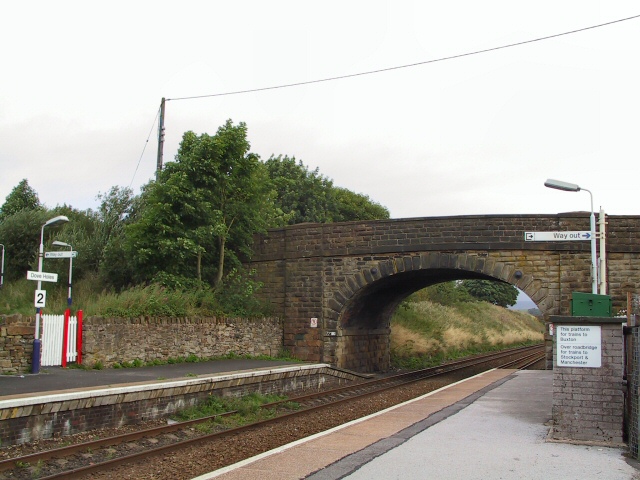
Dove Holes railway station
Dove Holes railway station serves the village of Dove Holes, Derbyshire, England. The station is on the Buxton line between Manchester Piccadilly and Buxton...

Dove Holes Tunnel
Dove Holes Tunnel is a tunnel built by the Midland Railway between Peak Forest Signal Box and Chapel-en-le-Frith in Derbyshire in 1860–64, now carrying...

Bagshaw
Bagshaw is a hamlet in Derbyshire, England. The hamlet falls within the civil parish of Chapel-en-le-Frith. It is about 1.2 km or 0.75 miles east of Chapel...
Nearby Amenities
Located within 500m of 53.310685,-1.8618236Have you been to Bee Low?
Leave your review of Bee Low below (or comments, questions and feedback).