Burnt Hill
Hill, Mountain in Yorkshire Harrogate
England
Burnt Hill

Burnt Hill is a prominent hill located in the county of Yorkshire, England. Situated in the northern part of the county, it forms part of the beautiful landscape of the Yorkshire Dales National Park. With a height of approximately 614 meters (2,014 feet), it is classified as a hill rather than a mountain.
The hill gets its name from the distinctive burnt appearance of the heather that covers its slopes during the summer months. This unique feature adds to the charm and character of the area, attracting both locals and visitors alike. The hill offers breathtaking panoramic views of the surrounding countryside, including rolling green valleys, picturesque villages, and other hills within the national park.
Burnt Hill is a popular destination for hikers and outdoor enthusiasts, who can explore the various footpaths that crisscross its slopes. These paths cater to different levels of difficulty, ensuring that there is something for everyone. The hill is also home to a variety of wildlife, including birds, rabbits, and occasionally, deer. This makes it an ideal spot for nature lovers and wildlife photographers.
In addition to its natural beauty, Burnt Hill has historical significance. It is believed to have been used as a beacon hill during ancient times, serving as a signaling point for important events. Today, the hill stands as a symbol of Yorkshire's rich history and provides a tranquil escape for those seeking to immerse themselves in nature.
If you have any feedback on the listing, please let us know in the comments section below.
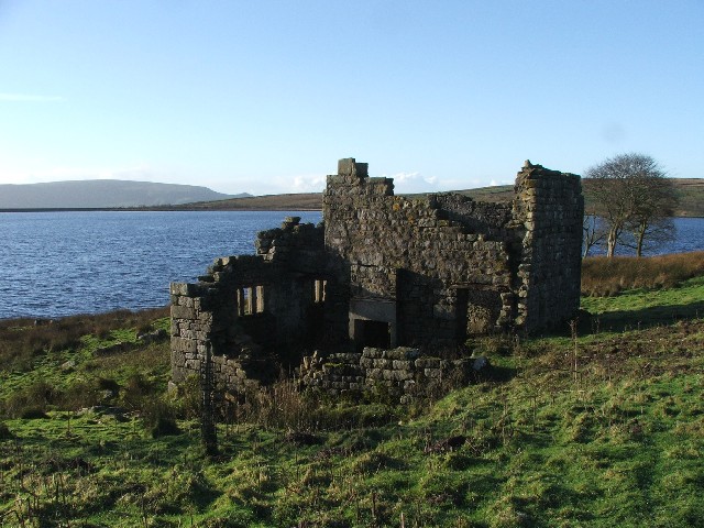
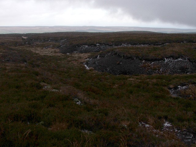
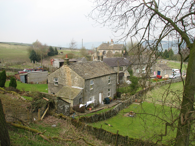
Burnt Hill Images
Images are sourced within 2km of 54.094865/-1.8648472 or Grid Reference SE0866. Thanks to Geograph Open Source API. All images are credited.


Burnt Hill is located at Grid Ref: SE0866 (Lat: 54.094865, Lng: -1.8648472)
Division: West Riding
Administrative County: North Yorkshire
District: Harrogate
Police Authority: North Yorkshire
What 3 Words
///guilty.thumb.lanes. Near Pateley Bridge, North Yorkshire
Nearby Locations
Related Wikis

Stump Cross Caverns
Stump Cross Caverns is a limestone cave system between Wharfedale and Nidderdale in North Yorkshire, England. == Geography == The caverns at Stump Cross...
Grimwith Reservoir
Grimwith Reservoir is located in the Yorkshire Dales in North Yorkshire, England. It was originally built by the Bradford Corporation as one of eleven...

Greenhow
Greenhow is a village in North Yorkshire, England, often referred to as Greenhow Hill. The term how derives from the Old Norse word haugr meaning a hill...
Stonebeck Down
Stonebeck Down is a civil parish in Harrogate district, North Yorkshire, England. The main settlements in the parish are the village of Ramsgill and the...

Gouthwaite Reservoir
Gouthwaite Reservoir is in Nidderdale, North Yorkshire, England. It is one of many reservoirs in the area, others include Roundhill Reservoir and Angram...
Six Dales Trail
The Six Dales Trail is a long distance footpath in North Yorkshire, England, with a short section in West Yorkshire. It is 38 miles (61 km) long and connects...
Heathfield, North Yorkshire
Heathfield is a hamlet in the civil parish of Stonebeck Down in upper Nidderdale, in North Yorkshire, England. It lies on a broad terrace on the west...

Trollers Gill
Trollers Gill is a limestone gill or gorge in North Yorkshire, England, close to the village of Skyreholme and 4.7 miles (7.5 km) south-east of Grassington...
Nearby Amenities
Located within 500m of 54.094865,-1.8648472Have you been to Burnt Hill?
Leave your review of Burnt Hill below (or comments, questions and feedback).