Ashop Head

Hill, Mountain in Derbyshire High Peak

England

Ashop Head

The Pennine Way near William Clough
The Pennine Way near William Clough Credit: Dave Kelly

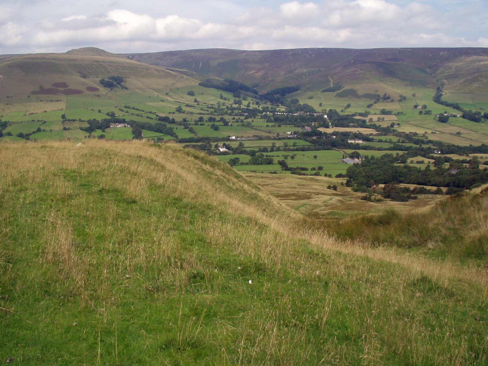
Ashopton Head, also known as Ashop Head, is a prominent hill located in the Peak District National Park, in Derbyshire, England. It is situated near the village of Ashopton, between the Derwent Valley and the Ladybower Reservoir.

Standing at an elevation of approximately 518 meters (1,699 feet), Ashopton Head offers breathtaking panoramic views of the surrounding countryside. It is a popular destination for hikers and outdoor enthusiasts, providing a challenging yet rewarding ascent. The hill can be accessed via various footpaths and trails, including the Derwent Valley Heritage Way and the Pennine Way.

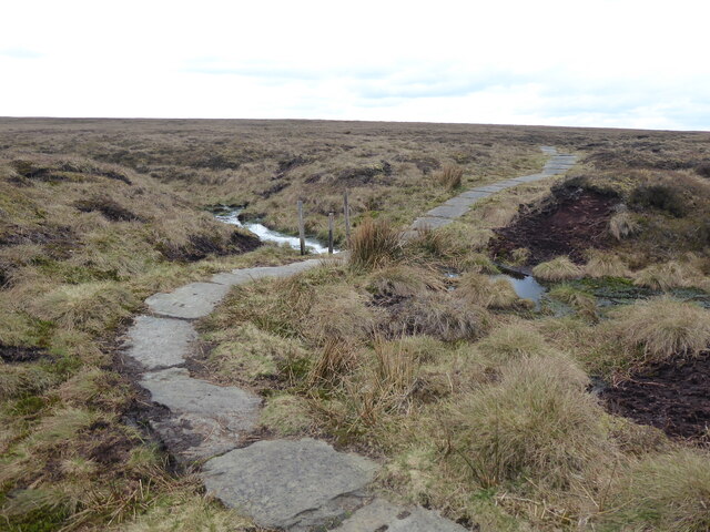
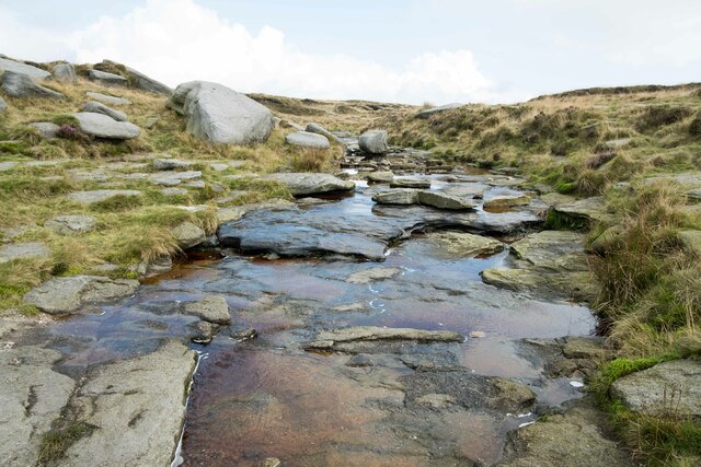
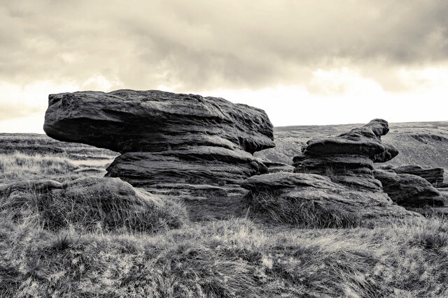
The landscape surrounding Ashopton Head is characterized by rugged moorland, rocky outcrops, and heather-covered slopes. The hill is known for its diverse flora and fauna, with numerous species of birds, mammals, and plants thriving in the area.

One of the notable features near Ashopton Head is the Ladybower Reservoir, a large body of water formed by the construction of a dam across the River Derwent. This reservoir not only serves as a vital water resource but also adds to the scenic beauty of the region.

Ashopton Head and its surroundings have historical significance as well. The village of Ashopton was submerged when the Ladybower Reservoir was created in the 1940s, as part of a project to provide water to the nearby cities of Sheffield and Derby. Today, the remnants of the submerged village can still be seen during periods of low water levels.

Overall, Ashopton Head offers visitors a chance to immerse themselves in the natural beauty of the Peak District, with its stunning views, diverse wildlife, and fascinating history.

If you have any feedback on the listing, please let us know in the comments section below.
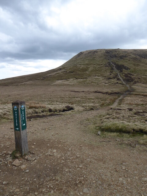
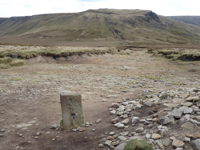
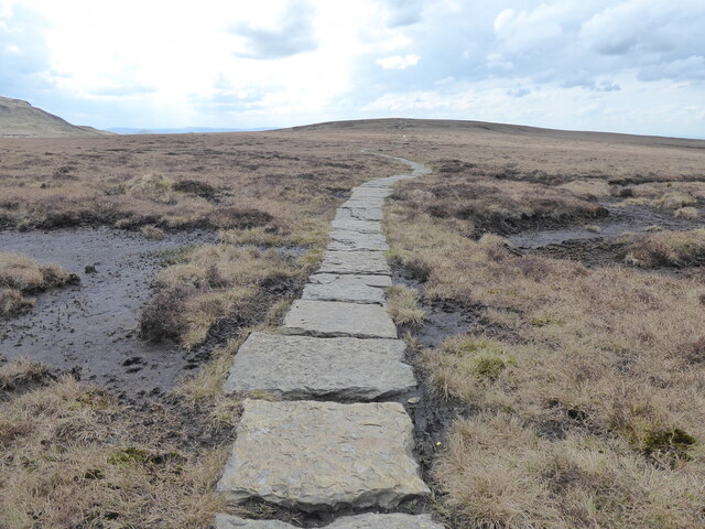
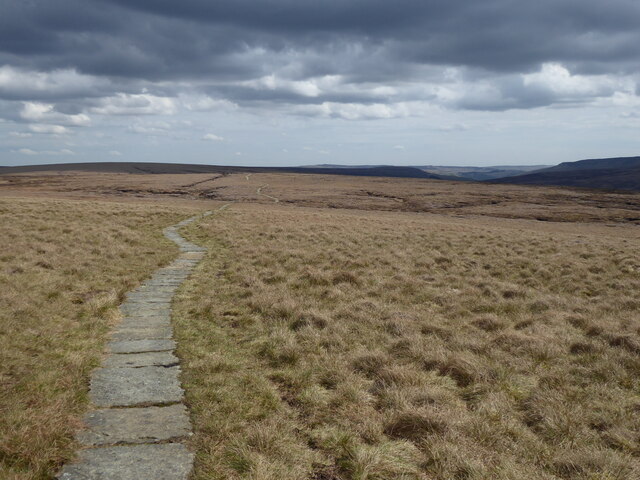
Ashop Head Images

Images are sourced within 2km of 53.411673/-1.8888469 or Grid Reference SK0790. Thanks to Geograph Open Source API. All images are credited.

The Pennine Way near William Clough
The Pennine Way near Mill Hill
The Pennine Way near Bakestone Delph Clough
The Pennine Way near Moss Castle
The Pennine Way near Featherbed Moss
Kinder Downfall The tallest waterfall in the Peak District was not so much a downfall as a trickle when I took this photo.

Wikipedia <span class="nowrap"><a title="https://en.wikipedia.org/wiki/River_Kinder" rel="nofollow ugc noopener" href="https://en.wikipedia.org/wiki/River_Kinder">Link</a><img style="margin-left:2px;" alt="External link" title="External link - shift click to open in new window" src="https://s1.geograph.org.uk/img/external.png" width="10" height="10"/></span>
Kinder Downfall
The tallest waterfall in the Peak District was not so much a downfall as a trickle when I took this photo. Wikipedia LinkExternal link
Above Kinder Downfall Seen from the Pennine Way as it crosses the River Kinder.
Above Kinder Downfall
Seen from the Pennine Way as it crosses the River Kinder.
River Kinder above Kinder Downfall The River Kinder above Kinder Downfall seen from the Pennine Way.

Wikipedia <span class="nowrap"><a title="https://en.wikipedia.org/wiki/River_Kinder" rel="nofollow ugc noopener" href="https://en.wikipedia.org/wiki/River_Kinder">Link</a><img style="margin-left:2px;" alt="External link" title="External link - shift click to open in new window" src="https://s1.geograph.org.uk/img/external.png" width="10" height="10"/></span>
River Kinder above Kinder Downfall
The River Kinder above Kinder Downfall seen from the Pennine Way. Wikipedia LinkExternal link
High Peak View View across the Peak District from the Pennine Way near Kinder Downfall.
High Peak View
View across the Peak District from the Pennine Way near Kinder Downfall.
View down the Valley Looking southwest from the edge of the Pennine Way, the River Kinder can be seen winding its way down the valley floor.
View down the Valley
Looking southwest from the edge of the Pennine Way, the River Kinder can be seen winding its way down the valley floor.
Gritstone Rocks next to the Pennine Way Unusual looking gritstone formations next to the Pennine Way between Kinder Downfall and the Sandy Heys outcrop.

Wikipedia Gritstone <span class="nowrap"><a title="https://en.wikipedia.org/wiki/Gritstone" rel="nofollow ugc noopener" href="https://en.wikipedia.org/wiki/Gritstone">Link</a><img style="margin-left:2px;" alt="External link" title="External link - shift click to open in new window" src="https://s1.geograph.org.uk/img/external.png" width="10" height="10"/></span>
Gritstone Rocks next to the Pennine Way
Unusual looking gritstone formations next to the Pennine Way between Kinder Downfall and the Sandy Heys outcrop. Wikipedia Gritstone LinkExternal link
Approaching Sandy Heys Heading west along the Pennine Way towards the outcrop of gritstone called Sandy Heys.

Wikipedia Gritstone <span class="nowrap"><a title="https://en.wikipedia.org/wiki/Gritstone" rel="nofollow ugc noopener" href="https://en.wikipedia.org/wiki/Gritstone">Link</a><img style="margin-left:2px;" alt="External link" title="External link - shift click to open in new window" src="https://s1.geograph.org.uk/img/external.png" width="10" height="10"/></span>
Approaching Sandy Heys
Heading west along the Pennine Way towards the outcrop of gritstone called Sandy Heys. Wikipedia Gritstone LinkExternal link
The Pennine Way at Sandy Heys Heading west along the Pennine Way at the outcrop of gritstone called Sandy Heys.

Wikipedia Gritstone <span class="nowrap"><a title="https://en.wikipedia.org/wiki/Gritstone" rel="nofollow ugc noopener" href="https://en.wikipedia.org/wiki/Gritstone">Link</a><img style="margin-left:2px;" alt="External link" title="External link - shift click to open in new window" src="https://s1.geograph.org.uk/img/external.png" width="10" height="10"/></span>
The Pennine Way at Sandy Heys
Heading west along the Pennine Way at the outcrop of gritstone called Sandy Heys. Wikipedia Gritstone LinkExternal link
Sandy Heys The outcrop of gritstone called Sandy Heys next to the Pennine Way.
Sandy Heys
The outcrop of gritstone called Sandy Heys next to the Pennine Way.
Gritstone Rocks at Sandy Heys Part of the outcrop of gritstone called Sandy Heys next to the Pennine Way.

Wikipedia Gritstone <span class="nowrap"><a title="https://en.wikipedia.org/wiki/Gritstone" rel="nofollow ugc noopener" href="https://en.wikipedia.org/wiki/Gritstone">Link</a><img style="margin-left:2px;" alt="External link" title="External link - shift click to open in new window" src="https://s1.geograph.org.uk/img/external.png" width="10" height="10"/></span>
Gritstone Rocks at Sandy Heys
Part of the outcrop of gritstone called Sandy Heys next to the Pennine Way. Wikipedia Gritstone LinkExternal link
View from Sandy Heys View towards Kinder Reservoir from the top of Sandy Heys in the Peak District.
View from Sandy Heys
View towards Kinder Reservoir from the top of Sandy Heys in the Peak District.
View along the Pennine Way from Sandy Heys The view northwest along the Pennine Way from the gritstone outcrop of Sandy Heys.
View along the Pennine Way from Sandy Heys
The view northwest along the Pennine Way from the gritstone outcrop of Sandy Heys.
Gritstone in the Peak District Strange and fascinating gritstone rock formations next to the Pennine Way near Sandy Heys.

Wikipedia Gritstone <span class="nowrap"><a title="https://en.wikipedia.org/wiki/Gritstone" rel="nofollow ugc noopener" href="https://en.wikipedia.org/wiki/Gritstone">Link</a><img style="margin-left:2px;" alt="External link" title="External link - shift click to open in new window" src="https://s1.geograph.org.uk/img/external.png" width="10" height="10"/></span>
Gritstone in the Peak District
Strange and fascinating gritstone rock formations next to the Pennine Way near Sandy Heys. Wikipedia Gritstone LinkExternal link
Show me another place!

Ashop Head is located at Grid Ref: SK0790 (Lat: 53.411673, Lng: -1.8888469)

Administrative County: Derbyshire

District: High Peak

Police Authority: Derbyshire

What 3 Words

///shirt.codes.soups. Near Glossop, Derbyshire

Nearby Locations

Ashop Head

Related Wikis

Nearby Amenities

Located within 500m of 53.411673,-1.8888469
Sabre Jets
Aircraft Type: military
Historic: aircraft_wreck
Lat/Long: 53.4090172/-1.8919102
Ford: yes
Lat/Long: 53.4120491/-1.885637
The data included in this document is from www.openstreetmap.org. The data is made available under ODbL.

Have you been to Ashop Head?

Leave your review of Ashop Head below (or comments, questions and feedback).