Addingham High Moor

Hill, Mountain in Yorkshire

England

Addingham High Moor

On hill path at Addingham Moorside with view towards Small Banks
On hill path at Addingham Moorside with view towards Small Banks Credit: Colin Park

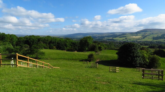
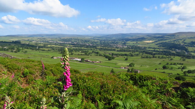
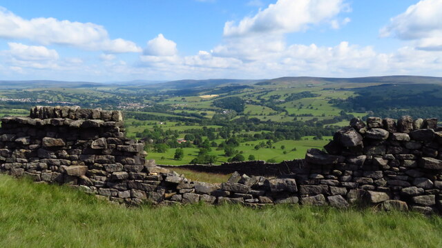
Addingham High Moor is a picturesque hill located in the county of Yorkshire, England. Situated near the village of Addingham, this moorland area is renowned for its natural beauty and dramatic landscapes. Rising to an elevation of approximately 400 meters, Addingham High Moor offers stunning panoramic views of the surrounding countryside.

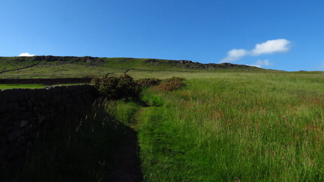
Covered in heather and grass, the moorland is home to a variety of plant and animal species, including several rare and endangered birds. The area is also known for its diverse wildlife, with sightings of wild deer, rabbits, and other small mammals being common.

The moor is crisscrossed by numerous footpaths and trails, making it a popular destination for walkers, hikers, and nature enthusiasts. The well-maintained paths offer access to the stunning views and allow visitors to explore the moor at their own pace. Additionally, the hill provides a challenging terrain for those looking for a more adventurous experience.

Addingham High Moor is an important historical site, with evidence of human activity dating back thousands of years. Archaeological finds, including Bronze Age burial mounds and ancient stone circles, provide insight into the area's rich past. The moorland also holds cultural significance, with several traditional events and festivals taking place throughout the year.

Overall, Addingham High Moor is a captivating destination that offers a unique blend of natural beauty, wildlife, and historical significance. It provides visitors with an opportunity to immerse themselves in the tranquility of the moorland while enjoying its breathtaking vistas.

If you have any feedback on the listing, please let us know in the comments section below.

Addingham High Moor Images

Images are sourced within 2km of 53.918173/-1.8876006 or Grid Reference SE0746. Thanks to Geograph Open Source API. All images are credited.
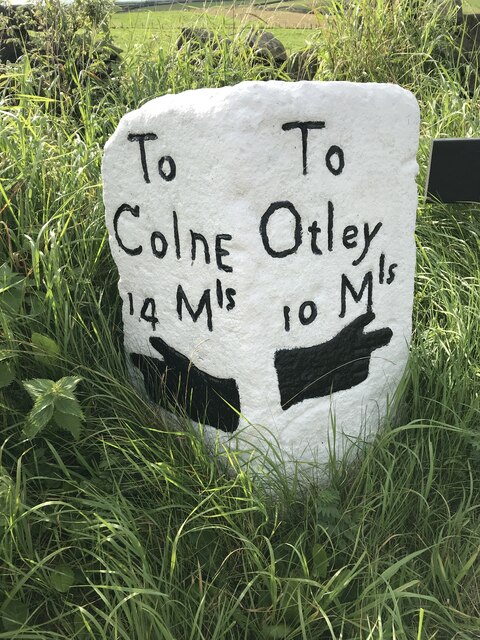
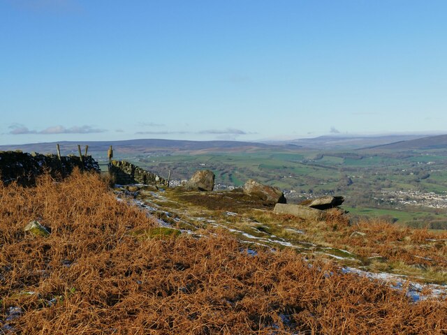
On hill path at Addingham Moorside with view towards Small Banks
Path leading uphill from Addingham Moorside towards Black Hill
Cragg House from Piper's Crag, Rombalds Moor
Broken down wall, E of Piper's Crag, Rombalds Moor
Milestone Brown Bank Lane / Turner Lane Junction Freshly painted and refurbished
Milestone Brown Bank Lane / Turner Lane Junction
Freshly painted and refurbished
Rhododendrons at High Brocka Bank Dazzling floral display in the back garden of Brocka Bank
Rhododendrons at High Brocka Bank
Dazzling floral display in the back garden of Brocka Bank
Brocka Bank Farm
Brocka Bank Farm
Ford on Holden Beck This ford is found above the falls on the Holden Beck. A video of the ford can be seen at:
<span class="nowrap"><a title="https://youtu.be/MS7EE2kjiK4" rel="nofollow ugc noopener" href="https://youtu.be/MS7EE2kjiK4">Link</a><img style="margin-left:2px;" alt="External link" title="External link - shift click to open in new window" src="https://s1.geograph.org.uk/img/external.png" width="10" height="10"/></span>
Ford on Holden Beck
This ford is found above the falls on the Holden Beck. A video of the ford can be seen at: LinkExternal link
The Sepulchre Stone Alongside the Dales High Way.
The Sepulchre Stone
Alongside the Dales High Way.
Levelled area of Ilkley Moor An area about ten yards square has been levelled by a cut-and-fill operation. Its purpose is unclear, as there was no evidence of there having been a building on it.
Levelled area of Ilkley Moor
An area about ten yards square has been levelled by a cut-and-fill operation. Its purpose is unclear, as there was no evidence of there having been a building on it.
Gateway in a wall on Ilkley Moor Rombalds Moor covers about 90 sq.km. between Wharfedale and Airedale. The highest point is 402m above sea level (grid ref for this shared description).  Parts of it also have local names referring to the nearest town, e.g. Hawksworth, Burley, Ilkley, Bingley and Morton Moors. 

The moor is particularly rich in remains of prehistoric activity. The most numerous relics are the rock carvings which can be found on many of the boulders and outcrops scattered across the moor. Burial monuments stone circles and a range of enclosed settlements are also known.  [source: Historic England, overall description covering several ancient monument sites]

There are several small reservoirs, originally built by local authorities, that collect water from the moors. The Rombalds Water Board was taken over by the Yorkshire Water Authority in 1973.
Gateway in a wall on Ilkley Moor
Rombalds Moor covers about 90 sq.km. between Wharfedale and Airedale. The highest point is 402m above sea level (grid ref for this shared description). Parts of it also have local names referring to the nearest town, e.g. Hawksworth, Burley, Ilkley, Bingley and Morton Moors. The moor is particularly rich in remains of prehistoric activity. The most numerous relics are the rock carvings which can be found on many of the boulders and outcrops scattered across the moor. Burial monuments stone circles and a range of enclosed settlements are also known. [source: Historic England, overall description covering several ancient monument sites] There are several small reservoirs, originally built by local authorities, that collect water from the moors. The Rombalds Water Board was taken over by the Yorkshire Water Authority in 1973.
Wet ground ahead! I did wonder whether to strike out across this area to get to the trig point on Long Ridge <a href="https://www.geograph.org.uk/photo/1475907">SE0846 : Trig point S5302 at Long Ridge End</a> 600 metres away, but the reeds suggested wet ground, and with snow cover too I didn't want to take any risks.
Wet ground ahead!
I did wonder whether to strike out across this area to get to the trig point on Long Ridge SE0846 : Trig point S5302 at Long Ridge End 600 metres away, but the reeds suggested wet ground, and with snow cover too I didn't want to take any risks.
Gate at Piper's Crag The wall marks a parish boundary, as marked by the boundary stone to the left of the gate <a href="https://www.geograph.org.uk/photo/6045387">SE0847 : Old Boundary Marker on Addingham High Moor,</a>.
Gate at Piper's Crag
The wall marks a parish boundary, as marked by the boundary stone to the left of the gate SE0847 : Old Boundary Marker on Addingham High Moor,.
View from the Dales High Way above Addingham The farm in the middle distance is Cragg House.
View from the Dales High Way above Addingham
The farm in the middle distance is Cragg House.
Lone tree above Cragg House farm Snow was still lying in the shadow of Ilkley Moor where the sun had not reached it.
Lone tree above Cragg House farm
Snow was still lying in the shadow of Ilkley Moor where the sun had not reached it.
Cragg House farm The grade II listed farmhouse <a href="https://www.geograph.org.uk/photo/4662607">SE0847 : Cragg House Farm</a> dates from 1695.
Cragg House farm
The grade II listed farmhouse SE0847 : Cragg House Farm dates from 1695.
Over Gate Croft farm The grade II listed farmhouse (list entry 1133475) dates from the 17th century.
Over Gate Croft farm
The grade II listed farmhouse (list entry 1133475) dates from the 17th century.
Access road to Over Gate Croft Viewed from a public footpath the other side of the fence.
Access road to Over Gate Croft
Viewed from a public footpath the other side of the fence.
Show me another place!

Addingham High Moor is located at Grid Ref: SE0746 (Lat: 53.918173, Lng: -1.8876006)

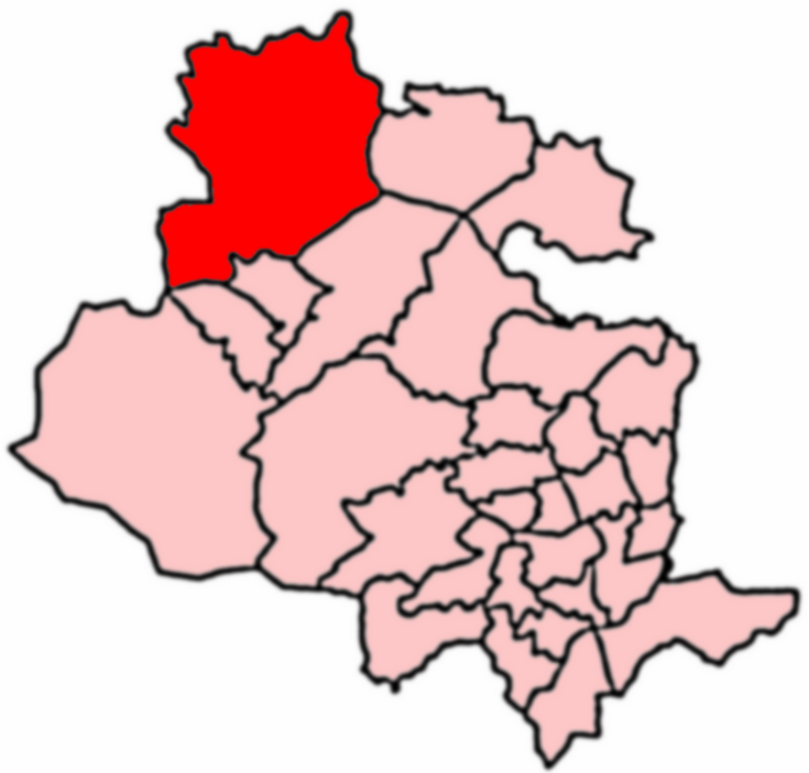
Division: West Riding

Unitary Authority: Bradford

Police Authority: West Yorkshire

What 3 Words

///ascendant.blacked.lined. Near Addingham, West Yorkshire

Related Wikis

Swastika Stone

The Swastika Stone is a stone adorned with a design that resembles a swastika, located on the Woodhouse Crag on the northern edge of Ilkley Moor in West...

Addingham

Addingham (formerly Haddincham c. 972, Odingehem 1086) is a village and civil parish in the City of Bradford in West Yorkshire, England. It is situated...

Craven (Bradford ward)

Craven is an electoral ward within the City of Bradford Metropolitan District Council, West Yorkshire, England. The population of the ward at the 2011...

Ilkley Golf Club

Ilkley Golf Club is a golf club in North Yorkshire, England, just outside the town of Ilkley in West Yorkshire. It is located about a mile to the northwest...

Addingham railway station

Addingham railway station was on the Midland Railway route from Skipton to Ilkley. It served the village of Addingham in West Yorkshire, England. ��2...

Nebstone

The Nebstone is a notable rock found close to the Swastika Stone on the northern edge of Ilkley Moor in West Yorkshire, England. It has the appearance...

St Peter's Church, Addingham

St Peter's Church is a Church of England parish church in Addingham, West Yorkshire. It is a Grade I listed building, with the main structure dating to...

Nesfield

Nesfield is a small village, 2 miles (3.2 km) north-west of Ilkley on the north bank of the River Wharfe, in the civil parish of Nesfield with Langbar...

Nearby Amenities

Located within 500m of 53.918173,-1.8876006
Windgate Nick
Natural: peak
Source: OS 1:25k
Lat/Long: 53.919963/-1.8938689
Black Hill
Natural: peak
Source: OS 1853 sheet 185
Lat/Long: 53.9185499/-1.893136
Natural: spring
Source: OS 1:25k
Lat/Long: 53.9217085/-1.8864525
Barrier: stile
Lat/Long: 53.919253/-1.8923313
Hugh Teal Hall
Place: locality
Source: OS 1:25k
Lat/Long: 53.9200325/-1.8872892
Millstone Lumps
Place: locality
Source: OS 1:25k
Lat/Long: 53.9209929/-1.890981
Man Made: cairn
Lat/Long: 53.9200888/-1.8921605
The data included in this document is from www.openstreetmap.org. The data is made available under ODbL.

Have you been to Addingham High Moor?

Leave your review of Addingham High Moor below (or comments, questions and feedback).