Birley Hill

Hill, Mountain in Northumberland

England

Birley Hill

Roughting Linn Waterfall Mid-summer and only a very light trickle of water over the falls. It's a lovely spot though, straight out of a fantasy film. Note that access is not open to the public and permission should be sought from the land owner.
Roughting Linn Waterfall Credit: Jon Taylor

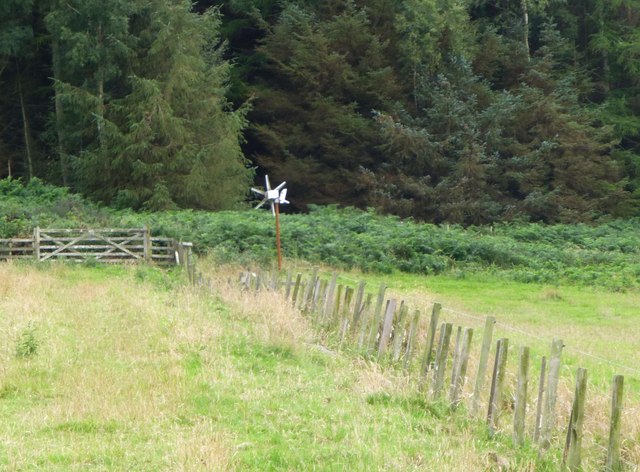
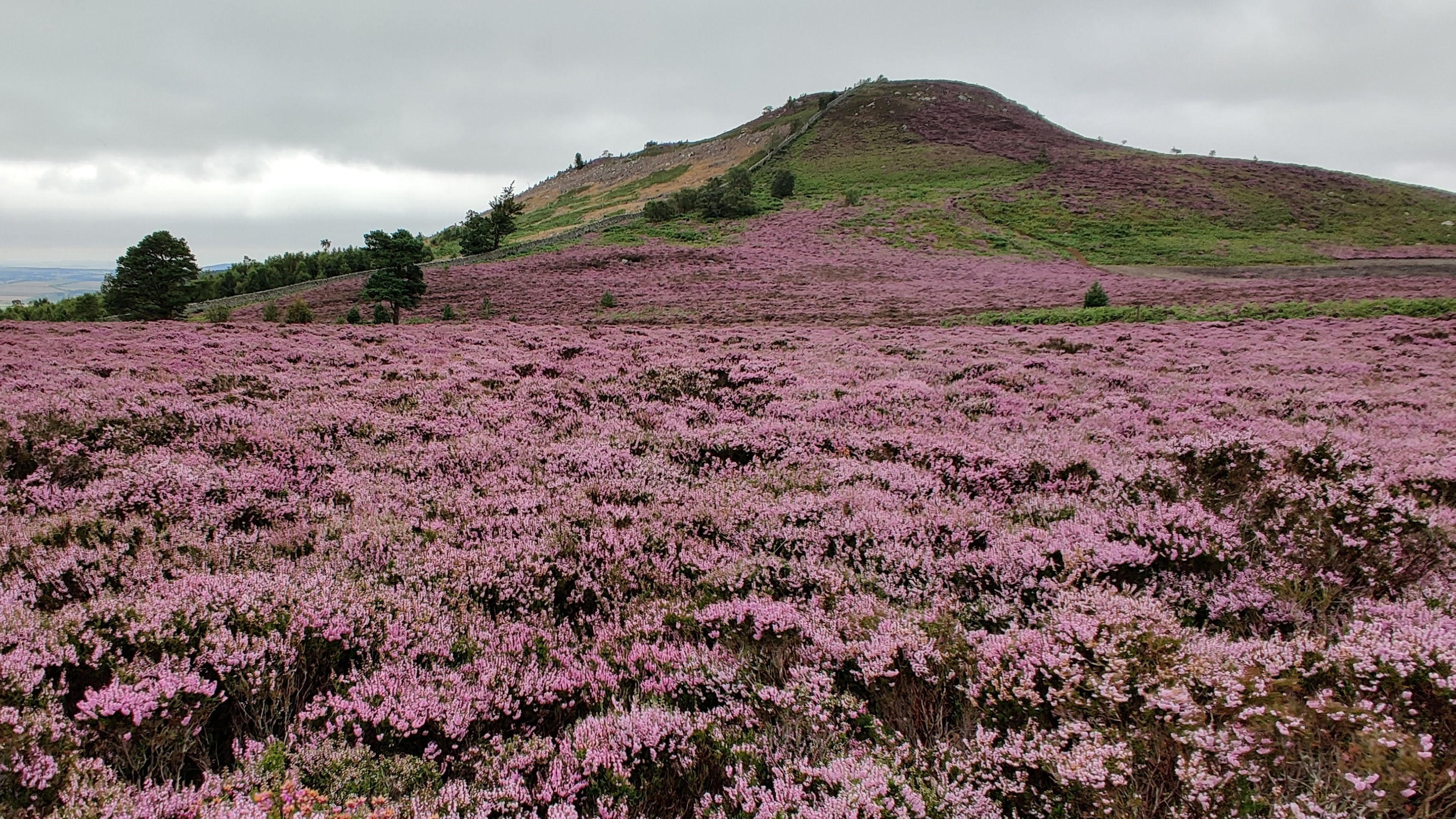
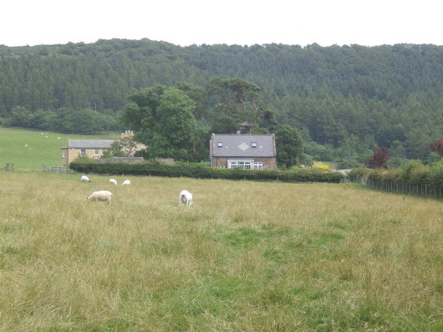
Birley Hill is a prominent geographical feature located in the county of Northumberland, England. Rising to an elevation of approximately 345 meters (1,132 feet), it is regarded as one of the notable hills in the region. Birley Hill is situated within the North Pennines, a designated Area of Outstanding Natural Beauty famed for its picturesque landscapes and diverse wildlife.

The hill is characterized by its distinctive rounded shape and is covered in lush vegetation, predominantly consisting of heather, grasses, and scattered shrubs. Its summit provides breathtaking panoramic views of the surrounding countryside, including the dramatic North Pennines and the sprawling valleys below. On a clear day, visitors can even catch a glimpse of the distant Cheviot Hills to the north.

Birley Hill is a popular destination for hikers, nature enthusiasts, and avid photographers, who are drawn to its natural beauty and tranquility. A network of well-maintained footpaths and trails crisscross the hill, allowing visitors to explore its various vantage points and enjoy the peaceful ambience. The area is home to a diverse range of flora and fauna, with native bird species such as the skylark and curlew frequently spotted in the vicinity.

In addition to its natural allure, Birley Hill also holds historical significance. The surrounding region is dotted with ancient settlements, prehistoric remains, and remnants of mining activity from the Industrial Revolution. These remnants of human history add an extra layer of fascination to the hill and its surroundings.

Overall, Birley Hill stands as a cherished natural landmark in Northumberland, offering a captivating blend of scenic beauty, recreational opportunities, and historical intrigue for all who visit.

If you have any feedback on the listing, please let us know in the comments section below.

Birley Hill Images

Images are sourced within 2km of 55.541978/-1.883279 or Grid Reference NU0727. Thanks to Geograph Open Source API. All images are credited.

Roughting Linn Waterfall Mid-summer and only a very light trickle of water over the falls. It's a lovely spot though, straight out of a fantasy film. Note that access is not open to the public and permission should be sought from the land owner.
Roughting Linn Waterfall
Mid-summer and only a very light trickle of water over the falls. It's a lovely spot though, straight out of a fantasy film. Note that access is not open to the public and permission should be sought from the land owner.
Sheep beside the River Till Viewed through the ironwork of the bridge parapet.
Sheep beside the River Till
Viewed through the ironwork of the bridge parapet.
River Till at Chatton River trivia - according to Wikipedia, the Till is the only major tributary of the Tweed to flow entirely in England.
River Till at Chatton
River trivia - according to Wikipedia, the Till is the only major tributary of the Tweed to flow entirely in England.
Girder Bridge over River Till There are bridges over this river both north and south of Chatton. Neither is given a name on the map.
Girder Bridge over River Till
There are bridges over this river both north and south of Chatton. Neither is given a name on the map.
In Ros Hill Wood On Millstone Hill.
Walking on the open rides is easy but against the grain almost impossible.
In Ros Hill Wood
On Millstone Hill. Walking on the open rides is easy but against the grain almost impossible.
Looking down along the boundary wall towards Drakestruther Moss The wood to the right has been clear felled leaving large heaps of brash.
Looking down along the boundary wall towards Drakestruther Moss
The wood to the right has been clear felled leaving large heaps of brash.
Looking up Millstone Hill towards Ross Castle With Ros Hill Wood on the left, a fine dry stone wall in the centre and clear felling on the Amersidelaw Moor side.
Looking up Millstone Hill towards Ross Castle
With Ros Hill Wood on the left, a fine dry stone wall in the centre and clear felling on the Amersidelaw Moor side.
Boundary Stone at corner of dry stone wall The stone is marked N (Duke of Northumberland) 1859 on this side and T (Tankerville Estate) on the other side.
A number of substantial dry stone walls were built in 1859.
Boundary Stone at corner of dry stone wall
The stone is marked N (Duke of Northumberland) 1859 on this side and T (Tankerville Estate) on the other side. A number of substantial dry stone walls were built in 1859.
Gateway in wall With sign post to Chillingham on the right and Ross Hill straight on.
Gateway in wall
With sign post to Chillingham on the right and Ross Hill straight on.
Looking across the valley of Mill Burn Beyond the valley is Chattonpark Hill with its cup and ring marked rocks.
Looking across the valley of Mill Burn
Beyond the valley is Chattonpark Hill with its cup and ring marked rocks.
Weird animals on Whinny Knowe On first sight they looked like long necked deer, llamas perhaps, but on closer inspection they are game bird feeders fixed to stakes.
Weird animals on Whinny Knowe
On first sight they looked like long necked deer, llamas perhaps, but on closer inspection they are game bird feeders fixed to stakes.
Looking across the pasture  Up towards the woods on Whitecross Edge on the left and the forest on Amersidelaw Moor on the right.
Looking across the pasture
Up towards the woods on Whitecross Edge on the left and the forest on Amersidelaw Moor on the right.
Small wind turbine Powering an electric fence.
A better size than most turbines round here!
Small wind turbine
Powering an electric fence. A better size than most turbines round here!
Sheep in pasture at Shielhope Chattonpark Hill with its Park Plantation beyond the Mill Burn.
Sheep in pasture at Shielhope
Chattonpark Hill with its Park Plantation beyond the Mill Burn.
Massive bridge Where a now little used track from Bellshill to Chillingham crosses the Shielhope Burn. This was once a more important route.
Massive bridge
Where a now little used track from Bellshill to Chillingham crosses the Shielhope Burn. This was once a more important route.
River Till near Chatton
Minor road towards Chillingham Heading south.
Minor road towards Chillingham
Heading south.
Fields south of Chatton
Show me another place!

Birley Hill is located at Grid Ref: NU0727 (Lat: 55.541978, Lng: -1.883279)

Unitary Authority: Northumberland

Police Authority: Northumbria

What 3 Words

///store.linguists.dusts. Near Belford, Northumberland

Related Wikis

Chillingham cattle

Chillingham cattle, also known as Chillingham wild cattle, is a breed of cattle that live in a large enclosed park at Chillingham Castle, Northumberland...

Chatton

Chatton is a village in Northumberland, in England. It is roughly 6 km (3.7 mi) to the east of Wooler. == History == Chatton has been occupied for many...

Chillingham, Northumberland

Chillingham is a village in Northumberland, England. It is situated approximately 6 km (3.7 mi) to the east of Wooler, south of Chatton. At the 2011 Census...
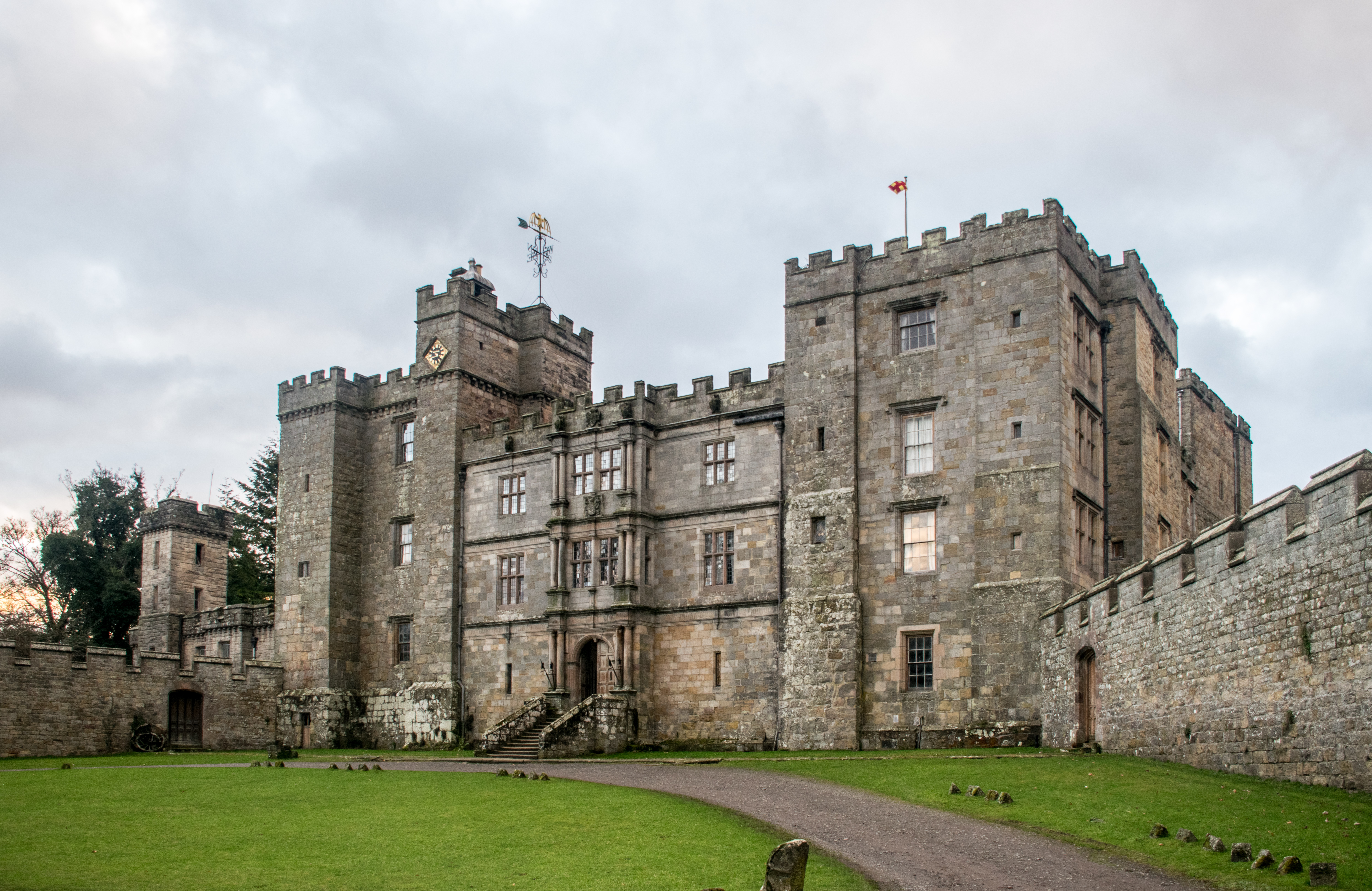
Chillingham Castle

Chillingham Castle is a medieval castle in the village of Chillingham in the northern part of Northumberland, England. It was the seat of the Grey and...

Berwick-upon-Tweed (UK Parliament constituency)

Berwick-upon-Tweed ( ) is a parliamentary constituency in Northumberland represented in the House of Commons of the UK Parliament since 2015 by Anne-Marie...

Ros Hill

Ros Hill, also known as Ros Castle due to the 3,000-year-old Iron Age hill fort on its summit, is a hill in the county of Northumberland in northern England...

Hepburn, Northumberland

Hepburn is a hamlet and former civil parish, now in the civil parish of Chillingham in the county of Northumberland, England. The civil parish was merged...

Chatton transmitting station

The Chatton transmitting station is a broadcasting and telecommunications facility, between Wooler and Seahouses, Northumberland. It is owned and operated...

Nearby Amenities

Located within 500m of 55.541978,-1.883279
Birley Hill
Place: locality
Lat/Long: 55.5427511/-1.8834422
Kay Hill
Ele: 219
Natural: peak
Lat/Long: 55.5377916/-1.8831361
The data included in this document is from www.openstreetmap.org. The data is made available under ODbL.

Have you been to Birley Hill?

Leave your review of Birley Hill below (or comments, questions and feedback).