Amersidelaw Hill Plantation

Wood, Forest in Northumberland

England

Amersidelaw Hill Plantation

Roughting Linn Waterfall Mid-summer and only a very light trickle of water over the falls. It's a lovely spot though, straight out of a fantasy film. Note that access is not open to the public and permission should be sought from the land owner.
Roughting Linn Waterfall Credit: Jon Taylor

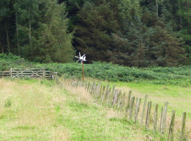
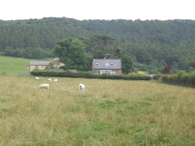
Amersidelaw Hill Plantation is located in Northumberland, a county in northeastern England. This picturesque plantation sits within the Wood and Forest region, known for its lush greenery and diverse wildlife. Covering an expansive area, Amersidelaw Hill Plantation is a haven for nature enthusiasts and outdoor adventurers.

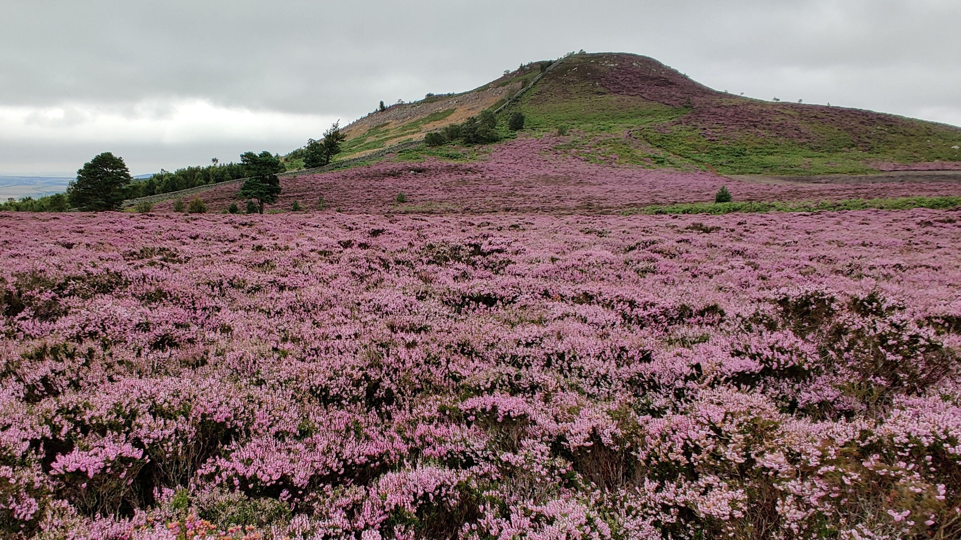
The plantation boasts a variety of trees, including oak, beech, and pine, which create a dense and vibrant forest ecosystem. The diverse flora provides a habitat for a wide range of wildlife, such as deer, rabbits, and various bird species. Visitors can explore the plantation's numerous walking trails, immersing themselves in the tranquility of nature and enjoying breathtaking views of rolling hills and scenic valleys.

Amersidelaw Hill Plantation also offers recreational activities for visitors to enjoy. Picnic areas are available for families and friends to gather and relax amidst the natural beauty of the surroundings. Additionally, the plantation provides opportunities for birdwatching, photography, and nature study, allowing visitors to engage with and learn about the local environment.

The plantation is easily accessible, with ample parking facilities and well-maintained paths for visitors of all ages and abilities. Its location in the Wood and Forest region makes it a popular destination for both locals and tourists seeking a peaceful retreat from the bustling city life.

Overall, Amersidelaw Hill Plantation in Northumberland is a captivating destination that showcases the beauty of the Wood and Forest region. With its scenic landscapes, diverse wildlife, and recreational activities, it offers a memorable experience for all who venture into its enchanting embrace.

If you have any feedback on the listing, please let us know in the comments section below.

Amersidelaw Hill Plantation Images

Images are sourced within 2km of 55.544201/-1.8776941 or Grid Reference NU0727. Thanks to Geograph Open Source API. All images are credited.

Roughting Linn Waterfall Mid-summer and only a very light trickle of water over the falls. It's a lovely spot though, straight out of a fantasy film. Note that access is not open to the public and permission should be sought from the land owner.
Roughting Linn Waterfall
Mid-summer and only a very light trickle of water over the falls. It's a lovely spot though, straight out of a fantasy film. Note that access is not open to the public and permission should be sought from the land owner.
In Ros Hill Wood On Millstone Hill.
Walking on the open rides is easy but against the grain almost impossible.
In Ros Hill Wood
On Millstone Hill. Walking on the open rides is easy but against the grain almost impossible.
Looking down along the boundary wall towards Drakestruther Moss The wood to the right has been clear felled leaving large heaps of brash.
Looking down along the boundary wall towards Drakestruther Moss
The wood to the right has been clear felled leaving large heaps of brash.
Looking up Millstone Hill towards Ross Castle With Ros Hill Wood on the left, a fine dry stone wall in the centre and clear felling on the Amersidelaw Moor side.
Looking up Millstone Hill towards Ross Castle
With Ros Hill Wood on the left, a fine dry stone wall in the centre and clear felling on the Amersidelaw Moor side.
Boundary Stone at corner of dry stone wall The stone is marked N (Duke of Northumberland) 1859 on this side and T (Tankerville Estate) on the other side.
A number of substantial dry stone walls were built in 1859.
Boundary Stone at corner of dry stone wall
The stone is marked N (Duke of Northumberland) 1859 on this side and T (Tankerville Estate) on the other side. A number of substantial dry stone walls were built in 1859.
Gateway in wall With sign post to Chillingham on the right and Ross Hill straight on.
Gateway in wall
With sign post to Chillingham on the right and Ross Hill straight on.
Looking across the valley of Mill Burn Beyond the valley is Chattonpark Hill with its cup and ring marked rocks.
Looking across the valley of Mill Burn
Beyond the valley is Chattonpark Hill with its cup and ring marked rocks.
Weird animals on Whinny Knowe On first sight they looked like long necked deer, llamas perhaps, but on closer inspection they are game bird feeders fixed to stakes.
Weird animals on Whinny Knowe
On first sight they looked like long necked deer, llamas perhaps, but on closer inspection they are game bird feeders fixed to stakes.
Looking across the pasture  Up towards the woods on Whitecross Edge on the left and the forest on Amersidelaw Moor on the right.
Looking across the pasture
Up towards the woods on Whitecross Edge on the left and the forest on Amersidelaw Moor on the right.
Small wind turbine Powering an electric fence.
A better size than most turbines round here!
Small wind turbine
Powering an electric fence. A better size than most turbines round here!
Sheep in pasture at Shielhope Chattonpark Hill with its Park Plantation beyond the Mill Burn.
Sheep in pasture at Shielhope
Chattonpark Hill with its Park Plantation beyond the Mill Burn.
Massive bridge Where a now little used track from Bellshill to Chillingham crosses the Shielhope Burn. This was once a more important route.
Massive bridge
Where a now little used track from Bellshill to Chillingham crosses the Shielhope Burn. This was once a more important route.
Ordnance Survey Flush Bracket 11277 This can be found on the wall of Chatton Mill - a private dwelling.
For more detail see : <span class="nowrap"><a title="http://www.bench-marks.org.uk/bm22159" rel="nofollow ugc noopener" href="http://www.bench-marks.org.uk/bm22159">Link</a><img style="margin-left:2px;" alt="External link" title="External link - shift click to open in new window" src="https://s1.geograph.org.uk/img/external.png" width="10" height="10"/></span>
Ordnance Survey Flush Bracket 11277
This can be found on the wall of Chatton Mill - a private dwelling. For more detail see : LinkExternal link
Looking towards Wooler The B6348 to Wooler with the snow-covered Cheviot Hills of the Northumberland National Park in the background.
Looking towards Wooler
The B6348 to Wooler with the snow-covered Cheviot Hills of the Northumberland National Park in the background.
Chatton Cricket Club The cattle were really engrossed in the game, but wandered off after about 8 overs when it became obvious that they were not going to get fed by the funny men in white.  What tickled me was that when I arrived, they were at Cow Corner.  Unfortunately the best shots that I got was when the bowling was from the other end and they were at Deep Backward Point.

A lovely ground.
Chatton Cricket Club
The cattle were really engrossed in the game, but wandered off after about 8 overs when it became obvious that they were not going to get fed by the funny men in white. What tickled me was that when I arrived, they were at Cow Corner. Unfortunately the best shots that I got was when the bowling was from the other end and they were at Deep Backward Point. A lovely ground.
Damage, Chatton Bridge Concrete barrier where a car hit the bridge a few days earlier. There is a nasty bend here.
Damage, Chatton Bridge
Concrete barrier where a car hit the bridge a few days earlier. There is a nasty bend here.
Chatton Cricket Club View from the boundary (road) during a match. The cattle were massed in two fields opposite and taking interest for a few overs before dispersing.   They would be at Cow Corner for a right handed batsman at the other end.
Chatton Cricket Club
View from the boundary (road) during a match. The cattle were massed in two fields opposite and taking interest for a few overs before dispersing. They would be at Cow Corner for a right handed batsman at the other end.
Chatton Cricket Club Pavilion and scoreboard.
Chatton Cricket Club
Pavilion and scoreboard.
Show me another place!

Amersidelaw Hill Plantation is located at Grid Ref: NU0727 (Lat: 55.544201, Lng: -1.8776941)

Unitary Authority: Northumberland

Police Authority: Northumbria

What 3 Words

///overdrive.compound.blast. Near Belford, Northumberland

Related Wikis

Nearby Amenities

Located within 500m of 55.544201,-1.8776941
Birley Hill
Place: locality
Lat/Long: 55.5427511/-1.8834422
The data included in this document is from www.openstreetmap.org. The data is made available under ODbL.

Have you been to Amersidelaw Hill Plantation?

Leave your review of Amersidelaw Hill Plantation below (or comments, questions and feedback).