Bamburgh Hill
Hill, Mountain in Northumberland
England
Bamburgh Hill

Bamburgh Hill, also known as Bamburgh Castle Hill, is a prominent landmark located in the coastal village of Bamburgh in Northumberland, England. Rising to a height of 45 meters (148 feet) above sea level, it is not classified as a hill or mountain in the traditional sense but is rather a prominent rocky outcrop overlooking the village and the North Sea.
The hill is dominated by the imposing Bamburgh Castle, which stands as a testament to its rich history. The castle is one of the most iconic and well-preserved medieval fortresses in the country, with origins dating back to the 6th century. The hill and the castle have witnessed centuries of occupation and have been associated with various historical figures, including the Anglo-Saxon Kings of Northumbria and the famous Victorian industrialist William Armstrong.
Bamburgh Hill offers stunning panoramic views of the surrounding landscape. From its vantage point, visitors can marvel at the vastness of the North Sea, the vast sandy beaches that stretch for miles, and the Farne Islands, a group of uninhabited islands that serve as an important wildlife sanctuary.
In addition to the castle, Bamburgh Hill is also home to St. Aidan's Church, a medieval parish church that adds to the historical significance of the site. The hill attracts thousands of tourists each year, drawn by its rich history, architectural beauty, and breathtaking views.
Overall, Bamburgh Hill is a captivating destination that combines natural beauty, historical significance, and architectural grandeur, making it a must-visit location for those exploring the Northumberland region.
If you have any feedback on the listing, please let us know in the comments section below.
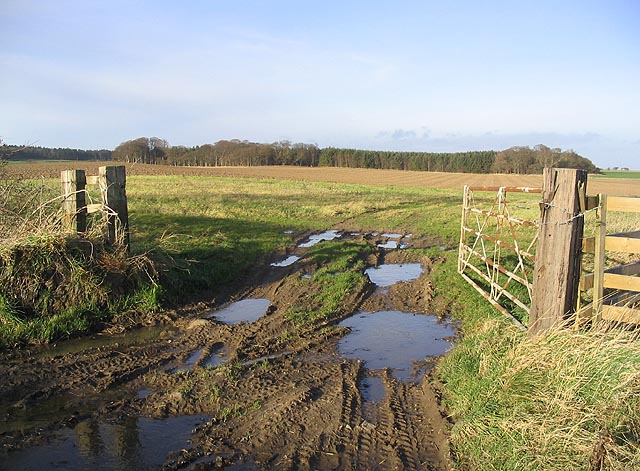
Bamburgh Hill Images
Images are sourced within 2km of 55.651141/-1.8838133 or Grid Reference NU0739. Thanks to Geograph Open Source API. All images are credited.


Bamburgh Hill is located at Grid Ref: NU0739 (Lat: 55.651141, Lng: -1.8838133)
Unitary Authority: Northumberland
Police Authority: Northumbria
What 3 Words
///reason.culling.growth. Near Lowick, Northumberland
Nearby Locations
Related Wikis

Fenwick, Kyloe
Fenwick is a small hamlet in the civil parish of Kyloe near Berwick-upon-Tweed and has a population of approx 400. Fenwick lies only three miles from Holy...

Buckton, Northumberland
Buckton is a small village in Northumberland, North East England, located just over 5 km north of Belford.Buckton consists of a farm and a few cottages...

Smeafield railway station
Smeafield railway station served the farmstead of Smeafield, Northumberland, England from 1871 to 1930 on the East Coast Main Line. == History == The station...

Kyloe
Kyloe is a civil parish in the county of Northumberland, about 8 miles (13 km) south-east of Berwick-upon-Tweed. According to the parish council, the main...

Beal, Northumberland
Beal is a village in Northumberland, in England. It is situated a short distance inland from the North Sea coast, and lies on the link road between the...
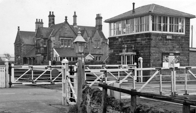
Beal railway station
Beal railway station, also known as Beal for Holy Island railway station, was a railway station that served the village of Beal, Northumberland, England...
Islandshire
Islandshire was an area of Northumberland, England, comprising Lindisfarne or Holy Island, plus five parishes on the mainland. It is historically associated...

Middleton, Northumberland
Middleton is a settlement and civil parish in Northumberland, England. The parish is situated on the North Sea coast, south of the island of Lindisfarne...
Have you been to Bamburgh Hill?
Leave your review of Bamburgh Hill below (or comments, questions and feedback).