Hollinsclough Moor

Hill, Mountain in Staffordshire Staffordshire Moorlands

England

Hollinsclough Moor

Cross-valley view towards Leycote
Cross-valley view towards Leycote Credit: David Martin

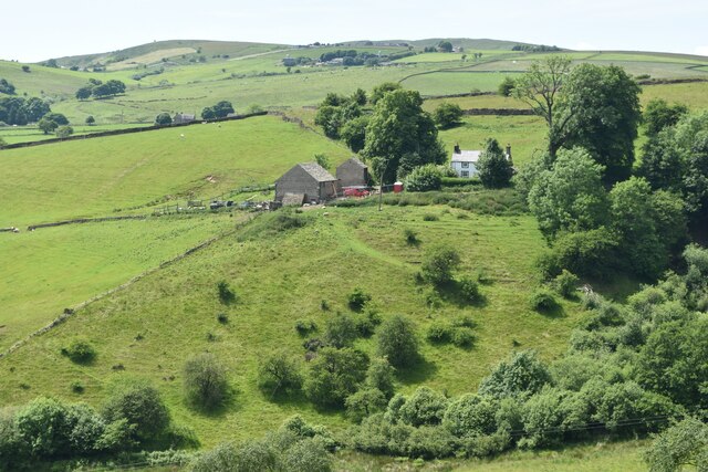
Hollinsclough Moor is a picturesque hill located in the county of Staffordshire, England. It is situated in the Staffordshire Moorlands district, near the village of Hollinsclough. Standing at an elevation of approximately 500 meters (1,640 feet), it is widely regarded as one of the tallest hills in the region.

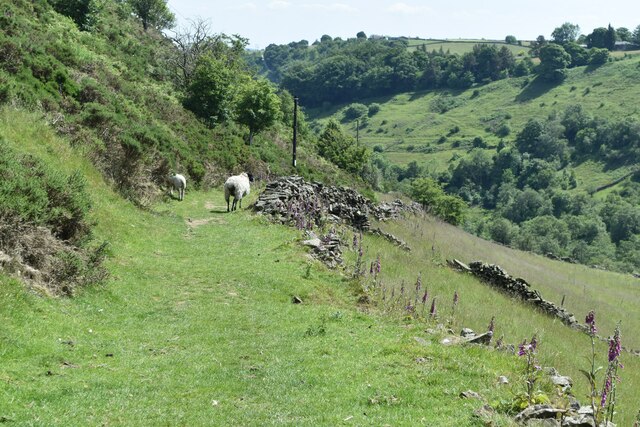
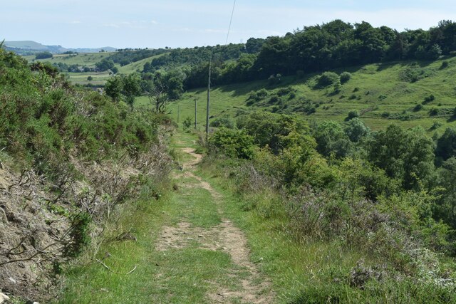
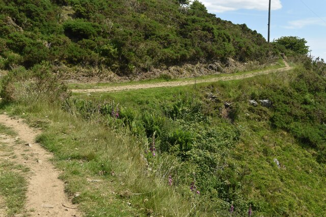
The moor is characterized by its rugged and rocky terrain, covered in heather and grasslands. It offers stunning panoramic views of the surrounding countryside, including the nearby Peak District National Park. The hill is often frequented by hikers, nature enthusiasts, and photographers, who are drawn to its natural beauty and tranquility.

Hollinsclough Moor is also home to a rich variety of flora and fauna. The moorland habitat supports a diverse range of plant species, such as bilberry, cotton grass, and heath bedstraw. It is also a haven for birdlife, with species like curlews, lapwings, and red grouse commonly spotted in the area.

In addition to its natural attractions, Hollinsclough Moor holds a significant historical and cultural value. The hill has been inhabited for centuries, and remnants of ancient settlements, including stone circles and burial mounds, can still be found in the vicinity. These archaeological sites provide insight into the area's past and contribute to its overall appeal.

Overall, Hollinsclough Moor offers a unique and captivating experience for visitors, combining stunning landscapes, diverse wildlife, and a rich historical heritage. It is truly a hidden gem in the Staffordshire countryside.

If you have any feedback on the listing, please let us know in the comments section below.

Hollinsclough Moor Images

Images are sourced within 2km of 53.189604/-1.9186793 or Grid Reference SK0565. Thanks to Geograph Open Source API. All images are credited.

Cross-valley view towards Leycote
Path descending from Fough towards Hollinsclough
Bend in path below Fough The path takes a diversion here around a gulley.
Bend in path below Fough
The path takes a diversion here around a gulley.
Chapel and Old Vicarage, Hollinsclough
View towards High Wheeldon
View across Hollins Farm to Chrome Hill
Footpath and steps A well built set of steps to gain access to the footpath.
Footpath and steps
A well built set of steps to gain access to the footpath.
Field wall and stile The footpath down to Ball Bank.
Field wall and stile
The footpath down to Ball Bank.
Resting animals All the grazing animals are resting except one.
Resting animals
All the grazing animals are resting except one.
Footpath and stile This stile appears to be ready for some maintenance.
Footpath and stile
This stile appears to be ready for some maintenance.
Grazing cattle Grazing cattle and a derelict stone enclosure.
Grazing cattle
Grazing cattle and a derelict stone enclosure.
Fawside Edge The farm buildings at Fawside Edge.
Fawside Edge
The farm buildings at Fawside Edge.
In the village of Hollinsclough This image shows the old vicarage and the Methodist Chapel (1801)
In the village of Hollinsclough
This image shows the old vicarage and the Methodist Chapel (1801)
Bank Top Cottage Above Hollinsclough with a view to Chrome Hill.
Bank Top Cottage
Above Hollinsclough with a view to Chrome Hill.
Bank Top Farmhouse Above Hollinsclough with a view to Chrome Hill
Bank Top Farmhouse
Above Hollinsclough with a view to Chrome Hill
Outbuilding in the hamlet of Coatestown
Chrome Hill from Hollinsclough Rake
Show me another place!

Hollinsclough Moor is located at Grid Ref: SK0565 (Lat: 53.189604, Lng: -1.9186793)

Administrative County: Staffordshire

District: Staffordshire Moorlands

Police Authority: Staffordshire

What 3 Words

///landlords.horseshoe.parties. Near Buxton, Derbyshire

Nearby Locations

Hollinsclough Moor

Related Wikis

Nearby Amenities

Located within 500m of 53.189604,-1.9186793
Parking
Description: Large layby
Ele: 411.0000000
Lat/Long: 53.189534/-1.9196368
Bench
Ele: 414.0000000
Lat/Long: 53.1894521/-1.918562
Description: Trig Point
Ele: 413
Man Made: survey_point
Source Ele: Garmin eTrex Vista HCx
Lat/Long: 53.1896546/-1.9186479
Ele: 413.0000000
Lat/Long: 53.1894631/-1.9182153
Ele: 411.0000000
Lat/Long: 53.1894502/-1.9189459
Barrier: stile
Material: wood
Source: survey;gps
Stile: stepover
Lat/Long: 53.1861223/-1.9192791
Barrier: stile
Material: stone
Source: survey;gps
Stile: stepover
Lat/Long: 53.1905837/-1.9232543
Barrier: cattle_grid
Bicycle: yes
Foot: yes
Motorcar: yes
Motorcycle: yes
Lat/Long: 53.1916549/-1.9247022
Barrier: stile
Material: stone
Source: survey;gps
Stile: stepover
Lat/Long: 53.1916732/-1.9246512
Barrier: stile
Material: stone
Source: survey;gps
Stile: stepover
Lat/Long: 53.1916892/-1.9247424
Barrier: stile
Material: wood
Source: survey;gps
Stile: stepover
Lat/Long: 53.1873323/-1.9226293
Barrier: stile
Material: wood
Source: survey;gps
Stile: stepover
Lat/Long: 53.1889277/-1.9222455
The data included in this document is from www.openstreetmap.org. The data is made available under ODbL.

Have you been to Hollinsclough Moor?

Leave your review of Hollinsclough Moor below (or comments, questions and feedback).