Shaftoe Crags

Hill, Mountain in Northumberland

England

Shaftoe Crags

Garden and tennis court at Capheaton Hallo No doubt there was a complete walled garden here at one time, but only the north and east walls are still standing.
Garden and tennis court at Capheaton Hallo Credit: Oliver Dixon

Shaftoe Crags is a prominent hill located in the county of Northumberland, England. Situated near the village of Belsay, it forms part of the wider North Pennines Area of Outstanding Natural Beauty. Rising to an elevation of approximately 234 meters (768 feet), this beautiful crag offers stunning panoramic views of the surrounding countryside.

The hill is characterized by its rugged and rocky terrain, which is a result of its geological composition primarily made up of sandstone and limestone. The crag itself is known for its distinctive cliff face, which adds to its unique appeal. It is a popular spot for hikers and climbers, attracting both experienced outdoor enthusiasts and casual walkers alike.

The surrounding area is rich in natural beauty and biodiversity, with an abundance of wildlife and plant species. Shaftoe Crags is home to various bird species, including peregrine falcons, kestrels, and buzzards, making it a prime location for birdwatching. The hill also boasts a diverse range of vegetation, including heather, gorse, and grasses, which add to its picturesque charm.

In addition to its natural beauty, Shaftoe Crags also holds historical significance. The area is dotted with remnants of ancient settlements, including Iron Age hillforts and the remains of medieval castles, providing a glimpse into the region's past.

Overall, Shaftoe Crags is a captivating hill in Northumberland that offers a combination of stunning landscapes, diverse wildlife, and a rich historical heritage. It is a must-visit destination for nature lovers, history enthusiasts, and anyone seeking a peaceful retreat in the heart of the North Pennines.

If you have any feedback on the listing, please let us know in the comments section below.

Shaftoe Crags Images

Images are sourced within 2km of 55.131328/-1.921506 or Grid Reference NZ0581. Thanks to Geograph Open Source API. All images are credited.

Garden and tennis court at Capheaton Hallo No doubt there was a complete walled garden here at one time, but only the north and east walls are still standing.
Garden and tennis court at Capheaton Hallo
No doubt there was a complete walled garden here at one time, but only the north and east walls are still standing.
Greenhouse at Capheaton Hall An enormous and ancient greenhouse situated within what at one time would have been the walled garden. The greenhouse gives shelter to a number of espalier fruit trees.
Greenhouse at Capheaton Hall
An enormous and ancient greenhouse situated within what at one time would have been the walled garden. The greenhouse gives shelter to a number of espalier fruit trees.
Vegetable patch at Capheaton Hall Vegetable patch located within what would at one time have been a walled garden. Netting has been draped over the vegetables, supported by lengths of hose bent to form  hoops.
Vegetable patch at Capheaton Hall
Vegetable patch located within what would at one time have been a walled garden. Netting has been draped over the vegetables, supported by lengths of hose bent to form hoops.
Gardens at Capheaton Hall No doubt there was a complete walled garden here at one time, but only the north and east walls are still standing.
Gardens at Capheaton Hall
No doubt there was a complete walled garden here at one time, but only the north and east walls are still standing.
Potato patch at Capheaton Hall A number of varieties of potato are under cultivation here. A small dovecote stands in the middle of the patch. Beyond is an enormous and ancient greenhouse which gives shelter to a number of espalier fruit trees.
Potato patch at Capheaton Hall
A number of varieties of potato are under cultivation here. A small dovecote stands in the middle of the patch. Beyond is an enormous and ancient greenhouse which gives shelter to a number of espalier fruit trees.
Capheaton Hall South face of grade I listed stately home, built 1667-8. In addition to still being a family home, is now used as a wedding and events venue. The West Wing (seen on the left) is let as holiday accommodation.
Capheaton Hall
South face of grade I listed stately home, built 1667-8. In addition to still being a family home, is now used as a wedding and events venue. The West Wing (seen on the left) is let as holiday accommodation.
Capheaton Hall East elevation of grade I listed stately home, built 1667-8. In addition to still being a family home, is now used as a wedding and events venue.
Capheaton Hall
East elevation of grade I listed stately home, built 1667-8. In addition to still being a family home, is now used as a wedding and events venue.
Ornamental pond in front of Capheaton Hall In front of south face of grade I listed stately home, built 1667-8. In addition to still being a family home, is now used as a wedding and events venue.
Ornamental pond in front of Capheaton Hall
In front of south face of grade I listed stately home, built 1667-8. In addition to still being a family home, is now used as a wedding and events venue.
Capheaton Hall Grade I listed stately home, built 1667-8, seen from the south-east. In addition to still being a family home, is now used as a wedding and events venue.
Capheaton Hall
Grade I listed stately home, built 1667-8, seen from the south-east. In addition to still being a family home, is now used as a wedding and events venue.
Sundial on the south face of Capheaton Hall Like all sundials constructed before the institution of British Summer Time in 1916, this sundial is reliably one hour slow throughout the summer.
Sundial on the south face of Capheaton Hall
Like all sundials constructed before the institution of British Summer Time in 1916, this sundial is reliably one hour slow throughout the summer.
The Conservatory at Capheaton Hall A freestanding building to the east of the main hall.
The Conservatory at Capheaton Hall
A freestanding building to the east of the main hall.
In the Conservatory at Capheaton Hall Mobile plant stands, seemingly constructed with old bicycle wheels, in the free-standing Conservatory on the east side of Capheaton Hall.
In the Conservatory at Capheaton Hall
Mobile plant stands, seemingly constructed with old bicycle wheels, in the free-standing Conservatory on the east side of Capheaton Hall.
The haha at Capheaton Hall Separating the lawn in front of the Hall (to the right) from the parkland to the south.
The haha at Capheaton Hall
Separating the lawn in front of the Hall (to the right) from the parkland to the south.
Crossing point over the haha at Capheaton Hall A way across the haha which separates the lawn in front of Capheaton Hall (to the left) from the parkland to the south. All, of course, discretely out of sight from the residents of the Hall.
Crossing point over the haha at Capheaton Hall
A way across the haha which separates the lawn in front of Capheaton Hall (to the left) from the parkland to the south. All, of course, discretely out of sight from the residents of the Hall.
Ordnance Survey Cut Mark This OS cut mark can be found at the SE angle of Ferney Chesters. It marks a point 152.614m above mean sea level.
Ordnance Survey Cut Mark
This OS cut mark can be found at the SE angle of Ferney Chesters. It marks a point 152.614m above mean sea level.
Country road
Country road
Field, Middleton
Field, Middleton
Uphill, Middleton An easy climb away from the Wansbeck in the direction of Bolam.  There were a lot of bikes out today, all with thinner tyres and lighter, more powerful engines than mine.
Uphill, Middleton
An easy climb away from the Wansbeck in the direction of Bolam. There were a lot of bikes out today, all with thinner tyres and lighter, more powerful engines than mine.
Show me another place!

Shaftoe Crags is located at Grid Ref: NZ0581 (Lat: 55.131328, Lng: -1.921506)

Unitary Authority: Northumberland

Police Authority: Northumbria

What 3 Words

///bongo.economies.elders. Near Rothley, Northumberland

Nearby Locations

Shaftoe Crags

Related Wikis

Shaftoe Crags Settlement

Shaftoe Crags Settlement is an archaeological site in Northumberland, England, about 8 miles (13 km) west of Morpeth. The site at Shaftoe Crags, with remains...

The Poind and his Man

The Poind and his Man is a prehistoric site in Northumberland, England, near the village of Bolam and about 7 miles (11 km) west of Morpeth. The site,...
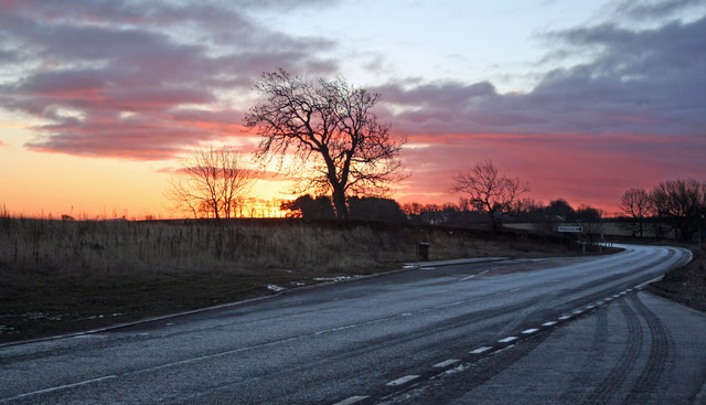
A696 road

The A696 is a major road in Northern England, that runs from Otterburn in Northumberland to Newcastle upon Tyne. == Route == The A696 begins at a junction...
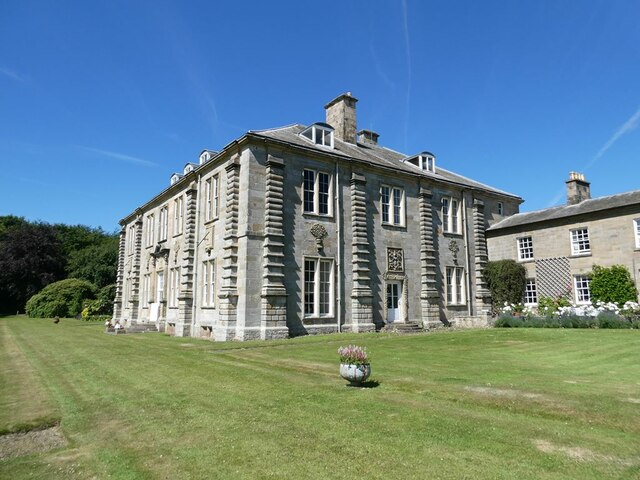
Capheaton Hall

Capheaton Hall, near Wallington, Northumberland, is an English country house, the seat of the Swinburne Baronets and a childhood home of the poet Algernon...

Nearby Amenities

Located within 500m of 55.131328,-1.921506
Power: pole
Lat/Long: 55.1273677/-1.9247266
Power: pole
Lat/Long: 55.1275678/-1.9217559
Power: pole
Lat/Long: 55.1276735/-1.9203312
Power: pole
Lat/Long: 55.1277713/-1.9188359
Power: pole
Lat/Long: 55.1278775/-1.9173467
Power: pole
Lat/Long: 55.1278928/-1.9258452
Power: pole
Lat/Long: 55.1284153/-1.9269544
Power: pole
Lat/Long: 55.128931/-1.9280661
Power: pole
Lat/Long: 55.1326281/-1.9231752
Power: pole
Lat/Long: 55.1327943/-1.9246574
Power: pole
Lat/Long: 55.1328467/-1.9277339
Man Made: survey_point
Lat/Long: 55.1313303/-1.9215198
The data included in this document is from www.openstreetmap.org. The data is made available under ODbL.

Have you been to Shaftoe Crags?

Leave your review of Shaftoe Crags below (or comments, questions and feedback).