Barkingside

Settlement in Essex

England

Barkingside

Redbridge Sports and Leisure Centre Why do such places have huge car parks ? You would have thought .. Oh, never mind.
Redbridge Sports and Leisure Centre Credit: John Davies

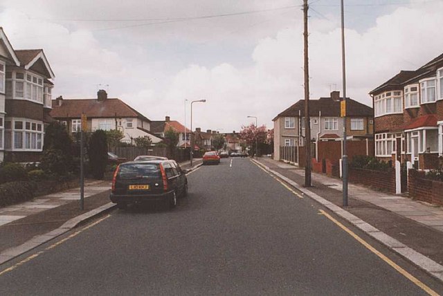
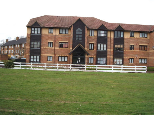
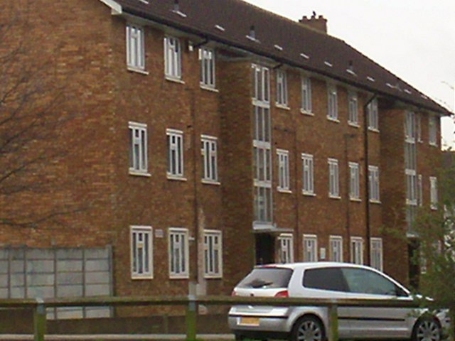
Barkingside is a suburban district located in the London Borough of Redbridge, Essex, England. Situated approximately 12 miles northeast of Central London, it lies within the Greater London Urban Area. The area is predominantly residential, with a mix of housing styles including Victorian and Edwardian terraces, semi-detached houses, and modern apartments.

Barkingside has a rich history, with evidence of human settlement dating back to the Roman era. The area was primarily an agricultural community until the early 20th century when it experienced significant urbanization and population growth. Today, Barkingside is a bustling suburb with a vibrant high street that offers a variety of shops, restaurants, and amenities.

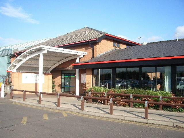
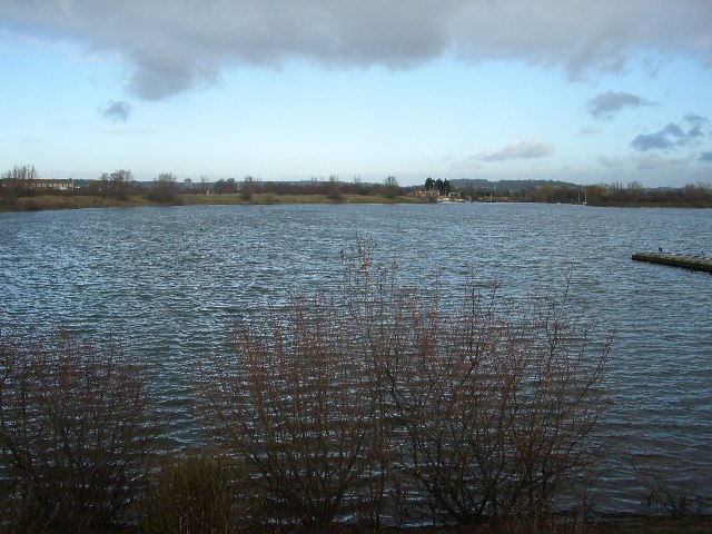
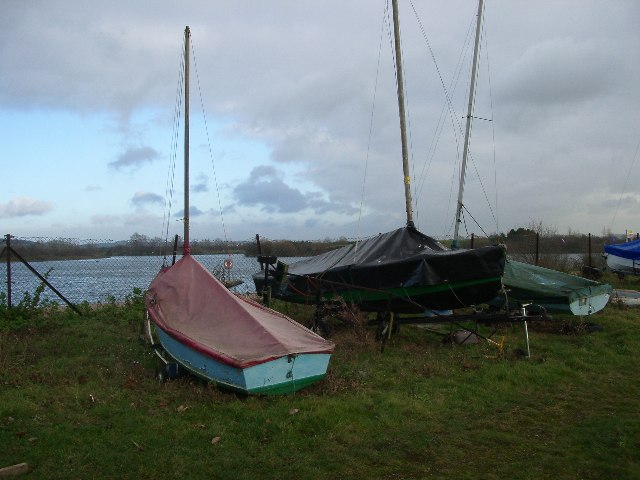
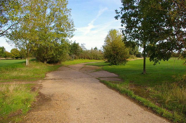
One of the notable landmarks in Barkingside is the Fullwell Cross roundabout, which serves as a focal point for the local community. Nearby, Fairlop Waters Country Park provides a scenic escape with its expansive green spaces, lakes, and recreational facilities. The park offers opportunities for outdoor activities such as fishing, sailing, golfing, and walking.

Barkingside benefits from excellent transport links, with several bus routes connecting the area to neighboring towns and London Underground's Central line providing direct access to the city center. The district also enjoys proximity to major road networks, including the A12 and M11, making it easily accessible by car.

With its attractive residential areas, convenient amenities, and good transport connections, Barkingside offers a desirable location for individuals and families looking for a suburban lifestyle within easy reach of London.

If you have any feedback on the listing, please let us know in the comments section below.

Barkingside Images

Images are sourced within 2km of 51.584087/0.078491 or Grid Reference TQ4489. Thanks to Geograph Open Source API. All images are credited.

Redbridge Sports and Leisure Centre Why do such places have huge car parks ? You would have thought .. Oh, never mind.
Redbridge Sports and Leisure Centre
Why do such places have huge car parks ? You would have thought .. Oh, never mind.
Fairlop Waters Country Park The former sand and gravel extraction area of Fairlop Plain is now a popular sailing and canoeing venue (in the summer, not when the January rain clouds are gathering, as here).
Fairlop Waters Country Park
The former sand and gravel extraction area of Fairlop Plain is now a popular sailing and canoeing venue (in the summer, not when the January rain clouds are gathering, as here).
Fairlop Waters Country Park Beached for the winter
Fairlop Waters Country Park
Beached for the winter
Wedmore Avenue This grid square is a largely residential area within the London Borough of Redbridge. There is parkland adjacent to these houses in Wedmore Avenue, just behind the photographer.
Wedmore Avenue
This grid square is a largely residential area within the London Borough of Redbridge. There is parkland adjacent to these houses in Wedmore Avenue, just behind the photographer.
RAF Fairlop Survivor? This asbestos building is on <a href="https://www.geograph.org.uk/photo/111606">TQ4590 : Fairlop Waters Country Park</a> this was built on the site of RAF Fairlop. The airfield opened as RFC Hainault Farm to counter the treat of Zeppelin raids in WW1, the base closed in 1919. The City of London Corporation bought the site before WW2 intending it to be London Airport but the site was requisitioned by the air ministry and a military base constructed. Operations began in November 1941 the base was used by Spitfires, Hurricane (fighter bomber version) and Typhoons it closed in 1946. I may be a tad romantic thinking this is a wartime survivor it is more likely to be associated with the gravel extraction that destroyed almost all vestiges of the aerodrome and created the lakes, however there are some concrete paths that look suspiciously like <a href="https://www.geograph.org.uk/photo/255652">TQ4590 : Fairlop Peri?</a>. To go to the next field in an alphabetical tour of Essex WW2 airfields click on <a href="https://www.geograph.org.uk/photo/221155">TL7830 : Gosfield Airfield</a>. Much information was gleaned from Graham Smith’s book “Essex Airfields In The Second World War”. <span class="nowrap"><a title="https://books.google.co.uk/books/about/Essex_Airfields_in_the_Second_World_War.html?id=u3atAAAACAAJ&redir_esc=y" rel="nofollow ugc noopener" href="https://books.google.co.uk/books/about/Essex_Airfields_in_the_Second_World_War.html?id=u3atAAAACAAJ&redir_esc=y">Link</a><img style="margin-left:2px;" alt="External link" title="External link - shift click to open in new window" src="https://s1.geograph.org.uk/img/external.png" width="10" height="10"/></span>
RAF Fairlop Survivor?
This asbestos building is on TQ4590 : Fairlop Waters Country Park this was built on the site of RAF Fairlop. The airfield opened as RFC Hainault Farm to counter the treat of Zeppelin raids in WW1, the base closed in 1919. The City of London Corporation bought the site before WW2 intending it to be London Airport but the site was requisitioned by the air ministry and a military base constructed. Operations began in November 1941 the base was used by Spitfires, Hurricane (fighter bomber version) and Typhoons it closed in 1946. I may be a tad romantic thinking this is a wartime survivor it is more likely to be associated with the gravel extraction that destroyed almost all vestiges of the aerodrome and created the lakes, however there are some concrete paths that look suspiciously like TQ4590 : Fairlop Peri?. To go to the next field in an alphabetical tour of Essex WW2 airfields click on TL7830 : Gosfield Airfield. Much information was gleaned from Graham Smith’s book “Essex Airfields In The Second World War”. LinkExternal link
Fairlop Peri? This is a concrete path that encircles much of <a href="https://www.geograph.org.uk/photo/111601">TQ4590 : Fairlop Waters Country Park</a> which is strong circumstantial evidence that this is the remains of the perimeter track of RAF Fairlop that formerly occupied the site see 
<a href="https://www.geograph.org.uk/photo/255648">TQ4590 : RAF Fairlop Survivor?</a>.
Fairlop Peri?
This is a concrete path that encircles much of TQ4590 : Fairlop Waters Country Park which is strong circumstantial evidence that this is the remains of the perimeter track of RAF Fairlop that formerly occupied the site see TQ4590 : RAF Fairlop Survivor?.
Virginia Gardens Virginia Gardens, Barkingside from its junction with Starch House Lane, looking towards the junction with Craven Gardens.
Virginia Gardens
Virginia Gardens, Barkingside from its junction with Starch House Lane, looking towards the junction with Craven Gardens.
Heathcote Avenue
Heathcote Avenue
Local area house A nice house in the middle of the field between Caterham High School and the local bus stop. 
Taken by George, Luke and Jack.
Local area house
A nice house in the middle of the field between Caterham High School and the local bus stop. Taken by George, Luke and Jack.
Rows of flats This picture is outside Caterham High School. It is a lovely block of flats with no graffiti on it.
Rows of flats
This picture is outside Caterham High School. It is a lovely block of flats with no graffiti on it.
Health Centre A health centre on Heathcote Avenue. It is a beautiful health centre that serves the public well.
Health Centre
A health centre on Heathcote Avenue. It is a beautiful health centre that serves the public well.
Littered greenery This is a picture of a park and it's got a lot of trees which give us fresh air, and lots of people are affecting this lovely park by dropping litter under the trees.
Littered greenery
This is a picture of a park and it's got a lot of trees which give us fresh air, and lots of people are affecting this lovely park by dropping litter under the trees.
The Unicorn pub The Unicorn Pub is a popular public house, it hosts many theme nights such as Elvis night, they provide enjoyable entertainment. It is on the corner of Caterham and Clayhall Avenue surrounded with sweet shops, a launderette and a video shop. It is also close to a public secondary school Caterham High, and opposite the pub are many bungalows and semi-detached houses.
The Unicorn pub
The Unicorn Pub is a popular public house, it hosts many theme nights such as Elvis night, they provide enjoyable entertainment. It is on the corner of Caterham and Clayhall Avenue surrounded with sweet shops, a launderette and a video shop. It is also close to a public secondary school Caterham High, and opposite the pub are many bungalows and semi-detached houses.
Clayhall, The Glade Clayhall is one of the many pleasant places in our local area. The picture above is of Clayhall park.
Clayhall, The Glade
Clayhall is one of the many pleasant places in our local area. The picture above is of Clayhall park.
Local Bungalow This is a typical 1930s bungalow with a well kept garden
Local Bungalow
This is a typical 1930s bungalow with a well kept garden
Caterham High School This is Caterham High School. It is a Sports College
Caterham High School
This is Caterham High School. It is a Sports College
Caterham Avenue Quite a busy road near to Caterham High School a lot of traffic and polluted.
Caterham Avenue
Quite a busy road near to Caterham High School a lot of traffic and polluted.
Traffic In this picture there are shops, cars and houses. This is a very noisy area full of pubs and parks. There are many facilities e.g. lights signs, post boxes, traffic lights.
Traffic
In this picture there are shops, cars and houses. This is a very noisy area full of pubs and parks. There are many facilities e.g. lights signs, post boxes, traffic lights.
Show me another place!

Barkingside is located at Grid Ref: TQ4489 (Lat: 51.584087, Lng: 0.078491)

Unitary Authority: Redbridge

Police Authority: Metropolitan

What 3 Words

///ranch.fleet.shots. Near Ilford, London

Nearby Locations

Barkingside

Related Wikis

Dr Barnardo's Memorial

The Memorial to Dr Barnardo by George Frampton, at Barkingside in the London Borough of Redbridge, commemorates the founder of the Barnardo's children...

Barkingside

Barkingside is an area in Ilford, in the London Borough of Redbridge. It includes the major road junction of Fullwell Cross which also gives its name to...

Barkingside tube station

Barkingside is a London Underground station on the Central line. It is on the eastern edge of Barkingside (a district of Ilford) in east London at the...

Redbridge F.C.

Redbridge Football Club is an English association football club based in Barkingside in the London Borough of Redbridge. Prior to July 2004 the club was...

Nearby Amenities

Located within 500m of 51.584087,0.078491
Crossing
Crossing: unmarked
Crossing Island: yes
Crossing Markings: no
Tactile Paving: yes
Lat/Long: 51.5810554/0.0737739
Traffic Signals
Lat/Long: 51.5880563/0.0808225
Barkingside Magistrates Court
Bus: yes
Direction: backward
Public Transport: stop_position
Ref: 48612
Lat/Long: 51.5880489/0.0814712
Direction: both
Ref GB Tflcid: RWG166942
Traffic Calming: hump
Lat/Long: 51.5803809/0.0765488
Direction: both
Traffic Calming: hump
Lat/Long: 51.5808346/0.0773647
Turning Circle
Lat/Long: 51.5822949/0.0836584
Turning Circle
Turning Circle: circle
Lat/Long: 51.5835448/0.0837623
Give Way
Direction: forward
Lat/Long: 51.5849111/0.0832253
Noexit: yes
Lat/Long: 51.5855064/0.0826414
Barrier: lift_gate
Lat/Long: 51.5870911/0.0822193
Noexit: yes
Lat/Long: 51.5843966/0.0842004
Bus Stop
Aldwych Avenue
Bus: yes
Naptan AtcoCode: 490003194N
Naptan Bearing: N
Naptan CommonName: Aldwych Avenue
Naptan Street: HORNS ROAD
Naptan Verified: no
Public Transport: platform
Ref: 74258
Lat/Long: 51.5813416/0.084013
Bus Stop
Barkingside Magistrates Court
Bus: yes
Local Ref: R
Naptan AtcoCode: 490003613R
Naptan Bearing: W
Naptan CommonName: Barkingside Magistrates Court
Naptan Indicator: Stop R
Naptan Street: TANNERS LANE
Naptan Verified: no
Public Transport: platform
Ref: 48612
Lat/Long: 51.587985/0.0814075
Bus Stop
Barkingside Tesco
Bus: yes
Local Ref: V
Naptan AtcoCode: 490003614V
Naptan Bearing: N
Naptan CommonName: Barkingside Tesco
Naptan Indicator: V
Naptan Street: TESCO STORE BARKINGSIDE
Naptan Verified: no
Public Transport: platform
Ref: 47350
Source Ref: naptan
Lat/Long: 51.5865489/0.0810715
Bus Stop
Brandville Gardens
Bus: yes
Departures Board: no
Local Ref: Y
Naptan AtcoCode: 490004258S
Naptan Bearing: S
Naptan CommonName: Tesco Barkingside
Naptan Indicator: Stop Y
Naptan Street: CRANBROOK ROAD
Naptan Verified: no
Public Transport: platform
Ref: 57220
Shelter: yes
Source Ref: naptan
Lat/Long: 51.5861321/0.0795334
Bus Stop
Brandville Gardens
Bus: yes
Local Ref: Q
Naptan AtcoCode: 490007060N
Naptan Bearing: N
Naptan CommonName: Redbridge Register Office
Naptan Indicator: Stop Q
Naptan Street: CRANBROOK ROAD
Naptan Verified: no
Public Transport: platform
Ref: 74664
Shelter: yes
Source Ref: naptan
Lat/Long: 51.5856288/0.078729
Bus Stop
Fullwood Primary School
Bus: yes
Local Ref: CA
Naptan AtcoCode: 490007060S
Naptan Bearing: S
Naptan CommonName: Redbridge Register Office
Naptan Indicator: Stop CA
Naptan Street: CRANBROOK ROAD
Naptan Verified: no
Public Transport: platform
Ref: 56279
Source Ref: naptan
Lat/Long: 51.5846928/0.0780686
Bus Stop
Beattyville Gardens
Bus: yes
Local Ref: CS
Naptan AtcoCode: 490007695N
Naptan Bearing: N
Naptan CommonName: Hamilton Avenue Cranbrook Rd
Naptan Indicator: Stop CS
Naptan Street: CRANBROOK ROAD
Naptan Verified: no
Public Transport: platform
Ref: 59272
Source Ref: naptan
Lat/Long: 51.5831823/0.0760556
Bus Stop
Hamilton Avenue
Bus: yes
Local Ref: CB
Naptan AtcoCode: 490007695S
Naptan Bearing: S
Naptan CommonName: Hamilton Avenue Cranbrook Rd
Naptan Indicator: Stop CB
Naptan Street: CRANBROOK ROAD
Naptan Verified: no
Public Transport: platform
Ref: 51140
Source Ref: naptan
Lat/Long: 51.5822215/0.0750532
Bus Stop
Princes Road
Bus: yes
Naptan AtcoCode: 490011212N
Naptan Bearing: N
Naptan CommonName: Princes Road
Naptan Street: HORNS ROAD
Naptan Verified: no
Public Transport: platform
Ref: 77898
Lat/Long: 51.5842473/0.0847406
Bus Stop
Princes Road
Bus: yes
Naptan AtcoCode: 490011212S
Naptan Bearing: N
Naptan CommonName: Princes Road
Naptan Street: HORNS ROAD
Naptan Verified: no
Public Transport: platform
Ref: 73909
Lat/Long: 51.5834459/0.0846937
Ref GB Tflcid: RWG166402
Traffic Calming: hump
Lat/Long: 51.5824904/0.074694
Noexit: yes
Lat/Long: 51.5857478/0.0776804
Police
Barkingside Police Station
Addr City: Ilford
Addr Postcode: IG6 1QB
Addr Street: High Street
Lat/Long: 51.5883992/0.0804994
Bus: yes
Direction: forward
Public Transport: stop_position
Lat/Long: 51.5856042/0.0788143
Noexit: yes
Lat/Long: 51.5827327/0.0836465
Tesco
Addr City: Ilford
Addr Housenumber: 796
Addr Postcode: IG6 1HY
Addr Street: Cranbrook Road
Brand: Tesco
Brand Wikidata: Q487494
Brand Wikipedia: en:Tesco
Contact Website: https://www.tesco.com/store-locator/ilford/796-cranbrook-road
Opening Hours: Mo-Sa 08:00-22:00; Su 10:00-16:00
Phone: +44 345 6779038
Shop: supermarket
Lat/Long: 51.5859108/0.082181
Place Of Worship
St. Augustine Catholic Church
Denomination: roman_catholic
Religion: christian
Lat/Long: 51.5809681/0.0740959
Noexit: yes
Lat/Long: 51.5857823/0.0832483
Barrier: bollard
Lat/Long: 51.5840875/0.0841822
Give Way
Direction: backward
Lat/Long: 51.5803231/0.0808079
Post Box
Collection Plate: CP1
Collection Times: Mo-Fr 16:45; Sa 11:15
Operator: Royal Mail
Operator Wikidata: Q638098
Post Box Type: pillar
Ref: IG6 152
Royal Cypher: EIIR
Royal Cypher Wikidata: Q33102113
Lat/Long: 51.5862481/0.0812872
Crossing
Bicycle: yes
Crossing: traffic_signals
Crossing Ref: toucan
Lat/Long: 51.5841244/0.084814
Tactile Paving: yes
Lat/Long: 51.5839904/0.0845856
Bus: yes
Direction: forward
Public Transport: stop_position
Lat/Long: 51.5865303/0.0809794
Toilets
Fee: no
Lat/Long: 51.5876475/0.0805565
Crossing
Crossing: unmarked
Crossing Markings: no
Lat/Long: 51.584028/0.0849065
Tactile Paving: yes
Lat/Long: 51.5840257/0.0846768
Tactile Paving: yes
Lat/Long: 51.5840891/0.0847188
Crossing
Crossing: uncontrolled
Crossing Island: no
Crossing Markings: zebra
Tactile Paving: yes
Lat/Long: 51.5854717/0.08103
Crossing
Crossing: uncontrolled
Crossing Island: no
Crossing Markings: zebra
Tactile Paving: yes
Lat/Long: 51.5855557/0.0815
Crossing
Crossing: uncontrolled
Crossing Island: no
Crossing Markings: zebra
Tactile Paving: yes
Lat/Long: 51.5855147/0.0808094
Noexit: yes
Lat/Long: 51.5862181/0.0823114
Noexit: yes
Lat/Long: 51.5826584/0.0836952
Traffic Signals
Traffic Signals Direction: forward
Lat/Long: 51.5841663/0.0848232
Traffic Signals
Traffic Signals Direction: backward
Lat/Long: 51.5840834/0.0848053
Give Way
Direction: forward
Lat/Long: 51.580192/0.079279
Give Way
Direction: forward
Lat/Long: 51.5801867/0.0791482
Give Way
Direction: backward
Lat/Long: 51.5795929/0.0785344
Barrier: lift_gate
Lat/Long: 51.5811636/0.0741069
Noexit: yes
Lat/Long: 51.5856346/0.0832745
Barrier: bollard
Source: Bing
Lat/Long: 51.5863499/0.0844311
Barrier: lift_gate
Lift Gate Type: single
Lat/Long: 51.5854856/0.0836269
Barrier: lift_gate
Lift Gate Type: single
Lat/Long: 51.5874113/0.0826133
Noexit: yes
Lat/Long: 51.5827454/0.0828487
Direction: both
Traffic Calming: hump
Lat/Long: 51.580224/0.0772218
Noexit: yes
Lat/Long: 51.5819293/0.0836213
Noexit: yes
Lat/Long: 51.587007/0.0807962
Noexit: yes
Lat/Long: 51.5866881/0.0819865
Noexit: yes
Lat/Long: 51.5868493/0.0819552
Noexit: yes
Lat/Long: 51.5866063/0.081604
Noexit: yes
Lat/Long: 51.5867154/0.0811388
Give Way
Direction: forward
Lat/Long: 51.5850502/0.0751789
Noexit: yes
Lat/Long: 51.5849856/0.076734
Crossing
Crossing: traffic_signals
Crossing Island: yes
Crossing Markings: dots
Source: local knowledge
Tactile Paving: yes
Traffic Signals Vibration: no
Lat/Long: 51.5880534/0.0810559
Crossing
Crossing: marked
Crossing Markings: yes
Lat/Long: 51.5879658/0.0808284
Crossing
Crossing: traffic_signals
Lat/Long: 51.5868205/0.0805445
Crossing
Crossing: traffic_signals
Lat/Long: 51.5868705/0.0806729
Give Way
Direction: backward
Lat/Long: 51.5804764/0.0803358
Crossing
Crossing: unmarked
Crossing Markings: no
Lat/Long: 51.5804553/0.0803085
Crossing
Crossing: unmarked
Crossing Island: no
Crossing Markings: no
Tactile Paving: yes
Lat/Long: 51.5862611/0.0842931
Entrance: yes
Lat/Long: 51.5871577/0.0829978
Entrance: yes
Lat/Long: 51.5870855/0.083623
Entrance: yes
Lat/Long: 51.58633/0.084
Entrance: yes
Lat/Long: 51.5871369/0.0828035
Fountain
Drinking Water: no
Lat/Long: 51.5865097/0.0842938
Fountain
Drinking Water: no
Lat/Long: 51.5869513/0.0831485
Bench
Lat/Long: 51.5869951/0.0831869
Bench
Lat/Long: 51.586989/0.0832096
Bench
Lat/Long: 51.5869268/0.0830816
Bench
Lat/Long: 51.5869118/0.0831081
Bench
Lat/Long: 51.5867811/0.0832176
Bench
Lat/Long: 51.5868197/0.0834062
Bench
Lat/Long: 51.5868018/0.0836547
Bench
Lat/Long: 51.586718/0.0830153
Bench
Lat/Long: 51.5866479/0.0827843
Bench
Lat/Long: 51.5865599/0.0831009
Bench
Lat/Long: 51.5864704/0.0834691
Bench
Lat/Long: 51.5863928/0.0844153
Bench
Lat/Long: 51.586606/0.0844835
Bench
Lat/Long: 51.5866479/0.0840418
Tactile Paving: yes
Lat/Long: 51.5840909/0.0846911
Fuel
Tesco Petrol
Brand: Tesco
Brand Wikidata: Q487494
Contact Website: https://www.tesco.com/store-locator/ilford/796-cranbrook-road/petrol-filling-station
Lat/Long: 51.5860753/0.0800827
Direction: both
Ref GB Tflcid: RWG166939
Traffic Calming: hump
Lat/Long: 51.579798/0.0778724
Ref GB Tflcid: RWG166399
Traffic Calming: cushion
Lat/Long: 51.5841634/0.0728845
Ref GB Tflcid: RWG166400
Traffic Calming: cushion
Lat/Long: 51.5833984/0.0744752
Direction: both
Ref GB Tflcid: RWG166947
Traffic Calming: hump
Lat/Long: 51.5809487/0.07495
Ref GB Tflcid: RWG166403
Traffic Calming: hump
Lat/Long: 51.5825005/0.0739009
Ref GB Tflcid: RWG166404
Traffic Calming: hump
Lat/Long: 51.5827121/0.0738554
Direction: both
Ref GB Tflcid: RWG166944
Traffic Calming: hump
Lat/Long: 51.5806901/0.0756831
Ref GB Tflcid: RWG166398
Traffic Calming: cushion
Lat/Long: 51.5843139/0.0725723
Post Box
Operator: Royal Mail
Operator Type: private
Operator Wikidata: Q638098
Post Box Type: pillar
Source: streetside
Lat/Long: 51.5823623/0.0753966
Crossing
Crossing: traffic_signals
Lat/Long: 51.5880445/0.0817484
Aldborough
Information: board
Tourism: information
Lat/Long: 51.5841098/0.0849589
Post Box
Operator: Royal Mail
Operator Wikidata: Q638098
Post Box Type: pillar
Lat/Long: 51.5841388/0.0849805
Crossing
Crossing: unmarked
Crossing Island: yes
Crossing Markings: no
Tactile Paving: yes
Lat/Long: 51.5847835/0.0847613
Post Box
Operator: Royal Mail
Operator Wikidata: Q638098
Post Box Type: pillar
Lat/Long: 51.5802406/0.0809454
Post Box
Operator: Royal Mail
Operator Wikidata: Q638098
Post Box Type: pillar
Source: streetside
Lat/Long: 51.5857631/0.073531
Crossing
Crossing: traffic_signals
Lat/Long: 51.5867921/0.0802942
Noexit: yes
Lat/Long: 51.5880203/0.0804975
Crossing
Crossing: unmarked
Crossing Island: yes
Crossing Markings: no
Tactile Paving: yes
Lat/Long: 51.5878012/0.0820344
Bench
Backrest: yes
Source: local knowledge;aerial imagery
Lat/Long: 51.5879154/0.0817292
Waste Basket
Material: plastic
Waste: trash
Lat/Long: 51.5881785/0.0812176
Give Way
Direction: backward
Lat/Long: 51.5873871/0.0737524
Give Way
Direction: forward
Lat/Long: 51.5879982/0.0820501
Crossing
Crossing: traffic_signals
Lat/Long: 51.5882419/0.0808073
Information: guidepost
Tourism: information
Lat/Long: 51.5881465/0.081062
Give Way
Direction: forward
Lat/Long: 51.5867719/0.0807621
Give Way
Direction: forward
Lat/Long: 51.5864568/0.0805256
Advertising: totem
Lat/Long: 51.586748/0.080505
Give Way
Direction: backward
Lat/Long: 51.5867762/0.0809222
Crossing
Crossing: traffic_signals
Lat/Long: 51.587053/0.0805113
Bus: yes
Direction: backward
Public Transport: stop_position
Lat/Long: 51.5862239/0.0795433
Waste Basket
Colour: Black
Material: plastic
Waste: trash
Lat/Long: 51.5862429/0.0794232
Waste Basket
Colour: Black
Material: plastic
Waste: trash
Lat/Long: 51.5865785/0.0795887
Waste Basket
Colour: Black
Material: plastic
Waste: trash
Lat/Long: 51.586827/0.079977
Bench
Backrest: yes
Material: woodimx603
Lat/Long: 51.5865413/0.0795244
Bench
Backrest: yes
Material: woodimx603
Lat/Long: 51.5866253/0.079654
Bench
Backrest: yes
Material: woodimx603
Lat/Long: 51.5867464/0.0798401
Bench
Backrest: yes
Material: woodimx603
Lat/Long: 51.5869267/0.0801236
Bench
Backrest: yes
Material: woodimx603
Lat/Long: 51.5871238/0.0803971
Waste Basket
Colour: Black
Material: plastic
Waste: trash
Lat/Long: 51.5877202/0.0804499
Defibrillator
Access: yes
Emergency: defibrillator
Indoor: no
Ref GB The Circuit: 11D047DD-4DE4-40D6-9A3A-B05100C0A445
Lat/Long: 51.5876485/0.0806147
Bicycle Parking
Access: yes
Covered: no
Fee: no
Lat/Long: 51.5868581/0.0807929
Give Way
Direction: backward
Lat/Long: 51.5871748/0.0820734
Barrier: lift_gate
Direction: backward
Lift Gate Type: single
Lat/Long: 51.5874619/0.0830097
Barrier: lift_gate
Direction: forward
Lift Gate Type: single
Lat/Long: 51.5874801/0.0830359
Give Way
Direction: forward
Lat/Long: 51.585437/0.0823762
Direction: both
Traffic Calming: hump
Lat/Long: 51.5853449/0.0816196
Give Way
Direction: backward
Lat/Long: 51.5852892/0.0817077
Give Way
Direction: backward
Lat/Long: 51.5852595/0.0816164
Give Way
Direction: backward
Lat/Long: 51.585153/0.0817889
Give Way
Direction: forward
Lat/Long: 51.5849583/0.0816352
Give Way
Direction: forward
Lat/Long: 51.5850222/0.0814258
Give Way
Direction: forward
Lat/Long: 51.585085/0.0812167
Give Way
Direction: backward
Lat/Long: 51.5854246/0.0816307
Give Way
Direction: backward
Lat/Long: 51.5854514/0.0815058
Give Way
Direction: backward
Lat/Long: 51.5851815/0.0820678
Give Way
Direction: forward
Lat/Long: 51.5851867/0.0808877
Compressed Air
Access: yes
Covered: no
Lat/Long: 51.5863139/0.0803754
Give Way
Direction: forward
Lat/Long: 51.5863009/0.0809775
Direction: both
Traffic Calming: hump
Lat/Long: 51.5857012/0.0814175
Give Way
Direction: forward
Lat/Long: 51.5856229/0.0814096
Give Way
Direction: forward
Lat/Long: 51.5857591/0.0813317
Give Way
Direction: forward
Lat/Long: 51.5858959/0.0812522
Give Way
Direction: forward
Lat/Long: 51.5860308/0.0811753
Give Way
Direction: forward
Lat/Long: 51.5861688/0.0810965
Give Way
Direction: backward
Lat/Long: 51.5855484/0.0810664
Give Way
Direction: backward
Lat/Long: 51.5856843/0.0809891
Give Way
Direction: forward
Lat/Long: 51.5856755/0.0808885
Give Way
Direction: backward
Lat/Long: 51.5858191/0.0809132
Give Way
Direction: backward
Lat/Long: 51.5859575/0.0808337
Give Way
Direction: backward
Lat/Long: 51.5860931/0.0807559
Crossing
Crossing: uncontrolled
Crossing Island: no
Crossing Markings: zebra
Tactile Paving: yes
Lat/Long: 51.5850923/0.0810768
Crossing
Crossing: uncontrolled
Crossing Island: no
Crossing Markings: zebra
Lat/Long: 51.585455/0.0817678
Crossing
Crossing: uncontrolled
Crossing Island: no
Crossing Markings: zebra
Lat/Long: 51.5853197/0.0818455
Crossing
Crossing: uncontrolled
Crossing Island: no
Crossing Markings: zebra
Lat/Long: 51.5851838/0.0819236
Vending Machine
Vending: parking_tickets
Lat/Long: 51.5868567/0.0813155
Crossing
Crossing: unmarked
Crossing Island: yes
Crossing Markings: no
Tactile Paving: yes
Lat/Long: 51.5879554/0.0820467
Barrier: lift_gate
Lift Gate Type: single
Lat/Long: 51.5875959/0.0818363
Barrier: lift_gate
Lift Gate Type: single
Lat/Long: 51.5873058/0.0824447
Vending Machine
Vending: parking_tickets
Lat/Long: 51.5869322/0.0820019
Give Way
Direction: backward
Lat/Long: 51.5863444/0.0811037
Give Way
Direction: backward
Lat/Long: 51.5857524/0.0843404
Give Way
Direction: forward
Lat/Long: 51.5849454/0.0834218
Give Way
Direction: forward
Lat/Long: 51.5854496/0.0842249
Give Way
Direction: backward
Lat/Long: 51.5843084/0.0831032
Give Way
Direction: backward
Lat/Long: 51.5841136/0.0823412
Give Way
Direction: forward
Lat/Long: 51.5840325/0.084855
Give Way
Direction: backward
Lat/Long: 51.5847726/0.0849001
Give Way
Direction: backward
Lat/Long: 51.5862821/0.0727055
Queen Elizabeth II Field Barkingside Recreation Ground
Direction: 210
Information: board
Operator: Vision Redbridge Culture and Leisure
Tourism: information
Lat/Long: 51.5863097/0.079449
Crossing
Crossing: uncontrolled
Crossing Island: yes
Crossing Markings: zebra
Tactile Paving: yes
Lat/Long: 51.5853459/0.0785917
Queen Elizabeth II Field Barkingside Recreation Ground
Direction: 20
Information: board
Operator: Vision Redbridge Culture and Leisure
Tourism: information
Lat/Long: 51.5875659/0.0756152
Waste Basket
Material: metal
Waste: trash
Lat/Long: 51.5877034/0.075901
Bench
Backrest: yes
Material: wood
Lat/Long: 51.5876928/0.0759398
Bench
Backrest: yes
Material: metal
Lat/Long: 51.5877857/0.0804159
Give Way
Direction: forward
Lat/Long: 51.5857814/0.0736653
Bench
Backrest: yes
Material: wood
Lat/Long: 51.5882984/0.0772073
Waste Basket
Material: metal
Waste: trash
Lat/Long: 51.5879344/0.0767443
Bench
Backrest: yes
Material: wood
Lat/Long: 51.5880292/0.0768682
Waste Basket
Material: metal
Waste: trash
Lat/Long: 51.5871154/0.076718
Bench
Backrest: yes
Material: wood
Lat/Long: 51.5871945/0.0764949
Waste Basket
Material: metal
Waste: trash
Lat/Long: 51.5869384/0.0773714
Bench
Backrest: yes
Material: wood
Lat/Long: 51.5870664/0.0769229
Bench
Backrest: yes
Material: wood
Lat/Long: 51.5867631/0.0779533
Waste Basket
Material: metal
Waste: trash
Lat/Long: 51.5867527/0.0779848
Bench
Backrest: yes
Material: wood
Lat/Long: 51.5865592/0.0785505
Waste Basket
Material: metal
Waste: trash
Lat/Long: 51.5865488/0.078582
Communication 4g: yes
Communication 5g: yes
Communication Lte: yes
Communication Mobile Phone: yes
Man Made: mast
Source: local knowledge;aerial imagery
Tower Construction: freestanding
Tower Type: communication
Lat/Long: 51.58789/0.0818382
Give Way
Direction: forward
Lat/Long: 51.5855002/0.0740622
Give Way
Direction: forward
Lat/Long: 51.5848905/0.0733734
Crossing
Crossing: unmarked
Crossing Island: no
Crossing Markings: no
Tactile Paving: yes
Lat/Long: 51.5882172/0.081109
Give Way
Direction: forward
Lat/Long: 51.5808049/0.0773363
Give Way
Direction: backward
Lat/Long: 51.5803196/0.0768722
Give Way
Direction: backward
Lat/Long: 51.5812915/0.0740001
Entrance: yes
Lat/Long: 51.5807145/0.0742011
Noexit: yes
Lat/Long: 51.5803302/0.0750765
Give Way
Direction: backward
Lat/Long: 51.5849122/0.0758584
Give Way
Direction: forward
Lat/Long: 51.5858591/0.0789674
Give Way
Direction: backward
Lat/Long: 51.5857154/0.0766951
Noexit: yes
Lat/Long: 51.5848918/0.077115
Noexit: yes
Lat/Long: 51.5883351/0.0803053
Noexit: yes
Lat/Long: 51.5882197/0.080302
Noexit: yes
Lat/Long: 51.5854293/0.0779092
Direction: both
Traffic Calming: bump
Lat/Long: 51.5855141/0.0790801
Direction: both
Traffic Calming: bump
Lat/Long: 51.5854267/0.0793133
Direction: both
Traffic Calming: bump
Lat/Long: 51.5853623/0.0794904
Crossing
Crossing: unmarked
Crossing Island: no
Crossing Markings: no
Tactile Paving: yes
Traffic Calming: table
Lat/Long: 51.5812837/0.0740236
Give Way
Direction: backward
Lat/Long: 51.5816984/0.0732852
Give Way
Direction: backward
Lat/Long: 51.58158/0.07407
Crossing
Crossing: unmarked
Crossing Island: yes
Crossing Markings: no
Tactile Paving: yes
Lat/Long: 51.5816631/0.074246
Give Way
Direction: backward
Lat/Long: 51.5818449/0.0745665
Crossing
Crossing: unmarked
Crossing Island: no
Crossing Markings: no
Tactile Paving: yes
Lat/Long: 51.5815898/0.0740476
Crossing
Crossing: unmarked
Crossing Island: no
Crossing Markings: no
Tactile Paving: yes
Lat/Long: 51.5818391/0.0745827
Bus: yes
Direction: backward
Public Transport: stop_position
Lat/Long: 51.5822483/0.0749787
Give Way
Direction: forward
Lat/Long: 51.5823679/0.0752298
Give Way
Direction: forward
Lat/Long: 51.5823742/0.075041
Crossing
Crossing: unmarked
Crossing Island: no
Crossing Markings: no
Tactile Paving: yes
Traffic Calming: table
Lat/Long: 51.5823576/0.0752582
Crossing
Crossing: unmarked
Crossing Island: no
Crossing Markings: no
Tactile Paving: yes
Lat/Long: 51.58238/0.0750238
Waste Basket
Colour: black
Material: plastic
Waste: trash
Lat/Long: 51.5821613/0.0750043
Crossing
Crossing: unmarked
Crossing Island: yes
Crossing Markings: no
Tactile Paving: yes
Lat/Long: 51.5824963/0.075297
Waste Basket
Colour: black
Material: plastic
Waste: trash
Lat/Long: 51.5828877/0.075565
Give Way
Direction: backward
Lat/Long: 51.5828718/0.0757499
Crossing
Crossing: unmarked
Crossing Island: no
Crossing Markings: no
Tactile Paving: yes
Traffic Calming: table
Lat/Long: 51.5828892/0.0757063
Give Way
Direction: backward
Lat/Long: 51.5829372/0.0760087
Crossing
Crossing: unmarked
Crossing Island: no
Crossing Markings: no
Tactile Paving: yes
Traffic Calming: table
Lat/Long: 51.5829215/0.076039
Bus: yes
Direction: forward
Public Transport: stop_position
Lat/Long: 51.5831477/0.076192
Waste Basket
Colour: black
Material: plastic
Waste: trash
Lat/Long: 51.5831776/0.0760996
Give Way
Direction: backward
Lat/Long: 51.5833816/0.0766096
Give Way
Direction: forward
Lat/Long: 51.583529/0.0766057
Crossing
Crossing: unmarked
Crossing Island: no
Crossing Markings: no
Tactile Paving: yes
Lat/Long: 51.5833742/0.0766304
Crossing
Crossing: unmarked
Crossing Island: no
Crossing Markings: no
Tactile Paving: yes
Lat/Long: 51.5835345/0.076593
Leisure: playground
Playground: spinner_bowl
Lat/Long: 51.587474/0.0763656
Natural: shrub
Source: aerial imagery
Lat/Long: 51.5866683/0.0798313
Natural: shrub
Source: aerial imagery
Lat/Long: 51.5867003/0.0799116
Man Made: water_tap
Lat/Long: 51.5875969/0.080425
Direction: 145
Information: map
Tourism: information
Lat/Long: 51.5863659/0.0843202
Drinking Water
Access: private
Fee: no
Lat/Long: 51.586534/0.0838692
Barrier: bollard
Lat/Long: 51.5862935/0.0842539
Natural: shrub
Source: aerial imagery
Lat/Long: 51.5866808/0.0843383
Natural: shrub
Source: aerial imagery
Lat/Long: 51.5865606/0.0842221
Natural: shrub
Source: aerial imagery
Lat/Long: 51.5865519/0.0841799
Natural: shrub
Source: aerial imagery
Lat/Long: 51.5865822/0.0841585
Natural: shrub
Source: aerial imagery
Lat/Long: 51.5866356/0.0841699
Natural: shrub
Source: aerial imagery
Lat/Long: 51.5866442/0.0842196
Natural: shrub
Source: aerial imagery
Lat/Long: 51.5866239/0.0842216
Natural: shrub
Source: aerial imagery
Lat/Long: 51.5866359/0.0841983
Natural: shrub
Source: aerial imagery
Lat/Long: 51.5866439/0.0842549
Natural: shrub
Source: aerial imagery
Lat/Long: 51.58666/0.0841123
Natural: shrub
Source: aerial imagery
Lat/Long: 51.5866844/0.084151
Natural: shrub
Source: aerial imagery
Lat/Long: 51.5867051/0.0841754
Natural: shrub
Source: aerial imagery
Lat/Long: 51.5867057/0.0842077
Natural: shrub
Source: aerial imagery
Lat/Long: 51.5866822/0.0842191
Natural: shrub
Source: aerial imagery
Lat/Long: 51.5866899/0.0841913
Natural: shrub
Source: aerial imagery
Lat/Long: 51.5866041/0.0841834
Noexit: yes
Lat/Long: 51.5859003/0.0850347
Noexit: yes
Lat/Long: 51.5855007/0.0849808
Noexit: yes
Lat/Long: 51.585328/0.083373
Noexit: yes
Lat/Long: 51.5856217/0.082652
Noexit: yes
Lat/Long: 51.5864012/0.0821759
Crossing
Crossing: unmarked
Crossing Island: no
Crossing Markings: no
Tactile Paving: yes
Lat/Long: 51.5872987/0.0824582
Crossing
Crossing: unmarked
Crossing Island: no
Crossing Markings: no
Tactile Paving: yes
Lat/Long: 51.5873626/0.0827005
Crossing
Crossing: unmarked
Crossing Island: no
Crossing Markings: no
Tactile Paving: yes
Lat/Long: 51.5873865/0.0829409
Noexit: yes
Lat/Long: 51.5837047/0.0838931
Noexit: yes
Lat/Long: 51.5836744/0.0842526
Give Way
Direction: backward
Lat/Long: 51.5829184/0.0844277
The data included in this document is from www.openstreetmap.org. The data is made available under ODbL.

Have you been to Barkingside?

Leave your review of Barkingside below (or comments, questions and feedback).