Black Heddon Hill

Hill, Mountain in Northumberland

England

Black Heddon Hill

Kyloe Hills Viewed from the west.
Kyloe Hills Credit: Ian Taylor

Black Heddon Hill is a prominent hill located in the county of Northumberland, England. Situated in the northern part of the county, it forms part of the wider Pennine range and stands at an elevation of approximately 579 meters (1,900 feet) above sea level. The hill is predominantly made up of carboniferous limestone, which gives it a distinctive dark appearance, hence the name "Black" Heddon Hill.

The hill offers stunning panoramic views of the surrounding countryside, with its summit providing a vantage point for observing the picturesque landscapes of Northumberland National Park. On a clear day, visitors can enjoy breathtaking vistas that stretch as far as the Cheviot Hills to the north and the Tyne Valley to the south.

Black Heddon Hill is a popular destination for outdoor enthusiasts, hikers, and nature lovers. There are several walking trails that traverse the hill, including the Pennine Way, which passes near its summit. The diverse flora and fauna found in the area make it an ideal spot for wildlife observation, with various species of birds, mammals, and plant life calling the hill home.

Additionally, Black Heddon Hill is steeped in history, with ancient settlements and burial sites dotting its slopes. The remains of a prehistoric hillfort, believed to have been constructed during the Iron Age, can still be seen on one of the hill's ridges, offering a glimpse into the region's rich past.

Overall, Black Heddon Hill offers a perfect blend of natural beauty, outdoor activities, and historical significance, making it a must-visit destination for those exploring Northumberland's rugged landscapes.

If you have any feedback on the listing, please let us know in the comments section below.

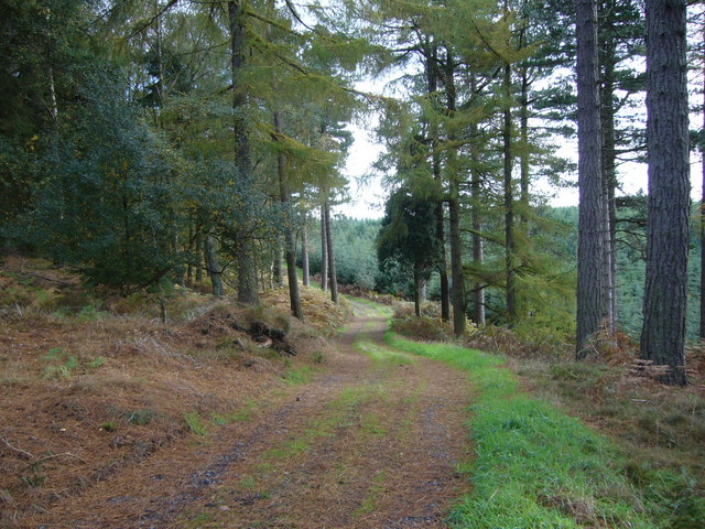
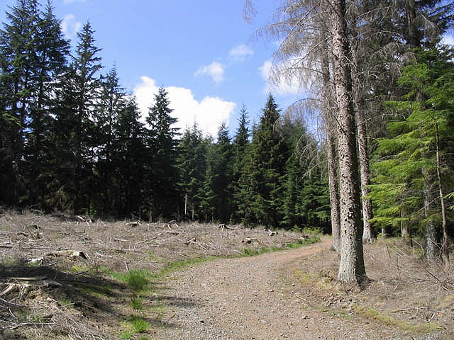
Black Heddon Hill Images

Images are sourced within 2km of 55.6359/-1.9293354 or Grid Reference NU0438. Thanks to Geograph Open Source API. All images are credited.

Kyloe Hills Viewed from the west.
Kyloe Hills
Viewed from the west.
Holburn Lake ... ... boasts an island that's taken quite a beating from those relentless Canada Geese. Their constant nibbling has worn it down quite a bit.
Holburn Lake ...
... boasts an island that's taken quite a beating from those relentless Canada Geese. Their constant nibbling has worn it down quite a bit.
Forest track in Kyloe Wood
Forest track near the top of Shepherdskirk Hill
Farm track This track with Kyloe Wood on the left, is also a public footpath leading to Shiellow Wood.
Farm track
This track with Kyloe Wood on the left, is also a public footpath leading to Shiellow Wood.
Holburn Moss An old post stands at the edge of Holburn Moss with Shiellow Wood behind.
Holburn Moss
An old post stands at the edge of Holburn Moss with Shiellow Wood behind.
Footpath by Holburn Lake The east end of the lake with Copsey Hill behind.
Footpath by Holburn Lake
The east end of the lake with Copsey Hill behind.
Bales in a field Near Holburn Bridge.
Bales in a field
Near Holburn Bridge.
Shiellow Crags At the west-northwest end of a line of crags in Shiellow Wood.
Shiellow Crags
At the west-northwest end of a line of crags in Shiellow Wood.
Forestry road in Kyloe Wood
Farm storage building In the Kyloe Hills near Collar Heugh.
Farm storage building
In the Kyloe Hills near Collar Heugh.
Lowick Castle This is considered to be the site of Lowick Castle.
For history and other picture <span class="nowrap"><a title="http://www.northofthetyne.co.uk/Motte%26Baileytraces.html" rel="nofollow ugc noopener" href="http://www.northofthetyne.co.uk/Motte%26Baileytraces.html">Link</a><img style="margin-left:2px;" alt="External link" title="External link - shift click to open in new window" src="https://s1.geograph.org.uk/img/external.png" width="10" height="10"/></span>
Lowick Castle
This is considered to be the site of Lowick Castle. For history and other picture LinkExternal link
The St Cuthberts Way between Buckton Moor and Kyloe Wood
The edge of Buckton Moor
Boundary between cultivation and open  moor The field had already been cut for hay or silage and this was the second growth.
Boundary between cultivation and open moor
The field had already been cut for hay or silage and this was the second growth.
Track leading to forestry and moorland The track had recently been paved with tarmacadam rubble - an excellent surface once it beds in. This surface had just been laid and was loose as well as quite pungent.
Track leading to forestry and moorland
The track had recently been paved with tarmacadam rubble - an excellent surface once it beds in. This surface had just been laid and was loose as well as quite pungent.
Rabbit Hill under forestry I thought Rabbit Hill would be a little more obvious but the forestry had subdued its contours.
Rabbit Hill under forestry
I thought Rabbit Hill would be a little more obvious but the forestry had subdued its contours.
Small gateway in wall between mature forest and open moor This was a mature forest rich with species - not an ordinary plantation like the one to the east (behind the photographer).
Small gateway in wall between mature forest and open moor
This was a mature forest rich with species - not an ordinary plantation like the one to the east (behind the photographer).
Show me another place!

Black Heddon Hill is located at Grid Ref: NU0438 (Lat: 55.6359, Lng: -1.9293354)

Unitary Authority: Northumberland

Police Authority: Northumbria

What 3 Words

///mirroring.teacher.presses. Near Lowick, Northumberland

Related Wikis

Kyloe

Kyloe is a civil parish in the county of Northumberland, about 8 miles (13 km) south-east of Berwick-upon-Tweed. According to the parish council, the main...

Holburn

Holburn is a hamlet in the English county of Northumberland. Holburn is located between Lowick and Belford. == Governance == Holburn is in the parliamentary...

Holburn Lake and Moss

Holburn Lake and Moss is a nature reserve in Northumberland, England to the east of the village of Holburn. Nearby is St Cuthbert's Cave. == The lake... ==

Fenwick, Kyloe

Fenwick is a small hamlet in the civil parish of Kyloe near Berwick-upon-Tweed and has a population of approx 400. Fenwick lies only three miles from Holy...

Nearby Amenities

Located within 500m of 55.6359,-1.9293354
Shepherdskirk Cairn Hill
Ele: 202
Natural: peak
Lat/Long: 55.6387184/-1.9313085
The data included in this document is from www.openstreetmap.org. The data is made available under ODbL.

Have you been to Black Heddon Hill?

Leave your review of Black Heddon Hill below (or comments, questions and feedback).