Whitfield Brow
Hill, Mountain in Durham
England
Whitfield Brow

Whitfield Brow is a prominent hill located in Durham, England. Standing at an elevation of approximately 299 meters (981 feet), it is considered one of the highest points in the region. Situated in the northern part of the county, it is part of the North Pennines Area of Outstanding Natural Beauty.
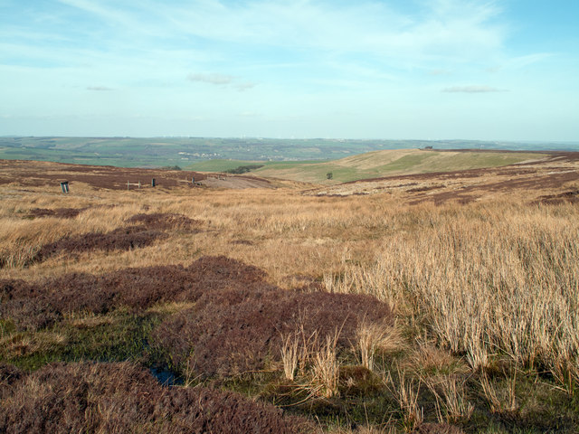
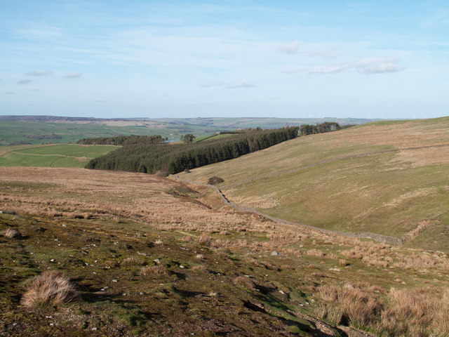
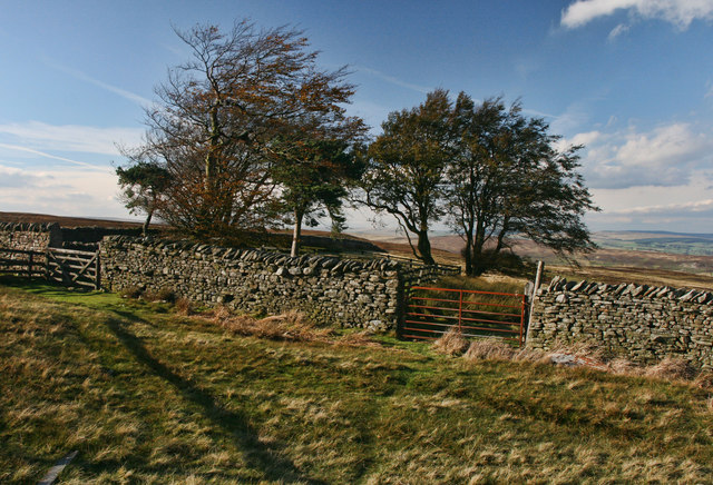
The hill is characterized by its rugged terrain and is primarily composed of limestone. Its slopes are covered in a variety of vegetation, including grasses, heather, and shrubs, creating a diverse and picturesque landscape. Whitfield Brow offers breathtaking panoramic views of the surrounding countryside, with sights stretching as far as the North Sea on clear days.
The hill is a popular destination for outdoor enthusiasts, attracting hikers, walkers, and nature lovers. There are several well-marked trails that lead to the summit, providing visitors with the opportunity to explore the area and enjoy the stunning scenery. The hill also offers a peaceful and tranquil atmosphere, making it an ideal spot for picnics and relaxation.
Whitfield Brow is home to a myriad of wildlife, including various bird species, such as peregrine falcons and curlews, as well as small mammals like rabbits and hares. The hill is also known for its rich archaeological history, with evidence of ancient settlements and prehistoric activities discovered in the surrounding areas.
Overall, Whitfield Brow in Durham is a remarkable natural landmark, offering visitors a chance to immerse themselves in the beauty of the North Pennines and enjoy the peace and serenity of the countryside.
If you have any feedback on the listing, please let us know in the comments section below.
Whitfield Brow Images
Images are sourced within 2km of 54.704055/-1.9906105 or Grid Reference NZ0034. Thanks to Geograph Open Source API. All images are credited.


Whitfield Brow is located at Grid Ref: NZ0034 (Lat: 54.704055, Lng: -1.9906105)
Unitary Authority: County Durham
Police Authority: Durham
What 3 Words
///remove.sock.poetry. Near Stanhope, Co. Durham
Nearby Locations
Related Wikis

Cornish Hush Mine
The Cornish Hush Mine was a British lead ore and fluorspar mine in Weardale. == Location == The mine was located in the Howden Burn valley in the Bollihope...
Hill End, County Durham
Hill End is a village in the civil parish of Stanhope, in County Durham, England. It is situated on the south side of Weardale, near Frosterley. ��2�...
White Kirkley
White Kirkley is a small village in the civil parish of Stanhope, in County Durham, England. It is situated on the south side of Weardale, opposite Frosterley...

Bridge End, County Durham
Bridge End is a hamlet in the civil parish of Stanhope, in County Durham, England. It is situated on the south bank of the River Wear, on the other side...
Nearby Amenities
Located within 500m of 54.704055,-1.9906105Have you been to Whitfield Brow?
Leave your review of Whitfield Brow below (or comments, questions and feedback).