Ewe Hill

Hill, Mountain in Northumberland

England

Ewe Hill

The River Breamish This is a quiet stretch of the River Breamish, caught between the steep flanks of Hartside Hill and Brough Law. Access from this point on foot along the right hand bank of the river is blocked by a fairly substantial rocky outcrop. For a selection of detailed free to download walking routes in the area visit <span class="nowrap"><a title="www.cheviotwalks.co.uk" rel="nofollow ugc noopener" href="http://www.cheviotwalks.co.uk">Link</a><img style="margin-left:2px;" alt="External link" title="External link - shift click to open in new window" src="https://s1.geograph.org.uk/img/external.png" width="10" height="10"/></span>
The River Breamish Credit: Geoff Holland

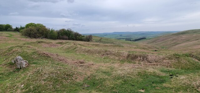
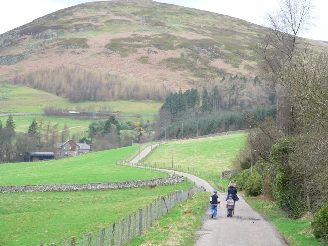
Ewe Hill is a prominent hill located in Northumberland, England. It is situated in the northern part of the county, near the village of Elsdon. Standing at an elevation of approximately 1,513 feet (461 meters), it is one of the notable peaks in the area.

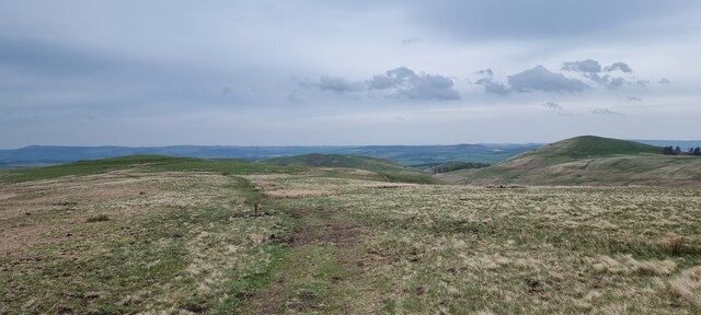
The hill is characterized by its gently sloping sides, covered with grass and heather, which give it a picturesque appearance. From the summit, there are panoramic views of the surrounding countryside, including the nearby Cheviot Hills to the north and the Simonside Hills to the east.

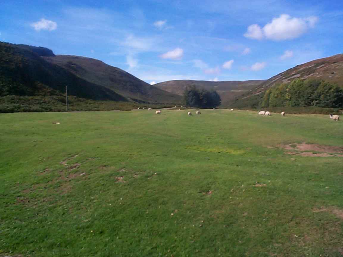
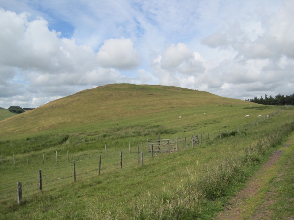
Ewe Hill is a popular destination for outdoor enthusiasts, particularly hikers and walkers, who are drawn to the stunning landscapes and scenic trails that traverse the hill. The routes leading up to the summit offer varying degrees of difficulty, catering to both experienced climbers and casual walkers.

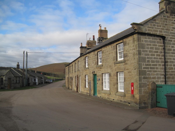
The hill is also home to a diverse range of flora and fauna, including heather, bilberry, and various species of birds and mammals. Additionally, the area surrounding Ewe Hill is dotted with ancient archaeological sites, such as Bronze Age burial cairns and Iron Age hill forts, adding to its historical significance.

Ewe Hill is easily accessible by road, with several parking areas located nearby, allowing visitors to embark on their adventure with ease. It is a place where nature enthusiasts can immerse themselves in the beauty of Northumberland's countryside, enjoy breathtaking views, and experience the serenity of the great outdoors.

If you have any feedback on the listing, please let us know in the comments section below.

Ewe Hill Images

Images are sourced within 2km of 55.433453/-1.9982497 or Grid Reference NU0015. Thanks to Geograph Open Source API. All images are credited.

The River Breamish This is a quiet stretch of the River Breamish, caught between the steep flanks of Hartside Hill and Brough Law. Access from this point on foot along the right hand bank of the river is blocked by a fairly substantial rocky outcrop. For a selection of detailed free to download walking routes in the area visit <span class="nowrap"><a title="www.cheviotwalks.co.uk" rel="nofollow ugc noopener" href="http://www.cheviotwalks.co.uk">Link</a><img style="margin-left:2px;" alt="External link" title="External link - shift click to open in new window" src="https://s1.geograph.org.uk/img/external.png" width="10" height="10"/></span>
The River Breamish
This is a quiet stretch of the River Breamish, caught between the steep flanks of Hartside Hill and Brough Law. Access from this point on foot along the right hand bank of the river is blocked by a fairly substantial rocky outcrop. For a selection of detailed free to download walking routes in the area visit LinkExternal link
Footbridge across Greensidehill Burn The footbridge lies close to a ford across the same burn just prior to it joining the River Breamish. In the middle distance are Ingram Glidders (called locally glitters), in other words the scree on the western slopes of Brough Law. For a selection of detailed free to download walking routes in the area visit <span class="nowrap"><a title="www.cheviotwalks.co.uk" rel="nofollow ugc noopener" href="http://www.cheviotwalks.co.uk">Link</a><img style="margin-left:2px;" alt="External link" title="External link - shift click to open in new window" src="https://s1.geograph.org.uk/img/external.png" width="10" height="10"/></span>
Footbridge across Greensidehill Burn
The footbridge lies close to a ford across the same burn just prior to it joining the River Breamish. In the middle distance are Ingram Glidders (called locally glitters), in other words the scree on the western slopes of Brough Law. For a selection of detailed free to download walking routes in the area visit LinkExternal link
Confluence of the Greensidehill Burn and the River Breamish Here, opposite the steep western slopes of Brough Law, the Greensidehill Burn flows into the larger River Breamish. For a selection of detailed free to download walking routes in the area visit <span class="nowrap"><a title="www.cheviotwalks.co.uk" rel="nofollow ugc noopener" href="http://www.cheviotwalks.co.uk">Link</a><img style="margin-left:2px;" alt="External link" title="External link - shift click to open in new window" src="https://s1.geograph.org.uk/img/external.png" width="10" height="10"/></span>
Confluence of the Greensidehill Burn and the River Breamish
Here, opposite the steep western slopes of Brough Law, the Greensidehill Burn flows into the larger River Breamish. For a selection of detailed free to download walking routes in the area visit LinkExternal link
Stile near Hartside Hill The green and yellow roundel attached to the fence indicates that a public footpath heads to the right after crossing the stile although there is no indication of a footpath on the ground. Ahead, stretches the Breamish Valley squeezed between the steep slopes of Brough Law and Hartside Hill. For a selection of detailed free to download walking routes in the area visit <span class="nowrap"><a title="www.cheviotwalks.co.uk" rel="nofollow ugc noopener" href="http://www.cheviotwalks.co.uk">Link</a><img style="margin-left:2px;" alt="External link" title="External link - shift click to open in new window" src="https://s1.geograph.org.uk/img/external.png" width="10" height="10"/></span>
Stile near Hartside Hill
The green and yellow roundel attached to the fence indicates that a public footpath heads to the right after crossing the stile although there is no indication of a footpath on the ground. Ahead, stretches the Breamish Valley squeezed between the steep slopes of Brough Law and Hartside Hill. For a selection of detailed free to download walking routes in the area visit LinkExternal link
Ford across the Greensidehill Burn This small ford lies close to the small footbridge shown at <a title="https://www.geograph.org.uk/photo/6939036" href="https://www.geograph.org.uk/photo/6939036">Link</a> and the confluence of the burn with the River Breamish <a title="https://www.geograph.org.uk/photo/6939044" href="https://www.geograph.org.uk/photo/6939044">Link</a>. For a selection of detailed free to download walking routes in the area visit <span class="nowrap"><a title="www.cheviotwalks.co.uk" rel="nofollow ugc noopener" href="http://www.cheviotwalks.co.uk">Link</a><img style="margin-left:2px;" alt="External link" title="External link - shift click to open in new window" src="https://s1.geograph.org.uk/img/external.png" width="10" height="10"/></span>
Ford across the Greensidehill Burn
This small ford lies close to the small footbridge shown at Link and the confluence of the burn with the River Breamish Link. For a selection of detailed free to download walking routes in the area visit LinkExternal link
Brough Law, Northumberland Looking west over moorland from Brough Law Hillfort. The stone wall in the foreground is part of the remains of the Iron Age hillfort settlement.
Brough Law, Northumberland
Looking west over moorland from Brough Law Hillfort. The stone wall in the foreground is part of the remains of the Iron Age hillfort settlement.
Brough Law, Northumberland Looking west from the south of Brough Law.
Brough Law, Northumberland
Looking west from the south of Brough Law.
River Island, River Breamish This appears to be a good example of river bifurcation, which occurs when a river flowing in a single stream separates into two or more separate streams which then continue downstream. If the streams eventually merge again then the bifurcation forms a river island, as in this particular case. For a selection of detailed free to download walking routes in the area visit <span class="nowrap"><a title="www.cheviotwalks.co.uk" rel="nofollow ugc noopener" href="http://www.cheviotwalks.co.uk">Link</a><img style="margin-left:2px;" alt="External link" title="External link - shift click to open in new window" src="https://s1.geograph.org.uk/img/external.png" width="10" height="10"/></span>
River Island, River Breamish
This appears to be a good example of river bifurcation, which occurs when a river flowing in a single stream separates into two or more separate streams which then continue downstream. If the streams eventually merge again then the bifurcation forms a river island, as in this particular case. For a selection of detailed free to download walking routes in the area visit LinkExternal link
The fort on Brough Law This is an Iron age fort showing three lines of concentric walls.
The fort on Brough Law
This is an Iron age fort showing three lines of concentric walls.
Looking over the valley of the Chesters Burn On the Ingram Hill Forts Trail.
Looking over the valley of the Chesters Burn
On the Ingram Hill Forts Trail.
Brough Law Iron Age bivallet hillfort and hut circle ‘Heritage Gateway - Results’. 2012. Heritagegateway.org.uk <<span class="nowrap"><a title="https://www.heritagegateway.org.uk/Gateway/Results_Single.aspx?resourceID=304&uid=1865423" rel="nofollow ugc noopener" href="https://www.heritagegateway.org.uk/Gateway/Results_Single.aspx?resourceID=304&uid=1865423">Link</a><img style="margin-left:2px;" alt="External link" title="External link - shift click to open in new window" src="https://s1.geograph.org.uk/img/external.png" width="10" height="10"/></span> > [accessed 28 October 2022]

‌‘Heritage Gateway - Results’. 2012. Heritagegateway.org.uk <<span class="nowrap"><a title="https://www.heritagegateway.org.uk/Gateway/Results_Single.aspx?resourceID=304&uid=1865422" rel="nofollow ugc noopener" href="https://www.heritagegateway.org.uk/Gateway/Results_Single.aspx?resourceID=304&uid=1865422">Link</a><img style="margin-left:2px;" alt="External link" title="External link - shift click to open in new window" src="https://s1.geograph.org.uk/img/external.png" width="10" height="10"/></span> > [accessed 28 October 2022]‌
Brough Law Iron Age bivallet hillfort and hut circle
‘Heritage Gateway - Results’. 2012. Heritagegateway.org.uk <LinkExternal link > [accessed 28 October 2022] ‌‘Heritage Gateway - Results’. 2012. Heritagegateway.org.uk <LinkExternal link > [accessed 28 October 2022]‌
View to Hartside Hill
The River Breamish from the Air
Brough Law, Northumberland Looking east-northeast from the vicinity of Brough Law in the direction of the village of Ingram.
Brough Law, Northumberland
Looking east-northeast from the vicinity of Brough Law in the direction of the village of Ingram.
Ewe Hill, Northumberland Looking south across moorland towards Ewe Hill.
Ewe Hill, Northumberland
Looking south across moorland towards Ewe Hill.
Middle Dean, Northumberland Looking over the perimeter of Middle Dean Hillfort, to the right is the deep gully of Middledean Burn,
Middle Dean, Northumberland
Looking over the perimeter of Middle Dean Hillfort, to the right is the deep gully of Middledean Burn,
Cochrane Pike, Northumberland Looking east-northeast from west of Cochrane Pike. In the middle distance (left to right) can be seen Wether Hill, West Hill and Old Fawdon Hill. On top of both Wether Hill and Old Fawden Hill can be found the remains of ancient settlements.
Cochrane Pike, Northumberland
Looking east-northeast from west of Cochrane Pike. In the middle distance (left to right) can be seen Wether Hill, West Hill and Old Fawdon Hill. On top of both Wether Hill and Old Fawden Hill can be found the remains of ancient settlements.
Ingram Farm, Northumberland Looking over farmland towards Ingram Farm to the west of the hamlet of Ingram.
Ingram Farm, Northumberland
Looking over farmland towards Ingram Farm to the west of the hamlet of Ingram.
Show me another place!

Ewe Hill is located at Grid Ref: NU0015 (Lat: 55.433453, Lng: -1.9982497)

Unitary Authority: Northumberland

Police Authority: Northumbria

What 3 Words

///flexibly.mimics.banana. Near Whittingham, Northumberland

Nearby Locations

Ewe Hill

Related Wikis

Ingram, Northumberland

Ingram is a small village and civil parish in Northumberland, England. It is located in the Cheviots on the River Breamish, and on the edge of Northumberland...

Castle Knowe, Northumberland

Castle Knowe, also known as Clinch Castle, is the site of an Iron Age hillfort in Northumberland, England, about 1 mile south-east of the village of Ingram...

Linhope

Linhope is a small village in Northumberland, England. It is located in the Cheviots on the River Breamish, and within Northumberland National Park. Linhope...

Unthank, Alnham

Unthank is a hamlet and former civil parish, now in the parish of Alnham in Northumberland, England. In 1951 the parish had a population of 11. == History... ==

Branton, Northumberland

Branton is a village and former civil parish, now in the parish of Ingram, in Northumberland, England. It is about 9 miles (14 km) west of Alnwick. In...

Church of St Michael, Alnham

The Church of St Michael in Alnham, in the English county of Northumberland, is a medieval structure dating from circa 1200. Built on a Roman camp site...

Alnham

Alnham is a hamlet and civil parish in Northumberland, England. It is about 14 miles (23 km) west of Alnwick, about 6 miles (9.7 km) from Scotland and...

Brandon, Northumberland

Brandon is a village and former civil parish, now in the parish of Ingram, in Northumberland, in England. It is about 9 miles (14 km) north-west of Alnwick...

Nearby Amenities

Located within 500m of 55.433453,-1.9982497
Ewe Hill
Ele: 293
Natural: peak
Lat/Long: 55.4344308/-1.9965644
The data included in this document is from www.openstreetmap.org. The data is made available under ODbL.

Have you been to Ewe Hill?

Leave your review of Ewe Hill below (or comments, questions and feedback).