Hewcroft Hill

Hill, Mountain in Yorkshire

England

Hewcroft Hill

Not so old Boundary Marker on the west bank of the River Tees Parish Boundary Marker on the south side of a stream running into the River Tees. On the boundary of Hunderthwaite and Romaldkirk parishes. Inscribed HUNDERTHWAITE. The Romaldkirk marker is at NZ 00480 21316 on the north bank of the stream. A list of the boundary markers can be found here <span class="nowrap"><a title="https://1drv.ms/w/s!Apt1XW0zY8DDgcFsnkpupbpYSiiVEQ?e=TaoW1W" rel="nofollow ugc noopener" href="https://1drv.ms/w/s!Apt1XW0zY8DDgcFsnkpupbpYSiiVEQ?e=TaoW1W">Link</a><img style="margin-left:2px;" alt="External link" title="External link - shift click to open in new window" src="https://s1.geograph.org.uk/img/external.png" width="10" height="10"/></span>. Read "Marking Parish Boundaries Along the Teesdale Way" ISBN 0 9520624 2 9.

Milestone Society National ID: YN_TEES10pb
Not so old Boundary Marker on the west bank of the River Tees Credit: Mike Rayner

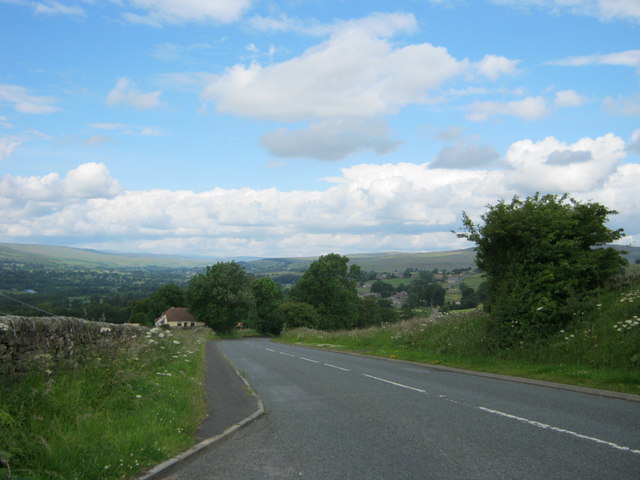
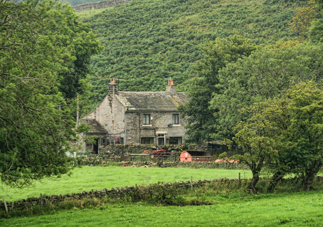
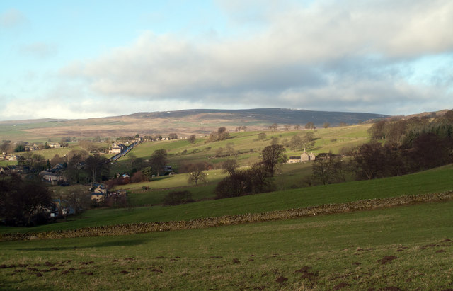
Hewcroft Hill, located in Yorkshire, England, is a prominent hill that offers breathtaking views and is a popular destination for nature enthusiasts and hikers. Situated in the picturesque Yorkshire Dales National Park, it stands at an elevation of approximately 500 meters (1,640 feet) above sea level.

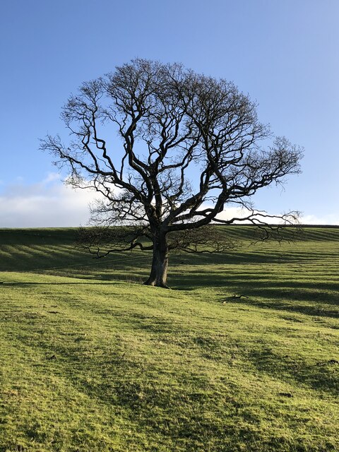
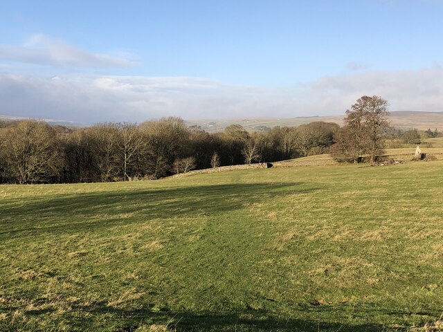
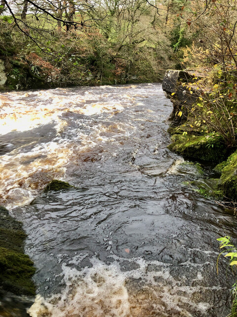
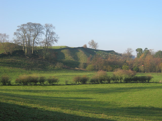
The hill is characterized by its gentle slopes covered in lush greenery, which is interspersed with vibrant wildflowers during the summer months. It is home to a diverse range of flora and fauna, including sheep, rabbits, and various bird species. The surrounding area boasts an array of natural wonders, such as cascading waterfalls, limestone cliffs, and caves.

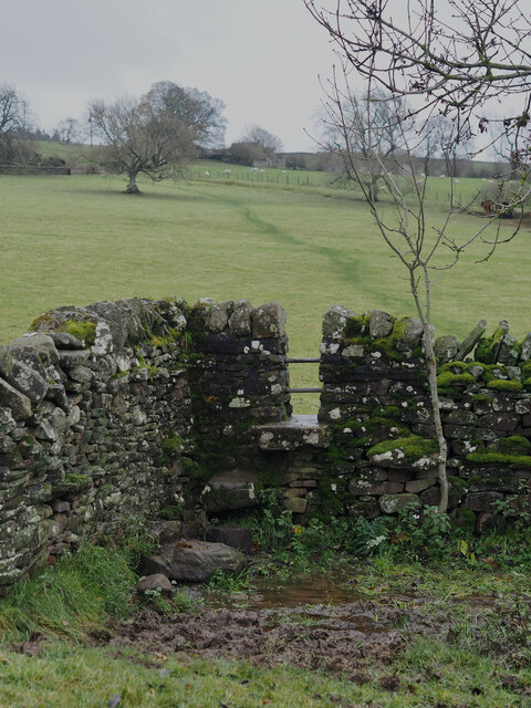
Hewcroft Hill is renowned for its extensive network of hiking trails, catering to all levels of ability. The pathways meander through the hill's stunning landscapes, providing stunning panoramic views of the Yorkshire Dales and beyond. The more adventurous visitors may choose to undertake challenging hikes that lead to the summit, rewarding them with even more breathtaking vistas.

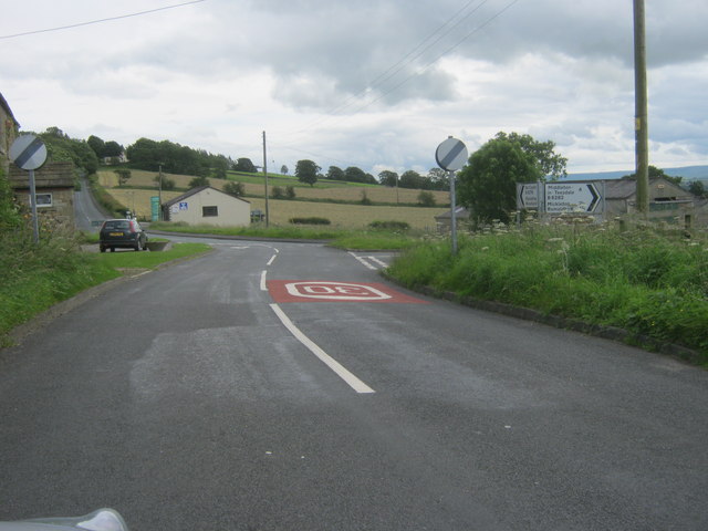
At the base of Hewcroft Hill, there is a small village that serves as a gateway to the hill. It offers amenities such as parking facilities, a visitor center, and a cafe, ensuring that visitors have access to refreshments and information about the local area.

Whether it is to appreciate the natural beauty, embark on an exhilarating hike, or simply to enjoy a peaceful picnic while taking in the views, Hewcroft Hill is a must-visit destination for those seeking a memorable experience in the heart of Yorkshire.

If you have any feedback on the listing, please let us know in the comments section below.

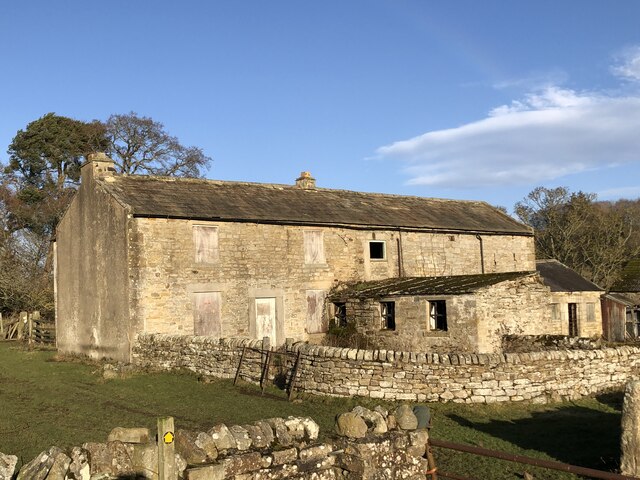
Hewcroft Hill Images

Images are sourced within 2km of 54.599091/-2.006004 or Grid Reference NY9922. Thanks to Geograph Open Source API. All images are credited.

Not so old Boundary Marker on the west bank of the River Tees Parish Boundary Marker on the south side of a stream running into the River Tees. On the boundary of Hunderthwaite and Romaldkirk parishes. Inscribed HUNDERTHWAITE. The Romaldkirk marker is at NZ 00480 21316 on the north bank of the stream. A list of the boundary markers can be found here <span class="nowrap"><a title="https://1drv.ms/w/s!Apt1XW0zY8DDgcFsnkpupbpYSiiVEQ?e=TaoW1W" rel="nofollow ugc noopener" href="https://1drv.ms/w/s!Apt1XW0zY8DDgcFsnkpupbpYSiiVEQ?e=TaoW1W">Link</a><img style="margin-left:2px;" alt="External link" title="External link - shift click to open in new window" src="https://s1.geograph.org.uk/img/external.png" width="10" height="10"/></span>. Read "Marking Parish Boundaries Along the Teesdale Way" ISBN 0 9520624 2 9.

Milestone Society National ID: YN_TEES10pb
Not so old Boundary Marker on the west bank of the River Tees
Parish Boundary Marker on the south side of a stream running into the River Tees. On the boundary of Hunderthwaite and Romaldkirk parishes. Inscribed HUNDERTHWAITE. The Romaldkirk marker is at NZ 00480 21316 on the north bank of the stream. A list of the boundary markers can be found here LinkExternal link. Read "Marking Parish Boundaries Along the Teesdale Way" ISBN 0 9520624 2 9. Milestone Society National ID: YN_TEES10pb
Not so old Boundary Marker on the west bank of the River Tees Parish Boundary Marker on the north side of a stream running into the River Tees. On the boundary of Hunderthwaite and Romaldkirk parishes. Inscribed ROMALDKIRK. The Hunderthwaite marker is at NZ 00479 21315 on the south bank of the stream. A list of the boundary markers can be found here <span class="nowrap"><a title="https://1drv.ms/w/s!Apt1XW0zY8DDgcFsnkpupbpYSiiVEQ?e=TaoW1W" rel="nofollow ugc noopener" href="https://1drv.ms/w/s!Apt1XW0zY8DDgcFsnkpupbpYSiiVEQ?e=TaoW1W">Link</a><img style="margin-left:2px;" alt="External link" title="External link - shift click to open in new window" src="https://s1.geograph.org.uk/img/external.png" width="10" height="10"/></span>. Read "Marking Parish Boundaries Along the Teesdale Way" ISBN 0 9520624 2 9.

Milestone Society National ID: YN_TEES10pb
Not so old Boundary Marker on the west bank of the River Tees
Parish Boundary Marker on the north side of a stream running into the River Tees. On the boundary of Hunderthwaite and Romaldkirk parishes. Inscribed ROMALDKIRK. The Hunderthwaite marker is at NZ 00479 21315 on the south bank of the stream. A list of the boundary markers can be found here LinkExternal link. Read "Marking Parish Boundaries Along the Teesdale Way" ISBN 0 9520624 2 9. Milestone Society National ID: YN_TEES10pb
Bare tree in rigg-and-furrow field
Course of the Teesdale Way near Barnley
Derelict farmhouse and buildings at Low Garth
River Tees in Full Spate by the Unreachable Fairy Cupboards
Stile Struggles: Cornered by an Impassable Quagmire
Oracular Ovines
Oracular Ovines
Folly Bank on the B6278 viewed from the viewpoint near the top
Folly House Folly House Farm.
Folly House
Folly House Farm.
B6278 The B6278 near Folly Head.
B6278
The B6278 near Folly Head.
Gueswick Hills near Romaldkirk
Fields above B6278 near Eggleston Eggleston with the B6278 can be seen at the left side of the image; the fields lie above the road on its north side. The distant high ground rises to Monk's Moor.
Fields above B6278 near Eggleston
Eggleston with the B6278 can be seen at the left side of the image; the fields lie above the road on its north side. The distant high ground rises to Monk's Moor.
The B6278 road joining the B6282 road at Eggleston
Junction of B classified roads outside Eggleston The B6282 and the B6278 meet just east of the County Durham village of Eggleston. The blue and yellow road sign is characteristic of a style of signage introduced by County Durham some years ago.
Junction of B classified roads outside Eggleston
The B6282 and the B6278 meet just east of the County Durham village of Eggleston. The blue and yellow road sign is characteristic of a style of signage introduced by County Durham some years ago.
Rutted route rising from Low Garth Farm access routes which become rutted are regularly hideously muddied affairs; not so here with this 'machined' way rising from the deserted farm at Low Garth above the west side of the River Tees.
Rutted route rising from Low Garth
Farm access routes which become rutted are regularly hideously muddied affairs; not so here with this 'machined' way rising from the deserted farm at Low Garth above the west side of the River Tees.
Teesdale Way rising through Great Wood The path rises obliquely across the slope on which Great Wood grows, the way being stepped with timbers retaining earth to ease passage and minimise erosion.
Teesdale Way rising through Great Wood
The path rises obliquely across the slope on which Great Wood grows, the way being stepped with timbers retaining earth to ease passage and minimise erosion.
Low Garth Low Garth is a deserted farm above the west side of the River Tees which despite being unoccupied for many years, (at least since 2003 - <a title="https://www.geograph.org.uk/photo/78187" href="https://www.geograph.org.uk/photo/78187">Link</a> ), seems to be structurally sound. The trees beyond appear to rise on a slope behind the buildings but they conceal the slot through which the River Tees flows unseen.
Low Garth
Low Garth is a deserted farm above the west side of the River Tees which despite being unoccupied for many years, (at least since 2003 - Link ), seems to be structurally sound. The trees beyond appear to rise on a slope behind the buildings but they conceal the slot through which the River Tees flows unseen.
Show me another place!

Hewcroft Hill is located at Grid Ref: NY9922 (Lat: 54.599091, Lng: -2.006004)

Division: North Riding

Unitary Authority: County Durham

Police Authority: Durham

What 3 Words

///power.buzzards.monk. Near Romaldkirk, Co. Durham

Related Wikis

Romaldkirk

Romaldkirk is a village in Teesdale, in the Pennines of England. The village lies within the historic boundaries of the North Riding of Yorkshire, but...

Eggleston Hall

Eggleston Hall is a privately owned 19th-century English country house in Eggleston, Teesdale, County Durham. It is a Grade II* listed building. ��2�...

Romaldkirk railway station

Romaldkirk railway station was situated on the Tees Valley Railway between Barnard Castle and Middleton-in-Teesdale. It served the village of Romaldkirk...
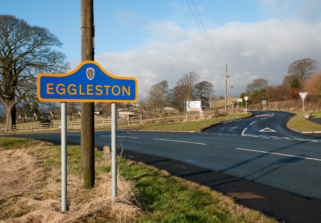
Eggleston

Eggleston is a village in County Durham, in England. The population of the civil parish taken at the 2011 Census was 448. It is in the Teesdale, a few...

Nearby Amenities

Located within 500m of 54.599091,-2.006004
Barrier: stile
Foot: yes
Lat/Long: 54.6008409/-2.0075721
Barrier: stile
Foot: yes
Lat/Long: 54.5986505/-2.0063513
Bus Stop
Egglestone Lane
Naptan AtcoCode: 13007003C
Naptan Bearing: E
Naptan BusStopType: MKD
Naptan CommonName: Egglestone Lane
Naptan Indicator: E-bound
Naptan Landmark: Landmark not known
Naptan NaptanCode: durdwamw
Naptan Notes: 1 Hutchison Terrace- off B6277 between Beer Beck High and Low Bridges- Romaldkirk
Naptan Street: Street not known
Naptan Verified: no
Source: naptan_import
Lat/Long: 54.5956634/-2.0102602
Bus Stop
Egglestone Lane
Naptan AtcoCode: 13007003G
Naptan Bearing: W
Naptan BusStopType: MKD
Naptan CommonName: Egglestone Lane
Naptan Indicator: W-bound
Naptan Landmark: Landmark not known
Naptan NaptanCode: durdwapa
Naptan Notes: Opposite 1 Hutchison Terrace- off B6277 between Beer Beck High and Low Bridges- Romaldkirk
Naptan Street: Street not known
Naptan Verified: no
Source: naptan_import
Lat/Long: 54.5955843/-2.0102653
Barrier: stile
Foot: yes
Lat/Long: 54.5966246/-2.0059503
Hewcroft Hill
Natural: peak
Source: OS OpenData StreetView
Lat/Long: 54.5990498/-2.0064307
Shoulder of Mutton
Natural: peak
Source: OS 1:25k
Lat/Long: 54.6006579/-2.0083561
Power: pole
Lat/Long: 54.599119/-2.0118351
Power: pole
Lat/Long: 54.5990281/-2.0130864
Power: pole
Lat/Long: 54.5982003/-2.003981
Power: pole
Lat/Long: 54.597172/-2.0041922
Power: pole
Transformer: distribution
Lat/Long: 54.59674/-2.004278
Power: pole
Lat/Long: 54.599192/-2.0105899
Power: pole
Lat/Long: 54.598983/-2.0090872
Power: pole
Lat/Long: 54.5988525/-2.0081913
Power: pole
Lat/Long: 54.5987227/-2.0072955
Power: pole
Lat/Long: 54.5985977/-2.0064385
Power: pole
Lat/Long: 54.5984306/-2.0053107
Power: pole
Lat/Long: 54.5982325/-2.0039763
The data included in this document is from www.openstreetmap.org. The data is made available under ODbL.

Have you been to Hewcroft Hill?

Leave your review of Hewcroft Hill below (or comments, questions and feedback).