Smeekin Hill

Hill, Mountain in Yorkshire

England

Smeekin Hill

Abel Cross A pair of wayside marker stones on the slopes above Crimsworth Dean
Abel Cross Credit: Kevin Waterhouse

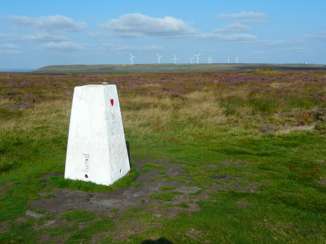
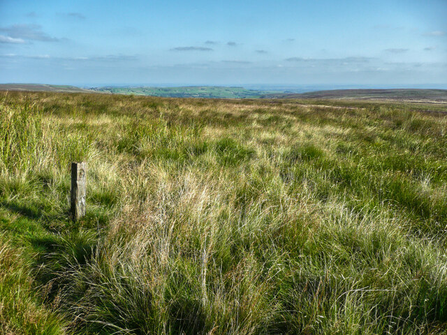
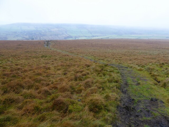
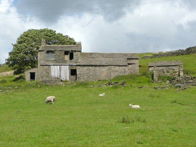
Smeekin Hill is a prominent hill located in the county of Yorkshire, England. Situated amidst the picturesque landscape of the Yorkshire Dales, it forms an important part of the local geography. The hill is characterized by its gently sloping terrain, reaching an elevation of approximately 500 meters (1,640 feet) above sea level.

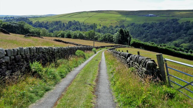
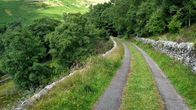
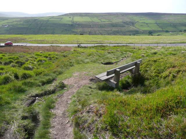
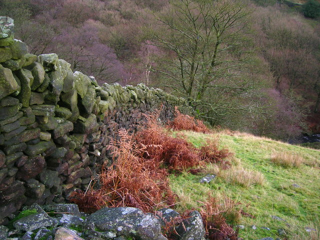
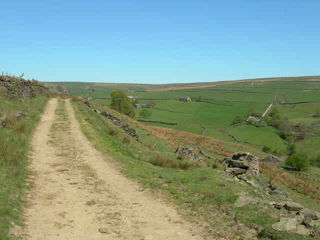
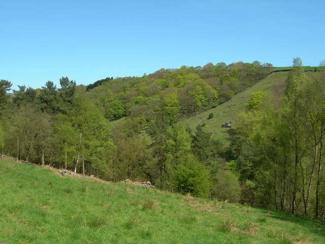
Covered in lush greenery, Smeekin Hill offers breathtaking panoramic views of the surrounding countryside. It is adorned with a variety of flora and fauna, making it an ideal destination for nature enthusiasts and hikers alike. The hill is also home to several species of birds, adding to its charm and appeal for birdwatchers.

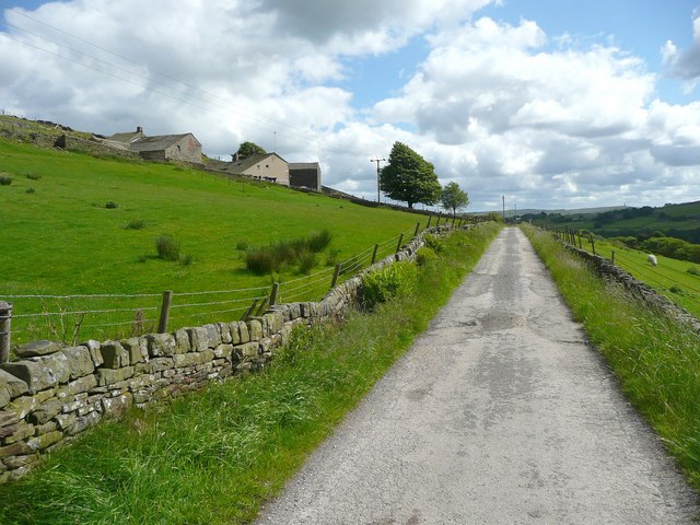
Smeekin Hill is often frequented by locals and tourists who come to enjoy its peaceful and serene atmosphere. Its tranquil surroundings and unspoiled natural beauty provide an excellent opportunity for visitors to relax and unwind. The hill offers various walking trails, allowing visitors to explore its enchanting landscape and discover its hidden gems.

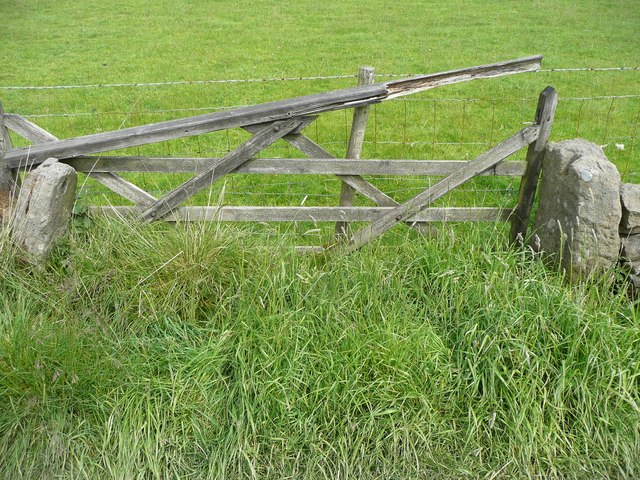
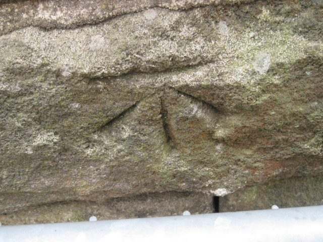
In addition to its natural allure, Smeekin Hill holds historical significance as well. It is believed to have been inhabited since ancient times, with evidence of prehistoric settlements in the area. The hill has also witnessed various historical events, and remnants of old structures can still be found scattered across its slopes.

Overall, Smeekin Hill stands as a captivating landmark in Yorkshire, offering a blend of natural splendor and historical intrigue. Its scenic beauty and tranquil ambiance make it a must-visit destination for those seeking a peaceful retreat amidst the stunning Yorkshire countryside.

If you have any feedback on the listing, please let us know in the comments section below.

Smeekin Hill Images

Images are sourced within 2km of 53.760766/-2.0132503 or Grid Reference SD9929. Thanks to Geograph Open Source API. All images are credited.

Abel Cross A pair of wayside marker stones on the slopes above Crimsworth Dean
Abel Cross
A pair of wayside marker stones on the slopes above Crimsworth Dean
Helliwell Wood Farmhouse In Crimsworth Dean
Helliwell Wood Farmhouse
In Crimsworth Dean
Barker Cote Farmhouse Converted to residential
Barker Cote Farmhouse
Converted to residential
Aqueduct in Crimsworth Dean The aqueduct connects a dam on the west side of Bridge Clough with one on the east. These dams connect with ones lower down the valley and all appeared to service Midgehole Dye Works
Aqueduct in Crimsworth Dean
The aqueduct connects a dam on the west side of Bridge Clough with one on the east. These dams connect with ones lower down the valley and all appeared to service Midgehole Dye Works
Small Shaw Lane Descending into Crimsworth Dean and approaching the first of two hairpin bends to reach the valley bottom
Small Shaw Lane
Descending into Crimsworth Dean and approaching the first of two hairpin bends to reach the valley bottom
Small Shaw Lane Descending into Crimsworth Dean and approaching the second of two hairpin bends to reach the valley bottom
Small Shaw Lane
Descending into Crimsworth Dean and approaching the second of two hairpin bends to reach the valley bottom
Triangulation pillar on High Brown Knoll, Wadsworth The pillar has had a new coat of paint and been given a simple decoration - a red heart. The wind farm on Ovenden Moor is in the distance.
Triangulation pillar on High Brown Knoll, Wadsworth
The pillar has had a new coat of paint and been given a simple decoration - a red heart. The wind farm on Ovenden Moor is in the distance.
Waymark post on the Limers Gate bridleway, Wadsworth This is one of a series of posts on the route of the bridleway, which is now an indistinct path as the main track is now via Wadsworth Lowe (boundary stone) and the triangulation pillar.
Waymark post on the Limers Gate bridleway, Wadsworth
This is one of a series of posts on the route of the bridleway, which is now an indistinct path as the main track is now via Wadsworth Lowe (boundary stone) and the triangulation pillar.
Limers Gate The bridleway descending off Naze Hill towards the A6033 Hebden Bridge Road
Limers Gate
The bridleway descending off Naze Hill towards the A6033 Hebden Bridge Road
Seat on Limers Gate Overlooking the junction with the A6033 and the Crimsworth Dean valley.
Seat on Limers Gate
Overlooking the junction with the A6033 and the Crimsworth Dean valley.
Cow Hey Lane, Wadsworth Lady Royd Farm is on the hillside.
Cow Hey Lane, Wadsworth
Lady Royd Farm is on the hillside.
Gate at Lady Royd Farm, Wadsworth The gate posts have a hole on the left into which a pole could be inserted, and a slot on the right into which the other end of the pole could be lowered. Presumably the pole would have vertical slats nailed onto it.
Gate at Lady Royd Farm, Wadsworth
The gate posts have a hole on the left into which a pole could be inserted, and a slot on the right into which the other end of the pole could be lowered. Presumably the pole would have vertical slats nailed onto it.
Derelict building at Lady Royd Farm, Wadsworth The first floor windows look domestic, as if the building has been a cottage, or perhaps sleeping accommodation above a cart shed.
Derelict building at Lady Royd Farm, Wadsworth
The first floor windows look domestic, as if the building has been a cottage, or perhaps sleeping accommodation above a cart shed.
Drystone wall in Crimsworth Dean
Just south of Nook Looking south down Grimsworth Dean/Middle Dean.
Stoodley Pike in the background.
Just south of Nook
Looking south down Grimsworth Dean/Middle Dean. Stoodley Pike in the background.
Just south of Nook Looking northeast towards Under Hill, at the junction with Sunny Bank Road (on the right) leading down to Sunny Bank and Lumb Bridge.
Just south of Nook
Looking northeast towards Under Hill, at the junction with Sunny Bank Road (on the right) leading down to Sunny Bank and Lumb Bridge.
Bridge Clough Looking northeast to Green Hirst Wood.
Bridge Clough
Looking northeast to Green Hirst Wood.
Ordnance Survey Cut Mark This mark can be found on one of the buildings at Laithe Farm.
For more detail see : <span class="nowrap"><a title="http://www.bench-marks.org.uk/bm40551" rel="nofollow ugc noopener" href="http://www.bench-marks.org.uk/bm40551">Link</a><img style="margin-left:2px;" alt="External link" title="External link - shift click to open in new window" src="https://s1.geograph.org.uk/img/external.png" width="10" height="10"/></span>
Ordnance Survey Cut Mark
This mark can be found on one of the buildings at Laithe Farm. For more detail see : LinkExternal link
Show me another place!

Smeekin Hill is located at Grid Ref: SD9929 (Lat: 53.760766, Lng: -2.0132503)

Division: West Riding

Unitary Authority: Calderdale

Police Authority: West Yorkshire

What 3 Words

///untruth.losses.down. Near Hebden Bridge, West Yorkshire

Related Wikis

Wainsgate Baptist Church

Wainsgate Baptist Church is a redundant chapel standing in an elevated position above the town of Hebden Bridge, West Yorkshire, England (grid reference...

Old Town, West Yorkshire

Old Town is a village in Calderdale, West Yorkshire, England. It is situated on a hilltop above Hebden Bridge and across the Hebden valley from Heptonstall...

Wadsworth, West Yorkshire

Wadsworth is a civil parish in the Metropolitan Borough of Calderdale in West Yorkshire, England. It has a population of 1,456, increasing to 1,603 at...

Chiserley

Chiserley is a hamlet located on a hilltop near the town of Hebden Bridge, in the county of West Yorkshire, England. The Hamlet falls within the Calder...

Hepton Rural District

Hepton was a rural district in the West Riding of Yorkshire, England, from 1894 to 1974. The district included four civil parishes: Heptonstall, Blackshaw...

Heptonstall

Heptonstall is a small village and civil parish within the Calderdale borough of West Yorkshire, England, historically part of the West Riding of Yorkshire...

Birchcliffe Baptist Church

Birchcliffe Baptist Church is a redundant Baptist chapel in the town of Hebden Bridge, West Yorkshire, England. It was founded by Daniel Taylor in 1764...

Hardcastle Crags

Hardcastle Crags is a wooded Pennine valley in West Yorkshire, England, owned by the National Trust. Historically part of the West Riding of Yorkshire...

Nearby Amenities

Located within 500m of 53.760766,-2.0132503
Waterway: weir
Lat/Long: 53.7575363/-2.0181443
Bus Stop
Hardcastle Crags
Bus: yes
Local Ref: 45019000
Naptan AtcoCode: 450019000
Naptan Bearing: SE
Naptan CommonName: Hardcastle Crags
Naptan Crossing: Adj Crimsworth Terrace
Naptan Indicator: Stop 45019000
Naptan Landmark: Adj Horse Bridge
Naptan PlusbusZoneRef: LEEDS
Naptan ShortCommonName: Hardcastle Crags
Naptan Street: Midgehole Road
Naptan Verified: yes
Public Transport: platform
Shelter: no
Source: naptan_import
Lat/Long: 53.7585754/-2.0180744
Bus Stop
Keighley Road Pecket Well
Local Ref: 45020902
Naptan AtcoCode: 450020902
Naptan Bearing: SW
Naptan CommonName: Keighley Road Pecket Well
Naptan Indicator: Stop 45020902
Naptan Landmark: Kitling Bridge
Naptan Notes: OSR taken place 140905
Naptan PlusbusZoneRef: LEEDS
Naptan ShortCommonName: Akroyd
Naptan Street: Keighley Road
Naptan Verified: no
Source: naptan_import
Lat/Long: 53.7590515/-2.0089644
Bus Stop
Pecket Bar Keighley Road
Local Ref: 45020903
Naptan AtcoCode: 450020903
Naptan Bearing: NE
Naptan CommonName: Pecket Bar Keighley Road
Naptan Crossing: Pecket Bar
Naptan Indicator: Stop 45020903
Naptan PlusbusZoneRef: LEEDS
Naptan ShortCommonName: Pecket Bar
Naptan Street: Keighley Road
Naptan Verified: no
Shelter: yes
Source: naptan_import
Lat/Long: 53.7605078/-2.0071141
Bus Stop
Keighley Road Pecket Bar
Local Ref: 45025569
Naptan AtcoCode: 450025569
Naptan Bearing: SW
Naptan CommonName: Keighley Road Pecket Bar
Naptan Crossing: Pecket Bar
Naptan Indicator: Stop 45025569
Naptan PlusbusZoneRef: LEEDS
Naptan ShortCommonName: Pecket Bar
Naptan Street: Keighley Road
Naptan Verified: no
Shelter: no
Source: naptan_import
Lat/Long: 53.7604635/-2.0070488
Bus Stop
Midgehole Road Hebden Terrace
Local Ref: 45024709
Naptan AtcoCode: 450024709
Naptan Bearing: SE
Naptan CommonName: Midgehole Road Hebden Terrace
Naptan Crossing: Hebden Terrace
Naptan Indicator: Stop 45024709
Naptan PlusbusZoneRef: LEEDS
Naptan ShortCommonName: Hebden Terrace
Naptan Street: Midgehole Road
Naptan Verified: no
Source: naptan_import
Lat/Long: 53.7572081/-2.0148274
Bus Stop
Keighley Road Ackroyd Path
Local Ref: 45051043
Naptan AtcoCode: 450051043
Naptan Bearing: NE
Naptan BusStopType: CUS
Naptan CommonName: Keighley Road Ackroyd Path
Naptan Crossing: Ackroyd Path
Naptan Indicator: Stop 45051043
Naptan PlusbusZoneRef: LEEDS
Naptan ShortCommonName: Sunny Royd
Naptan Street: Keighley Road
Naptan Verified: no
Source: naptan_import
Lat/Long: 53.7591055/-2.0090554
Bus Stop
Keighley Road Crimsworth Lane
Local Ref: 45051047
Naptan AtcoCode: 450051047
Naptan Bearing: NW
Naptan BusStopType: CUS
Naptan CommonName: Keighley Road Crimsworth Lane
Naptan Crossing: Crimsworth Lane
Naptan Indicator: Stop 45051047
Naptan PlusbusZoneRef: LEEDS
Naptan ShortCommonName: Higher Crimsworth
Naptan Street: Keighley Road
Naptan Verified: no
Source: naptan_import
Lat/Long: 53.7648219/-2.0099972
Midgehole Road Dye Works
Local Ref: 45051467
Naptan AtcoCode: 450051467
Naptan Bearing: NW
Naptan BusStopType: CUS
Naptan CommonName: Midgehole Road Dye Works
Naptan Indicator: Stop 45051467
Naptan PlusbusZoneRef: LEEDS
Naptan ShortCommonName: Hebden Terrace
Naptan Street: Midgehole Road
Naptan Verified: no
Source: naptan_import
Lat/Long: 53.7571534/-2.0148652
Smeekin Hill War Memorial.
Historic: memorial
Wheelchair: no
Lat/Long: 53.7597419/-2.0135356
Post Box
Brand: Royal Mail
Brand Wikidata: Q638098
Brand Wikipedia: en:Royal Mail
Collection Times: Mo-Fr 16:15; Sa 11:30
Operator: Royal Mail
Operator Wikidata: Q638098
Ref: HX7 170
Royal Cypher: EIIR
Royal Cypher Wikidata: Q33102113
Lat/Long: 53.7585964/-2.0183716
Telephone
Booth: K6
Covered: booth
Man Made: telephone_box
Tourism: information
Lat/Long: 53.7613075/-2.0062703
Post Box
Post Box Type: wall
Royal Cypher: EVIIR
Royal Cypher Wikidata: Q33102324
Lat/Long: 53.7614835/-2.0061281
Leisure: picnic_table
Lat/Long: 53.7588176/-2.0183891
Barrier: stile
Lat/Long: 53.7623931/-2.0114852
Barrier: stile
Lat/Long: 53.7627316/-2.0097235
Barrier: stile
Lat/Long: 53.76314/-2.0080955
Barrier: stile
Lat/Long: 53.7583301/-2.0071887
Information: guidepost
Tourism: information
Lat/Long: 53.7585364/-2.0076401
Information: guidepost
Tourism: information
Lat/Long: 53.7585144/-2.0076976
Access: private
Fixme: Check operator - conflicting information found
Leisure: fishing
Lat/Long: 53.7575929/-2.0185141
Power: pole
Lat/Long: 53.7593255/-2.0077244
Power: pole
Lat/Long: 53.7590031/-2.0197047
Power: pole
Lat/Long: 53.7585797/-2.0191897
Power: pole
Lat/Long: 53.7580327/-2.0184883
Power: pole
Lat/Long: 53.7577567/-2.0181303
Power: pole
Lat/Long: 53.7574618/-2.0172411
Power: pole
Lat/Long: 53.7571145/-2.0162018
Barrier: entrance
Lat/Long: 53.7572148/-2.0148515
Power: pole
Lat/Long: 53.7609328/-2.0199367
Power: pole
Lat/Long: 53.760274/-2.0202144
Power: pole
Lat/Long: 53.7596239/-2.0204853
Power: pole
Lat/Long: 53.7596215/-2.0205939
Power: substation
Lat/Long: 53.7569884/-2.0137087
Midgehole Farm
Place: farm
Source Name: OS_OpenData_StreetView
Lat/Long: 53.756485/-2.0125473
Toilets
Lat/Long: 53.7585465/-2.0178995
Bench
Lat/Long: 53.7612797/-2.00623
Historic: memorial
Lat/Long: 53.7613024/-2.0062112
Advertising: board
Lat/Long: 53.7613326/-2.0062326
The data included in this document is from www.openstreetmap.org. The data is made available under ODbL.

Have you been to Smeekin Hill?

Leave your review of Smeekin Hill below (or comments, questions and feedback).