Yarnshaw Hill

Hill, Mountain in Cheshire

England

Yarnshaw Hill

Shutlingsloe From Croker Hill
Shutlingsloe Credit: Anthony O'Neil

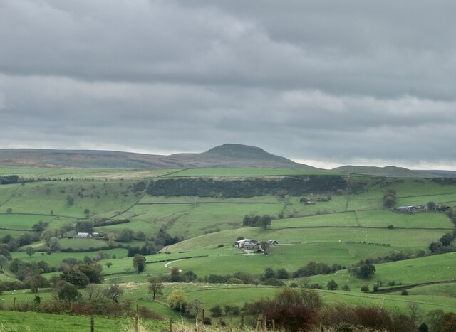
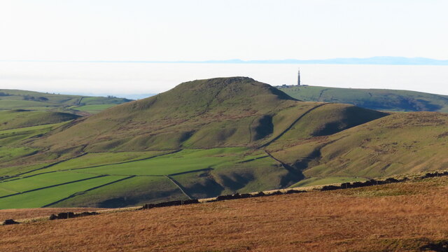
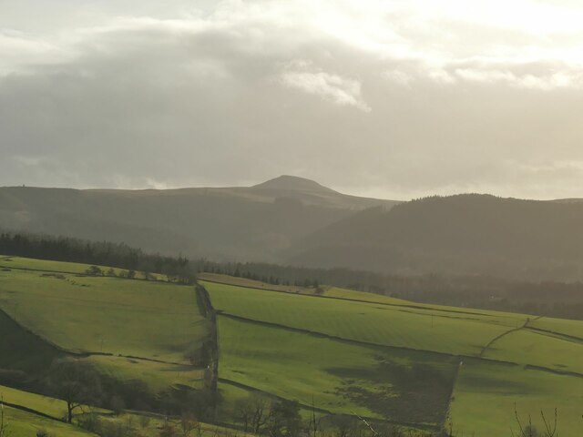
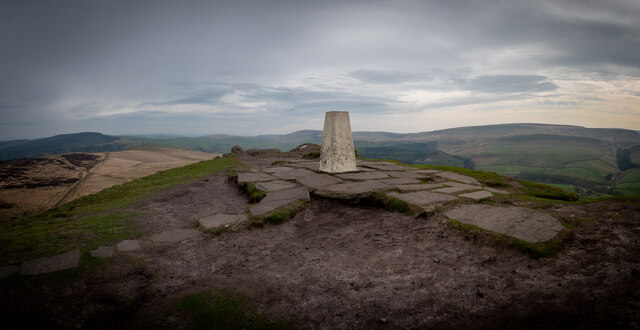
Yarnshaw Hill is a prominent hill located in the county of Cheshire, England. Situated in the northeastern part of the county, it forms a part of the Peak District National Park. The hill is renowned for its picturesque landscapes and offers breathtaking views of the surrounding countryside.

With an elevation of approximately 326 meters (1,070 feet), Yarnshaw Hill is not classified as a mountain but rather a prominent hill. It is formed from millstone grit, which is a type of sandstone commonly found in the Peak District region. The hill is covered with a mix of grassland, heath, and small patches of woodland.

Yarnshaw Hill is a popular destination for outdoor enthusiasts, including hikers, walkers, and nature lovers. Several footpaths and trails traverse the hill, allowing visitors to explore its diverse flora and fauna. The area is home to a variety of wildlife, including rabbits, foxes, and various bird species.

The hill's location within the Peak District National Park provides access to a range of other attractions and activities. Nearby, there are charming villages, historic sites, and other natural landmarks, such as the Roaches and the Tegg's Nose Country Park.

Overall, Yarnshaw Hill in Cheshire offers visitors a chance to immerse themselves in the natural beauty of the Peak District, providing stunning views, diverse wildlife, and a tranquil environment for outdoor recreation.

If you have any feedback on the listing, please let us know in the comments section below.

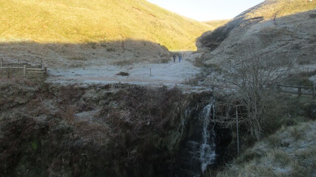
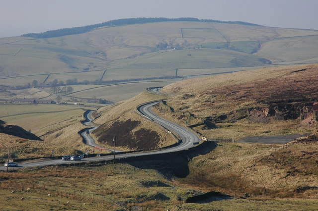
Yarnshaw Hill Images

Images are sourced within 2km of 53.2339/-2.0209491 or Grid Reference SJ9870. Thanks to Geograph Open Source API. All images are credited.

Shutlingsloe From Croker Hill
Shutlingsloe
From Croker Hill
Shutlingsloe & Croker Hill from Whetstone Ridge A clear sunny morning with a cold air inversion over the Cheshire Plain. The hills beyond are just into Wales.
Shutlingsloe & Croker Hill from Whetstone Ridge
A clear sunny morning with a cold air inversion over the Cheshire Plain. The hills beyond are just into Wales.
View towards Shutlingsloe from Tegg's Nose visitor centre The distance between the two is 4.5km as the crow flies.
View towards Shutlingsloe from Tegg's Nose visitor centre
The distance between the two is 4.5km as the crow flies.
Shutlingsloe from near Crag Hall, Wildboarclough
Shuttlingsloe Summit Panno Class: Ethel, Hump, Dodd (500-599m), Dewey  ( <span class="nowrap"><a title="https://www.hill-bagging.co.uk/mountaindetails.php?qu=S&rf=3644" rel="nofollow ugc noopener" href="https://www.hill-bagging.co.uk/mountaindetails.php?qu=S&rf=3644">Link</a><img style="margin-left:2px;" alt="External link" title="External link - shift click to open in new window" src="https://s1.geograph.org.uk/img/external.png" width="10" height="10"/></span> )

Trigpoint ( <span class="nowrap"><a title="http://www.trigpointinguk.com/trigs/trig-details.php?t=5970" rel="nofollow ugc noopener" href="http://www.trigpointinguk.com/trigs/trig-details.php?t=5970">Link</a><img style="margin-left:2px;" alt="External link" title="External link - shift click to open in new window" src="https://s1.geograph.org.uk/img/external.png" width="10" height="10"/></span> )
Shuttlingsloe Summit Panno
Class: Ethel, Hump, Dodd (500-599m), Dewey ( LinkExternal link ) Trigpoint ( LinkExternal link )
Cumberland Brook waterfall Quite spectacular.
Cumberland Brook waterfall
Quite spectacular.
On Cut-thorn Hill - view towards Sparbent & Dane Bower
View from Shutlingsloe towards Jodrell Bank The large dish of a radio telescope can be seen right in the centre of the picture on the horizon. Taken from the 506m hill looking due west.
View from Shutlingsloe towards Jodrell Bank
The large dish of a radio telescope can be seen right in the centre of the picture on the horizon. Taken from the 506m hill looking due west.
Shutlingsloe Taken from Macclesfield forest footpath
Shutlingsloe
Taken from Macclesfield forest footpath
Clough House, Wildboarclough This is a working farm which practices conservation in a big way, being the subject of a DEFRA case study (the web page for it is no longer available).   
The hill in the background is Shuttlingsloe.
Clough House, Wildboarclough
This is a working farm which practices conservation in a big way, being the subject of a DEFRA case study (the web page for it is no longer available). The hill in the background is Shuttlingsloe.
Footbridge over Cumberland Brook Bridge on the footpath that leads from Wildboarclough up to the Cat and Fiddle Inn.
Footbridge over Cumberland Brook
Bridge on the footpath that leads from Wildboarclough up to the Cat and Fiddle Inn.
The view northwards from Shutlingsloe Macclesfield Forest and beyond
The view northwards from Shutlingsloe
Macclesfield Forest and beyond
Cumberland cottage
Cumberland cottage
Wildboarclough church
Clough House, near Wildboarclough Clough House viewed from the footpath as it descends from Shutlingshoe Farm. Clough Brook flows through the valley beside the road in the valley bottom.
Clough House, near Wildboarclough
Clough House viewed from the footpath as it descends from Shutlingshoe Farm. Clough Brook flows through the valley beside the road in the valley bottom.
Shutlingsloe Farm, Wildboarclough View of Shutlingsloe Farm from the footpath that descend from Shutlingsloe.
Shutlingsloe Farm, Wildboarclough
View of Shutlingsloe Farm from the footpath that descend from Shutlingsloe.
Trig point on Shutlingsloe View to the north-east towards the Cat and Fiddle Inn which is actually at a higher elevation above sea level than the 509m high Shutlingsloe, known as the Cheshire Matterhorn due to its shape from certain directions. The couple pictured here were among many on the summit enjoying a beautiful winter's day.
Trig point on Shutlingsloe
View to the north-east towards the Cat and Fiddle Inn which is actually at a higher elevation above sea level than the 509m high Shutlingsloe, known as the Cheshire Matterhorn due to its shape from certain directions. The couple pictured here were among many on the summit enjoying a beautiful winter's day.
Trig point on Shutlingsloe View to the north-west and Macclesfield Forest from the trig point on 509m high Shutlingsloe.
Trig point on Shutlingsloe
View to the north-west and Macclesfield Forest from the trig point on 509m high Shutlingsloe.
Show me another place!

Yarnshaw Hill is located at Grid Ref: SJ9870 (Lat: 53.2339, Lng: -2.0209491)

Unitary Authority: Cheshire East

Police Authority: Cheshire

What 3 Words

///mailers.backpack.spun. Near Macclesfield, Cheshire

Related Wikis

Macclesfield Forest and Wildboarclough

Macclesfield Forest and Wildboarclough is a civil parish in the unitary authority of Cheshire East and the ceremonial county of Cheshire, England. It...

Shutlingsloe

Shutlingsloe is a hill near the village of Wildboarclough, in the east of the county of Cheshire. It stands to the south of Macclesfield Forest, on the...

Cat and Fiddle Road

The Cat and Fiddle is a road in England between Buxton, Derbyshire and Macclesfield, Cheshire, named after the Cat and Fiddle Inn public house at its summit...
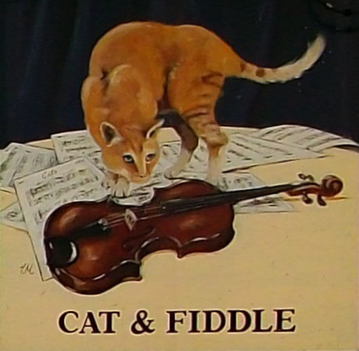
Cat and Fiddle Inn

The Cat and Fiddle Inn is Britain's highest-altitude whisky distillery. Before closure in 2015, it was the second-highest public house in Britain (after...

Forest Chapel

Forest Chapel stands in an isolated position in the civil parish of Macclesfield Forest and Wildboarclough in Cheshire, England, within the Peak District...

Crag Hall

Crag Hall is a country house east of the village of Wildboarclough, Cheshire, England and owned by the Earl of Derby. == Description == It was built in...

St Saviour's Church, Wildboarclough

St Saviour's Church is in the village of Wildboarclough, Cheshire, England. It is an active Anglican parish church in the deanery of Macclesfield, the...

Wildboarclough

Wildboarclough ( WIL-bÉ™-kluf) is a village in the civil parish of Macclesfield Forest and Wildboarclough, in the Cheshire East district, in the ceremonial...

Nearby Amenities

Located within 500m of 53.2339,-2.0209491
Dingers Hollow Farm
Place: locality
Lat/Long: 53.2358384/-2.027356
The data included in this document is from www.openstreetmap.org. The data is made available under ODbL.

Have you been to Yarnshaw Hill?

Leave your review of Yarnshaw Hill below (or comments, questions and feedback).