Slate Pit Hill

Hill, Mountain in Yorkshire

England

Slate Pit Hill

Blackstone Edge Reservoir crossed by power lines
Blackstone Edge Reservoir crossed by power lines Credit: Colin Pyle

Slate Pit Hill is a prominent hill located in the county of Yorkshire, England. Situated in the heart of the Yorkshire Dales National Park, it stands at an elevation of approximately 450 meters (1476 feet) above sea level. This natural beauty is a popular destination for hikers, nature enthusiasts, and outdoor adventurers.

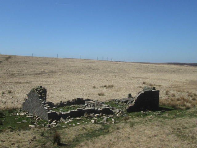
The hill gets its name from the abundance of slate rocks that can be found on its slopes. These slate deposits have been used for centuries in the local area for building materials, roofing, and even as writing tablets in the past. Today, remnants of the old slate mining industry can still be seen around the hill, adding to its historical charm.

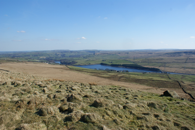
From the summit of Slate Pit Hill, visitors are treated to breathtaking panoramic views of the surrounding Yorkshire Dales landscape. Rolling hills, picturesque valleys, and meandering rivers create a stunning backdrop that captures the essence of rural England. On clear days, it is even possible to catch a glimpse of the iconic Three Peaks, which are located a short distance away.

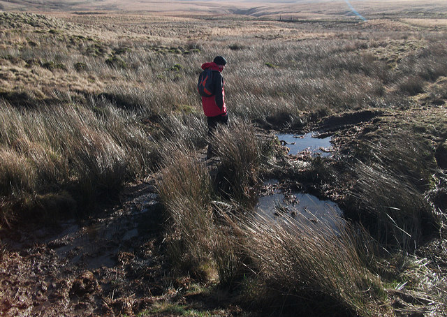
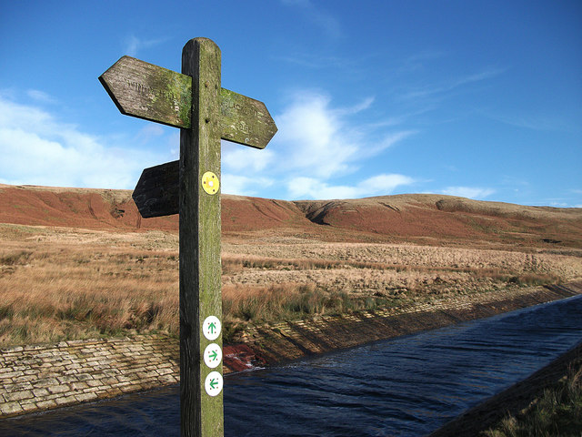
The hill is accessible via several footpaths that wind through the Dales, allowing visitors to explore its natural wonders at their own pace. Along the way, they may encounter an array of wildlife, including birds of prey, sheep, and wildflowers that add color to the landscape.

Slate Pit Hill is a true gem in the Yorkshire Dales, offering visitors a chance to immerse themselves in the beauty of the countryside and connect with nature. Whether it's a leisurely stroll or a challenging hike, this hill provides an unforgettable experience for all.

If you have any feedback on the listing, please let us know in the comments section below.

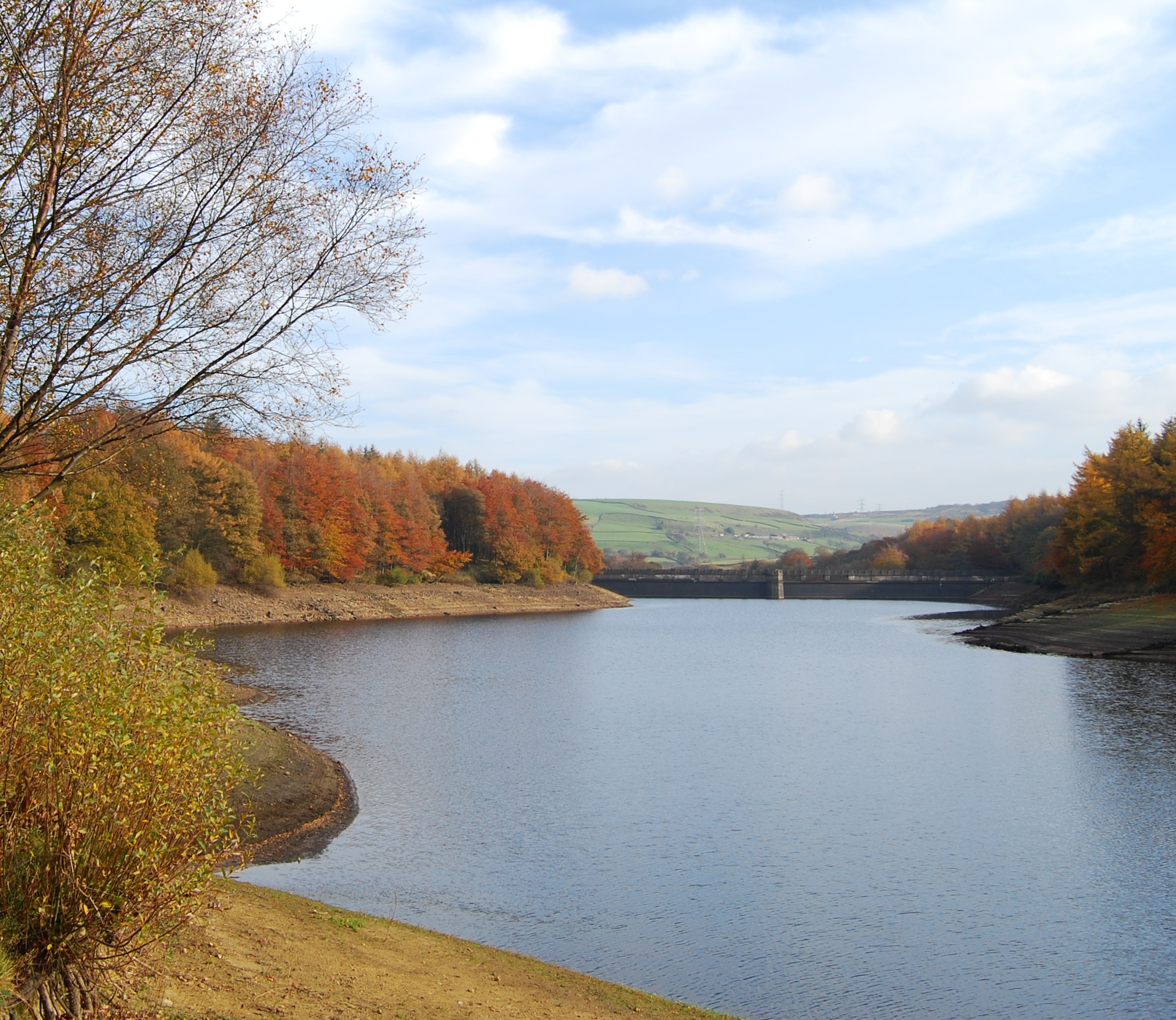
Slate Pit Hill Images

Images are sourced within 2km of 53.65928/-2.0231443 or Grid Reference SD9818. Thanks to Geograph Open Source API. All images are credited.

Blackstone Edge Reservoir crossed by power lines
Bog trotting on Rishworth Moor On the concessionary path leading to Green Withens. It's been one of the wettest winters on record and the peat is saturated.
Bog trotting on Rishworth Moor
On the concessionary path leading to Green Withens. It's been one of the wettest winters on record and the peat is saturated.
Fingerpost at Green Withens
Approaching Blackstone Edge Reservoir
Black Castle Drain
Black Castle Drain
Black Castle Drain
Black Castle Drain
Gate and footbridge on Soyland Moor This Yorkshire Water permissive path is still not shown on OS maps. The bridge crosses Black Castle Drain.
Gate and footbridge on Soyland Moor
This Yorkshire Water permissive path is still not shown on OS maps. The bridge crosses Black Castle Drain.
Ruin on Collin Hill, below Manshead End This used to be a shooting box
Ruin on Collin Hill, below Manshead End
This used to be a shooting box
Greenwood Clough
Greenwood Clough
The White House and Blackstone Edge Reservoir from the Pennine Way Looking north from the Pennine Way on Blackstone Edge Moor. The white building is the White House pub and behind it is Blackstone Edge Reservoir.
The White House and Blackstone Edge Reservoir from the Pennine Way
Looking north from the Pennine Way on Blackstone Edge Moor. The white building is the White House pub and behind it is Blackstone Edge Reservoir.
Blackstone Edge Moor, Broad Head Drain
Stone Bridge over Broad Head Drain, Blackstone Edge Moor
Blackstone Edge Moor
Pennine Way, Broad Head Drain
'Roman' Road over Blackstone Edge Blackstone Edge Long Causeway also known as Blackstone Edge Roman is a cobbled ‘road’ surface crossing the bleak moorland for about 2 miles along Blackstone Edge on the Lancashire-West Yorkshire border. The road has a deep groove running down the centre. 

It is a Scheduled monument (List entry Number: 1003746 <span class="nowrap"><a title="https://historicengland.org.uk/listing/the-list/list-entry/1003746" rel="nofollow ugc noopener" href="https://historicengland.org.uk/listing/the-list/list-entry/1003746">Link</a><img style="margin-left:2px;" alt="External link" title="External link - shift click to open in new window" src="https://s1.geograph.org.uk/img/external.png" width="10" height="10"/></span>  Historic England). Initially thought to be of Roman Origin, this road is still marked on Ordnance Survey maps as a ‘Roman Road’ but many historians have argued over whether or not the paved road over Blackstone Edge was built by the Romans, with no firm conclusion ever being reached but nowadays the most widely accepted theory is that it is an early turnpike road from circa 1735. Indeed, in 1965 James Leonard Maxim reported the discovery of a medieval pack-horse track that passed under part of the road and that therefore must pre-date it (Maxim, James L., A Lancashire Lion, J.L. Maxim Trustees: Leeds 1965). 

Others believe that it may be even more modern being constructed in connection with stone gathering or quarrying activity on the moor. It is, however, likely that a Roman road did once cross the Pennines hereabouts before the medieval pack-horse tracks and the 1735 turnpike road were constructed.
'Roman' Road over Blackstone Edge
Blackstone Edge Long Causeway also known as Blackstone Edge Roman is a cobbled ‘road’ surface crossing the bleak moorland for about 2 miles along Blackstone Edge on the Lancashire-West Yorkshire border. The road has a deep groove running down the centre. It is a Scheduled monument (List entry Number: 1003746 LinkExternal link Historic England). Initially thought to be of Roman Origin, this road is still marked on Ordnance Survey maps as a ‘Roman Road’ but many historians have argued over whether or not the paved road over Blackstone Edge was built by the Romans, with no firm conclusion ever being reached but nowadays the most widely accepted theory is that it is an early turnpike road from circa 1735. Indeed, in 1965 James Leonard Maxim reported the discovery of a medieval pack-horse track that passed under part of the road and that therefore must pre-date it (Maxim, James L., A Lancashire Lion, J.L. Maxim Trustees: Leeds 1965). Others believe that it may be even more modern being constructed in connection with stone gathering or quarrying activity on the moor. It is, however, likely that a Roman road did once cross the Pennines hereabouts before the medieval pack-horse tracks and the 1735 turnpike road were constructed.
The Aiggin Stone The Aiggin Stone, an irregular block of gritstone approximately 7 feet long, stands alongside the packhorse route marking the county boundary. The stone has a cross and the letters I and T cut into it. Its name is said to derive from the French aiguille for a needle or aigle an eagle.

Some suggest that it is Roman in origin (linked to the nearby “Roman” road, others that it’s merely a waymarker, others that it’s a milestone, and the more common notion is that it’s a boundary marker of the counties of Yorkshire and Lancashire (its position in the landscape presently sits it in Lancashire).  According to a nearby information plate, The Littleborough and District Lions regard it to be “A mediæval guide stone …..some 600 years old” (<a href="https://www.geograph.org.uk/photo/4938914">SD9717 : Aiggin Stone Information</a>).

<span class="nowrap"><a title="https://megalithix.wordpress.com/2011/03/25/aiggin-stone/" rel="nofollow ugc noopener" href="https://megalithix.wordpress.com/2011/03/25/aiggin-stone/">Link</a><img style="margin-left:2px;" alt="External link" title="External link - shift click to open in new window" src="https://s1.geograph.org.uk/img/external.png" width="10" height="10"/></span>  The Northern Antiquarian
The Aiggin Stone
The Aiggin Stone, an irregular block of gritstone approximately 7 feet long, stands alongside the packhorse route marking the county boundary. The stone has a cross and the letters I and T cut into it. Its name is said to derive from the French aiguille for a needle or aigle an eagle. Some suggest that it is Roman in origin (linked to the nearby “Roman” road, others that it’s merely a waymarker, others that it’s a milestone, and the more common notion is that it’s a boundary marker of the counties of Yorkshire and Lancashire (its position in the landscape presently sits it in Lancashire). According to a nearby information plate, The Littleborough and District Lions regard it to be “A mediæval guide stone …..some 600 years old” (SD9717 : Aiggin Stone Information). LinkExternal link The Northern Antiquarian
Aiggin Stone Information Small stone tablet positioned near to <a href="https://www.geograph.org.uk/photo/4938903">SD9717 : The Aiggin Stone</a> by the Littleborough and District Lions, declaring the Aiggin Stone to be "A mediæval guide stone for travellers some 600 years old".
Aiggin Stone Information
Small stone tablet positioned near to SD9717 : The Aiggin Stone by the Littleborough and District Lions, declaring the Aiggin Stone to be "A mediæval guide stone for travellers some 600 years old".
Aiggin Stone and Cairn, Blackstone Edge The Aiggin Stone, an irregular block of gritstone approximately 7 feet long, stands alongside the packhorse route marking the county boundary. The stone has a cross and the letters I and T cut into it. Its name is said to derive from the French aiguille for a needle or aigle an eagle.

Some suggest that it is Roman in origin (linked to the nearby “Roman” road, others that it’s merely a waymarker, others that it’s a milestone, and the more common notion is that it’s a boundary marker of the counties of Yorkshire and Lancashire (its position in the landscape presently sits it in Lancashire).  According to a nearby information tablet (<a href="https://www.geograph.org.uk/photo/4938914">SD9717 : Aiggin Stone Information</a>), The Littleborough and District Lions regard it to be “A mediæval guide stone …..some 600 years old” 

The cairn is more recent; there is no indication of its significance, it is the largest of several cairns sited on the moorland alongside the Pennine Way in this area.
Aiggin Stone and Cairn, Blackstone Edge
The Aiggin Stone, an irregular block of gritstone approximately 7 feet long, stands alongside the packhorse route marking the county boundary. The stone has a cross and the letters I and T cut into it. Its name is said to derive from the French aiguille for a needle or aigle an eagle. Some suggest that it is Roman in origin (linked to the nearby “Roman” road, others that it’s merely a waymarker, others that it’s a milestone, and the more common notion is that it’s a boundary marker of the counties of Yorkshire and Lancashire (its position in the landscape presently sits it in Lancashire). According to a nearby information tablet (SD9717 : Aiggin Stone Information), The Littleborough and District Lions regard it to be “A mediæval guide stone …..some 600 years old” The cairn is more recent; there is no indication of its significance, it is the largest of several cairns sited on the moorland alongside the Pennine Way in this area.
Show me another place!

Slate Pit Hill is located at Grid Ref: SD9818 (Lat: 53.65928, Lng: -2.0231443)

Division: West Riding

Unitary Authority: Calderdale

Police Authority: West Yorkshire

What 3 Words

///buckling.wealth.puns. Near Littleborough, Manchester

Related Wikis

Blackstone Edge Reservoir

Blackstone Edge Reservoir is a reservoir in the Metropolitan Borough of Rochdale, Greater Manchester, England. It is close to Blackstone Edge, from which...

Baitings Reservoir

Baitings Reservoir is a large water supply reservoir operated by Yorkshire Water close to Ripponden in the West Yorkshire Pennines, England. It lies in...

Blackstone Edge

Blackstone Edge ( BLAK-stən) is a gritstone escarpment at 472 metres (1,549 ft) above sea level in the Pennine hills surrounded by moorland on the boundary...

Ryburn Reservoir

Ryburn Reservoir is a supply reservoir operated by Yorkshire Water close to Ripponden in the Yorkshire Pennines, England. It lies in the valley of the...

Nearby Amenities

Located within 500m of 53.65928,-2.0231443
Design: barrel
Power: tower
Lat/Long: 53.6629017/-2.0218413
Design: barrel
Power: tower
Lat/Long: 53.6620518/-2.0255488
Design: barrel
Power: tower
Lat/Long: 53.6614585/-2.0283361
Power: tower
Lat/Long: 53.6616988/-2.0233374
Power: tower
Lat/Long: 53.6606286/-2.0279652
Bus Stop
Rochdale Road
Local Ref: 45024983
Naptan AtcoCode: 450024983
Naptan Bearing: W
Naptan BusStopType: CUS
Naptan CommonName: Rochdale Road
Naptan Crossing: Black Castle Hill
Naptan Indicator: Stop 45024983
Naptan Landmark: Slate Pit Hill
Naptan ShortCommonName: Black Castle Hill
Naptan Street: Rochdale Road
Naptan Verified: no
Source: naptan_import
Lat/Long: 53.6615082/-2.0227602
Barrier: stile
Lat/Long: 53.6621466/-2.0195664
The data included in this document is from www.openstreetmap.org. The data is made available under ODbL.

Have you been to Slate Pit Hill?

Leave your review of Slate Pit Hill below (or comments, questions and feedback).