Beldhaw Hill

Hill, Mountain in Yorkshire Richmondshire

England

Beldhaw Hill

Old milepost When first recorded for the Milestone Society in 2004, this milepost on the A684 had lost a large section of the bevel.   In 2007 it was repaired for the Yorkshire Dales National Park and repainted.   In 2019 there is evidence of the repair with rusty lines on the bevel.   It was made at the foundry of F Mattison  & Co, Bedale.  This is cast inside the back of the right-hand side.   It is Grade II listed 1296900.
Old milepost Credit: Chris Minto

Beldhaw Hill is a prominent hill located in the county of Yorkshire, England. Situated in the beautiful Yorkshire Dales National Park, it is part of the Pennine range and stands at an elevation of approximately 480 meters (1575 feet) above sea level.

The hill is characterized by its rugged terrain, with steep slopes covered in heather and grasses. It offers stunning panoramic views of the surrounding countryside, including the rolling hills, valleys, and quaint villages that dot the landscape. On a clear day, one can even catch a glimpse of the distant Yorkshire Three Peaks, which add to the scenic beauty of the area.

Beldhaw Hill is a popular destination for hikers and nature enthusiasts, who are drawn to its tranquil and unspoiled environment. There are various walking trails that lead to the summit, providing opportunities for both challenging hikes and leisurely strolls. The hill offers a sense of solitude and serenity, away from the hustle and bustle of urban life.

The hill is also known for its rich biodiversity. It is home to a variety of plant and animal species, including heather, bilberry, and mosses, as well as birds of prey such as kestrels and buzzards. The area is protected as a Site of Special Scientific Interest (SSSI), ensuring the preservation of its natural features.

Overall, Beldhaw Hill is a captivating natural landmark that showcases the stunning beauty of the Yorkshire countryside. Its rugged terrain, breathtaking views, and diverse ecosystem make it a must-visit destination for anyone exploring the region.

If you have any feedback on the listing, please let us know in the comments section below.

Beldhaw Hill Images

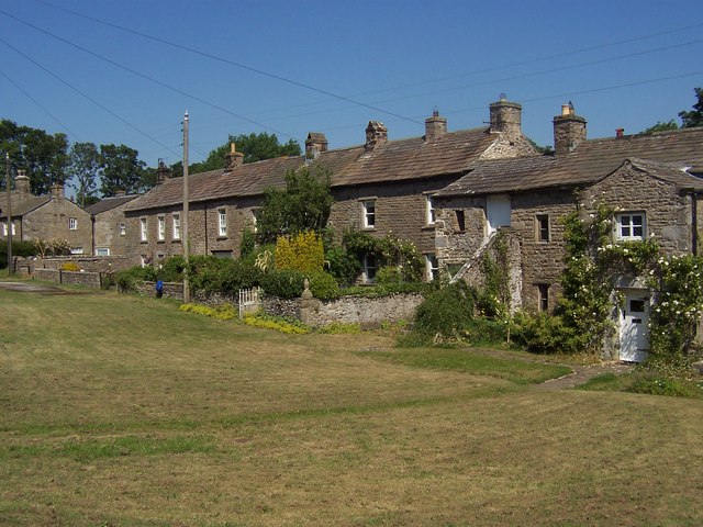
Images are sourced within 2km of 54.315656/-2.0318775 or Grid Reference SD9891. Thanks to Geograph Open Source API. All images are credited.

Old milepost When first recorded for the Milestone Society in 2004, this milepost on the A684 had lost a large section of the bevel.   In 2007 it was repaired for the Yorkshire Dales National Park and repainted.   In 2019 there is evidence of the repair with rusty lines on the bevel.   It was made at the foundry of F Mattison  & Co, Bedale.  This is cast inside the back of the right-hand side.   It is Grade II listed 1296900.
Old milepost
When first recorded for the Milestone Society in 2004, this milepost on the A684 had lost a large section of the bevel. In 2007 it was repaired for the Yorkshire Dales National Park and repainted. In 2019 there is evidence of the repair with rusty lines on the bevel. It was made at the foundry of F Mattison & Co, Bedale. This is cast inside the back of the right-hand side. It is Grade II listed 1296900.
Old milepost This milespost on the A684 was damaged.  The two sides were retrieved by the Yorkshire Dales National Park and then the top bevel was located recently.   It has been repaired with a strengthening framework inside which allows the foundry name, Mattisons of Bedale, to be seen.  It also has an extension into the ground.  Repainted and reset with a surrounding membrane and stones to help keep down the roadside grasses and weeds.   It had to be moved with the agreement of the YDNP listing to a wider verge and safer position a little to the east of its original site.   It is Grade II Listed 1296900.
Old milepost
This milespost on the A684 was damaged. The two sides were retrieved by the Yorkshire Dales National Park and then the top bevel was located recently. It has been repaired with a strengthening framework inside which allows the foundry name, Mattisons of Bedale, to be seen. It also has an extension into the ground. Repainted and reset with a surrounding membrane and stones to help keep down the roadside grasses and weeds. It had to be moved with the agreement of the YDNP listing to a wider verge and safer position a little to the east of its original site. It is Grade II Listed 1296900.
Where did that bridge go? The splendid drystone single arch footbridge that was constructed here in August 2010 is no more [see 'Ballowfield drystone bridge' by Anthony Harrison and 'New bridge at Ballowfield']. In December 2011 a rapid thaw of lying snow together with very heavy rain caused localised flooding in the Dales. Eller Beck became a raging torrent and severely damaged the new footbridge, so the remains have been taken away and this simple timber beam bridge put in its place.  There are plans for a stone arch bridge Mk2 later in 2012.
Where did that bridge go?
The splendid drystone single arch footbridge that was constructed here in August 2010 is no more [see 'Ballowfield drystone bridge' by Anthony Harrison and 'New bridge at Ballowfield']. In December 2011 a rapid thaw of lying snow together with very heavy rain caused localised flooding in the Dales. Eller Beck became a raging torrent and severely damaged the new footbridge, so the remains have been taken away and this simple timber beam bridge put in its place. There are plans for a stone arch bridge Mk2 later in 2012.
A684 passing milestone Leyburn 10 North of Thornton Rust
A684 passing milestone Leyburn 10
North of Thornton Rust
A684 east passing end of lay by North of Thornton Rust
A684 east passing end of lay by
North of Thornton Rust
Lady Hill, with disused rail track in foreground
Eller Beck at Ballowfields The beck seen here at the Ballowfields Quarry Nature Reserve beside the Carperby/Askrigg Road, called The Straights
Eller Beck at Ballowfields
The beck seen here at the Ballowfields Quarry Nature Reserve beside the Carperby/Askrigg Road, called The Straights
Footpath at Ballowfields Path below Haw Bank, in the Ballowfields Quarry Nature Reserve
Footpath at Ballowfields
Path below Haw Bank, in the Ballowfields Quarry Nature Reserve
Lady Hill As seen looking east from beside the River Ure
Lady Hill
As seen looking east from beside the River Ure
The Lady on Lady Hill Western flank of this very photogenic landscape in Wensleydale.
The Lady on Lady Hill
Western flank of this very photogenic landscape in Wensleydale.
Ballowfields Local Nature Reserve On the left are spoil heaps from a former mine.
Ballowfields Local Nature Reserve
On the left are spoil heaps from a former mine.
Ballowfields Local Nature Reserve Between Woodhall and Carperby.
Ballowfields Local Nature Reserve
Between Woodhall and Carperby.
Stepping stones across the Ure Part of a bridleway linking Woodhall with the road on the south bank of the river.  These stones are more often covered than exposed. Water levels were particularly low in October 2007.
Stepping stones across the Ure
Part of a bridleway linking Woodhall with the road on the south bank of the river. These stones are more often covered than exposed. Water levels were particularly low in October 2007.
Lady Hill from Woodhall Looking across the fields towards this mid Wensleydale landmark, which is an example of a drumlin.
Lady Hill from Woodhall
Looking across the fields towards this mid Wensleydale landmark, which is an example of a drumlin.
Eroded path by the Ure A section of Askrigg parish path 34A, which is badly eroded along this part of the Ure near Lady Hill.  In times of high water the route becomes dangerous to use.
Eroded path by the Ure
A section of Askrigg parish path 34A, which is badly eroded along this part of the Ure near Lady Hill. In times of high water the route becomes dangerous to use.
Eller Beck Eller Beck at the point where it flows through Ballowfields Nature Reserve.
Eller Beck
Eller Beck at the point where it flows through Ballowfields Nature Reserve.
Ballowfields meadow A local nature reserve and a popular spot for a stroll with the dog.
Ballowfields meadow
A local nature reserve and a popular spot for a stroll with the dog.
Old coppiced woodland The southern flank of Haw Bank has coppiced hazel woodland on the more accessible slopes, although it is clear that this area has not been coppiced for a very long time.
Old coppiced woodland
The southern flank of Haw Bank has coppiced hazel woodland on the more accessible slopes, although it is clear that this area has not been coppiced for a very long time.
Show me another place!

Beldhaw Hill is located at Grid Ref: SD9891 (Lat: 54.315656, Lng: -2.0318775)

Division: North Riding

Administrative County: North Yorkshire

District: Richmondshire

Police Authority: North Yorkshire

What 3 Words

///spider.applied.recliner. Near Leyburn, North Yorkshire

Nearby Locations

Carperby Moor Beldhaw Hill

Related Wikis

Woodhall, North Yorkshire

Woodhall is a small hamlet in Wensleydale, North Yorkshire, England. It is about 2 miles (3 km) away from Askrigg and 3 miles (5 km) north west of Aysgarth...

Nappa Hall

Nappa Hall is a fortified manor house in Wensleydale, North Yorkshire, England, described by English Heritage as "probably the finest and least-spoilt...

A684 road

The A684 is an A road that runs through Cumbria and North Yorkshire, starting at Kendal, Cumbria and ending at Ellerbeck and the A19 road in North Yorkshire...

Thornton Rust

Thornton Rust is a village and civil parish in North Yorkshire, England. It lies in the Yorkshire Dales about 2 miles (3.2 km) west of Aysgarth, high on...

Nearby Amenities

Located within 500m of 54.315656,-2.0318775
The data included in this document is from www.openstreetmap.org. The data is made available under ODbL.

Have you been to Beldhaw Hill?

Leave your review of Beldhaw Hill below (or comments, questions and feedback).