Carperby Moor

Downs, Moorland in Yorkshire Richmondshire

England

Carperby Moor

Lime kiln at Ballowfields Old field lime kiln close to the road at Ballowfields. The arch survives despite the weight and penetrating roots of the large ash tree on top.
Lime kiln at Ballowfields Credit: Gordon Hatton

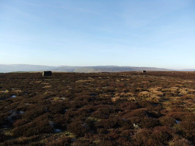
Carperby Moor is a picturesque area located in the county of Yorkshire, England. Known for its vast expanse of rolling downs and moorland, it offers stunning views and a tranquil atmosphere. Covering an area of approximately 10 square miles, Carperby Moor is a haven for nature enthusiasts and hikers.

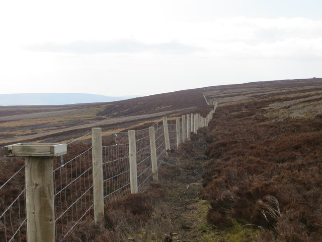
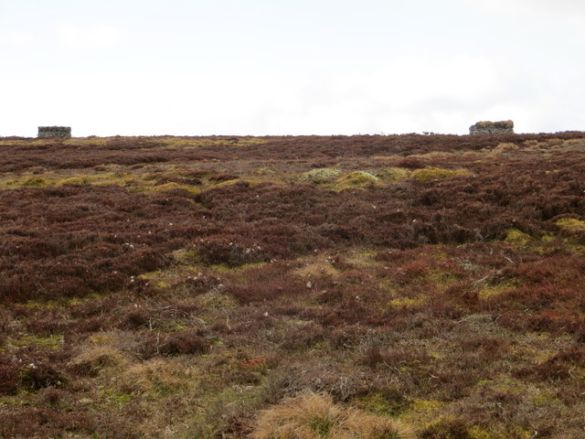
The landscape of Carperby Moor is characterized by its undulating hills, heather-covered moors, and scattered outcrops of rocks. The heather blooms in vibrant purples and pinks during the summer months, creating a stunning contrast against the greenery of the surrounding fields. The moorland is interspersed with small streams and glistening tarns, adding to the charm and beauty of the area.

Wildlife thrives in Carperby Moor, with various species of birds, such as curlews, lapwings, and red grouse, calling it home. The moorland provides an ideal habitat for these birds, and their distinctive calls can often be heard echoing across the landscape. Hikers and nature lovers can also spot other animals, including hares, rabbits, and the occasional deer.

The area offers a network of walking trails, allowing visitors to explore the moorland and take in the breathtaking views. These paths meander through the rolling hills, offering glimpses of historical landmarks, such as ancient stone circles and burial mounds.

Carperby Moor is steeped in history, with evidence of human activity dating back thousands of years. There are remnants of Bronze Age settlements and Roman roads, serving as a testament to the area's rich cultural heritage.

In conclusion, Carperby Moor is a captivating destination, where visitors can immerse themselves in the beauty of Yorkshire's downs and moorland. With its stunning vistas, diverse wildlife, and historical significance, it is a must-visit for nature lovers and history enthusiasts alike.

If you have any feedback on the listing, please let us know in the comments section below.

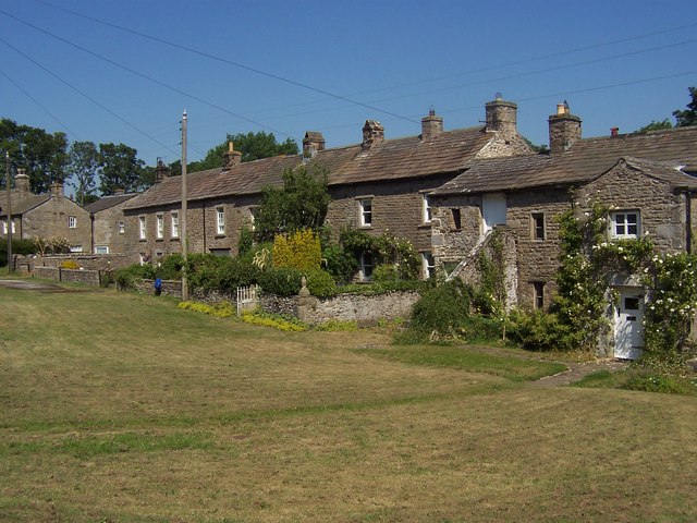
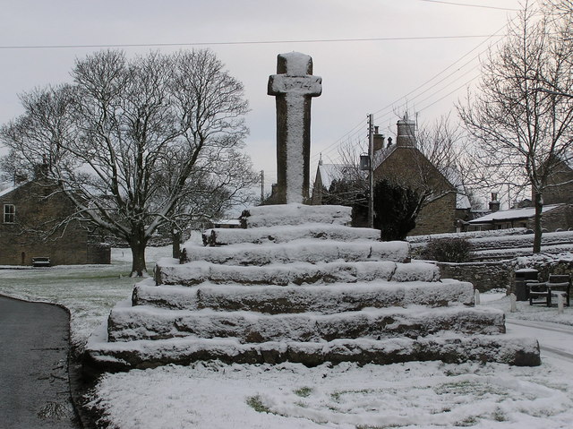
Carperby Moor Images

Images are sourced within 2km of 54.322847/-2.0279012 or Grid Reference SD9891. Thanks to Geograph Open Source API. All images are credited.

Lime kiln at Ballowfields Old field lime kiln close to the road at Ballowfields. The arch survives despite the weight and penetrating roots of the large ash tree on top.
Lime kiln at Ballowfields
Old field lime kiln close to the road at Ballowfields. The arch survives despite the weight and penetrating roots of the large ash tree on top.
Waterfall and Rusty Pump Water falling alongside remains of pelton wheel originally fed from dam above, which was part of an early 20thC hydro-electric power scheme for the hamlets of Woodhall & Ballowfields.
Waterfall and Rusty Pump
Water falling alongside remains of pelton wheel originally fed from dam above, which was part of an early 20thC hydro-electric power scheme for the hamlets of Woodhall & Ballowfields.
Grouse butts above Ellerkin Scar
Old mine, Nappa Scar The evening sun casts a shadow over a disused mine shaft.
Old mine, Nappa Scar
The evening sun casts a shadow over a disused mine shaft.
Ellerkin Scar A wintry view, seen from the Heugh Lane track.
Ellerkin Scar
A wintry view, seen from the Heugh Lane track.
Woodhall road junction Where the minor road up from Woodhall Park joins the road to Askrigg.
Woodhall road junction
Where the minor road up from Woodhall Park joins the road to Askrigg.
Fence Line Looking south-east along the edge of Woodhall Greets.
Fence Line
Looking south-east along the edge of Woodhall Greets.
Grouse Butts Looking west from the path along the edge of Woodhall Greets.
Grouse Butts
Looking west from the path along the edge of Woodhall Greets.
Moles at Work Looking east towards Ellerkin Scar.
Moles at Work
Looking east towards Ellerkin Scar.
Looking into Wensleydale Looking south-west from Beldhaw Hill down onto the River Ure with Addleborough in the background.
Looking into Wensleydale
Looking south-west from Beldhaw Hill down onto the River Ure with Addleborough in the background.
Ford and Footbridge across Thackwaite Beck Looking east with Ivy Scar in the background.
Ford and Footbridge across Thackwaite Beck
Looking east with Ivy Scar in the background.
Oxclose Road (Path) Looking east towards Oxclose Gate.
Oxclose Road (Path)
Looking east towards Oxclose Gate.
Bell pits below Beldhaw Hill Marked as Tips (dis) on the map, this is in fact a series of bell pits (small shaft mines) flanking the bridleway which runs from above Newbiggin to Woodhall
Bell pits below Beldhaw Hill
Marked as Tips (dis) on the map, this is in fact a series of bell pits (small shaft mines) flanking the bridleway which runs from above Newbiggin to Woodhall
Bell pits below Beldhaw Hill Marked as Shafts (dis) on the map, this is a series of bell pits alongside the bridleway from above Newbiggin to Woodhall. Characterised by the circular upcast with a hollow in the middle bell pits are a form of small mine. Beldhaw Hill is the prominent knoll in the background.
Bell pits below Beldhaw Hill
Marked as Shafts (dis) on the map, this is a series of bell pits alongside the bridleway from above Newbiggin to Woodhall. Characterised by the circular upcast with a hollow in the middle bell pits are a form of small mine. Beldhaw Hill is the prominent knoll in the background.
Ford and top of waterfall The ford in the foreground carries a bridleway across Thackthwaite Beck. Just beyond this it falls over the edge as a waterfall to drop down into the gully below.
Ford and top of waterfall
The ford in the foreground carries a bridleway across Thackthwaite Beck. Just beyond this it falls over the edge as a waterfall to drop down into the gully below.
View to Haw Bank As seen from a road called "The Straights", between the villages of Askrigg and Carperby
View to Haw Bank
As seen from a road called "The Straights", between the villages of Askrigg and Carperby
Benchmark on building at West End Farm Ordnance Survey cut mark benchmark described on the Bench Mark Database at <span class="nowrap"><a title="http://www.bench-marks.org.uk/bm60155" rel="nofollow ugc noopener" href="http://www.bench-marks.org.uk/bm60155">Link</a><img style="margin-left:2px;" alt="External link" title="External link - shift click to open in new window" src="https://s1.geograph.org.uk/img/external.png" width="10" height="10"/></span>
Benchmark on building at West End Farm
Ordnance Survey cut mark benchmark described on the Bench Mark Database at LinkExternal link
Buildings at West End Farm, Low Lane There is an OS benchmark <a href="https://www.geograph.org.uk/photo/4207978">SD9790 : Benchmark on building at West End Farm</a> near the left hand corner of the large barn right of the black downpipe
Buildings at West End Farm, Low Lane
There is an OS benchmark SD9790 : Benchmark on building at West End Farm near the left hand corner of the large barn right of the black downpipe
Show me another place!

Carperby Moor is located at Grid Ref: SD9891 (Lat: 54.322847, Lng: -2.0279012)

Division: North Riding

Administrative County: North Yorkshire

District: Richmondshire

Police Authority: North Yorkshire

What 3 Words

///tiptoes.donates.showering. Near Leyburn, North Yorkshire

Nearby Locations

Carperby Moor Beldhaw Hill

Related Wikis

Richmondshire

Richmondshire was a local government district of North Yorkshire, England, from 1974 to 2023. It covered a large northern area of the Yorkshire Dales including...

Woodhall, North Yorkshire

Woodhall is a small hamlet in Wensleydale, North Yorkshire, England. It is about 2 miles (3 km) away from Askrigg and 3 miles (5 km) north west of Aysgarth...

Nappa Hall

Nappa Hall is a fortified manor house in Wensleydale, North Yorkshire, England, described by English Heritage as "probably the finest and least-spoilt...

Newbiggin, Askrigg

Newbiggin is a hamlet very close to Askrigg, North Yorkshire, England. Another Newbiggin is only about 7 miles (11 km) away. The hamlet consists of eight...

A684 road

The A684 is an A road that runs through Cumbria and North Yorkshire, starting at Kendal, Cumbria and ending at Ellerbeck and the A19 road in North Yorkshire...

Thornton Rust

Thornton Rust is a village and civil parish in North Yorkshire, England. It lies in the Yorkshire Dales about 2 miles (3.2 km) west of Aysgarth, high on...

Carperby

Carperby is a village in the Yorkshire Dales, North Yorkshire, England. It lies 7 miles (11 km) west of Leyburn. == Etymology == The derivation of the...

Carperby-cum-Thoresby

Carperby-cum-Thoresby is a civil parish in the Richmondshire district of North Yorkshire, England. The parish contains the village of Carperby and the...

Nearby Amenities

Located within 500m of 54.322847,-2.0279012
Historic: mine_shaft
Source: NPE
Lat/Long: 54.3269666/-2.0298415
Historic: mine_shaft
Source: NPE
Lat/Long: 54.3270667/-2.0283823
Historic: mine_shaft
Source: NPE
Lat/Long: 54.326391/-2.0306998
Historic: mine_shaft
Source: NPE
Lat/Long: 54.326391/-2.0317727
Swinehaw Hut
Natural: fell
Source: NPE
Lat/Long: 54.3207095/-2.0261507
Carperby Moor
Natural: moor
Source: NPE
Lat/Long: 54.3233626/-2.0208722
The data included in this document is from www.openstreetmap.org. The data is made available under ODbL.

Have you been to Carperby Moor?

Leave your review of Carperby Moor below (or comments, questions and feedback).