Fiddler Hill

Hill, Mountain in Yorkshire Craven

England

Fiddler Hill

New building opposite Ashfield Farm It's not clear yet what the building's function will be, but the architect has taken advantage of the south facing aspect to include solar panels.
New building opposite Ashfield Farm Credit: Stephen Craven

Fiddler Hill, located in Yorkshire, England, is a picturesque hill that offers stunning panoramic views of the surrounding countryside. Situated at an altitude of approximately 400 meters, it is considered one of the highest peaks in the region. The hill is part of the Pennines, a range of hills and mountains that stretch across northern England.

Fiddler Hill is renowned for its natural beauty and is a popular destination for outdoor enthusiasts and hikers. The hill boasts a diverse landscape, with heather-covered moorlands, rocky outcrops, and lush green valleys. Its unique geographical position allows visitors to enjoy breathtaking vistas of the nearby valleys and rolling hills.

The hill is also home to a variety of plant and animal species that thrive in this unique environment. Rare birds such as the golden plover and curlew can be spotted in the area, making it a haven for birdwatchers. The hill is also home to a rich array of wildflowers, including heather, bluebells, and orchids, adding to its natural charm.

Fiddler Hill is easily accessible, with several well-marked trails leading to the summit. The most popular route starts from the nearby village of Hilltop and takes visitors through scenic woodlands and open fields, eventually reaching the top of the hill. Once at the summit, visitors are rewarded with breathtaking panoramic views of the surrounding countryside, making it a perfect spot for photography enthusiasts.

Overall, Fiddler Hill in Yorkshire offers a serene escape from city life and a chance to immerse oneself in the stunning natural beauty of the region.

If you have any feedback on the listing, please let us know in the comments section below.

Fiddler Hill Images

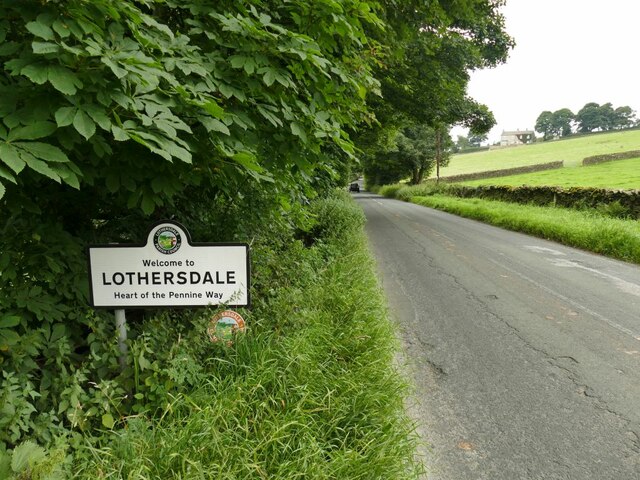
Images are sourced within 2km of 53.925869/-2.0346077 or Grid Reference SD9747. Thanks to Geograph Open Source API. All images are credited.

New building opposite Ashfield Farm It's not clear yet what the building's function will be, but the architect has taken advantage of the south facing aspect to include solar panels.
New building opposite Ashfield Farm
It's not clear yet what the building's function will be, but the architect has taken advantage of the south facing aspect to include solar panels.
New stile, old style A stile on a public footpath next to a new gate leading into a development site <a href="https://www.geograph.org.uk/photo/6954458">SD9745 : New building opposite Ashfield Farm</a> but in keeping with local tradition.
New stile, old style
A stile on a public footpath next to a new gate leading into a development site SD9745 : New building opposite Ashfield Farm but in keeping with local tradition.
Ashfield Farm, Lothersdale Buildings on Stansfield Brow.
Ashfield Farm, Lothersdale
Buildings on Stansfield Brow.
Sign entering Lothersdale on Stansfield Brow The village calls itself as the 'heart of the Pennine Way'.  The long distance path passes through the village (but not on this road).
Sign entering Lothersdale on Stansfield Brow
The village calls itself as the 'heart of the Pennine Way'. The long distance path passes through the village (but not on this road).
Tow Top Farm A cattle farm; while I was slowly making my way up the hill opposite, the farmer made several trips with tractor and tanker to spread slurry from the farm on the surrounding fields. See <a href="https://www.geograph.org.uk/photo/6039464">SD9646 : Descending to Tow Top Farm</a> for a closer view of the farmhouse.
Tow Top Farm
A cattle farm; while I was slowly making my way up the hill opposite, the farmer made several trips with tractor and tanker to spread slurry from the farm on the surrounding fields. See SD9646 : Descending to Tow Top Farm for a closer view of the farmhouse.
Sheep pens alongside White Hill Lane
Cross Green Farm The farm is at an altitude of 315m, near the summit of the road from Lothersdale to Carleton-in-Craven.
Cross Green Farm
The farm is at an altitude of 315m, near the summit of the road from Lothersdale to Carleton-in-Craven.
Rose hips by the road side
Cyclists on Herd Stock Hill Just past the junction with White Hill Lane.
Cyclists on Herd Stock Hill
Just past the junction with White Hill Lane.
Disturbed pheasants I was about to take this view from the roadside into a conifer plantation when I startled a covey of pheasants that flew away noisily. At least five are in this view.
Disturbed pheasants
I was about to take this view from the roadside into a conifer plantation when I startled a covey of pheasants that flew away noisily. At least five are in this view.
Small disused quarry There was a much larger one the other side of the road.
Small disused quarry
There was a much larger one the other side of the road.
Bridleway towards Cononley Taken at the summit of the track.
Bridleway towards Cononley
Taken at the summit of the track.
Entrance to Street Head Farm The signpost in the corner has appeared since an earlier photo in 2014 <a href="https://www.geograph.org.uk/photo/3815113">SD9647 : Street Head Farm and the entrance to Tewit Cote</a>.
Entrance to Street Head Farm
The signpost in the corner has appeared since an earlier photo in 2014 SD9647 : Street Head Farm and the entrance to Tewit Cote.
Heather moorland on Burnt Hill Heather growth is regularly controlled by burning; I wonder if that's how the hill got its name?
Heather moorland on Burnt Hill
Heather growth is regularly controlled by burning; I wonder if that's how the hill got its name?
Peat Gill Head A cattle farm above Cononley.
Peat Gill Head
A cattle farm above Cononley.
Gap in a wall on Burnt Hill A regular rectangular gap beneath the capstones, suggesting it's intentional, perhaps as a sheep creep.
Gap in a wall on Burnt Hill
A regular rectangular gap beneath the capstones, suggesting it's intentional, perhaps as a sheep creep.
Bench above Carleton Park The bench was ideally placed as I was looking for a lunch stop, and was in remarkable good condition - either recently installed or refurbished. The location in a corner of a wall shelters it from prevailing winds.  There is no plaque or wording, only the symbol of the Yorkshire rose.
Bench above Carleton Park
The bench was ideally placed as I was looking for a lunch stop, and was in remarkable good condition - either recently installed or refurbished. The location in a corner of a wall shelters it from prevailing winds. There is no plaque or wording, only the symbol of the Yorkshire rose.
Ramshaw from below Burnt Hill The name is that of a ridge with a public footpath running along it. I guess the etymology and maybe pronunciation is rams'haw rather than ram'shaw since 'haw' is a local name for a small hill.
Ramshaw from below Burnt Hill
The name is that of a ridge with a public footpath running along it. I guess the etymology and maybe pronunciation is rams'haw rather than ram'shaw since 'haw' is a local name for a small hill.
Show me another place!

Fiddler Hill is located at Grid Ref: SD9747 (Lat: 53.925869, Lng: -2.0346077)

Division: West Riding

Administrative County: North Yorkshire

District: Craven

Police Authority: North Yorkshire

What 3 Words

///skips.shorthand.director. Near Low Bradley, North Yorkshire

Nearby Locations

Fiddler Hill

Related Wikis

Nearby Amenities

Located within 500m of 53.925869,-2.0346077
Barrier: stile
Lat/Long: 53.9238007/-2.0376931
Building: yes
Lat/Long: 53.9236882/-2.0327863
Barrier: stile
Lat/Long: 53.923312/-2.0361483
Barrier: cattle_grid
Lat/Long: 53.9231067/-2.0355947
The data included in this document is from www.openstreetmap.org. The data is made available under ODbL.

Have you been to Fiddler Hill?

Leave your review of Fiddler Hill below (or comments, questions and feedback).