Long Fell

Hill, Mountain in Northumberland

England

Long Fell

Darden Lough A hidden gem, well worth the walk.
Darden Lough Credit: No Body

Long Fell is a prominent hill located in the county of Northumberland, England. It is part of the North Pennines Area of Outstanding Natural Beauty and stands at an elevation of approximately 1,823 feet (556 meters) above sea level. The hill is situated within the picturesque Northumberland National Park and is a popular destination for outdoor enthusiasts and nature lovers.

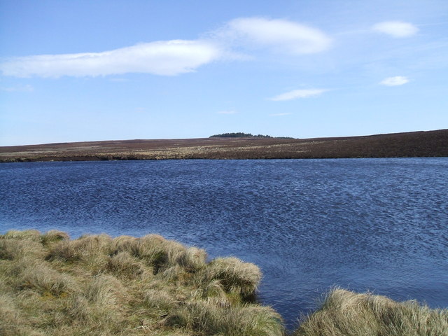
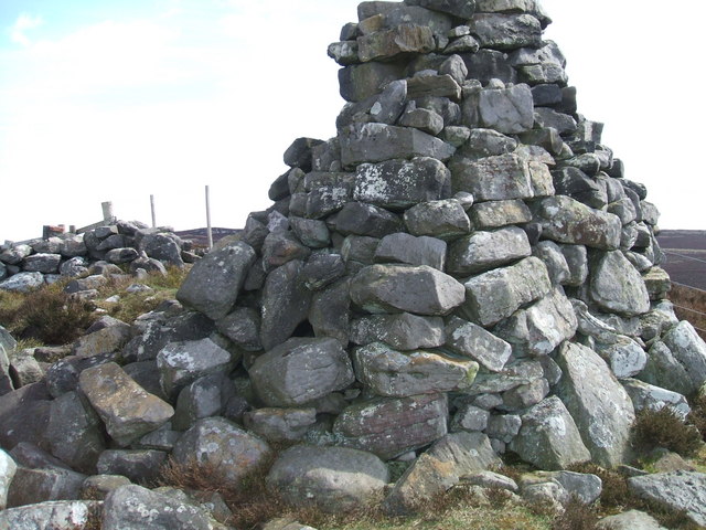
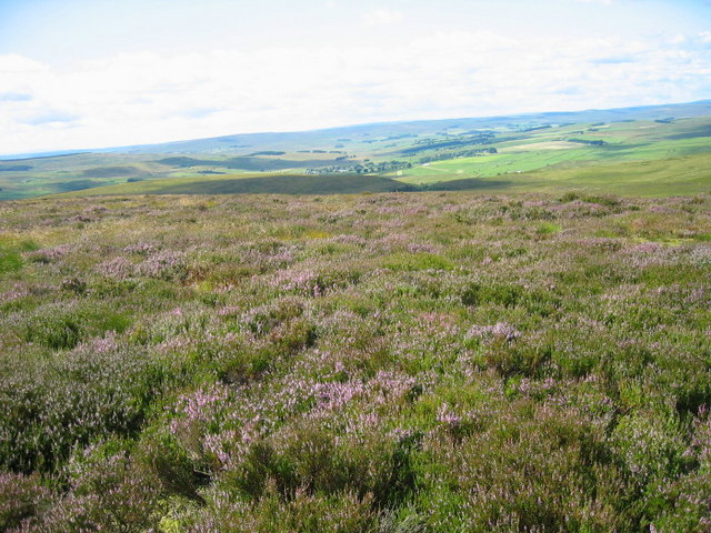
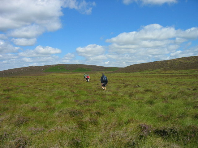
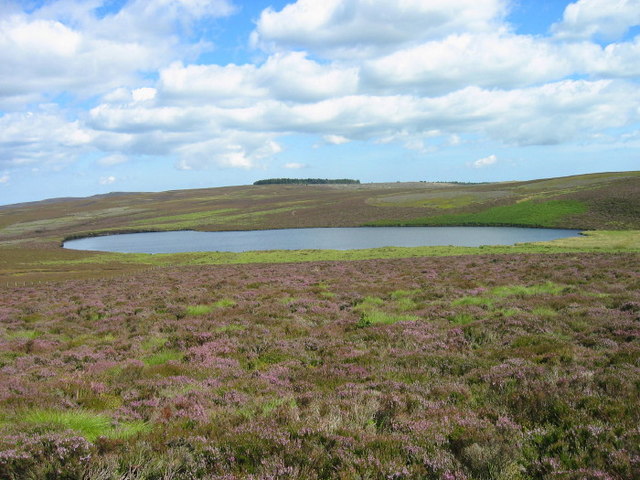
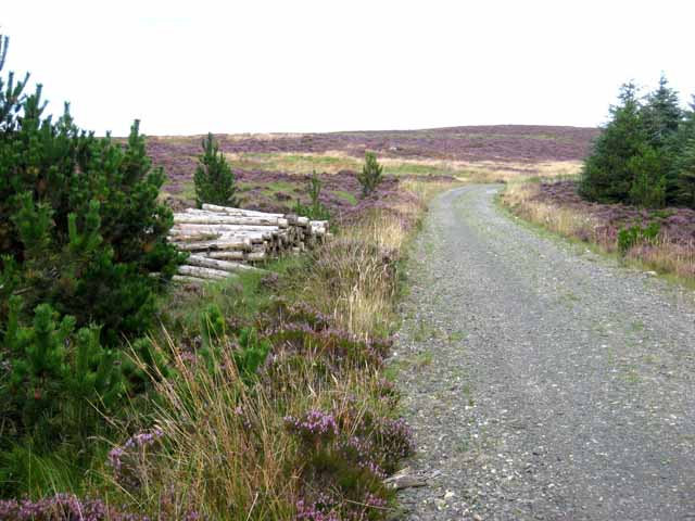
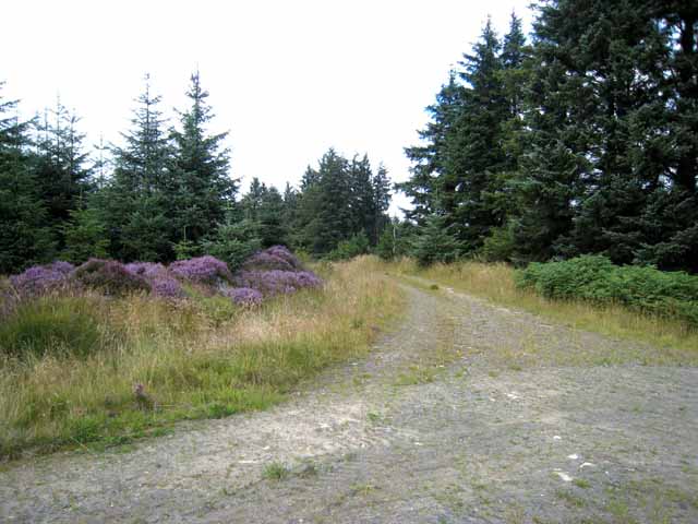
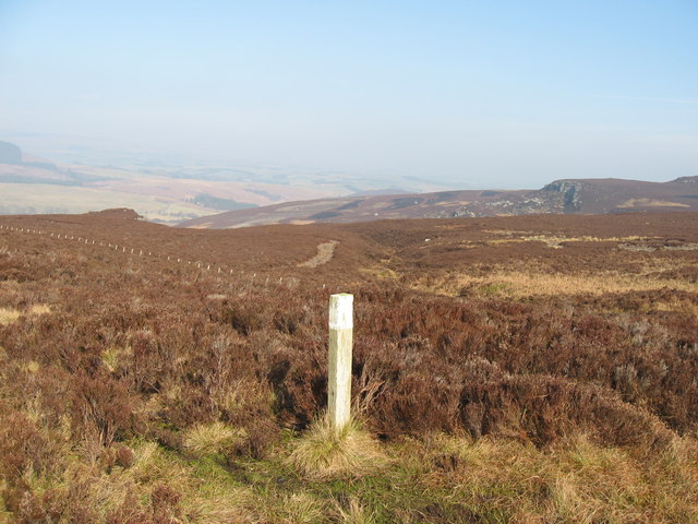
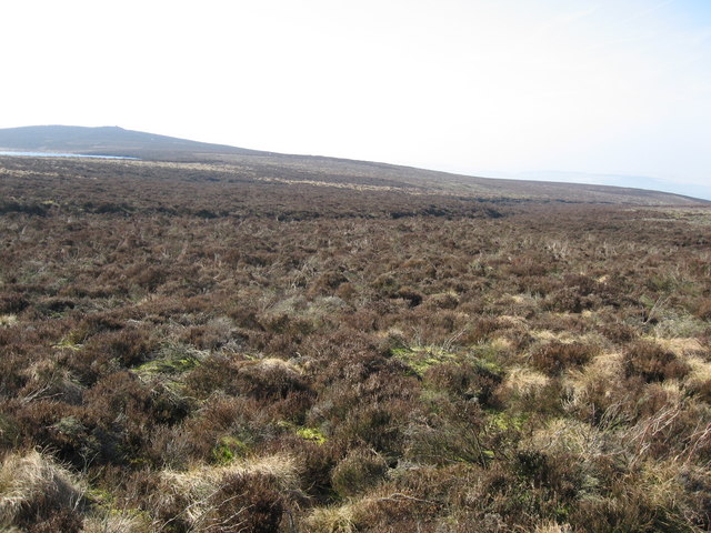
Long Fell is characterized by its gently sloping grassy slopes, which provide a relatively easy climb for hikers and walkers. The summit offers breathtaking panoramic views of the surrounding countryside, including the nearby Cheviot Hills and the Northumberland coastline. On a clear day, it is even possible to see as far as the Scottish Borders.

The hill is covered in a patchwork of heather moorland, grassland, and scattered rocky outcrops. These diverse habitats support a variety of wildlife, including birds such as curlews, lapwings, and red grouse. Rare plant species, such as the bilberry and the crowberry, can also be found here.

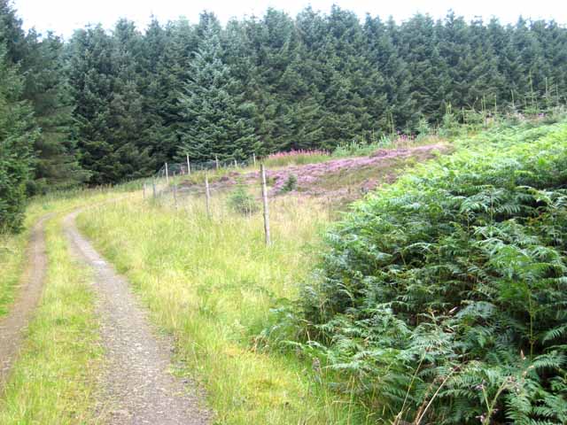
Long Fell is accessible via several footpaths and trails, making it a popular destination for both experienced hikers and casual walkers. The surrounding area offers ample opportunities for outdoor activities, such as picnicking, birdwatching, and photography. Additionally, the hill is a designated Site of Special Scientific Interest (SSSI), further highlighting its ecological importance.

Overall, Long Fell in Northumberland is a stunning natural landmark, offering visitors a chance to immerse themselves in the beauty of the North Pennines and experience the diverse wildlife and landscapes that this region has to offer.

If you have any feedback on the listing, please let us know in the comments section below.

Long Fell Images

Images are sourced within 2km of 55.249979/-2.0369843 or Grid Reference NY9795. Thanks to Geograph Open Source API. All images are credited.

Darden Lough A hidden gem, well worth the walk.
Darden Lough
A hidden gem, well worth the walk.
Darden Pike Cairn at Darden Pike. Great place to sit and have lunch on a bright sunny day, and survey the surrounding farmland and moorland as I have done on many occasions
Darden Pike
Cairn at Darden Pike. Great place to sit and have lunch on a bright sunny day, and survey the surrounding farmland and moorland as I have done on many occasions
King's Dod looking towards Couquetdale
Moorland near Darden Pike
Darden Lough
Darden Lough
Forest colours, Harwood Forest Harwood Forest is a coniferous forest first established in the 1950s. A study in the subdued colours of the forest - light green bracken, dark green Sitka spruce, pink rosebay willowherb and purple heather.
Forest colours, Harwood Forest
Harwood Forest is a coniferous forest first established in the 1950s. A study in the subdued colours of the forest - light green bracken, dark green Sitka spruce, pink rosebay willowherb and purple heather.
Shooting hide in Harwood Forest
Slopes of Tod Knowe, Harwood Forest Harwood Forest is a coniferous forest first established in the 1950s.
Slopes of Tod Knowe, Harwood Forest
Harwood Forest is a coniferous forest first established in the 1950s.
Pit, Harwood Forest Harwood Forest is a coniferous forest first established in the 1950s. Large amounts of road-making material are needed for forestry and this is presumably an old pit from which road-making material has been excavated.
Pit, Harwood Forest
Harwood Forest is a coniferous forest first established in the 1950s. Large amounts of road-making material are needed for forestry and this is presumably an old pit from which road-making material has been excavated.
Darden Rigg, Harwood Forest Harwood Forest is a coniferous forest first established in the 1950s. Darden Rigg is a high ridge on the northern boundary of the forest.
Darden Rigg, Harwood Forest
Harwood Forest is a coniferous forest first established in the 1950s. Darden Rigg is a high ridge on the northern boundary of the forest.
Hemmel Hill, Harwood Forest Harwood Forest is a coniferous forest first established in the 1950s. Not much of a view from the top of this hill!
Hemmel Hill, Harwood Forest
Harwood Forest is a coniferous forest first established in the 1950s. Not much of a view from the top of this hill!
Old pit, Harwood Forest Harwood Forest is a coniferous forest first established in the 1950s. A large amount of road-building is needed for forestry; presumably this pit was formerly a source of road-building material
Old pit, Harwood Forest
Harwood Forest is a coniferous forest first established in the 1950s. A large amount of road-building is needed for forestry; presumably this pit was formerly a source of road-building material
Colster Cleugh View looking across Eastnook towards the foot of Colster Burn as seen from Smiddy Hill.
Colster Cleugh
View looking across Eastnook towards the foot of Colster Burn as seen from Smiddy Hill.
Waymarker near Darden Burn
Moorland near High Rigg Darden Loch and the cairn on Darden Pike are visible to the left in the distance.  Rumbling Sike cuts from left to right across the middle distance.
Moorland near High Rigg
Darden Loch and the cairn on Darden Pike are visible to the left in the distance. Rumbling Sike cuts from left to right across the middle distance.
High Rigg Near Darden Lough.
High Rigg
Near Darden Lough.
Darden Lough A pair of Canada geese appear to have taken up residency.
Darden Lough
A pair of Canada geese appear to have taken up residency.
Trig point on Darden Pike Darden Lough is in the background.
Trig point on Darden Pike
Darden Lough is in the background.
Show me another place!

Long Fell is located at Grid Ref: NY9795 (Lat: 55.249979, Lng: -2.0369843)

Unitary Authority: Northumberland

Police Authority: Northumbria

What 3 Words

///navy.kite.hairstyle. Near Otterburn, Northumberland

Related Wikis

Harwood Forest

Harwood Forest is a 3,527 hectares (8,720 acres) conifer plantation located to the south of Rothbury in North Northumberland, England, and managed by Forestry...

Billsmoor Park and Grasslees Wood

Billsmoor Park and Grasslees Wood is the name given to a Site of Special Scientific Interest (SSSI) in Northumberland, North East England, designated in...

High Cove

High Cove is a major slip feature to the west of Grasslees Burn in the Simonside Hills, Northumberland, England. It contains several small rifts and caves...

Tosson Hill

Tosson Hill is the highest hill in the Simonside Hills to the south of Rothbury in Northumberland, England. The summit lies about 2 kilometres (1.2 mi...

Elsdon Castle

Elsdon Castle is a castle in the village of Elsdon about 10 miles (16 km) to the southwest of Rothbury, in Northumberland, England, and also known as Mote...

Elsdon Tower

Elsdon Tower is a Grade I listed medieval tower house converted for use as a Rectory situated at Elsdon, Northumberland. Originally part of the estate...

St Cuthbert's Church, Elsdon

St Cuthbert's Church is located in Elsdon, Alnwick, northeast England. The church was one of the resting places of St. Cuthbert's body in the wanderings...

Redesdale Studios

Redesdale Studios was a Northumberland recording studio founded in 1996. It was situated in Elsdon in North Northumberland. It began as a partnership between...

Have you been to Long Fell?

Leave your review of Long Fell below (or comments, questions and feedback).