Old Hill

Hill, Mountain in Staffordshire Stafford

England

Old Hill

Tackeroo Railway - leaving the Mere Pits embankment A standard gauge military railway was completed in 1915 by the West Cannock Colliery Company to service the large Brocton and Rugeley training camps established on Cannock Chase at the outbreak of the Great War. There were connections to the Rugeley to Stafford line at Milford & Brocton Station and the Walsall to Rugeley line at Hednesford. 

Large numbers of British and Commonwealth servicemen trained on the open heathland of Cannock Chase with upwards of 250000 passing through the camps during the war.
Tackeroo Railway - leaving the Mere Pits embankment Credit: John M

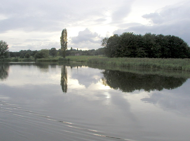
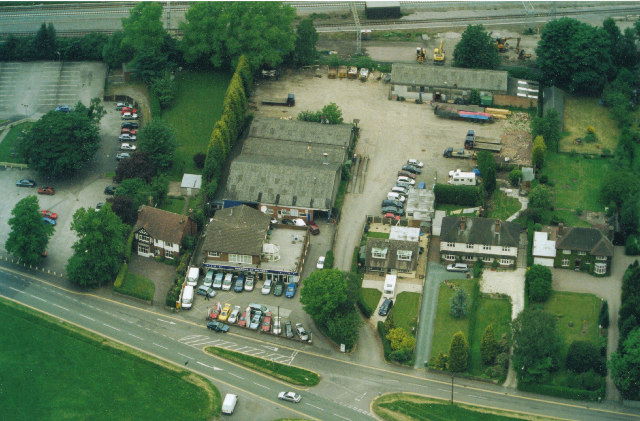
Old Hill is a small village located in the county of Staffordshire, England. Situated on a hill, it offers picturesque views of the surrounding countryside and is a popular destination for nature enthusiasts and hikers. The village is part of the larger town of Rowley Regis and is bordered by other small settlements such as Cradley Heath, Halesowen, and Blackheath.

The area is known for its rich history, with evidence of human habitation dating back to prehistoric times. Old Hill was once a thriving mining community, with coal mining being the primary industry in the region during the 19th and early 20th centuries. The remnants of the old mine shafts can still be seen in the landscape today.

In terms of amenities, Old Hill offers a range of services to its residents and visitors. The village has several shops, pubs, and restaurants, providing a variety of options for dining and entertainment. Additionally, there are schools, a library, and a community center, ensuring that the needs of the local population are well catered to.

Old Hill is well-connected to the rest of Staffordshire and the West Midlands region. The village has its own train station, providing easy access to nearby towns and cities such as Birmingham and Wolverhampton. It is also well-served by bus routes, allowing for convenient travel within the area.

Overall, Old Hill is a charming village with a rich heritage and stunning natural beauty. Whether one is interested in exploring its history, enjoying the outdoors, or simply relaxing in a peaceful setting, Old Hill has something to offer for everyone.

If you have any feedback on the listing, please let us know in the comments section below.

Old Hill Images

Images are sourced within 2km of 52.79492/-2.0363956 or Grid Reference SJ9721. Thanks to Geograph Open Source API. All images are credited.

Tackeroo Railway - leaving the Mere Pits embankment A standard gauge military railway was completed in 1915 by the West Cannock Colliery Company to service the large Brocton and Rugeley training camps established on Cannock Chase at the outbreak of the Great War. There were connections to the Rugeley to Stafford line at Milford & Brocton Station and the Walsall to Rugeley line at Hednesford. 

Large numbers of British and Commonwealth servicemen trained on the open heathland of Cannock Chase with upwards of 250000 passing through the camps during the war.
Tackeroo Railway - leaving the Mere Pits embankment
A standard gauge military railway was completed in 1915 by the West Cannock Colliery Company to service the large Brocton and Rugeley training camps established on Cannock Chase at the outbreak of the Great War. There were connections to the Rugeley to Stafford line at Milford & Brocton Station and the Walsall to Rugeley line at Hednesford. Large numbers of British and Commonwealth servicemen trained on the open heathland of Cannock Chase with upwards of 250000 passing through the camps during the war.
Shugborough Hall, near Cannock Chase This is the home of Lord Lichfield. Part of the house is open to the public. The County Museum is in the grounds as is a working farm museum.
Shugborough Hall, near Cannock Chase
This is the home of Lord Lichfield. Part of the house is open to the public. The County Museum is in the grounds as is a working farm museum.
Tixall Wide on The Staffs. & Worcs. Canal When this stretch of the Staffs . & Worcs. Canal was built, the landowner at this point insisted that the canal be made very wide here so as to resemble a lake and not an ugly narrow canal!
Tixall Wide on The Staffs. & Worcs. Canal
When this stretch of the Staffs . & Worcs. Canal was built, the landowner at this point insisted that the canal be made very wide here so as to resemble a lake and not an ugly narrow canal!
Nickolls Transport DAF 85CF taken in our yard. The depot is in Milford near Stafford.
Nickolls Transport
DAF 85CF taken in our yard. The depot is in Milford near Stafford.
Milford Church Fete A true vision of little Britain, this picture was taken at the Church Garden Fete on a very warm day in June 2005
Milford Church Fete
A true vision of little Britain, this picture was taken at the Church Garden Fete on a very warm day in June 2005
Two Trucks in the yard Two vehicles belonging to Nickolls Transport, Milford, Stafford.  Behind the yard you can see the railway line.
Two Trucks in the yard
Two vehicles belonging to Nickolls Transport, Milford, Stafford. Behind the yard you can see the railway line.
Aerial View of Milford, near Stafford Showing Transport Depot
Aerial View of Milford, near Stafford
Showing Transport Depot
Quarrying on Cannock Chase 1926 Satnall Hills
Quarrying on Cannock Chase 1926
Satnall Hills
Fields at Tixall Farm The distant wood is Bricklawn Covert. The GR given is for the near pylon.
Fields at Tixall Farm
The distant wood is Bricklawn Covert. The GR given is for the near pylon.
Essex Bridge, Shugborough When viewed from the river, this bridge looks just like any other old bridge, but it's much more fun than your average old bridge! This is a packhorse bridge, built to link the Shugborough estate to the village of Great Haywood. And if you search on the Web for information and photos of it, you'll be in for another surprise: it used to be over twice as long. By the way, it crosses the Trent just below the point where that river meets the River Sow.
Essex Bridge, Shugborough
When viewed from the river, this bridge looks just like any other old bridge, but it's much more fun than your average old bridge! This is a packhorse bridge, built to link the Shugborough estate to the village of Great Haywood. And if you search on the Web for information and photos of it, you'll be in for another surprise: it used to be over twice as long. By the way, it crosses the Trent just below the point where that river meets the River Sow.
The Chase from The Park A view from the Haywood entrance to the Shugborough estate, looking south to the Forestry Commission land at Coalpit Lane Covert (SJ 996207).
The Chase from The Park
A view from the Haywood entrance to the Shugborough estate, looking south to the Forestry Commission land at Coalpit Lane Covert (SJ 996207).
The bridge at the back of Shugborough Hall At summer level in times of drought the left bank exposes sand
The bridge at the back of Shugborough Hall
At summer level in times of drought the left bank exposes sand
Toll House The Toll House at the end of the Staffs & Worcester Canal where it joins the Trent & Mersey. The Aqueduct in the background is over the Trent. At the time this photo was taken the toll house was let as a shop.
Toll House
The Toll House at the end of the Staffs & Worcester Canal where it joins the Trent & Mersey. The Aqueduct in the background is over the Trent. At the time this photo was taken the toll house was let as a shop.
Essex Bridge Seen from the south, spanning the River Trent.  Originally there were 40 arches at least, although only 14 remain today - that still makes it the longest surviving packhorse bridge in Britain.  Named after the Earls of Essex who required a short cut onto the heights of Cannock Chase.  To day it takes the Staffordshire Way into the Shugborough Estate
Essex Bridge
Seen from the south, spanning the River Trent. Originally there were 40 arches at least, although only 14 remain today - that still makes it the longest surviving packhorse bridge in Britain. Named after the Earls of Essex who required a short cut onto the heights of Cannock Chase. To day it takes the Staffordshire Way into the Shugborough Estate
Folly, Shugborough Estate Bizarre edifice near the railway line that runs through the Shrugborough Estate, taken from the Staffordshire Way
Folly, Shugborough Estate
Bizarre edifice near the railway line that runs through the Shrugborough Estate, taken from the Staffordshire Way
A 513 Main Road from Rugeley to Stafford.  After leaving the Shugborough Estate it is necessary to follow this dangerous road before bearing off into the woods on Cannock Chase
A 513
Main Road from Rugeley to Stafford. After leaving the Shugborough Estate it is necessary to follow this dangerous road before bearing off into the woods on Cannock Chase
Clearing below Oat Hill Staffordshire Way walkers certainly need this sign, as bearings through the woods are confusing
Clearing below Oat Hill
Staffordshire Way walkers certainly need this sign, as bearings through the woods are confusing
Haywood Park This view of the farm and its lands shows how close it is to the wilderness of Cannock Chase. Compare the layout of the fields to the boundaries shown on an OS map.
Haywood Park
This view of the farm and its lands shows how close it is to the wilderness of Cannock Chase. Compare the layout of the fields to the boundaries shown on an OS map.
Show me another place!

Old Hill is located at Grid Ref: SJ9721 (Lat: 52.79492, Lng: -2.0363956)

Administrative County: Staffordshire

District: Stafford

Police Authority: Staffordshire

What 3 Words

///prep.senders.bolsters. Near Great Haywood, Staffordshire

Related Wikis

Shugborough Tunnel

The Shugborough Tunnel is a 777-yard (710 m) railway tunnel on the Trent Valley line running under part of the Shugborough Estate in Colwich, Staffordshire...

Milford and Brocton railway station

Milford and Brocton railway station served the villages of Milford and Brocton in Staffordshire, England from 1877 to 1950 on the Trent Valley line....

Tixall

Tixall is a small village and civil parish in the Stafford district, in the English county of Staffordshire lying on the western side of the Trent valley...

Milford, Staffordshire

Milford is a village in the county of Staffordshire, England. It lies at the edge of Cannock Chase, on the A513 road between Stafford and Rugeley. Just...
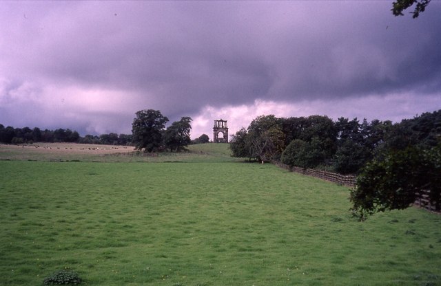
Tixall Gatehouse

Tixall Gatehouse is a 16th-century gatehouse situated at Tixall, near Stafford, Staffordshire and is all that remains of Tixall Hall which was demolished...
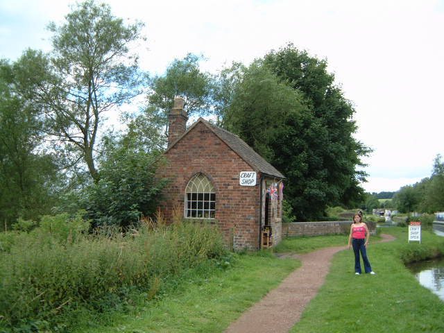
Tixall Wide

Tixall Wide, also known as Tixall Broad or The Broad Water, is a body of water that forms part of the Staffordshire and Worcestershire Canal near Tixall...

Way for the Millennium

The Way for the Millennium is a 41-mile-long (66 km) eastโ€“west route across Staffordshire, deliberately designed for easy walking, using towpaths, old...

Milford Hall

Milford Hall is a privately owned 18th-century English country house at Milford, near Stafford. It is the family seat of the Levett Haszard family and...

Related Videos

Product Preview: On Cloudwander & Cloudtrax Hiking Boots / Shoes | Run and Ride

On Cloudtrax Walking Boot // Designed for both street and mountain peak, this hiking boot is engineered to give you ideal comfort ...

Narrowboat Holidays - Hiring A Canal Boat In The UK | Quest Vlog #24

Ever wanted to hire a canal boat and take a leisurely cruise through the UK countryside? We asked Anglo Welsh, our favourite ...

He Called My Wife A Slag ๐Ÿ˜ณ Hiking & Cooking Chinese Curry At Shugborough Estate ๐Ÿฅพ๐Ÿ”ฅ๐Ÿ›

Welcome back .... In this episode I take you on a hike through the Shugborough Estate in Staffordshire. Along the way, I chat ...

SHUGBOROUGH ESTATE #nationaltrust#walking #explore #shrugburgh #daytrip #estate

The Shugborough Estate is a rich blend of landscape,monuments,gardens,and architecture shaped by travel and adventure.

Nearby Amenities

Located within 500m of 52.79492,-2.0363956
Seamark Type: gate
Waterway: lock_gate
Lat/Long: 52.7952403/-2.0340372
Seamark Type: gate
Waterway: lock_gate
Lat/Long: 52.7950478/-2.0341758
Noexit: yes
Lat/Long: 52.7945511/-2.0376798
Noexit: yes
Lat/Long: 52.793886/-2.037801
Noexit: yes
Lat/Long: 52.7904375/-2.0369259
Power: pole
Lat/Long: 52.793261/-2.0350771
Power: pole
Lat/Long: 52.7927744/-2.0358603
Power: pole
Lat/Long: 52.7939195/-2.0340551
Power: pole
Lat/Long: 52.7945958/-2.0329581
Power: pole
Lat/Long: 52.7937897/-2.0356269
Power: pole
Lat/Long: 52.7925895/-2.0371665
The data included in this document is from www.openstreetmap.org. The data is made available under ODbL.

Have you been to Old Hill?

Leave your review of Old Hill below (or comments, questions and feedback).