Black Covert

Wood, Forest in Staffordshire Stafford

England

Black Covert

Millennium sundial on Broc Hill You have to stand on the right part of the plate depending on the month, and the time is given on the rocks beyond. I am assured it works, but it wasn't working on this misty day.
Millennium sundial on Broc Hill Credit: Bill Boaden

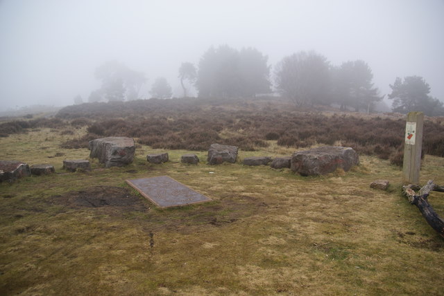
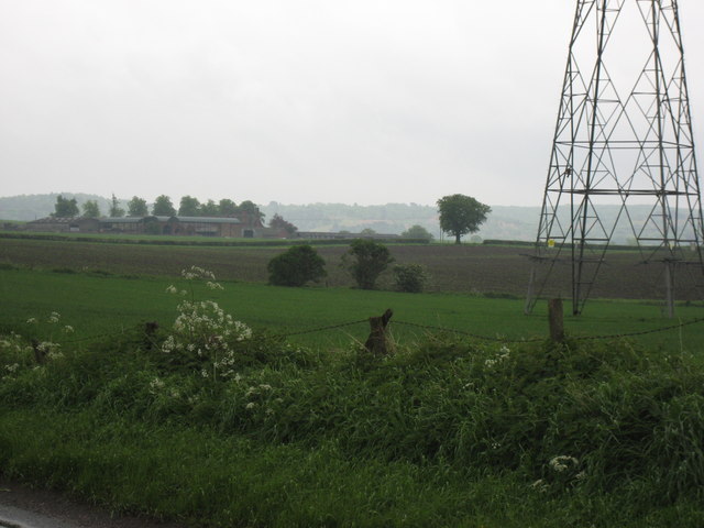
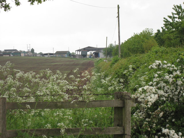
Black Covert is a dense woodland area located in Staffordshire, England. Covering an area of approximately 200 acres, it is situated near the village of Blackshaw Moor, just south of the beautiful Peak District National Park. The woodland is known for its rich biodiversity and is home to a variety of wildlife species.

The forest consists mainly of deciduous trees such as oak, beech, and birch, which create a stunning canopy of greenery during the summer months. The woodland floor is covered with a carpet of ferns, bluebells, and other wildflowers, providing a picturesque setting for nature enthusiasts and hikers.

The site is managed by the Staffordshire Wildlife Trust, ensuring the preservation of its natural beauty and wildlife. Black Covert offers several walking trails of varying lengths, allowing visitors to explore the woodland and experience its tranquility. These trails are well-maintained and signposted, making it easy for visitors to navigate their way through the forest.

Apart from its natural beauty, Black Covert also has historical significance. The woodland was once part of the ancient Croxden Abbey estate, and remnants of the abbey can still be seen within the forest. This adds an element of intrigue and fascination to the area, attracting history buffs and those interested in the region's past.

Overall, Black Covert is a hidden gem in Staffordshire, offering a peaceful retreat for nature lovers and a glimpse into the area's rich natural and historical heritage.

If you have any feedback on the listing, please let us know in the comments section below.

Black Covert Images

Images are sourced within 2km of 52.794243/-2.0441215 or Grid Reference SJ9721. Thanks to Geograph Open Source API. All images are credited.

Millennium sundial on Broc Hill You have to stand on the right part of the plate depending on the month, and the time is given on the rocks beyond. I am assured it works, but it wasn't working on this misty day.
Millennium sundial on Broc Hill
You have to stand on the right part of the plate depending on the month, and the time is given on the rocks beyond. I am assured it works, but it wasn't working on this misty day.
Tackeroo Railway - leaving the Mere Pits embankment A standard gauge military railway was completed in 1915 by the West Cannock Colliery Company to service the large Brocton and Rugeley training camps established on Cannock Chase at the outbreak of the Great War. There were connections to the Rugeley to Stafford line at Milford & Brocton Station and the Walsall to Rugeley line at Hednesford. 

Large numbers of British and Commonwealth servicemen trained on the open heathland of Cannock Chase with upwards of 250000 passing through the camps during the war.
Tackeroo Railway - leaving the Mere Pits embankment
A standard gauge military railway was completed in 1915 by the West Cannock Colliery Company to service the large Brocton and Rugeley training camps established on Cannock Chase at the outbreak of the Great War. There were connections to the Rugeley to Stafford line at Milford & Brocton Station and the Walsall to Rugeley line at Hednesford. Large numbers of British and Commonwealth servicemen trained on the open heathland of Cannock Chase with upwards of 250000 passing through the camps during the war.
Tixall Wide on The Staffs. & Worcs. Canal When this stretch of the Staffs . & Worcs. Canal was built, the landowner at this point insisted that the canal be made very wide here so as to resemble a lake and not an ugly narrow canal!
Tixall Wide on The Staffs. & Worcs. Canal
When this stretch of the Staffs . & Worcs. Canal was built, the landowner at this point insisted that the canal be made very wide here so as to resemble a lake and not an ugly narrow canal!
Nickolls Transport DAF 85CF taken in our yard. The depot is in Milford near Stafford.
Nickolls Transport
DAF 85CF taken in our yard. The depot is in Milford near Stafford.
Milford Church Fete A true vision of little Britain, this picture was taken at the Church Garden Fete on a very warm day in June 2005
Milford Church Fete
A true vision of little Britain, this picture was taken at the Church Garden Fete on a very warm day in June 2005
Two Trucks in the yard Two vehicles belonging to Nickolls Transport, Milford, Stafford.  Behind the yard you can see the railway line.
Two Trucks in the yard
Two vehicles belonging to Nickolls Transport, Milford, Stafford. Behind the yard you can see the railway line.
Aerial View of Milford, near Stafford Showing Transport Depot
Aerial View of Milford, near Stafford
Showing Transport Depot
Quarrying on Cannock Chase 1926 Satnall Hills
Quarrying on Cannock Chase 1926
Satnall Hills
Folly, Shugborough Estate Bizarre edifice near the railway line that runs through the Shrugborough Estate, taken from the Staffordshire Way
Folly, Shugborough Estate
Bizarre edifice near the railway line that runs through the Shrugborough Estate, taken from the Staffordshire Way
A 513 Main Road from Rugeley to Stafford.  After leaving the Shugborough Estate it is necessary to follow this dangerous road before bearing off into the woods on Cannock Chase
A 513
Main Road from Rugeley to Stafford. After leaving the Shugborough Estate it is necessary to follow this dangerous road before bearing off into the woods on Cannock Chase
Clearing below Oat Hill Staffordshire Way walkers certainly need this sign, as bearings through the woods are confusing
Clearing below Oat Hill
Staffordshire Way walkers certainly need this sign, as bearings through the woods are confusing
Barley Mow at Milford On the corner of Milford Common
Barley Mow at Milford
On the corner of Milford Common
Milford Common Looking towards the south with the Barley Mow Public House behind the right shoulder
Milford Common
Looking towards the south with the Barley Mow Public House behind the right shoulder
Tixall  The obelisk
Tixall The obelisk
Brancote Farm On a rather poor day !
Brancote Farm
On a rather poor day !
Tixall Heath Farm From the side of its drive way
Tixall Heath Farm
From the side of its drive way
Milford edge of Cannock Chase The building in front is Sister Dora's retirement home.
Milford edge of Cannock Chase
The building in front is Sister Dora's retirement home.
Bridleway From the quiet road, an even quieter bridleway!!
Bridleway
From the quiet road, an even quieter bridleway!!
Show me another place!

Black Covert is located at Grid Ref: SJ9721 (Lat: 52.794243, Lng: -2.0441215)

Administrative County: Staffordshire

District: Stafford

Police Authority: Staffordshire

What 3 Words

///cove.detail.voters. Near Great Haywood, Staffordshire

Related Wikis

Milford and Brocton railway station

Milford and Brocton railway station served the villages of Milford and Brocton in Staffordshire, England from 1877 to 1950 on the Trent Valley line....

Milford, Staffordshire

Milford is a village in the county of Staffordshire, England. It lies at the edge of Cannock Chase, on the A513 road between Stafford and Rugeley. Just...

Milford Hall

Milford Hall is a privately owned 18th-century English country house at Milford, near Stafford. It is the family seat of the Levett Haszard family and...

Shugborough Tunnel

The Shugborough Tunnel is a 777-yard (710 m) railway tunnel on the Trent Valley line running under part of the Shugborough Estate in Colwich, Staffordshire...

Tixall

Tixall is a small village and civil parish in the Stafford district, in the English county of Staffordshire lying on the western side of the Trent valley...

Tixall Gatehouse

Tixall Gatehouse is a 16th-century gatehouse situated at Tixall, near Stafford, Staffordshire and is all that remains of Tixall Hall which was demolished...

Tixall Wide

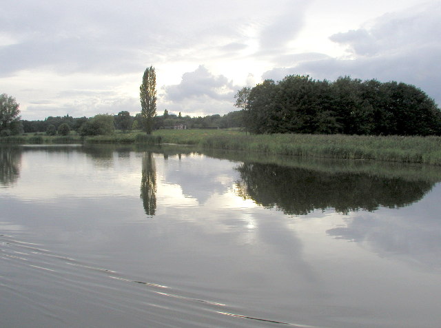
Tixall Wide, also known as Tixall Broad or The Broad Water, is a body of water that forms part of the Staffordshire and Worcestershire Canal near Tixall...

Walton-on-the-Hill, Staffordshire

Walton-on-the-Hill is a village in the Borough of Stafford in Staffordshire, England. It is about 5 km east of the centre of Stafford, and lies on the...

Nearby Amenities

Located within 500m of 52.794243,-2.0441215
Noexit: yes
Lat/Long: 52.7945511/-2.0376798
Noexit: yes
Lat/Long: 52.793886/-2.037801
The data included in this document is from www.openstreetmap.org. The data is made available under ODbL.

Have you been to Black Covert?

Leave your review of Black Covert below (or comments, questions and feedback).