Brownsey Moor
Hill, Mountain in Yorkshire Richmondshire
England
Brownsey Moor

Brownsey Moor is a picturesque hill located in the Yorkshire Dales National Park, in the county of Yorkshire, England. Situated approximately 3 miles southeast of the market town of Hawes, it is a popular destination for hikers, nature enthusiasts, and those seeking panoramic views of the surrounding countryside.
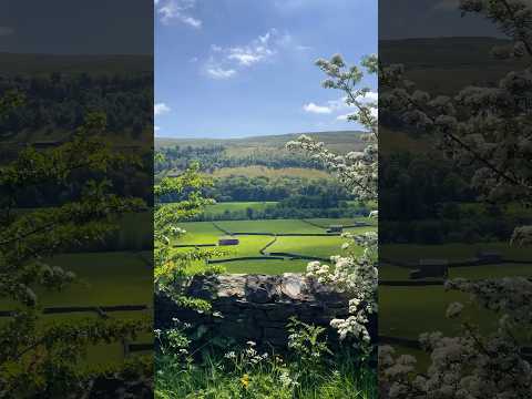
Standing at an elevation of 1,845 feet, Brownsey Moor offers breathtaking vistas of the Yorkshire Dales, with its rolling green hills, scattered limestone outcrops, and meandering rivers. The hill itself is characterized by its gentle slopes and heather-covered moorland, creating a serene and tranquil atmosphere.
The area is home to a rich diversity of flora and fauna, with species such as curlews, lapwings, and skylarks frequently spotted. Additionally, the moorland is adorned with colorful wildflowers during the summer months, providing a vibrant display of nature's beauty.
Visitors to Brownsey Moor can explore the various footpaths and trails that crisscross the area, offering opportunities for both leisurely walks and more challenging hikes. The nearby Pennine Way, a long-distance footpath, passes close by, attracting avid walkers from far and wide.
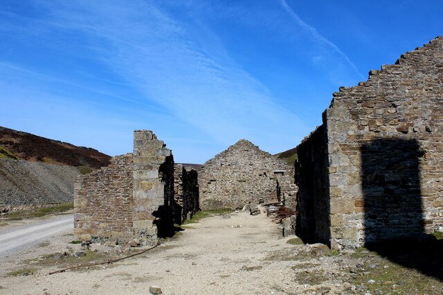
In addition to its natural beauty, Brownsey Moor also holds historical significance. The hill is home to several ancient archaeological sites, including burial mounds and stone circles, providing glimpses into the region's past.
Overall, Brownsey Moor is a captivating destination that combines stunning natural landscapes, diverse wildlife, and a touch of history. Whether seeking tranquility, outdoor adventure, or simply a place to connect with nature, this Yorkshire gem offers something for everyone.
If you have any feedback on the listing, please let us know in the comments section below.
Brownsey Moor Images
Images are sourced within 2km of 54.3908/-2.0496614 or Grid Reference SD9699. Thanks to Geograph Open Source API. All images are credited.


Brownsey Moor is located at Grid Ref: SD9699 (Lat: 54.3908, Lng: -2.0496614)
Division: North Riding
Administrative County: North Yorkshire
District: Richmondshire
Police Authority: North Yorkshire
What 3 Words
///sheepish.blitz.splint. Near Bowes, Co. Durham
Nearby Locations
Related Wikis

Melbecks
Melbecks is a civil parish in North Yorkshire, England. It is located in upper Swaledale and covers the settlements of Gunnerside, Low Row, Feetham and...

Low Row
Low Row is a village in Swaledale, in the Yorkshire Dales, North Yorkshire, England. It lies about 3 miles west of Reeth and is between Healaugh and Gunnerside...

Feetham
Feetham is a hamlet opposite Low Row in the Yorkshire Dales, North Yorkshire, England. The origin of the place-name is from Old Norse and means place at...

Gunnerside
Gunnerside is a village in North Yorkshire, England. It is situated in Swaledale, on the B6270 road, 3 miles (5 km) east of Muker and 6 miles (10 km) west...

Kearton
Kearton is a hamlet in the Yorkshire Dales, North Yorkshire, England. Kearton is situated near Low Row and Reeth. == References == == External links... ==

Crackpot, North Yorkshire
Crackpot is a village in Swaledale, North Yorkshire, England. Its name derives from the Old English kraka (crow) and the Viking word pot (usually a pit...

Gunnerside Gill
Gunnerside Gill (or Ghyll) is a small valley in the Yorkshire Dales, England, which branches off Swaledale into moorland to the north of Gunnerside. The...

Satron
Satron is a hamlet in Swaledale, North Yorkshire, England. It lies 0.6 miles (1 km) south west of Gunnerside on the opposite bank of the River Swale. It...
Related Videos

Hiking around Gunnerside Yorkshire Dales
A family Hike to Gunnerside Gill in the Yorkshire Dales. Gunnerside is home to some wonderful old buildings that have been left ...
The Swale Trail of Swaledale
Went on a five hour walk in Swaledale in England. It was amazing, even in the biting chill.
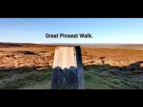
Great Heights And "STUNNING" Scenery.
Great Pinseat is a 17.5 mile loop trail located near Reeth, North Yorkshire, England that features a river and is rated as moderate.
Nearby Amenities
Located within 500m of 54.3908,-2.0496614Have you been to Brownsey Moor?
Leave your review of Brownsey Moor below (or comments, questions and feedback).