Bingy Hill

Hill, Mountain in Yorkshire Richmondshire

England

Bingy Hill

Cubeck
Cubeck Credit: David Robinson

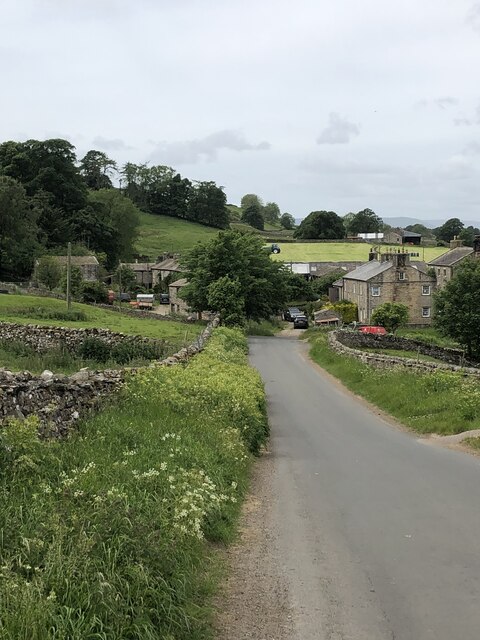
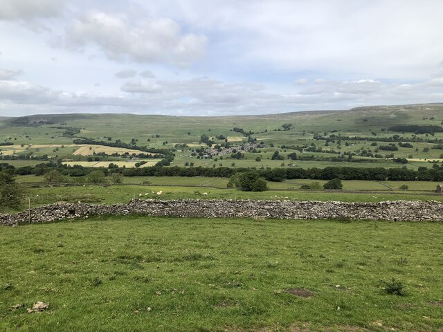
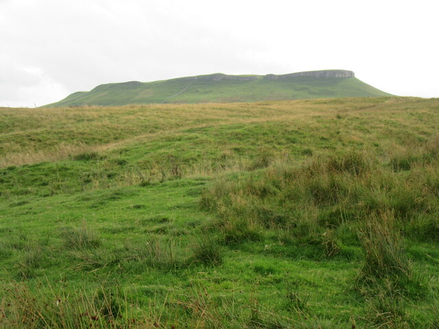
Bingy Hill is a prominent geographical feature located in the county of Yorkshire, England. It is classified as a hill rather than a mountain, as it stands at an elevation of around 206 meters (676 feet) above sea level. Situated near the village of South Milford, Bingy Hill offers magnificent panoramic views of the surrounding countryside.

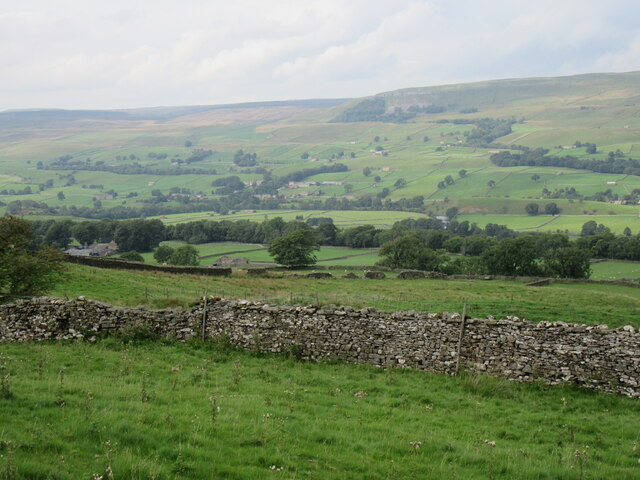
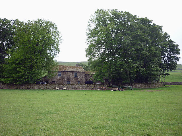
Covered in lush greenery, Bingy Hill is known for its picturesque landscapes and is a popular destination for hikers, nature enthusiasts, and photographers alike. The hill is characterized by its gently sloping sides, making it accessible to visitors of various fitness levels. The terrain is predominantly grassy, with scattered trees and shrubs adding to the natural beauty.

At the summit of Bingy Hill, visitors are rewarded with breathtaking vistas that stretch for miles in every direction. On a clear day, the view encompasses rolling hills, meandering rivers, and charming villages that dot the Yorkshire countryside. The hill’s location also makes it an ideal spot for stargazing, as the lack of light pollution allows for excellent visibility of the night sky.

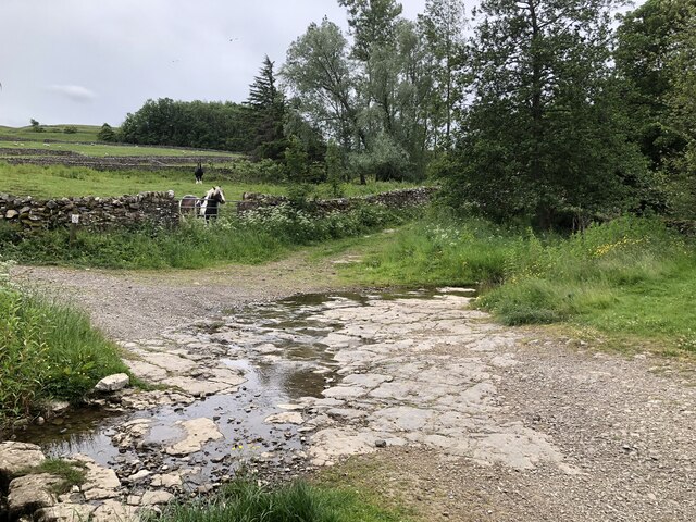
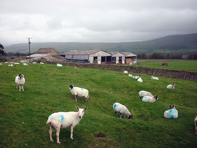
Bingy Hill is a popular destination for outdoor activities such as walking, picnicking, and birdwatching. The area is home to a diverse range of wildlife, and visitors may spot various species of birds, small mammals, and even deer. The hill is also intersected by several public footpaths, allowing for exploration of the surrounding areas.

Overall, Bingy Hill offers a serene and tranquil escape from the hustle and bustle of everyday life, providing visitors with the opportunity to connect with nature and enjoy the breathtaking beauty of the Yorkshire landscape.

If you have any feedback on the listing, please let us know in the comments section below.
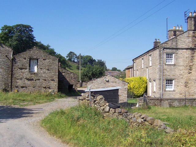
Bingy Hill Images

Images are sourced within 2km of 54.303069/-2.0669506 or Grid Reference SD9589. Thanks to Geograph Open Source API. All images are credited.

Wensleydale View of Wensleydale from lower slopes of Addlebrough. The treeline in the middle distance is Worton Scar, and the small town of Askrigg can be seen in the centre of the image.
Wensleydale
View of Wensleydale from lower slopes of Addlebrough. The treeline in the middle distance is Worton Scar, and the small town of Askrigg can be seen in the centre of the image.
Bridleway track fording small stream on Thornton Rust Moor
Limestone construction near Thornton Rust Resembling an old kiln, the building seems to sit right atop a swallow hole marked on OS maps.
Limestone construction near Thornton Rust
Resembling an old kiln, the building seems to sit right atop a swallow hole marked on OS maps.
Fossil shells in limestone bed of stream at Thornton Rust
Ford at Thornton Rust The limestone bed is full of fossil shells, easily seen on the water-wet rock as seen here: <a href="https://www.geograph.org.uk/photo/7235586">SD9788 : Fossil shells in limestone bed of stream at Thornton Rust</a>
Ford at Thornton Rust
The limestone bed is full of fossil shells, easily seen on the water-wet rock as seen here: SD9788 : Fossil shells in limestone bed of stream at Thornton Rust
The north side of Addlebrough Looking up at the north side of Addlebrough.
The north side of Addlebrough
Looking up at the north side of Addlebrough.
Near Cubeck Looking across Wensleydale near Cubeck.
Near Cubeck
Looking across Wensleydale near Cubeck.
Thornton Scar Looking north through the trees on Thornton Scar.
Thornton Scar
Looking north through the trees on Thornton Scar.
Old milepost When first recorded for the Milestone Society in 2004, this milepost on the A684 had lost a large section of the bevel.   In 2007 it was repaired for the Yorkshire Dales National Park and repainted.   In 2019 there is evidence of the repair with rusty lines on the bevel.   It was made at the foundry of F Mattison  & Co, Bedale.  This is cast inside the back of the right-hand side.   It is Grade II listed 1296900.
Old milepost
When first recorded for the Milestone Society in 2004, this milepost on the A684 had lost a large section of the bevel. In 2007 it was repaired for the Yorkshire Dales National Park and repainted. In 2019 there is evidence of the repair with rusty lines on the bevel. It was made at the foundry of F Mattison & Co, Bedale. This is cast inside the back of the right-hand side. It is Grade II listed 1296900.
Old milepost This milespost on the A684 was damaged.  The two sides were retrieved by the Yorkshire Dales National Park and then the top bevel was located recently.   It has been repaired with a strengthening framework inside which allows the foundry name, Mattisons of Bedale, to be seen.  It also has an extension into the ground.  Repainted and reset with a surrounding membrane and stones to help keep down the roadside grasses and weeds.   It had to be moved with the agreement of the YDNP listing to a wider verge and safer position a little to the east of its original site.   It is Grade II Listed 1296900.
Old milepost
This milespost on the A684 was damaged. The two sides were retrieved by the Yorkshire Dales National Park and then the top bevel was located recently. It has been repaired with a strengthening framework inside which allows the foundry name, Mattisons of Bedale, to be seen. It also has an extension into the ground. Repainted and reset with a surrounding membrane and stones to help keep down the roadside grasses and weeds. It had to be moved with the agreement of the YDNP listing to a wider verge and safer position a little to the east of its original site. It is Grade II Listed 1296900.
Wide grass verge in Thornton Rust
The village institute, Thornton Rust Dated 1924.
The village institute, Thornton Rust
Dated 1924.
Scar Top The house does not seem to be occupied - slates are sliding off the roof.
Scar Top
The house does not seem to be occupied - slates are sliding off the roof.
Wall on Thornton Rust Moor Looking towards Pen Hill.
Wall on Thornton Rust Moor
Looking towards Pen Hill.
Dakota over Addlebrough This World War II veteran waggled his wings as he flew over us.
Dakota over Addlebrough
This World War II veteran waggled his wings as he flew over us.
Cow at Scar Top
Cow at Scar Top
Sheep at Scar Top Almost all Swaledales except the Blue Faced Leicester at the front.
Sheep at Scar Top
Almost all Swaledales except the Blue Faced Leicester at the front.
Show me another place!

Bingy Hill is located at Grid Ref: SD9589 (Lat: 54.303069, Lng: -2.0669506)

Division: North Riding

Administrative County: North Yorkshire

District: Richmondshire

Police Authority: North Yorkshire

What 3 Words

///rabble.moved.thundered. Near Leyburn, North Yorkshire

Related Wikis

Cubeck

Cubeck is a hamlet in the Richmondshire district of North Yorkshire, England. It is near Thornton Rust and Worton. == External links == Media related...

Worton, North Yorkshire

Worton is a hamlet in Wensleydale in the Yorkshire Dales in the Richmondshire district of North Yorkshire, England. It lies 1-mile (1.6 km) east of Bainbridge...

Nappa Hall

Nappa Hall is a fortified manor house in Wensleydale, North Yorkshire, England, described by English Heritage as "probably the finest and least-spoilt...

Cringley House

Cringley House (also known as Skeldale House) is an historic building in the English village of Askrigg, North Yorkshire. Standing on the south side of...

Nearby Amenities

Located within 500m of 54.303069,-2.0669506
Worton
Place: hamlet
Wikidata: Q8037288
Lat/Long: 54.3057969/-2.0706186
Cubeck
Place: hamlet
Source: os_25k_firstseries
Wikidata: Q736927
Lat/Long: 54.3008212/-2.0715357
East Scar Top Farm
Place: farm
Lat/Long: 54.299518/-2.0637489
Post Box
Source: survey
Lat/Long: 54.3009189/-2.0706601
Telephone
Booth: K6
Covered: booth
Lat/Long: 54.305944/-2.0708683
Barrier: stile
Lat/Long: 54.3004451/-2.0609691
Power: pole
Lat/Long: 54.3024164/-2.0599607
Power: pole
Lat/Long: 54.3026684/-2.0609719
Power: pole
Lat/Long: 54.3029063/-2.0620072
Power: pole
Lat/Long: 54.304879/-2.0675205
Power: pole
Lat/Long: 54.3032177/-2.0632061
Power: pole
Lat/Long: 54.3035714/-2.0646438
Power: pole
Lat/Long: 54.3039095/-2.0659313
Power: pole
Lat/Long: 54.3040926/-2.0674494
Power: pole
Lat/Long: 54.3042491/-2.0687717
Power: pole
Lat/Long: 54.3044197/-2.0701075
Power: pole
Lat/Long: 54.3046122/-2.0717463
Power: pole
Lat/Long: 54.3046622/-2.0731598
Bus Stop
Woton
Bench: yes
Bus: yes
Departures Board: timetable
Naptan AtcoCode: 3200YNA90941
Naptan NaptanCode: 32090941
Physically Present: yes
Public Transport: platform
Shelter: yes
Waste Basket: yes
Lat/Long: 54.3057947/-2.0711699
Bus Stop
Woton
Bus: yes
Departures Board: timetable
Physically Present: yes
Public Transport: platform
Shelter: no
Lat/Long: 54.3056524/-2.0709158
Ford: yes
Lat/Long: 54.3037439/-2.0607801
Ford: yes
Lat/Long: 54.3021775/-2.0639531
Power: pole
Lat/Long: 54.3044514/-2.0700721
Power: pole
Lat/Long: 54.303589/-2.0709905
Power: pole
Lat/Long: 54.30281/-2.0712464
Power: pole
Lat/Long: 54.3022653/-2.0714045
Power: pole
Lat/Long: 54.3015757/-2.0716178
The data included in this document is from www.openstreetmap.org. The data is made available under ODbL.

Have you been to Bingy Hill?

Leave your review of Bingy Hill below (or comments, questions and feedback).