Horse Hill

Hill, Mountain in Wiltshire

England

Horse Hill

Path on Winkelbury Hill
Path on Winkelbury Hill Credit: Richard Webb

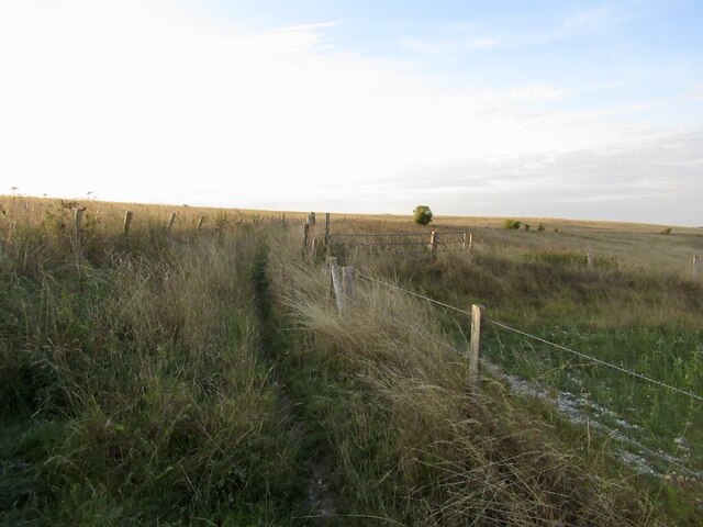
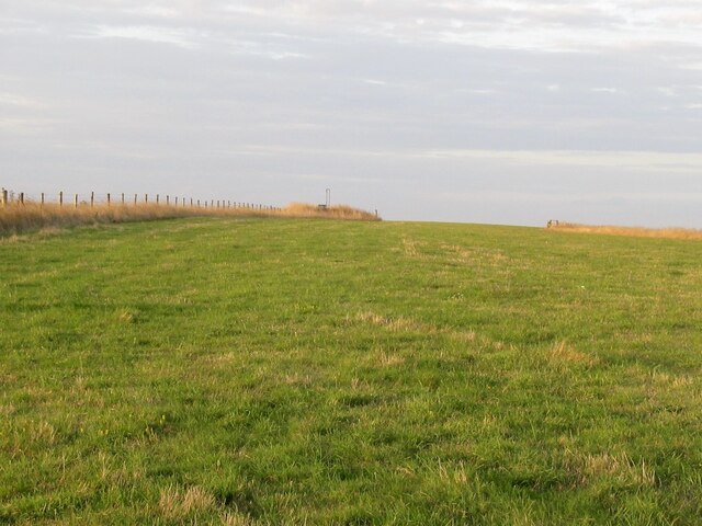
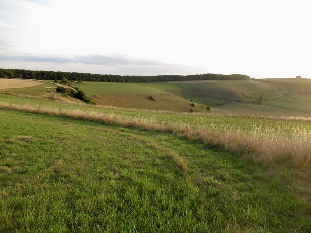
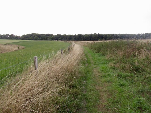
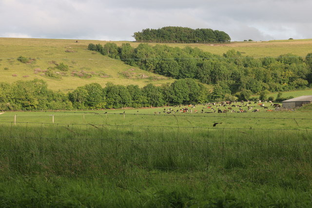
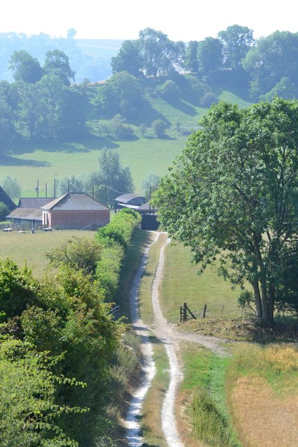
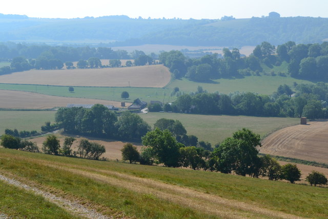
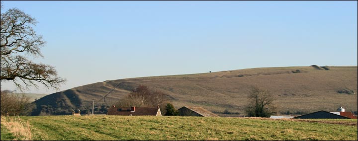
Horse Hill, located in Wiltshire, England, is a prominent and picturesque chalk hill that forms part of the North Wessex Downs Area of Outstanding Natural Beauty. Rising to an elevation of around 261 meters (856 feet), it stands as one of the highest points in the region, offering magnificent panoramic views of the surrounding countryside.

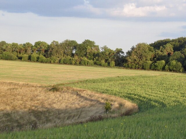
Situated near the village of Broad Hinton, Horse Hill is characterized by its gentle slopes and well-defined ridge, which is covered in lush grassland and scattered with patches of woodland. The hill's geology consists mainly of chalk, a soft, white sedimentary rock that forms characteristic escarpments and downs in this part of England.

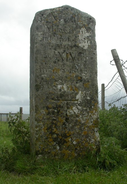
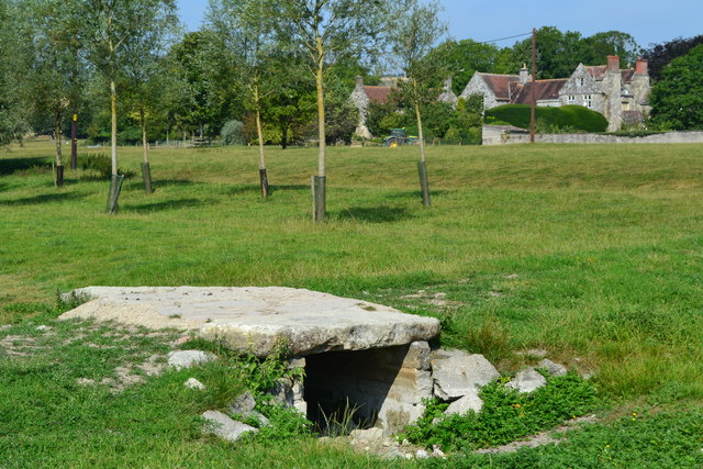
Horse Hill is renowned for its rich historical and archaeological significance. Various Bronze Age barrows, or burial mounds, can be found scattered across its slopes, indicating human presence in the area dating back over 4,000 years. Additionally, the hill has played a role in more recent history, serving as a training ground for horses during World War I and II.

The site is a popular destination for outdoor enthusiasts, offering a range of activities such as hiking, nature walks, and picnicking. Several footpaths and trails traverse the hill, allowing visitors to explore its diverse flora and fauna, including rare chalk grassland species. The hill's location within an Area of Outstanding Natural Beauty ensures its protection and preservation for future generations to enjoy.

If you have any feedback on the listing, please let us know in the comments section below.
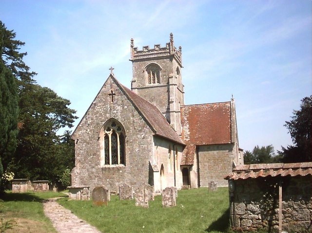
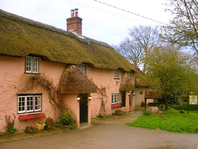
Horse Hill Images

Images are sourced within 2km of 51.005167/-2.0726789 or Grid Reference ST9422. Thanks to Geograph Open Source API. All images are credited.

Path on Winkelbury Hill
Lower Bridmore
Lower Bridmore
Downland, Winkelbury Hill The ground drops away sharply here.
Downland, Winkelbury Hill
The ground drops away sharply here.
Tumulus on Winkelbury Hill
West side of Winkelbury Hill View of the downs towards Monk's Down.
West side of Winkelbury Hill
View of the downs towards Monk's Down.
Path on Winkelbury Hill
Old Milestone on Whitesheet Hill, Berwick St John Parish Carved stone post by the UC road, in parish of Berwick St John (Salisbury District), Whitesheet Hill, top of hill at junction of bridleway and footpath, in field, 12m from track, on South side of road. Erected by the Whitesheet turnpike trust in the 18th century. See 9:50 minutes into this video <span class="nowrap"><a title="https://m.youtube.com/watch?v=GmOhltFV5pc" rel="nofollow ugc noopener" href="https://m.youtube.com/watch?v=GmOhltFV5pc">Link</a><img style="margin-left:2px;" alt="External link" title="External link - shift click to open in new window" src="https://s1.geograph.org.uk/img/external.png" width="10" height="10"/></span>

Inscription reads:- : XCVII / Miles from / Hide (sic) Park Corner / XIV / From Salisbury / 1756 :
Carved benchmark front lower.

Scheduled Monument. List Entry Number: 1005703

Milestone Society National ID: WI_SAOSH14
Old Milestone on Whitesheet Hill, Berwick St John Parish
Carved stone post by the UC road, in parish of Berwick St John (Salisbury District), Whitesheet Hill, top of hill at junction of bridleway and footpath, in field, 12m from track, on South side of road. Erected by the Whitesheet turnpike trust in the 18th century. See 9:50 minutes into this video LinkExternal link Inscription reads:- : XCVII / Miles from / Hide (sic) Park Corner / XIV / From Salisbury / 1756 : Carved benchmark front lower. Scheduled Monument. List Entry Number: 1005703 Milestone Society National ID: WI_SAOSH14
Berwick St John The historic Talbot Inn is one of many attractive stone buildings in this village.
Berwick St John
The historic Talbot Inn is one of many attractive stone buildings in this village.
Old Milestone on Whitesheet Hill, Berwick St John Parish Carved stone post by the UC road, in parish of Berwick St John (Salisbury District), Whitesheet Hill, top of hill at junction of bridleway and footpath, in field, 12m from track, on South side of road. Erected by the Whitesheet turnpike trust in the 18th century. See 9:50 minutes into this video <span class="nowrap"><a title="https://m.youtube.com/watch?v=GmOhltFV5pc" rel="nofollow ugc noopener" href="https://m.youtube.com/watch?v=GmOhltFV5pc">Link</a><img style="margin-left:2px;" alt="External link" title="External link - shift click to open in new window" src="https://s1.geograph.org.uk/img/external.png" width="10" height="10"/></span>.

Inscription reads:- : XCVII / Miles from / Hide (sic) Park Corner / XIV / From Salisbury / 1756 :
Carved benchmark front lower.

Scheduled Monument. List Entry Number: 1005703

Milestone Society National ID: WI_SAOSH14
Old Milestone on Whitesheet Hill, Berwick St John Parish
Carved stone post by the UC road, in parish of Berwick St John (Salisbury District), Whitesheet Hill, top of hill at junction of bridleway and footpath, in field, 12m from track, on South side of road. Erected by the Whitesheet turnpike trust in the 18th century. See 9:50 minutes into this video LinkExternal link. Inscription reads:- : XCVII / Miles from / Hide (sic) Park Corner / XIV / From Salisbury / 1756 : Carved benchmark front lower. Scheduled Monument. List Entry Number: 1005703 Milestone Society National ID: WI_SAOSH14
White Sheet Hill, Donhead St Andrew
White Sheet Hill, Donhead St Andrew The cows live at Horwood Dairy Farm
White Sheet Hill, Donhead St Andrew
The cows live at Horwood Dairy Farm
Track to Norrington Farm
Downland view north of Norrington Farm
Rolling downland north of Norrington Farm
View over Norrington Farm The early haze warns of a day that will later reach 32°C.
View over Norrington Farm
The early haze warns of a day that will later reach 32°C.
Bridge and farm Bridge over dry stream bed with Norrington Farm beyond.
Bridge and farm
Bridge over dry stream bed with Norrington Farm beyond.
Norrington
Norrington
Barn at Norrington Farm
Show me another place!

Horse Hill is located at Grid Ref: ST9422 (Lat: 51.005167, Lng: -2.0726789)

Unitary Authority: Wiltshire

Police Authority: Wiltshire

What 3 Words

///colleague.pulse.sues. Near Ansty, Wiltshire

Related Wikis

Berwick St John

Berwick St John is a village and civil parish in southwest Wiltshire, England, about 5 miles (8 km) east of Shaftesbury in Dorset. The parish includes...

Winklebury Hill

Winkelbury Hill (grid reference ST952216) is a 62.95 hectare biological Site of Special Scientific Interest in Berwick St John parish, south-west Wiltshire...

Gallows Hill SSSI, Wiltshire

Gallows Hill SSSI is a Site of Special Scientific Interest on the north side of the Ebble Valley in south Wiltshire, England. Its chalk grassland and scrub...

Pincombe Down

Pincombe Down (grid reference ST966217) is a 23.8 hectare biological Site of Special Scientific Interest in southwest Wiltshire, England, notified in 1971...

Ferne House

Ferne House is a country house in the parish of Donhead St Andrew in Wiltshire, England, owned by Viscount Rothermere.There has been a settlement on the...

Alvediston

Alvediston is a small village and civil parish in Wiltshire, England, about 7 miles (11 km) east of Shaftesbury and 11 miles (18 km) southwest of Salisbury...

Alvediston Manor

Alvediston Manor, Alvediston, Wiltshire, England is an 18th-century house. From 1968 until his death in 1977, it was the home of the former prime minister...

Ashcombe House, Wiltshire

Ashcombe House, also known as Ashcombe Park, is a Georgian manor house, set in 1,134 acres (4.59 km2) of land on Cranborne Chase in the parish of Berwick...

Nearby Amenities

Located within 500m of 51.005167,-2.0726789
Material: wood
Power: pole
Source: bing
Lat/Long: 51.0021453/-2.0769823
Material: wood
Power: pole
Source: bing
Lat/Long: 51.0023495/-2.0769341
Horse Hill
Access: private
Ele: 160
Natural: peak
Lat/Long: 51.0051862/-2.0726629
The data included in this document is from www.openstreetmap.org. The data is made available under ODbL.

Have you been to Horse Hill?

Leave your review of Horse Hill below (or comments, questions and feedback).