Hill of Minnes

Hill, Mountain in Aberdeenshire

Scotland

Hill of Minnes

New factory at Kinknockie New facility for timber frames unit opposite Kinknockie Farm.
New factory at Kinknockie Credit: Scott Cormie

Hill of Minnes is a prominent natural landmark located in Aberdeenshire, Scotland. Situated in the eastern part of the county, this hill stands at an elevation of approximately 450 meters (1,480 feet) above sea level. It is part of the larger range known as the Grampian Mountains, which stretch across the Scottish Highlands.

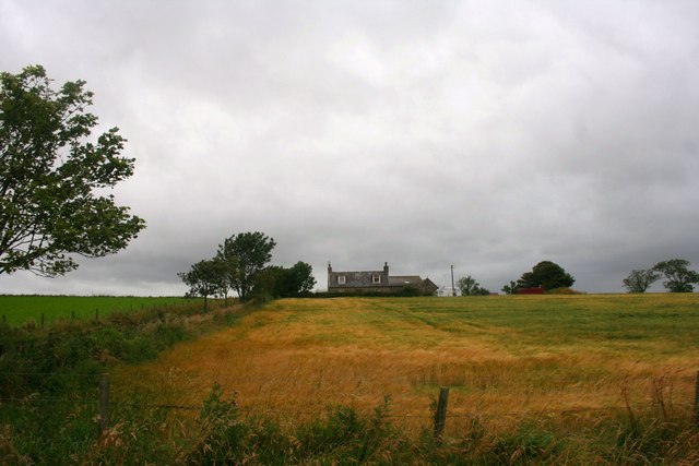
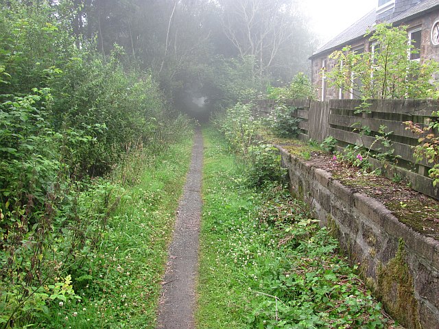
The Hill of Minnes offers breathtaking panoramic views of the surrounding countryside and is a popular destination for outdoor enthusiasts and hikers. Its distinctive shape and rugged terrain make it an ideal location for those seeking a challenging climb or a peaceful walk in nature.

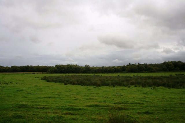
The hill is covered in heather and grass, creating a vibrant and colorful landscape, especially during the summer months. Various species of wildlife can be spotted in the area, including red deer, rabbits, and a variety of bird species.

The summit of Hill of Minnes provides visitors with a stunning vista, offering sweeping views of the nearby towns and villages, as well as the North Sea coastline in the distance. On a clear day, it is possible to see as far as the Cairngorms National Park, which lies to the west of Aberdeenshire.

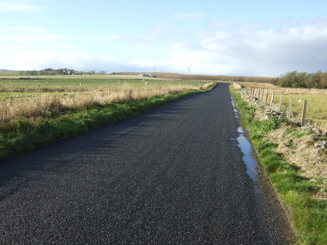
Access to the Hill of Minnes is relatively easy, with several footpaths and trails leading to the summit. However, caution should be exercised, particularly during adverse weather conditions, as the terrain can become slippery and treacherous.

Overall, Hill of Minnes is a captivating natural landmark, offering visitors a chance to immerse themselves in the beauty of Aberdeenshire's countryside while enjoying spectacular views from its summit.

If you have any feedback on the listing, please let us know in the comments section below.

Hill of Minnes Images

Images are sourced within 2km of 57.30339/-2.0892553 or Grid Reference NJ9423. Thanks to Geograph Open Source API. All images are credited.

New factory at Kinknockie New facility for timber frames unit opposite Kinknockie Farm.
New factory at Kinknockie
New facility for timber frames unit opposite Kinknockie Farm.
Cottages at Kinknockie Roadside white-washed cottages at Kinknockie.
Cottages at Kinknockie
Roadside white-washed cottages at Kinknockie.
Fiddesbeg from the north-east A distant view of the farm at Fiddesbeg, viewed from the road to the north-east.
Fiddesbeg from the north-east
A distant view of the farm at Fiddesbeg, viewed from the road to the north-east.
Road near Hill of Fiddes Minor road heading west at the Hill of Fiddes.
Road near Hill of Fiddes
Minor road heading west at the Hill of Fiddes.
Tillyfour Croftland Fields by Tillyfour Croft with woodland at Craibadonna Moss behind.
Tillyfour Croftland
Fields by Tillyfour Croft with woodland at Craibadonna Moss behind.
Tillyfour Access Road Tillyfour farm road between Craibadonna and Bridgefoot.
Tillyfour Access Road
Tillyfour farm road between Craibadonna and Bridgefoot.
Craibadona Moss Wetland and woodland by Craibadona Farm.
Craibadona Moss
Wetland and woodland by Craibadona Farm.
Mudhouse Croft Sitting at the top of a small hill by Craibadona.
Mudhouse Croft
Sitting at the top of a small hill by Craibadona.
Road to Mill of Minnes The road between Fiddesbeg and Mill of Minnes.
Road to Mill of Minnes
The road between Fiddesbeg and Mill of Minnes.
Latch Country road heading west.
Latch
Country road heading west.
Grazing, Kincraig
Grazing, Kincraig
Country road heading west Towards Udny.
Country road heading west
Towards Udny.
Woodland near Mill of Fiddes
Farmland and wind turbines Near Mill of Fiddes.
Farmland and wind turbines
Near Mill of Fiddes.
Fiddesbeg Cottages
Fiddesbeg Cottages
Country road, Fiddesbeg Heading south west.
Country road, Fiddesbeg
Heading south west.
Foveran Burn Mill of Minnes Looking west.
Foveran Burn Mill of Minnes
Looking west.
Farmland, Mill of Minnes
Show me another place!

Hill of Minnes is located at Grid Ref: NJ9423 (Lat: 57.30339, Lng: -2.0892553)

Unitary Authority: Aberdeenshire

Police Authority: North East

What 3 Words

///princely.memo.worlds. Near Newburgh, Aberdeenshire

Nearby Locations

Hill of Minnes

Related Wikis

Foveran

Foveran (Scottish Gaelic: Fobharan) is the name of both a parish and village in Aberdeenshire, Scotland. The village is located 11 miles (18 km) north...

Udny Station

Udny Station (Scots: Widnie Station) is a small village in Aberdeenshire, Scotland. It is 8 miles east of Oldmeldrum and 5 miles south west of Ellon....

Udny railway station

Udny railway station was a railway station located in Udny, Aberdeenshire. == History == The station was opened on 18 July 1861 by the Formartine and Buchan...

Logierieve railway station

Logierieve railway station was a railway station in Logierieve, Aberdeenshire. == History == Logierieve railway station was opened on 18 July 1861, originally...

Nearby Amenities

Located within 500m of 57.30339,-2.0892553
Hill of Minnes
Place: isolated_dwelling
Lat/Long: 57.3011156/-2.0852016
Hill of Minnes
Ele: 83
Natural: peak
Lat/Long: 57.3032485/-2.0889996
Power: pole
Lat/Long: 57.3051519/-2.0822808
Power: pole
Lat/Long: 57.3051507/-2.083625
Power: pole
Lat/Long: 57.3051611/-2.0850034
Power: pole
Lat/Long: 57.30516/-2.0863219
Power: pole
Lat/Long: 57.3052028/-2.0877624
Power: pole
Lat/Long: 57.3054906/-2.0889975
Power: pole
Lat/Long: 57.3055063/-2.0903492
Power: pole
Lat/Long: 57.3053768/-2.0915564
Power: pole
Lat/Long: 57.3052715/-2.0926972
Power: pole
Lat/Long: 57.3051501/-2.0938937
Power: pole
Lat/Long: 57.3053201/-2.0952294
Power: pole
Lat/Long: 57.3054045/-2.0959314
Power: pole
Lat/Long: 57.3069613/-2.0941559
Power: pole
Lat/Long: 57.3065034/-2.0946482
Power: pole
Lat/Long: 57.3059496/-2.0952647
The data included in this document is from www.openstreetmap.org. The data is made available under ODbL.

Have you been to Hill of Minnes?

Leave your review of Hill of Minnes below (or comments, questions and feedback).