Castle Hill

Hill, Mountain in Aberdeenshire

Scotland

Castle Hill

Parkhouse Hill The grassy track is the way to the Aikey Brae recumbent stone circle, which is hidden from here by the clump of conifers to the right.
Parkhouse Hill Credit: Anne Burgess

Castle Hill is a prominent hill located in Aberdeenshire, Scotland. Standing at an impressive height of 427 meters (1,401 feet), it offers breathtaking panoramic views of the surrounding countryside and is a popular destination for locals and tourists alike.

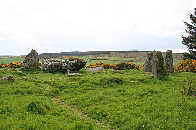
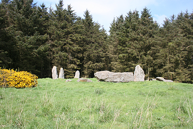
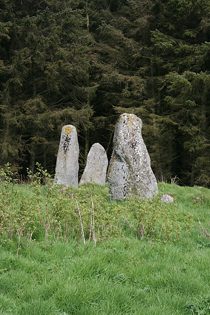
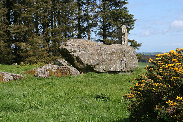
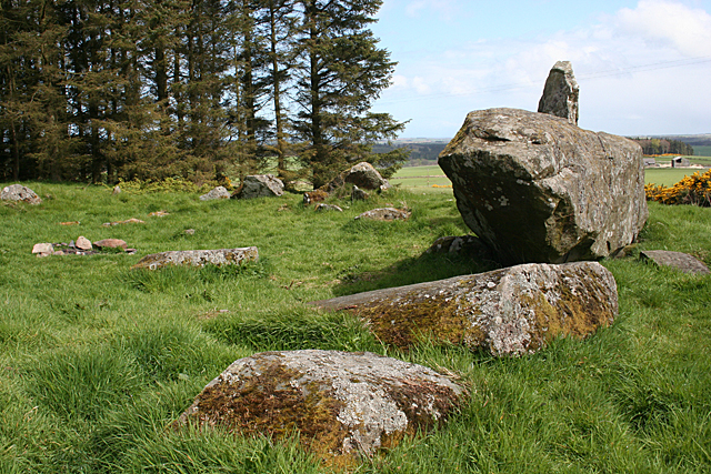
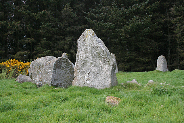
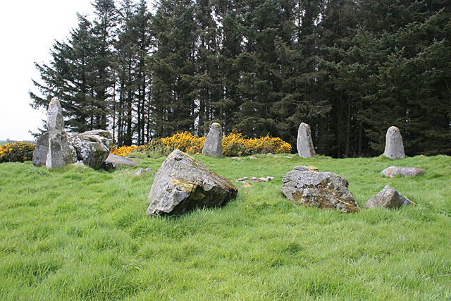
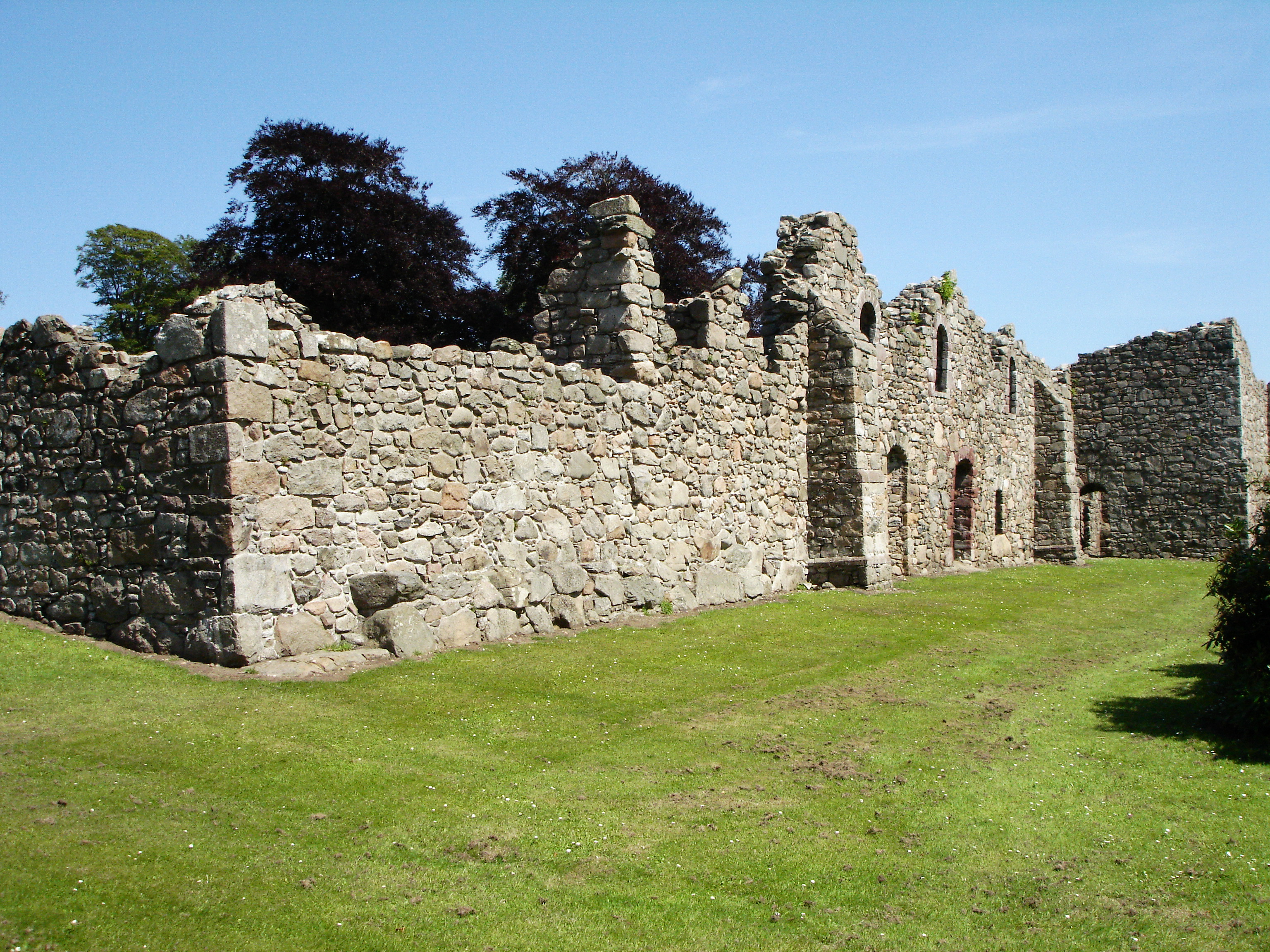
The hill gets its name from the remains of a medieval fortress that once stood atop its summit. Today, only remnants of the castle's stone walls and earthworks remain, providing a glimpse into its historical significance. The castle was believed to have been built in the 12th century and served as a strategic stronghold during the era. Its location on the hill provided a vantage point for monitoring the surrounding area and defending against potential threats.

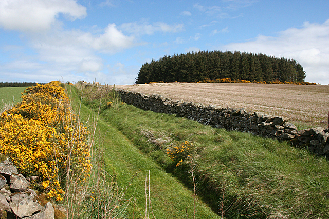
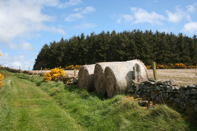
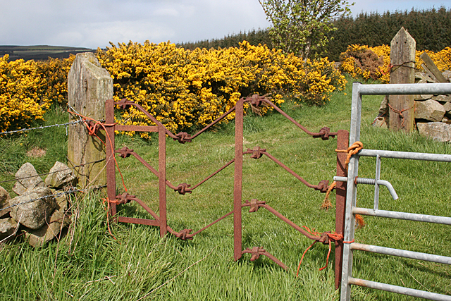
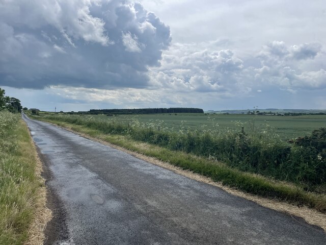
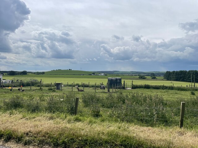
Castle Hill is easily accessible, with various walking trails leading to its summit. The paths are well-maintained and suitable for all levels of fitness. As visitors ascend the hill, they are treated to stunning views of the Aberdeenshire countryside, with rolling hills, lush green fields, and distant mountains stretching out before them.

The hill is also home to a diverse range of flora and fauna, making it an ideal spot for nature enthusiasts. Wildflowers, heather, and various species of birds can often be spotted along the trails, adding to the natural beauty of the area.

Whether it's history, natural beauty, or outdoor adventure, Castle Hill offers something for everyone. Its commanding presence and picturesque surroundings make it a must-visit destination for those exploring Aberdeenshire.

If you have any feedback on the listing, please let us know in the comments section below.
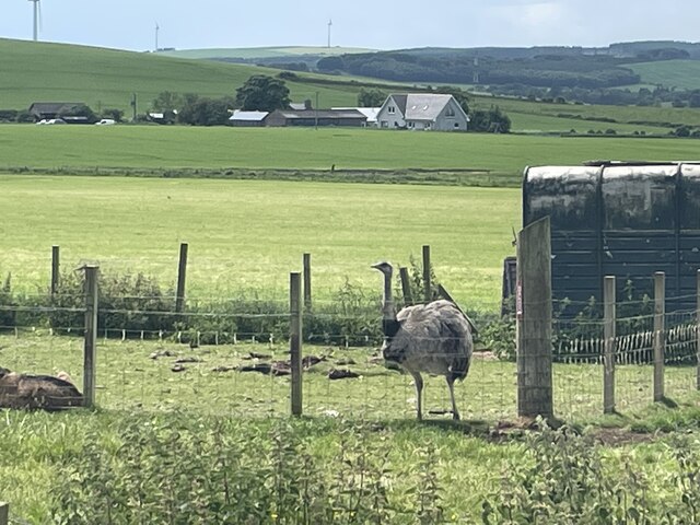
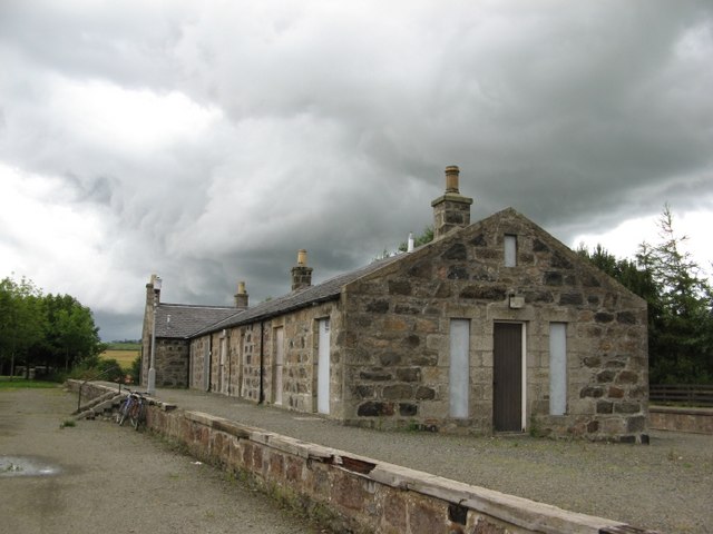
Castle Hill Images

Images are sourced within 2km of 57.507312/-2.0917733 or Grid Reference NJ9446. Thanks to Geograph Open Source API. All images are credited.

Parkhouse Hill The grassy track is the way to the Aikey Brae recumbent stone circle, which is hidden from here by the clump of conifers to the right.
Parkhouse Hill
The grassy track is the way to the Aikey Brae recumbent stone circle, which is hidden from here by the clump of conifers to the right.
Edible Gate? On closer inspection, the bales are straw, not hay, so any livestock would have to be pretty desperate to munch their way through this cleverly improvised and presumably temporary gate.
Edible Gate?
On closer inspection, the bales are straw, not hay, so any livestock would have to be pretty desperate to munch their way through this cleverly improvised and presumably temporary gate.
Elaborate Gate My first thought on seeing this gate was that it had been bent out of shape, producing folds in the horizontal bars, but I think the undulations are too tidy, so it was probably made like this. I'd be interested in any other opinions on the matter.
Elaborate Gate
My first thought on seeing this gate was that it had been bent out of shape, producing folds in the horizontal bars, but I think the undulations are too tidy, so it was probably made like this. I'd be interested in any other opinions on the matter.
Aikey Brae Recumbent Stone Circle (1) You approach the circle through a dense conifer plantation, thinking gloomily that the whole thing is going to be in deep shade, then you emerge from among the trees to this view. On the left are the east flanker and the enormous recumbent, and on the right are the remaining stones of the western arc of the circle. See <span class="nowrap"><a title="http://canmore.rcahms.gov.uk/en/site/20571/details/aikey+brae/" rel="nofollow ugc noopener" href="http://canmore.rcahms.gov.uk/en/site/20571/details/aikey+brae/">Link</a><img style="margin-left:2px;" alt="External link" title="External link - shift click to open in new window" src="https://s1.geograph.org.uk/img/external.png" width="10" height="10"/></span> for more details. <a href="https://www.geograph.org.uk/photo/4468384">NJ9547 : Aikey Brae Recumbent Stone Circle (2)</a>
Aikey Brae Recumbent Stone Circle (1)
You approach the circle through a dense conifer plantation, thinking gloomily that the whole thing is going to be in deep shade, then you emerge from among the trees to this view. On the left are the east flanker and the enormous recumbent, and on the right are the remaining stones of the western arc of the circle. See LinkExternal link for more details. NJ9547 : Aikey Brae Recumbent Stone Circle (2)
Aikey Brae Recumbent Stone Circle (2) This is the opposite view from <a href="https://www.geograph.org.uk/photo/4468375">NJ9547 : Aikey Brae Recumbent Stone Circle (1)</a>, with the recumbent and east flanker on the right and the remaining three stones still standing on the left, each one shorter than the next the further away they are from the recumbent. See <span class="nowrap"><a title="http://canmore.rcahms.gov.uk/en/site/20571/details/aikey+brae/" rel="nofollow ugc noopener" href="http://canmore.rcahms.gov.uk/en/site/20571/details/aikey+brae/">Link</a><img style="margin-left:2px;" alt="External link" title="External link - shift click to open in new window" src="https://s1.geograph.org.uk/img/external.png" width="10" height="10"/></span> for more details. <a href="https://www.geograph.org.uk/photo/4468390">NJ9547 : Aikey Brae Recumbent Stone Circle (3)</a>
Aikey Brae Recumbent Stone Circle (2)
This is the opposite view from NJ9547 : Aikey Brae Recumbent Stone Circle (1), with the recumbent and east flanker on the right and the remaining three stones still standing on the left, each one shorter than the next the further away they are from the recumbent. See LinkExternal link for more details. NJ9547 : Aikey Brae Recumbent Stone Circle (3)
Aikey Brae Recumbent Stone Circle (3) These are the three stones in the western arc of the circle. Each is shorter than its neighbour nearer the recumbent setting. See <span class="nowrap"><a title="http://canmore.rcahms.gov.uk/en/site/20571/details/aikey+brae/" rel="nofollow ugc noopener" href="http://canmore.rcahms.gov.uk/en/site/20571/details/aikey+brae/">Link</a><img style="margin-left:2px;" alt="External link" title="External link - shift click to open in new window" src="https://s1.geograph.org.uk/img/external.png" width="10" height="10"/></span> for more details. <a href="https://www.geograph.org.uk/photo/4468393">NJ9547 : Aikey Brae Recumbent Stone Circle (4)</a>
Aikey Brae Recumbent Stone Circle (3)
These are the three stones in the western arc of the circle. Each is shorter than its neighbour nearer the recumbent setting. See LinkExternal link for more details. NJ9547 : Aikey Brae Recumbent Stone Circle (4)
Aikey Brae Recumbent Stone Circle (4) This is the recumbent setting. The west flanker, nearest to the camera position, has fallen, but the east flanker is still standing at the far end of the massive recumbent. See <span class="nowrap"><a title="http://canmore.rcahms.gov.uk/en/site/20571/details/aikey+brae/" rel="nofollow ugc noopener" href="http://canmore.rcahms.gov.uk/en/site/20571/details/aikey+brae/">Link</a><img style="margin-left:2px;" alt="External link" title="External link - shift click to open in new window" src="https://s1.geograph.org.uk/img/external.png" width="10" height="10"/></span> for more details. <a href="https://www.geograph.org.uk/photo/4468397">NJ9547 : Aikey Brae Recumbent Stone Circle (5)</a>
Aikey Brae Recumbent Stone Circle (4)
This is the recumbent setting. The west flanker, nearest to the camera position, has fallen, but the east flanker is still standing at the far end of the massive recumbent. See LinkExternal link for more details. NJ9547 : Aikey Brae Recumbent Stone Circle (5)
Aikey Brae Recumbent Stone Circle (5) The closest stone is one of the fallen ones, and the next one, also fallen, is the west Flanker. The recumbent is still in its original position, as is the east flanker which sticks up beyond it. More fallen stones, in the eastern arc, are visible to the left of the recumbent. See <span class="nowrap"><a title="http://canmore.rcahms.gov.uk/en/site/20571/details/aikey+brae/" rel="nofollow ugc noopener" href="http://canmore.rcahms.gov.uk/en/site/20571/details/aikey+brae/">Link</a><img style="margin-left:2px;" alt="External link" title="External link - shift click to open in new window" src="https://s1.geograph.org.uk/img/external.png" width="10" height="10"/></span> for more details. <a href="https://www.geograph.org.uk/photo/4468398">NJ9547 : Aikey Brae Recumbent Stone Circle (6)</a>
Aikey Brae Recumbent Stone Circle (5)
The closest stone is one of the fallen ones, and the next one, also fallen, is the west Flanker. The recumbent is still in its original position, as is the east flanker which sticks up beyond it. More fallen stones, in the eastern arc, are visible to the left of the recumbent. See LinkExternal link for more details. NJ9547 : Aikey Brae Recumbent Stone Circle (6)
Aikey Brae Recumbent Stone Circle (6) The nearest stone is the east flanker, and the recumbent is to its left. In the background are the three remaining standing stones in the western arc of the circle. See <span class="nowrap"><a title="http://canmore.rcahms.gov.uk/en/site/20571/details/aikey+brae/" rel="nofollow ugc noopener" href="http://canmore.rcahms.gov.uk/en/site/20571/details/aikey+brae/">Link</a><img style="margin-left:2px;" alt="External link" title="External link - shift click to open in new window" src="https://s1.geograph.org.uk/img/external.png" width="10" height="10"/></span> for more details. <a href="https://www.geograph.org.uk/photo/4468403">NJ9547 : Aikey Brae Recumbent Stone Circle (7)</a>
Aikey Brae Recumbent Stone Circle (6)
The nearest stone is the east flanker, and the recumbent is to its left. In the background are the three remaining standing stones in the western arc of the circle. See LinkExternal link for more details. NJ9547 : Aikey Brae Recumbent Stone Circle (7)
Aikey Brae Recumbent Stone Circle (7) In the foreground are fallen stones in the eastern arc, and the standing stones of the western arc are at the far side of the circle. The recumbent and remaining standing flanker are on the left. See <span class="nowrap"><a title="http://canmore.rcahms.gov.uk/en/site/20571/details/aikey+brae/" rel="nofollow ugc noopener" href="http://canmore.rcahms.gov.uk/en/site/20571/details/aikey+brae/">Link</a><img style="margin-left:2px;" alt="External link" title="External link - shift click to open in new window" src="https://s1.geograph.org.uk/img/external.png" width="10" height="10"/></span> for more details. <a href="https://www.geograph.org.uk/photo/4468375">NJ9547 : Aikey Brae Recumbent Stone Circle (1)</a>
Aikey Brae Recumbent Stone Circle (7)
In the foreground are fallen stones in the eastern arc, and the standing stones of the western arc are at the far side of the circle. The recumbent and remaining standing flanker are on the left. See LinkExternal link for more details. NJ9547 : Aikey Brae Recumbent Stone Circle (1)
Akie Brea Stone Circle The stone circle can be seen easier now the surrounding wood has gone
Akie Brea Stone Circle
The stone circle can be seen easier now the surrounding wood has gone
Path up the hill A good quality path for getting to the stone circle on the summit
Path up the hill
A good quality path for getting to the stone circle on the summit
The Formartine and Buchan Way The Formartine and Buchan Way is a long-distance trail in Scotland, extending from Dyce north to Peterhead and Fraserburgh in the Buchan and Formartine districts of Aberdeenshire in Scotland. It follows the track of a former railway line, the Formartine and Buchan Railway, and is open to walkers, cyclists and horse riders.The railway closed in 1979 (Fraserburgh) and 1970 (Maud-Peterhead). The walkway opened in the early 1990s, and is managed by Aberdeenshire Council. It is listed as one of Scotland's Great Trails by NatureScot
64 km (40 mi) to Fraserburgh, plus 21 km (13 mi) spur to Peterhead.
The Formartine and Buchan Way
The Formartine and Buchan Way is a long-distance trail in Scotland, extending from Dyce north to Peterhead and Fraserburgh in the Buchan and Formartine districts of Aberdeenshire in Scotland. It follows the track of a former railway line, the Formartine and Buchan Railway, and is open to walkers, cyclists and horse riders.The railway closed in 1979 (Fraserburgh) and 1970 (Maud-Peterhead). The walkway opened in the early 1990s, and is managed by Aberdeenshire Council. It is listed as one of Scotland's Great Trails by NatureScot 64 km (40 mi) to Fraserburgh, plus 21 km (13 mi) spur to Peterhead.
The Formartine and Buchan Way
Backhill of Clackriack Road
Fields of Buchan
Fields of Buchan
An Ostrich in a field
Show me another place!

Castle Hill is located at Grid Ref: NJ9446 (Lat: 57.507312, Lng: -2.0917733)

Unitary Authority: Aberdeenshire

Police Authority: North East

What 3 Words

///snowy.custodian.cups. Near Mintlaw, Aberdeenshire

Nearby Locations

Castle Hill Buchan

Related Wikis

Clackriach Castle

Clackriach Castle was a 16th-century tower house, about 11 miles (18 km) north of Ellon, Aberdeenshire, Scotland, and 1 mile (1.6 km) south-east of Maud...

Maud Hospital

Maud Hospital was a small hospital providing psychogeriatric services in Maud, Aberdeenshire. It was managed by NHS Grampian. == History == The hospital...

Maud Junction railway station

Maud Junction railway station was a railway station in Maud, Aberdeenshire, Scotland, now housing the Maud Railway Museum. It was a junction where the...

Abbey of Deer Platform railway station

Abbey of Deer Platform was a small railway station on the branch line from Maud to Peterhead in the Scottish county of Aberdeenshire. == History == The...

Maud, Aberdeenshire

Maud (Scottish Gaelic: Am Mòd) is a village in the Buchan area of the Scottish county of Aberdeenshire, with a population of 780 (2006 estimate). Located...

Stuartfield

Stuartfield is a small inland village in the Buchan area of Aberdeenshire, Scotland, situated 1.8 kilometres (1.1 mi) south of Old Deer. It was formerly...

Deer Abbey

Deer Abbey was a Cistercian monastery in Buchan, Scotland. It was founded by 1219 under the patronage William Comyn, jure uxoris Earl of Buchan, who is...

Maud F.C.

Maud Football Club are a Scottish football club from the village of Maud, Aberdeenshire. Members of the Scottish Junior Football Association, they currently...

Nearby Amenities

Located within 500m of 57.507312,-2.0917733
Power: pole
Lat/Long: 57.5113547/-2.088158
Power: pole
Lat/Long: 57.5105743/-2.0878594
Power: pole
Lat/Long: 57.5100168/-2.0883571
Power: pole
Lat/Long: 57.5094673/-2.0888484
Power: pole
Lat/Long: 57.5089008/-2.089361
Power: pole
Lat/Long: 57.5082762/-2.0899137
Power: pole
Lat/Long: 57.5076641/-2.090458
Power: pole
Lat/Long: 57.5071135/-2.0909557
Power: pole
Lat/Long: 57.5065458/-2.0908096
Power: pole
Lat/Long: 57.5058267/-2.0906507
Power: pole
Lat/Long: 57.5051509/-2.090475
Power: pole
Lat/Long: 57.5045569/-2.0903225
Power: pole
Lat/Long: 57.5040438/-2.0901785
Power: pole
Lat/Long: 57.5034305/-2.0900111
Power: pole
Lat/Long: 57.5053028/-2.0990037
Power: pole
Lat/Long: 57.5051583/-2.0982201
Power: pole
Lat/Long: 57.5049956/-2.0973327
Power: pole
Lat/Long: 57.5048431/-2.0964898
Power: pole
Lat/Long: 57.5046815/-2.095577
Power: pole
Lat/Long: 57.5045128/-2.0947104
Power: pole
Lat/Long: 57.5043233/-2.093592
Power: pole
Lat/Long: 57.504182/-2.0925844
Power: pole
Lat/Long: 57.5041126/-2.0913496
The data included in this document is from www.openstreetmap.org. The data is made available under ODbL.

Have you been to Castle Hill?

Leave your review of Castle Hill below (or comments, questions and feedback).