Race Yate

Hill, Mountain in Yorkshire

England

Race Yate

Embedded rocks along Crawlaw Rigg Just out of view to the left of the rocks is a well-built cairn which might be the feature Crawlaw Currack, at the eastern end of Currack Rigg.
At the centre of the image is Shacklesborough; beyond, on the horizon is Mickle Fell, its summit being the left dome with the trig point location being above the left side of Shacklesborough.
Embedded rocks along Crawlaw Rigg Credit: Trevor Littlewood

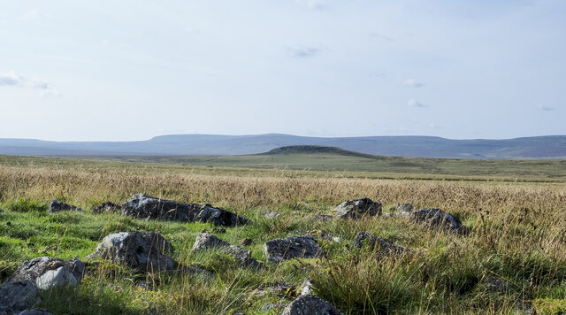
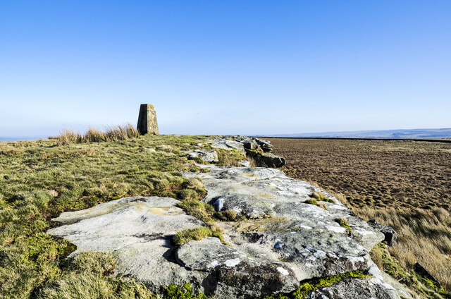
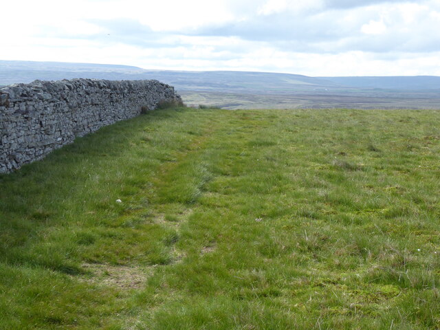
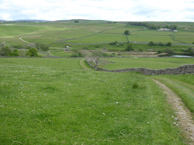
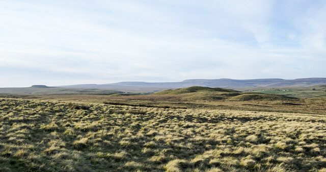
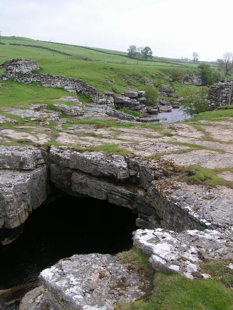
Race Yate is a small hill located in the county of Yorkshire, England. Situated in the northern part of the region, it is part of the beautiful Yorkshire Dales National Park. Although not particularly tall, Race Yate offers stunning views of the surrounding countryside, making it a popular destination for hikers and nature enthusiasts.

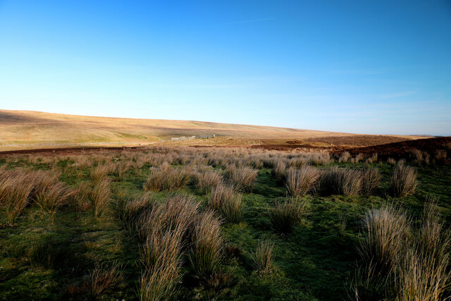
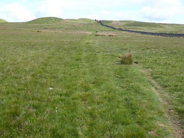
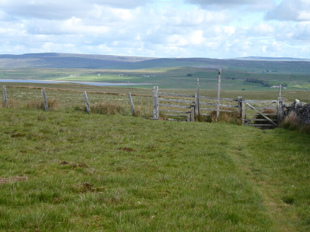
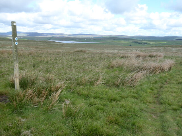
The hill is characterized by its gentle slopes and lush greenery, adorned with a variety of native flora and fauna. It is home to a diverse range of wildlife, including birds, rabbits, and occasionally deer. The summit of Race Yate provides panoramic vistas of the picturesque Yorkshire Dales, with rolling hills and valleys stretching as far as the eye can see.

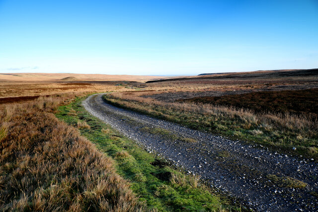
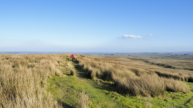
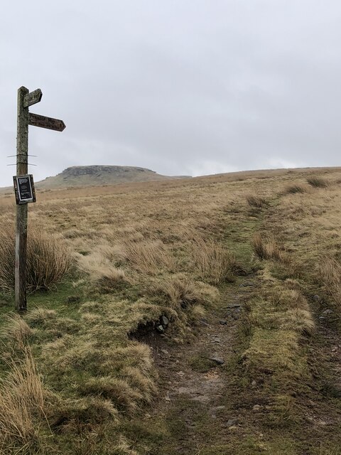
The hill is easily accessible by foot, with several hiking trails leading to its summit. These trails offer a range of difficulty levels, catering to both experienced hikers and beginners. Along the way, visitors can enjoy the tranquil atmosphere and take in the natural beauty of the surroundings.

Race Yate is also a popular spot for outdoor activities such as picnicking and photography, as well as birdwatching, thanks to the various avian species that inhabit the area. The hill's proximity to nearby towns and villages allows visitors to easily combine their visit with exploring the charming local communities and sampling the region's renowned cuisine.

In summary, Race Yate is a delightful hill in Yorkshire, offering breathtaking views, diverse wildlife, and a peaceful escape into nature.

If you have any feedback on the listing, please let us know in the comments section below.
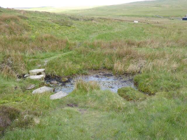
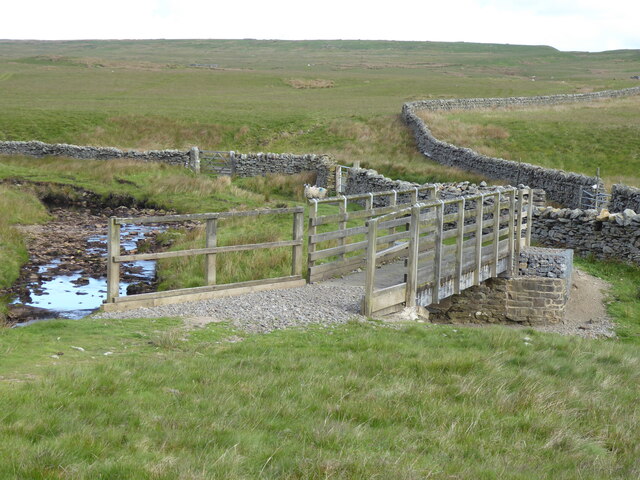
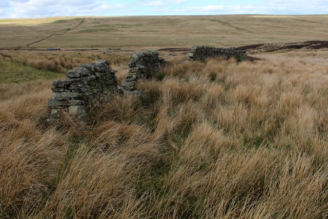
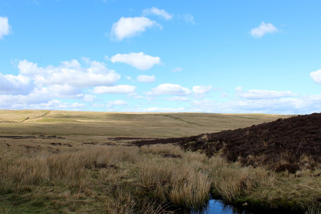
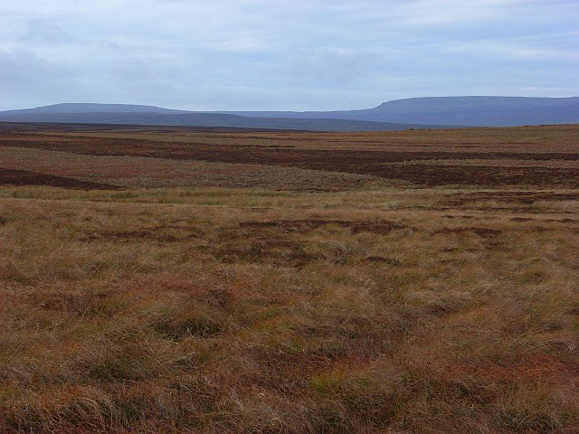
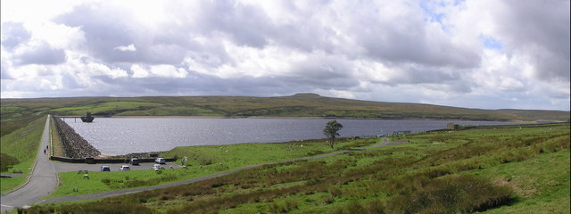
Race Yate Images

Images are sourced within 2km of 54.539499/-2.0936133 or Grid Reference NY9416. Thanks to Geograph Open Source API. All images are credited.

Embedded rocks along Crawlaw Rigg Just out of view to the left of the rocks is a well-built cairn which might be the feature Crawlaw Currack, at the eastern end of Currack Rigg.
At the centre of the image is Shacklesborough; beyond, on the horizon is Mickle Fell, its summit being the left dome with the trig point location being above the left side of Shacklesborough.
Embedded rocks along Crawlaw Rigg
Just out of view to the left of the rocks is a well-built cairn which might be the feature Crawlaw Currack, at the eastern end of Currack Rigg. At the centre of the image is Shacklesborough; beyond, on the horizon is Mickle Fell, its summit being the left dome with the trig point location being above the left side of Shacklesborough.
Sheepfold in Sled Dale The very large scale map calls this structure a livestock pen, whilst the 1:25000 map prefers Sheepfold (as do I). The moor is nowadays managed for grouse, and there are certainly no sheep up here in the winter months, but a few are to be found dotted around in the summer. The sunlit moorland beyond Deepdale Beck is the Great Allotment, but the shallow valley is not Deepdale - that lies lower down the course of the stream. Up here it is called Sled Dale - probably appropriate as most times I've been here before, I've been on skis rather than a sled, but certainly something to slide along the snow has been most useful !
Sheepfold in Sled Dale
The very large scale map calls this structure a livestock pen, whilst the 1:25000 map prefers Sheepfold (as do I). The moor is nowadays managed for grouse, and there are certainly no sheep up here in the winter months, but a few are to be found dotted around in the summer. The sunlit moorland beyond Deepdale Beck is the Great Allotment, but the shallow valley is not Deepdale - that lies lower down the course of the stream. Up here it is called Sled Dale - probably appropriate as most times I've been here before, I've been on skis rather than a sled, but certainly something to slide along the snow has been most useful !
Estate track on North Dodd The estate track leaves the A66 opposite Old Spital, heads north onto North Moor and then turns sharply east to head down Sled Dale to West Stoney Keld. At this point, on the northern side of North Dodd, it is following the left bank of Boldron Strand, a small stream which doesn't flow anywhere near Boldron (a small village some ten kilometres to the east). It is, in fact, a right bank tributary to Deepdale Beck, flowing, at the confluence, in Sled Dale, only forming Deepdale somewhat further to the east as it cuts down. The rather prominent knoll in this view is Green How, not living up to its name at this late season when all the sedges have yellowed.
Estate track on North Dodd
The estate track leaves the A66 opposite Old Spital, heads north onto North Moor and then turns sharply east to head down Sled Dale to West Stoney Keld. At this point, on the northern side of North Dodd, it is following the left bank of Boldron Strand, a small stream which doesn't flow anywhere near Boldron (a small village some ten kilometres to the east). It is, in fact, a right bank tributary to Deepdale Beck, flowing, at the confluence, in Sled Dale, only forming Deepdale somewhat further to the east as it cuts down. The rather prominent knoll in this view is Green How, not living up to its name at this late season when all the sedges have yellowed.
Sheepfold in Sled Dale Sled Dale seems very well supplied with sheepfolds, many in better condition than this one next to the estate track, and low winter light picks them out in the rather gently rolling landscape, as they are often placed on firmer, and therefore slightly raised, ground above the mostly peaty, boggy terrain. Beyond Deepdale Beck (which retains its name well upstream of Deepdale from which it derives its name) the ground climbs again to a long ridge, Race Yate Rigg, which forms the watershed with Baldersdale to the north.
Sheepfold in Sled Dale
Sled Dale seems very well supplied with sheepfolds, many in better condition than this one next to the estate track, and low winter light picks them out in the rather gently rolling landscape, as they are often placed on firmer, and therefore slightly raised, ground above the mostly peaty, boggy terrain. Beyond Deepdale Beck (which retains its name well upstream of Deepdale from which it derives its name) the ground climbs again to a long ridge, Race Yate Rigg, which forms the watershed with Baldersdale to the north.
Rock edge at West Hare Crag West Hare Crag is one of a number of low rock outcrops in this vicinity. The trig point is known to the OS as Brown Rigg. Brown Rigg is the name of the moorland ridge which is followed by the distant wall.
Rock edge at West Hare Crag
West Hare Crag is one of a number of low rock outcrops in this vicinity. The trig point is known to the OS as Brown Rigg. Brown Rigg is the name of the moorland ridge which is followed by the distant wall.
Bridleway passing through rushes The walker ahead in the image is on the short grass of a bridleway heading along or towards Ladyfold Rigg. In this area the word Rigg appears a number of times on maps and applies to ridges separated by shallow valleys running more or less parallel to one another.
Bridleway passing through rushes
The walker ahead in the image is on the short grass of a bridleway heading along or towards Ladyfold Rigg. In this area the word Rigg appears a number of times on maps and applies to ridges separated by shallow valleys running more or less parallel to one another.
Pennine Way Signpost The Pennine Way Bowes Loop, heading up Cotherstone Moor to the outcrop of Goldsborough
Pennine Way Signpost
The Pennine Way Bowes Loop, heading up Cotherstone Moor to the outcrop of Goldsborough
Gully Below Hagworm Hall
The Pennine Way crossing Duckett Sike
The Pennine Way crossing Deepdale Beck
The Pennine Way near Knotts Hill
The Pennine Way near Race Yate
The Pennine Way near Peatbrig Hill
The Pennine Way near Clove Lodge
Tussocky grass near to West Hare Crag Tussocks on the grassy moorland between Catty Crag Quarry and the minor summit at West Hare Crag.
The distant view is north of west where Shacklesborough is the small plinth at the left side of the image. Occupying the horizon centrally and to the right are Little Crag and Mickle Fell. The Burners Hills are lesser features in the middle distance.
Tussocky grass near to West Hare Crag
Tussocks on the grassy moorland between Catty Crag Quarry and the minor summit at West Hare Crag. The distant view is north of west where Shacklesborough is the small plinth at the left side of the image. Occupying the horizon centrally and to the right are Little Crag and Mickle Fell. The Burners Hills are lesser features in the middle distance.
Bield above Duckett Sike Beside the Pennine Way, south of Deepdale Beck is a partially dismantled bield.
A "Bield" is a shelter.
Bield above Duckett Sike
Beside the Pennine Way, south of Deepdale Beck is a partially dismantled bield. A "Bield" is a shelter.
Duckett Sike Looking northwards downstream towards Deepdale Beck from the Pennine Way
Duckett Sike
Looking northwards downstream towards Deepdale Beck from the Pennine Way
Show me another place!

Race Yate is located at Grid Ref: NY9416 (Lat: 54.539499, Lng: -2.0936133)

Division: North Riding

Unitary Authority: County Durham

Police Authority: Durham

What 3 Words

///gathers.acoustics.this. Near Bowes, Co. Durham

Related Wikis

Cotherstone Moor

Cotherstone Moor is a Site of Special Scientific Interest in the Teesdale district in south-west County Durham, England. It is an extensive area of moorland...

Hunder Beck Juniper

Hunder Beck Juniper is a Site of Special Scientific Interest in the Teesdale district of south-west County Durham, England. It lies between the Balderhead...

Blackton Reservoir

Blackton Reservoir is a reservoir in County Durham, England. It is situated in Baldersdale, about 4 miles (7 km) west of Cotherstone, where the River Balder...

Hannah's Meadows

Hannah's Meadows is a Site of Special Scientific Interest in the Teesdale district of south-west County Durham, England. It consists of three fields,...

Mere Beck Meadows

Mere Beck Meadows, formerly known as Willoughby Hall Meadows, is a Site of Special Scientific Interest in the Teesdale district of County Durham, England...

Balderhead Reservoir

Balderhead Reservoir is a reservoir in Baldersdale, County Durham, England. It is one of a chain of three reservoirs on the River Balder, a tributary of...

Baldersdale

Baldersdale is a dale, or valley, on the east side of the Pennines in England, northwest of Barnard Castle. Its principal settlements are Hury and Briscoe...

God's Bridge

God's Bridge is a Site of Special Scientific Interest in the County Durham district of south-west County Durham, England. It is a natural limestone bridge...

Nearby Amenities

Located within 500m of 54.539499,-2.0936133
Race Yate
Ele: 427.3
Natural: peak
Source: NPE
Lat/Long: 54.5391336/-2.0940718
Barrier: stile
Foot: yes
Image: https://www.geograph.org.uk/photo/1567864
Stile: stepover
Lat/Long: 54.540197/-2.0909673
The data included in this document is from www.openstreetmap.org. The data is made available under ODbL.

Have you been to Race Yate?

Leave your review of Race Yate below (or comments, questions and feedback).