Well Hill

Hill, Mountain in Yorkshire

England

Well Hill

OS Bench Mark OS cut bench mark from the first, 19th century, levelling, on flat rock close to the trig point. There is no sign of a pivot or rivet. The BM is shown on the 1853 6" OS map but not on subsequent editions, nor on any 25" maps. Marked as 1434.7 feet above old datum
OS Bench Mark Credit: Phil Johnstone

Well Hill is a small hill located in the Yorkshire Dales National Park in Yorkshire, England. Situated in the northern part of the park, it offers stunning panoramic views of the surrounding countryside. While it may not be considered a towering mountain, Well Hill stands at an impressive height of 300 meters above sea level, making it a popular destination for hikers and nature enthusiasts.

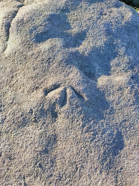
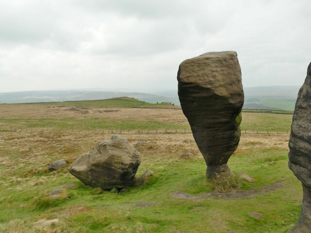
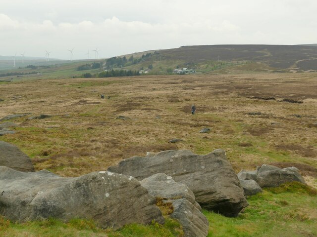
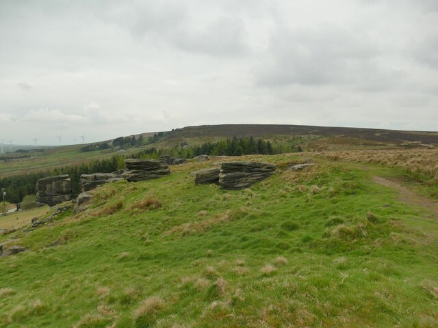
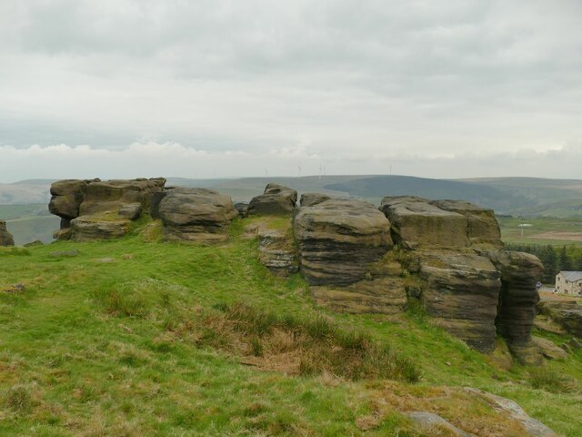
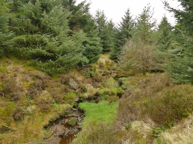
The hill is characterized by its rolling green slopes, covered in heather and grasses, which create a picturesque landscape. On a clear day, visitors can enjoy breathtaking vistas that stretch for miles, encompassing the rugged beauty of the Dales. The hill is also home to a variety of wildlife, including birds, rabbits, and foxes, adding to the charm of the area.

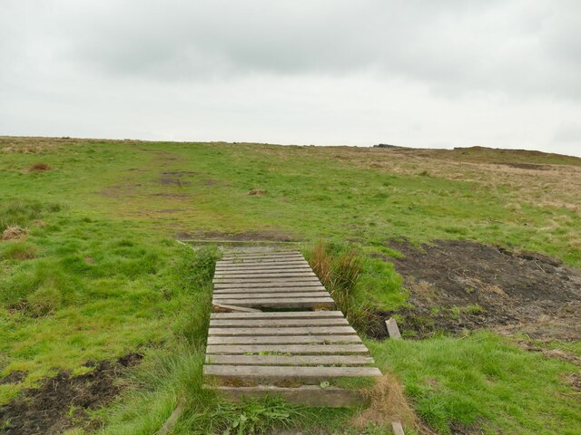
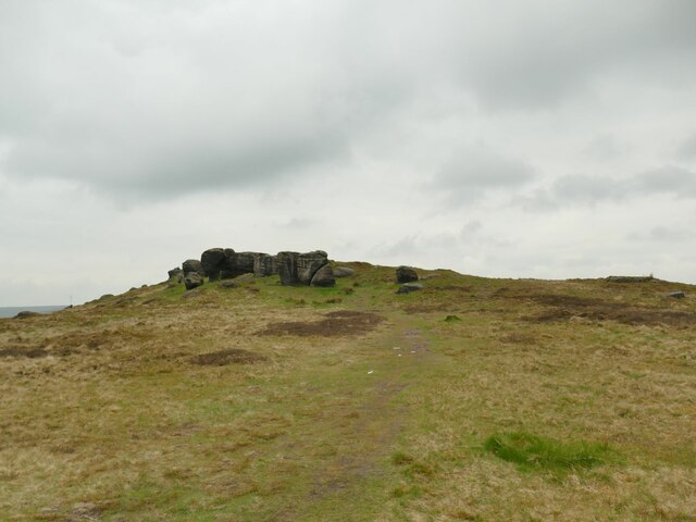
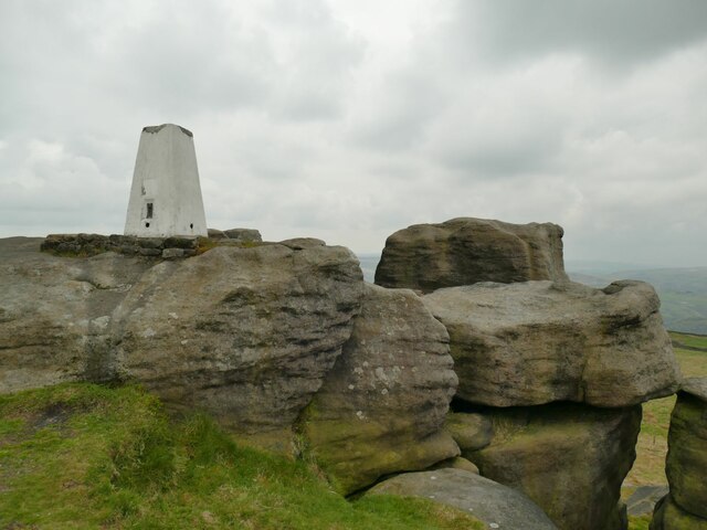
There are several footpaths that lead to the summit of Well Hill, allowing visitors to explore the area and take in the scenic beauty at their own pace. The paths are relatively easy to navigate, making it suitable for walkers of all abilities. At the top, a stone cairn marks the highest point, providing a sense of accomplishment for those who reach it.

Well Hill is a peaceful and tranquil place, offering a refuge from the hustle and bustle of everyday life. It is a popular spot for picnics and relaxation, with benches strategically placed to take advantage of the stunning views. The hill is also a great spot for stargazing, as the absence of light pollution allows for clear views of the night sky.

Overall, Well Hill is a hidden gem in the Yorkshire Dales, offering a serene and natural escape for those seeking to connect with nature and enjoy the beauty of the British countryside.

If you have any feedback on the listing, please let us know in the comments section below.
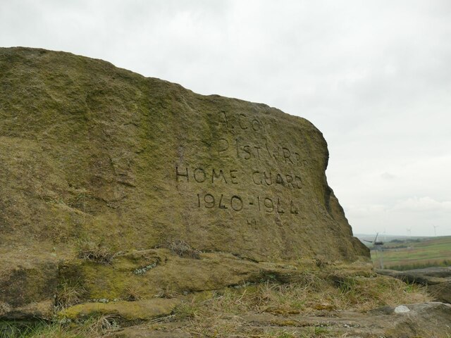
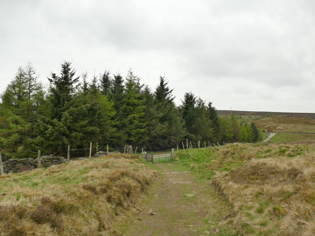
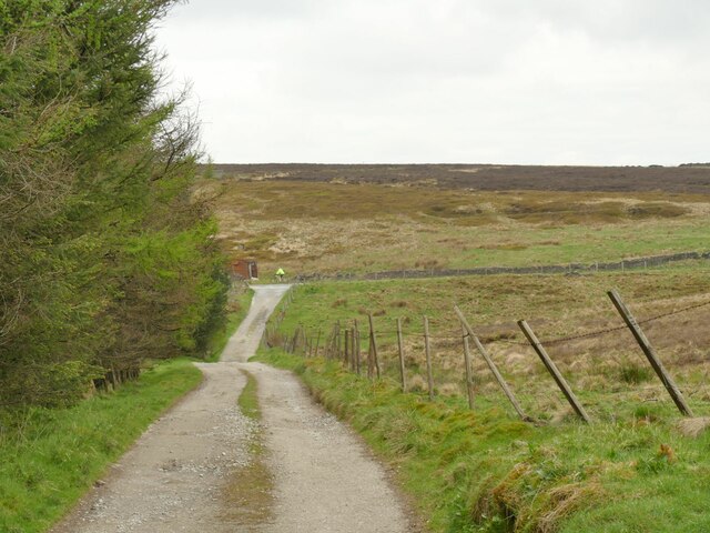
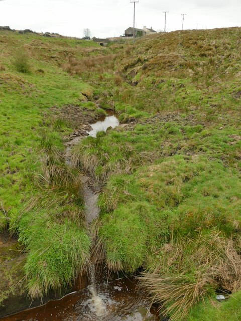
Well Hill Images

Images are sourced within 2km of 53.745801/-2.0929269 or Grid Reference SD9327. Thanks to Geograph Open Source API. All images are credited.

OS Bench Mark OS cut bench mark from the first, 19th century, levelling, on flat rock close to the trig point. There is no sign of a pivot or rivet. The BM is shown on the 1853 6" OS map but not on subsequent editions, nor on any 25" maps. Marked as 1434.7 feet above old datum
OS Bench Mark
OS cut bench mark from the first, 19th century, levelling, on flat rock close to the trig point. There is no sign of a pivot or rivet. The BM is shown on the 1853 6" OS map but not on subsequent editions, nor on any 25" maps. Marked as 1434.7 feet above old datum
Black and white lambs Below Greenhurst Hey Farm.
Black and white lambs
Below Greenhurst Hey Farm.
Above Greenhurst Hey The farm commands a fine view over the upper Calder Valley although this was a dull day. Most of the length of this track to the farm and beyond is surfaced with these upside-down concrete railway sleepers, a good choice as they will neither rot nor rut and are probably not very susceptible to frost damage. The track is a public footpath.
Above Greenhurst Hey
The farm commands a fine view over the upper Calder Valley although this was a dull day. Most of the length of this track to the farm and beyond is surfaced with these upside-down concrete railway sleepers, a good choice as they will neither rot nor rut and are probably not very susceptible to frost damage. The track is a public footpath.
Bridleway below Windy Harbour Farm The track forms part of the Todmorden Centenary Way.
Bridleway below Windy Harbour Farm
The track forms part of the Todmorden Centenary Way.
The Wizard of Whirlaw An odd carving in the style of the Easter Island sculptures, by a stile alongside the Todmorden Centenary Way. At one time there was a 'junior' version alongside <a href="https://www.geograph.org.uk/photo/2878250">SD9326 : Scary face at Windy Harbour</a> that is no longer present.

Thanks to a local blogger Paul Knights, I found this is titled 'the Wizard of Whirlaw', carved by Mike Williams and inspired by the 1959 book of the same name by local author Billy Holt.
The Wizard of Whirlaw
An odd carving in the style of the Easter Island sculptures, by a stile alongside the Todmorden Centenary Way. At one time there was a 'junior' version alongside SD9326 : Scary face at Windy Harbour that is no longer present. Thanks to a local blogger Paul Knights, I found this is titled 'the Wizard of Whirlaw', carved by Mike Williams and inspired by the 1959 book of the same name by local author Billy Holt.
Mast Farm, Windy Harbour Lane Although now called a 'farm', the security fence and the name give away the fact that this was the control building for an adjacent mast (still shown on the Explorer map) that has been removed in recent years.
Mast Farm, Windy Harbour Lane
Although now called a 'farm', the security fence and the name give away the fact that this was the control building for an adjacent mast (still shown on the Explorer map) that has been removed in recent years.
Start of a footpath off Eastwood Road The boardwalk over a sometimes boggy patch within metres of leaving the road was not a good sign, but it had been a fairly dry winter and spring, and the going was good across Bridestones Moor.
Start of a footpath off Eastwood Road
The boardwalk over a sometimes boggy patch within metres of leaving the road was not a good sign, but it had been a fairly dry winter and spring, and the going was good across Bridestones Moor.
Approaching the Bridestones The moor contains several gritstone outcrops generically known as the Bridestones, some of them having individual names. This is the first significant outcrop approaching from the east.
Approaching the Bridestones
The moor contains several gritstone outcrops generically known as the Bridestones, some of them having individual names. This is the first significant outcrop approaching from the east.
The Bottleneck on Bridestones Moor The moor contains several gritstone outcrops generically known as the Bridestones, some of them having individual names. This is perhaps the most distinctive individual rock. <a href="https://www.geograph.org.uk/photo/5350930">SD9326 : The Bride Stone, Todmorden</a> shows the other side and another contributor gives us the geological detail at <a href="https://www.geograph.org.uk/photo/4105934">SD9326 : The Bride Stone</a>.
The Bottleneck on Bridestones Moor
The moor contains several gritstone outcrops generically known as the Bridestones, some of them having individual names. This is perhaps the most distinctive individual rock. SD9326 : The Bride Stone, Todmorden shows the other side and another contributor gives us the geological detail at SD9326 : The Bride Stone.
Bridestones triangulation pillar Given a height of 437 or 438 metres on modern maps, though these trig points were more important for their location on plan than the precise elevation.  The 1907 1:2500 map shows it 20 metres further west, a big enough  discrepancy at that scale to suggest it was in fact relocated at some time.
Bridestones triangulation pillar
Given a height of 437 or 438 metres on modern maps, though these trig points were more important for their location on plan than the precise elevation. The 1907 1:2500 map shows it 20 metres further west, a big enough discrepancy at that scale to suggest it was in fact relocated at some time.
West from the Great Bridestones
Outcrop above Bridestones Farm The moor contains several gritstone outcrops generically known as the Bridestones, some of them having individual names. This one doesn't seem to have a name, but the farm below has taken the name of the wider group.
Outcrop above Bridestones Farm
The moor contains several gritstone outcrops generically known as the Bridestones, some of them having individual names. This one doesn't seem to have a name, but the farm below has taken the name of the wider group.
Rock outcrop above Bridestones Farm The moor contains several gritstone outcrops generically known as the Bridestones, some of them having individual names. This one doesn't seem to have a name, but the farm below (right of photo) has taken the name of the wider group.
Rock outcrop above Bridestones Farm
The moor contains several gritstone outcrops generically known as the Bridestones, some of them having individual names. This one doesn't seem to have a name, but the farm below (right of photo) has taken the name of the wider group.
Graffito on rock outcrop above Bridestones Farm The text is "A Coy 21st WY Br Home Guard 1940-1944".  The lettering looks surprisingly sharp for an 80-year-old carving in an exposed location.  Maybe the gritstone is hard enough, or perhaps it's been re-cut more recently?

For context, it is on one of the rocks to the right of the group in <a href="https://www.geograph.org.uk/photo/7170447">SD9226 : Rock outcrop above Bridestones Farm</a>.
Graffito on rock outcrop above Bridestones Farm
The text is "A Coy 21st WY Br Home Guard 1940-1944". The lettering looks surprisingly sharp for an 80-year-old carving in an exposed location. Maybe the gritstone is hard enough, or perhaps it's been re-cut more recently? For context, it is on one of the rocks to the right of the group in SD9226 : Rock outcrop above Bridestones Farm.
Approaching Eleanor's Wood A conifer wood above Todmorden.
Approaching Eleanor's Wood
A conifer wood above Todmorden.
Track above Eleanor's Wood The track is a public footpath and in the other direction gives access to Hudson Clough Farm.
Track above Eleanor's Wood
The track is a public footpath and in the other direction gives access to Hudson Clough Farm.
Redmires Water above Eleanor's Wood Only a very small beck at this point.
Redmires Water above Eleanor's Wood
Only a very small beck at this point.
Redmires Water through  Eleanor's Wood The conifer wood has been planted either side of the beck.
Redmires Water through Eleanor's Wood
The conifer wood has been planted either side of the beck.
Show me another place!

Well Hill is located at Grid Ref: SD9327 (Lat: 53.745801, Lng: -2.0929269)

Division: West Riding

Unitary Authority: Calderdale

Police Authority: West Yorkshire

What 3 Words

///poet.carpeted.oven. Near Cornholme, West Yorkshire

Related Wikis

Blackshaw

Blackshaw is a civil parish in the Calderdale metropolitan borough of West Yorkshire, England. It contains the village of Blackshaw Head. According to...

South Pennines Regional Park

The South Pennines Regional Park (or South Pennines Park) is a proposed national park that would cover the South Pennines area in Northern England, encompassing...

Colden, West Yorkshire

Colden is a hamlet in the civil parish of Heptonstall in Calderdale, West Yorkshire, England. Historically part of the West Riding of Yorkshire, the hamlet...

Mons Mill, Todmorden

Mons Mill, Todmorden, is a former cotton spinning mill in Todmorden, Calderdale, West Yorkshire, England built for the Hare Spinning Company Limited. It...

Todmorden High School

Todmorden High School is a comprehensive school in the town of Todmorden, Calderdale LEA, West Yorkshire, England. == Admissions == Todmorden High School...

Stansfield Hall railway station

Stansfield Hall railway station (English: ) was the second station in Stansfield, Todmorden in West Yorkshire, England and was situated on the Copy Pit...

Cornholme railway station

Cornholme railway station served the village of Cornholme in West Yorkshire, England on the Copy Pit line. The station was opened by the Lancashire and...

Todmorden War Memorial

Todmorden War Memorial is a war memorial located in Todmorden, West Yorkshire, England.The memorial is in the garden of remembrance in Centre Vale Park...

Nearby Amenities

Located within 500m of 53.745801,-2.0929269
Kebs Road
Local Ref: 45024639
Naptan AtcoCode: 450024639
Naptan Bearing: W
Naptan BusStopType: CUS
Naptan CommonName: Kebs Road
Naptan Indicator: Stop 45024639
Naptan PlusbusZoneRef: LEEDS
Naptan ShortCommonName: Higher Moss Hall
Naptan Street: Kebs Road
Naptan Verified: no
Source: naptan_import
Lat/Long: 53.7434042/-2.0916423
The data included in this document is from www.openstreetmap.org. The data is made available under ODbL.

Have you been to Well Hill?

Leave your review of Well Hill below (or comments, questions and feedback).