White Hill

Hill, Mountain in Durham

England

White Hill

Gate in fence on Bolt's Law A public footpath passes through the gate. The trig point might be thought to be at the highest point of the hill but at 540 m it is in fact one metre lower than another location on Bolt's Law, roughly half a kilometre to the south-west, behind the camera position.
Gate in fence on Bolt's Law Credit: Trevor Littlewood

White Hill is a prominent landmark located in Durham, a historic city in the northeast of England. Situated in the region known as County Durham, White Hill is a hill/mountain that forms part of the beautiful landscape of the area. It is situated approximately 6.5 miles west of Durham city center.

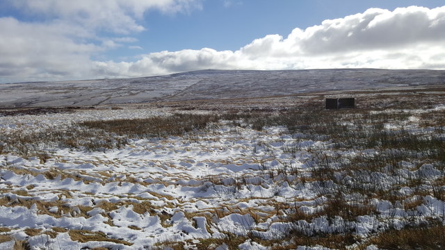
Rising to an elevation of around 1,000 feet (305 meters), White Hill offers stunning panoramic views of the surrounding countryside. The hill is characterized by its gentle slopes and is covered in lush greenery, making it a popular destination for hikers, nature enthusiasts, and photographers.

White Hill is located within an area of outstanding natural beauty, with its rich biodiversity and diverse flora and fauna attracting a wide range of wildlife. The hill is home to various species of birds, small mammals, and wildflowers, providing a haven for nature lovers.

Access to White Hill is convenient, with several footpaths and trails leading to the summit. These paths offer different levels of difficulty, catering to both experienced hikers and beginners. The hill is a popular spot for outdoor activities such as walking, hiking, and picnicking.

Due to its elevated position, White Hill often experiences cooler temperatures and stronger winds compared to the surrounding areas. This, coupled with its breathtaking views, makes it an ideal location to escape the bustle of the city and immerse oneself in the serenity of nature.

Overall, White Hill is a magnificent natural landmark in Durham, offering visitors a chance to explore the area's natural beauty and enjoy outdoor activities in a tranquil setting.

If you have any feedback on the listing, please let us know in the comments section below.

White Hill Images

Images are sourced within 2km of 54.809784/-2.1013492 or Grid Reference NY9346. Thanks to Geograph Open Source API. All images are credited.

Gate in fence on Bolt's Law A public footpath passes through the gate. The trig point might be thought to be at the highest point of the hill but at 540 m it is in fact one metre lower than another location on Bolt's Law, roughly half a kilometre to the south-west, behind the camera position.
Gate in fence on Bolt's Law
A public footpath passes through the gate. The trig point might be thought to be at the highest point of the hill but at 540 m it is in fact one metre lower than another location on Bolt's Law, roughly half a kilometre to the south-west, behind the camera position.
Heather moorland south of Bolt's Law trig point The foreground moorland runs away towards the valley and slopes of the Stanhope Burn. The distant hill is Collier Law.
Heather moorland south of Bolt's Law trig point
The foreground moorland runs away towards the valley and slopes of the Stanhope Burn. The distant hill is Collier Law.
Valley of Stogel Cleugh Stogel Cleugh is a feeding stream to Rookhope Burn, itself a tributary valley of the River Wear. The image was recorded from the minor road crossing between Rook Hope in County Durham and Hunstanworth in Northumberland.
Valley of Stogel Cleugh
Stogel Cleugh is a feeding stream to Rookhope Burn, itself a tributary valley of the River Wear. The image was recorded from the minor road crossing between Rook Hope in County Durham and Hunstanworth in Northumberland.
View from the road over fields of Boltshope Park These fields are amongst the last cultivated land before the road ascends onto Moorland
View from the road over fields of Boltshope Park
These fields are amongst the last cultivated land before the road ascends onto Moorland
Footpath to Cuthbert's Hill crossing the moor road
Road over Hunstanworth Moor
Sheep grazing at Boltshope Park
Sheep grazing at Boltshope Park Although clearly not in the same grid square, Bolt's Law hill and the chimneys from the old mine workings on the opposite side of the valley can be seen.
Sheep grazing at Boltshope Park
Although clearly not in the same grid square, Bolt's Law hill and the chimneys from the old mine workings on the opposite side of the valley can be seen.
Grouse butt on Hunstanworth Moor
Grouse butt on Hunstanworth Moor This peak of Bolt's Law is on the horizon
Grouse butt on Hunstanworth Moor
This peak of Bolt's Law is on the horizon
Road near St. Cuthberts Hill on Hunstanworth Moor
Road near Haining's Plantation Looking south-westward.
Road near Haining's Plantation
Looking south-westward.
Road near Ramshawsike Plantation Looking southward.
Road near Ramshawsike Plantation
Looking southward.
Moorland Road crossing Hunstanworth Moor near White Hill Looking south-westward.
Moorland Road crossing Hunstanworth Moor near White Hill
Looking south-westward.
Moorland Road being crossed by a footpath on Hunstanworth Moor Looking south-westward.
Moorland Road being crossed by a footpath on Hunstanworth Moor
Looking south-westward.
Slope descending to Whitelees The near building is the farmhouse at Whitelees. The slope is descending into the valley of the Nookton Burn; Nookton (Farm) is to be seen on the opposite slope.
Slope descending to Whitelees
The near building is the farmhouse at Whitelees. The slope is descending into the valley of the Nookton Burn; Nookton (Farm) is to be seen on the opposite slope.
High camp, Stanhope Common Early morning mist fills Weardale.
High camp, Stanhope Common
Early morning mist fills Weardale.
Gate in fence line along path The path in the direction of view is heading towards Bolt's Law.
Gate in fence line along path
The path in the direction of view is heading towards Bolt's Law.
Show me another place!

White Hill is located at Grid Ref: NY9346 (Lat: 54.809784, Lng: -2.1013492)

Unitary Authority: County Durham

Police Authority: Durham

What 3 Words

///masses.increment.surpasses. Near Stanhope, Co. Durham

Nearby Locations

White Hill

Related Wikis

Ramshaw, Consett

Ramshaw is a small village in County Durham, in England. It is situated to the south of Hunstanworth, a few miles west of Consett. Lead mining was an important...

Townfield

Townfield is a village in County Durham, in England. It is situated just to the south of Hunstanworth and part of that parish, about 10 miles (16 km) west...

Beldon Burn

Beldon Burn is a headwater stream of the River Derwent in Northumberland and County Durham, England.It rises at Quickcleugh Moss as the Quickcleugh Burn...

Lintzgarth

Lintzgarth is a village in the civil parish of Stanhope, in County Durham, England. It is situated to the west of Rookhope. The Lintzgarth smeltmill was...

Nearby Amenities

Located within 500m of 54.809784,-2.1013492
Hunstanworth Moor
Natural: moor
Source: NPE
Lat/Long: 54.808299/-2.1084264
Hunting Stand
Hunting Stand: grouse_butt
Lat/Long: 54.8110933/-2.0941588
Hunting Stand
Hunting Stand: grouse_butt
Lat/Long: 54.8109388/-2.0949367
Hunting Stand
Hunting Stand: grouse_butt
Lat/Long: 54.8107966/-2.0956528
Hunting Stand
Hunting Stand: grouse_butt
Lat/Long: 54.8106358/-2.0964038
Hunting Stand
Hunting Stand: grouse_butt
Lat/Long: 54.810489/-2.0971629
Hunting Stand
Hunting Stand: grouse_butt
Lat/Long: 54.807603/-2.104665
Hunting Stand
Hunting Stand: grouse_butt
Lat/Long: 54.808631/-2.104716
Hunting Stand
Hunting Stand: grouse_butt
Lat/Long: 54.8090932/-2.1049118
Hunting Stand
Hunting Stand: grouse_butt
Lat/Long: 54.8094873/-2.1050727
Hunting Stand
Hunting Stand: grouse_butt
Lat/Long: 54.8121907/-2.0955214
Hunting Stand
Hunting Stand: grouse_butt
Lat/Long: 54.8118476/-2.0958138
Hunting Stand
Hunting Stand: grouse_butt
Lat/Long: 54.8115122/-2.0961008
The data included in this document is from www.openstreetmap.org. The data is made available under ODbL.

Have you been to White Hill?

Leave your review of White Hill below (or comments, questions and feedback).