Wholhope Hill

Hill, Mountain in Northumberland

England

Wholhope Hill

A blocked forestry track above Sting Burn Dating from Storm Arwen (26/27 November 2021), this section of little-used forestry track north-east of Memmer Kirk was impassable on bike, and would be rather tricky on foot.

This photograph was taken during the Coronavirus (COVID-19) pandemic of 2020/21/22.
A blocked forestry track above Sting Burn Credit: James T M Towill

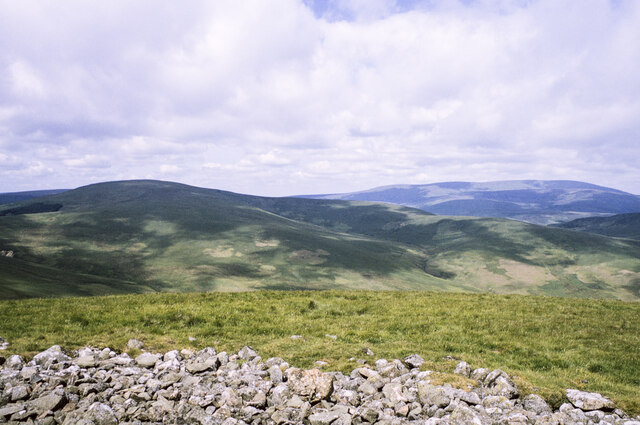
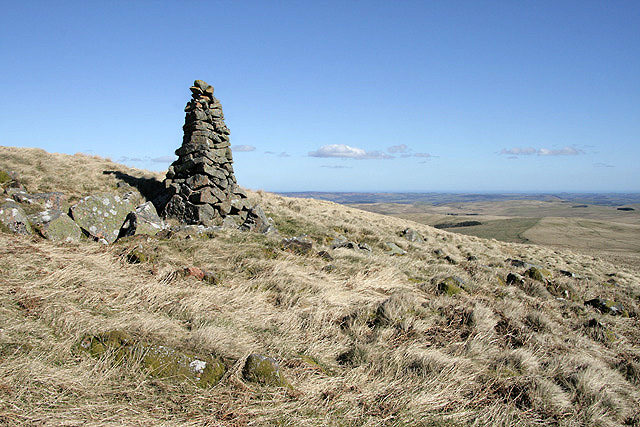
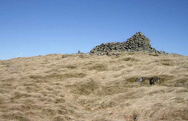
Wholhope Hill is a prominent feature located in the county of Northumberland, England. This hill, also known as Whelp Hill, is part of the North Pennines Area of Outstanding Natural Beauty. Rising to an elevation of approximately 551 meters (1,808 feet), it offers breathtaking views of the surrounding landscape.

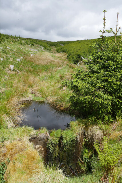
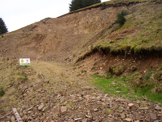
Wholhope Hill is situated in a rural area, characterized by rolling hills, moorland, and picturesque valleys. It is located near the village of Allenheads, which is known for its mining heritage. The hill is primarily composed of peat and is covered in heather, grasses, and scattered shrubs.

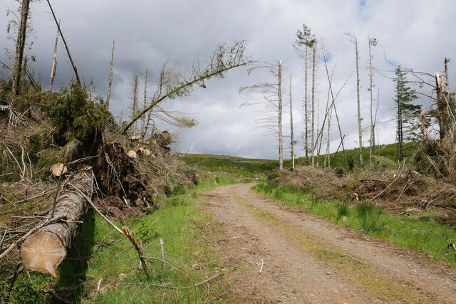
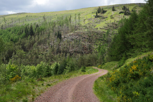
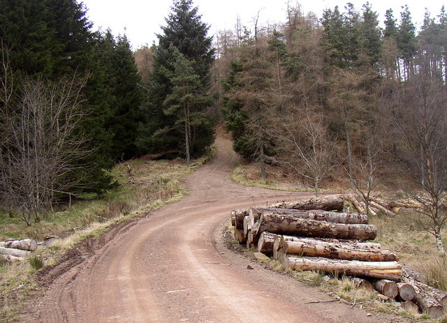
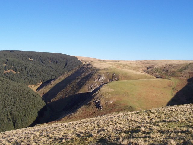
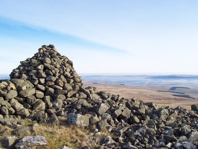
The ascent to the summit of Wholhope Hill is a popular activity for outdoor enthusiasts, particularly hikers and nature lovers. The surrounding area is crisscrossed by walking trails, allowing visitors to explore the beauty of the Northumberland countryside. From the top of the hill, one can enjoy panoramic views of the North Pennines, including other notable peaks such as Cross Fell and the Cheviot Hills.

Wholhope Hill is also home to a diverse range of wildlife, including various species of birds, such as curlews and lapwings, as well as small mammals. The hillside is known for its tranquility and solitude, offering visitors a chance to immerse themselves in the natural beauty of the area.

Overall, Wholhope Hill is a stunning natural landmark in Northumberland, providing visitors with an opportunity to experience the rugged beauty of the North Pennines and enjoy the serenity of the countryside.

If you have any feedback on the listing, please let us know in the comments section below.

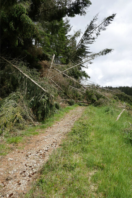
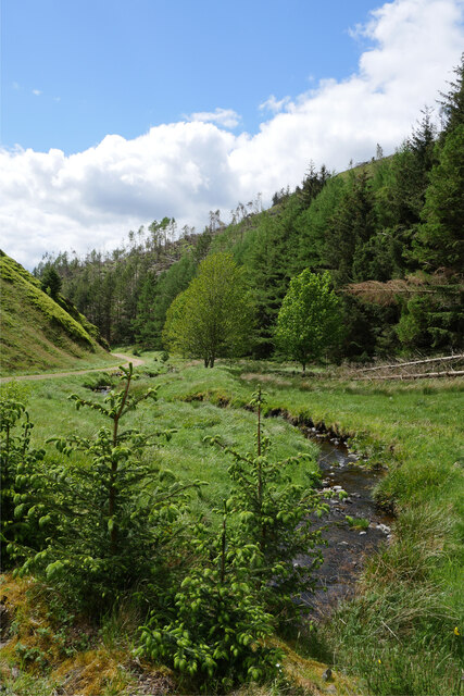
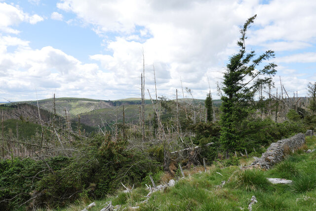
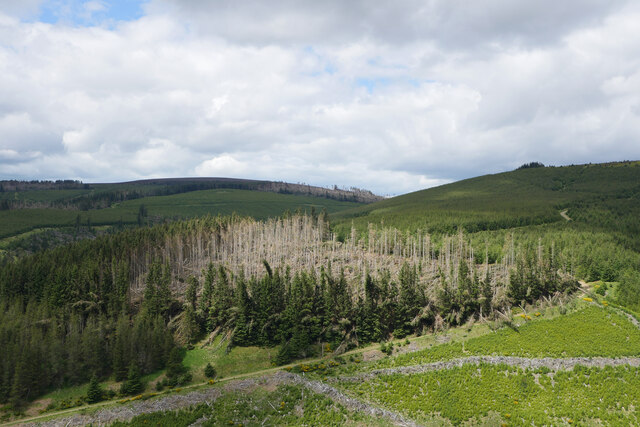
Wholhope Hill Images

Images are sourced within 2km of 55.396192/-2.1030372 or Grid Reference NT9311. Thanks to Geograph Open Source API. All images are credited.

A blocked forestry track above Sting Burn Dating from Storm Arwen (26/27 November 2021), this section of little-used forestry track north-east of Memmer Kirk was impassable on bike, and would be rather tricky on foot.

This photograph was taken during the Coronavirus (COVID-19) pandemic of 2020/21/22.
A blocked forestry track above Sting Burn
Dating from Storm Arwen (26/27 November 2021), this section of little-used forestry track north-east of Memmer Kirk was impassable on bike, and would be rather tricky on foot. This photograph was taken during the Coronavirus (COVID-19) pandemic of 2020/21/22.
The Yoke Burn in Kidland Forest Labelled as a ford on the 1:25k map, the Yoke Burn is now conveyed under the forestry track in a culvert.

This photograph was taken during the Coronavirus (COVID-19) pandemic of 2020/21/22.
The Yoke Burn in Kidland Forest
Labelled as a ford on the 1:25k map, the Yoke Burn is now conveyed under the forestry track in a culvert. This photograph was taken during the Coronavirus (COVID-19) pandemic of 2020/21/22.
Devastation on Dryhope Hill Storm Arwen (26/27 November 2021) has resulted in destruction of numerous areas within Kidland Forest.

This photograph was taken during the Coronavirus (COVID-19) pandemic of 2020/21/22.
Devastation on Dryhope Hill
Storm Arwen (26/27 November 2021) has resulted in destruction of numerous areas within Kidland Forest. This photograph was taken during the Coronavirus (COVID-19) pandemic of 2020/21/22.
Illuminating the destruction A patch of glorious sunlight illuminates an area of Kidland Forest badly damaged by Storm Arwen (26/27 November 2021).  Earlier, I had tried to bike up the track shown here, only to be stopped by the many trees blocking my way.

This photograph was taken during the Coronavirus (COVID-19) pandemic of 2020/21/22.
Illuminating the destruction
A patch of glorious sunlight illuminates an area of Kidland Forest badly damaged by Storm Arwen (26/27 November 2021). Earlier, I had tried to bike up the track shown here, only to be stopped by the many trees blocking my way. This photograph was taken during the Coronavirus (COVID-19) pandemic of 2020/21/22.
A small dam on the Sting Burn This small dam was beside the forestry track near Sting Head, perhaps to regulate the flow of water and prevent damage to the embankment of the track under which the burn passes?

This photograph was taken during the Coronavirus (COVID-19) pandemic of 2020/21/22.
A small dam on the Sting Burn
This small dam was beside the forestry track near Sting Head, perhaps to regulate the flow of water and prevent damage to the embankment of the track under which the burn passes? This photograph was taken during the Coronavirus (COVID-19) pandemic of 2020/21/22.
Storm Arwen's destruction near Sting Head Yet more evidence of the destruction caused in Kidland Forest by Storm Arwen (26/27 November 2021).

This photograph was taken during the Coronavirus (COVID-19) pandemic of 2020/21/22.
Storm Arwen's destruction near Sting Head
Yet more evidence of the destruction caused in Kidland Forest by Storm Arwen (26/27 November 2021). This photograph was taken during the Coronavirus (COVID-19) pandemic of 2020/21/22.
A track between Meadow Sike and Milkhope Heading back down to the valley floor track after a cycle to Sting Head.  Storm Arwen (26/27 November 2021) has resulted in destruction of numerous areas within Kidland Forest as seen on the hillside in the background.

This photograph was taken during the Coronavirus (COVID-19) pandemic of 2020/21/22.
A track between Meadow Sike and Milkhope
Heading back down to the valley floor track after a cycle to Sting Head. Storm Arwen (26/27 November 2021) has resulted in destruction of numerous areas within Kidland Forest as seen on the hillside in the background. This photograph was taken during the Coronavirus (COVID-19) pandemic of 2020/21/22.
Rocks and grass on Hogdon Law There's a mass of stones at the summit of Hogdon Law, many of them gathered into a cairn which is behind the camera position.
Beyond the stones are two of Northumberland's highest hills: to the right and most distant is The Cheviot, to the left and cloud-shadowed is Cushat Law.
Rocks and grass on Hogdon Law
There's a mass of stones at the summit of Hogdon Law, many of them gathered into a cairn which is behind the camera position. Beyond the stones are two of Northumberland's highest hills: to the right and most distant is The Cheviot, to the left and cloud-shadowed is Cushat Law.
A cairn on Hogdon Law This 2m high cairn is at the 490m contour on the southeast side of the hill.
A cairn on Hogdon Law
This 2m high cairn is at the 490m contour on the southeast side of the hill.
The summit cairn on Hogdon Law This is a sizable cairn with a stone shelter wall.
The summit cairn on Hogdon Law
This is a sizable cairn with a stone shelter wall.
Cairn at Sting Head This cairn stands on a small grass-covered mound at Sting Head on the edge of the Kidland Forest close to where two separate burns bearing the name 'Sting' flow in opposite directions. The conical hill in the distance is Hogdon Law. For a selection of free to download walking routes in the area visit <span class="nowrap"><a title="www.cheviotwalks.co.uk" rel="nofollow ugc noopener" href="http://www.cheviotwalks.co.uk">Link</a><img style="margin-left:2px;" alt="External link" title="External link - shift click to open in new window" src="https://s1.geograph.org.uk/img/external.png" width="10" height="10"/></span>
Cairn at Sting Head
This cairn stands on a small grass-covered mound at Sting Head on the edge of the Kidland Forest close to where two separate burns bearing the name 'Sting' flow in opposite directions. The conical hill in the distance is Hogdon Law. For a selection of free to download walking routes in the area visit LinkExternal link
Memmer Kirk (remains of) Believed to be the site of a Medieval Chapel
Memmer Kirk (remains of)
Believed to be the site of a Medieval Chapel
Stell next to the site of Memmer Kirk
Quarry in Yoke Burn area of Kidland Forest A new Forestry access road is under construction in this area of the forest and stone from this quarry is being used in that process.
Quarry in Yoke Burn area of Kidland Forest
A new Forestry access road is under construction in this area of the forest and stone from this quarry is being used in that process.
Bridleway to Heigh leaves the forest road in Kidland
Ravens Crag above the Allerhope Burn The edge of the Kidland Forest lies to the left of the Crag and hides the summit of Wether Cairn. For free detailed walking routes in the area visit <span class="nowrap"><a title="www.cheviotwalks.co.uk" rel="nofollow ugc noopener" href="http://www.cheviotwalks.co.uk">Link</a><img style="margin-left:2px;" alt="External link" title="External link - shift click to open in new window" src="https://s1.geograph.org.uk/img/external.png" width="10" height="10"/></span>
Ravens Crag above the Allerhope Burn
The edge of the Kidland Forest lies to the left of the Crag and hides the summit of Wether Cairn. For free detailed walking routes in the area visit LinkExternal link
Cairn on Hogdon Law Large cairn on the southern slopes of Hogdon Law. For free detailed walking routes in the area visit <span class="nowrap"><a title="www.cheviotwalks.co.uk" rel="nofollow ugc noopener" href="http://www.cheviotwalks.co.uk">Link</a><img style="margin-left:2px;" alt="External link" title="External link - shift click to open in new window" src="https://s1.geograph.org.uk/img/external.png" width="10" height="10"/></span>
Cairn on Hogdon Law
Large cairn on the southern slopes of Hogdon Law. For free detailed walking routes in the area visit LinkExternal link
Hogdon Law The large summit cairn on Hogdon Law. For free detailed walking routes in the area visit <span class="nowrap"><a title="www.cheviotwalks.co.uk" rel="nofollow ugc noopener" href="http://www.cheviotwalks.co.uk">Link</a><img style="margin-left:2px;" alt="External link" title="External link - shift click to open in new window" src="https://s1.geograph.org.uk/img/external.png" width="10" height="10"/></span>
Hogdon Law
The large summit cairn on Hogdon Law. For free detailed walking routes in the area visit LinkExternal link
Show me another place!

Wholhope Hill is located at Grid Ref: NT9311 (Lat: 55.396192, Lng: -2.1030372)

Unitary Authority: Northumberland

Police Authority: Northumbria

What 3 Words

///revamped.disputes.forge. Near Whittingham, Northumberland

Nearby Locations

Wholhope Hill

Related Wikis

Kidland

Kidland is a former civil parish, now in the parish of Alwinton in Northumberland, England, about 2 miles (3 km) northwest of Alwinton village. In 1951...

Biddlestone Hall

Biddlestone Hall was a large country house at Biddlestone in Northumberland. == History == The Georgian style mansion was built for the Selby family about...

Biddlestone Chapel

Biddlestone Chapel is a redundant Roman Catholic chapel in Biddlestone, Northumberland, England. It is recorded in the National Heritage List for England...

Clennell, Northumberland

Clennell is a small village and as Clennel, a former civil parish, now in the parish of Alwinton, in Northumberland, England. It is about 1 mile (1.6 km...

Biddlestone

Biddlestone is a village and civil parish in Northumberland, England. It is about 14 miles (23 km) to the west of Alnwick. In the early 21st Century several...

Clennell Hall

Clennell Hall is an historic manor house, now operated as a country hotel, situated at Clennell, near Alwinton, Northumberland, England. It is a Grade...

Alwinton

Alwinton (previously named "Allenton" and sometimes still referred to as this) is a village and former parish in Northumberland, England. Alwinton is named...

Church of St Michael, Alnham

The Church of St Michael in Alnham, in the English county of Northumberland, is a medieval structure dating from circa 1200. Built on a Roman camp site...

Nearby Amenities

Located within 500m of 55.396192,-2.1030372
Wholhope Hill
Created By: Potlatch 0.10f
Place: locality
Lat/Long: 55.3967445/-2.1039282
The data included in this document is from www.openstreetmap.org. The data is made available under ODbL.

Have you been to Wholhope Hill?

Leave your review of Wholhope Hill below (or comments, questions and feedback).