Barham

Settlement in Huntingdonshire Huntingdonshire

England

Barham

Footpath to Old Weston Off the road to Leighton Bromswold the footpath to Old Weston
Footpath to Old Weston Credit: Shaun Ferguson

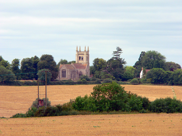
Barham is a small village located in the county of Huntingdonshire, in the eastern region of England. Situated about 8 miles northwest of the town of Huntingdon, it lies in a rural setting surrounded by picturesque countryside.

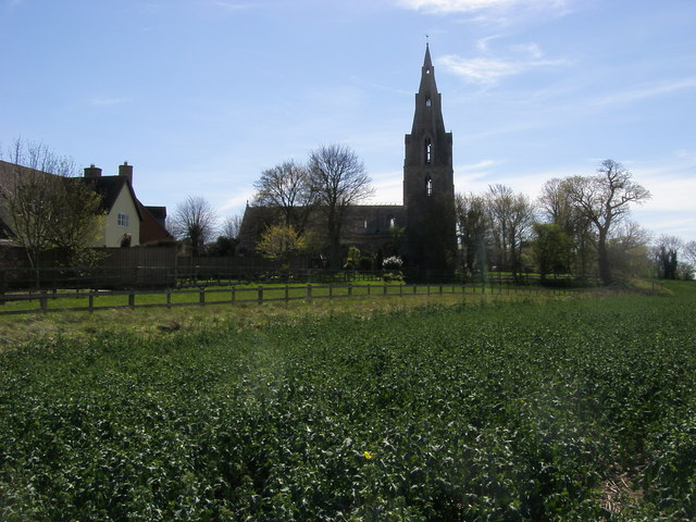
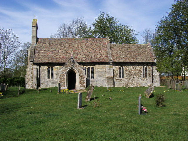
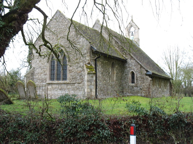
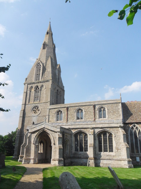
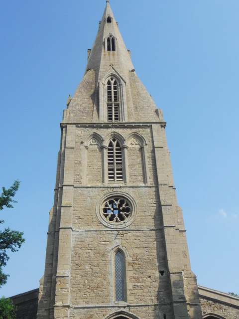
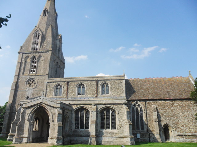
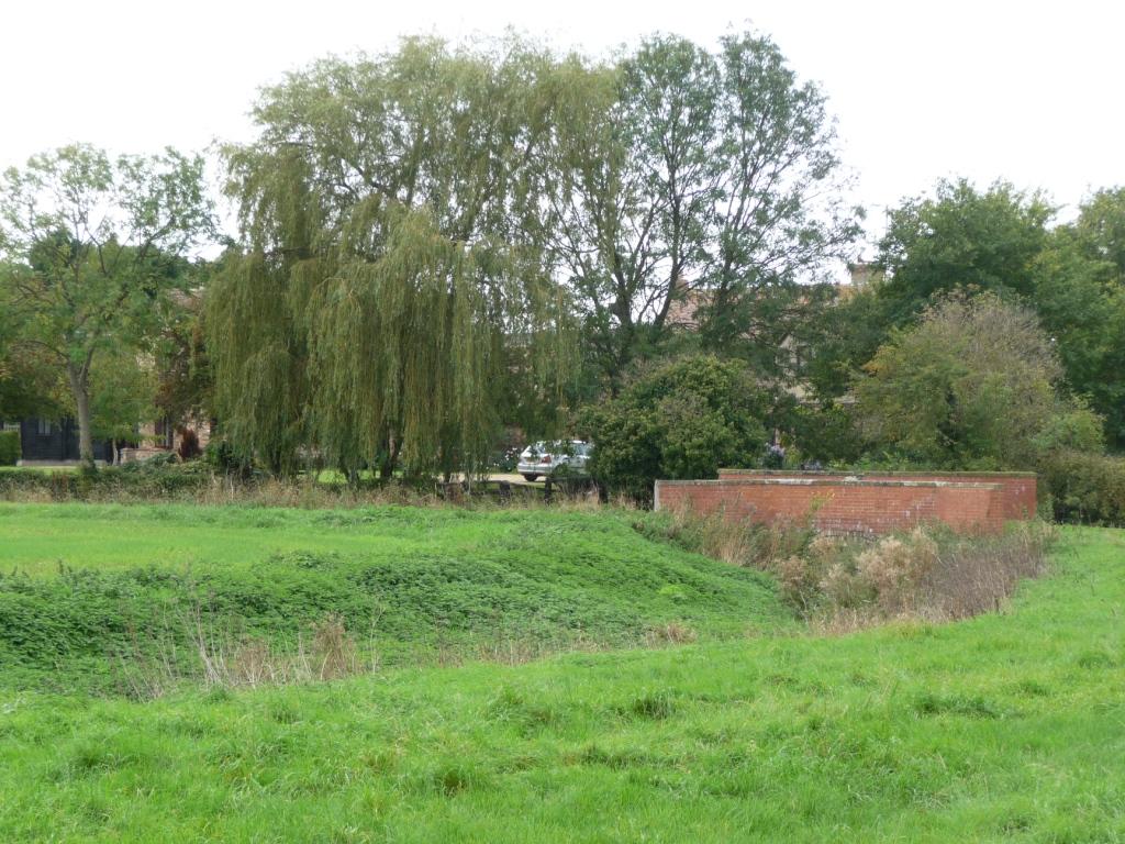
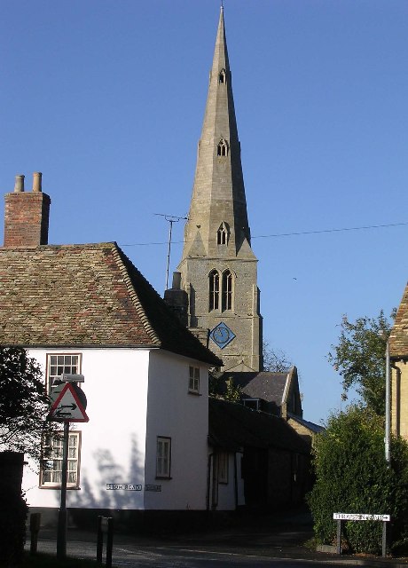
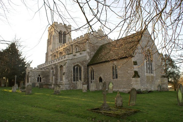
The village is home to a close-knit community, with a population of around 200 residents. It boasts a rich history dating back to medieval times, and this is evident in the architecture and layout of the village. The centerpiece of Barham is the charming St. Giles Church, a Grade II listed building that dates back to the 12th century. Its distinctive spire and beautiful stained glass windows make it a notable landmark in the area.

Although small, Barham offers a range of amenities and services to its residents. These include a local pub, The White Horse Inn, which serves as a social hub for the village. There is also a village hall that hosts various events and gatherings throughout the year. Additionally, Barham benefits from its proximity to larger towns, such as Huntingdon, where residents can access a wider range of facilities, shops, and services.

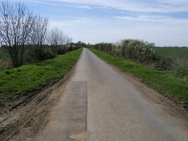
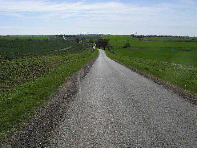
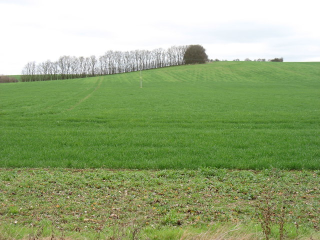
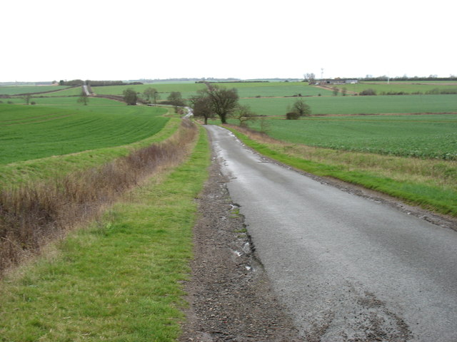
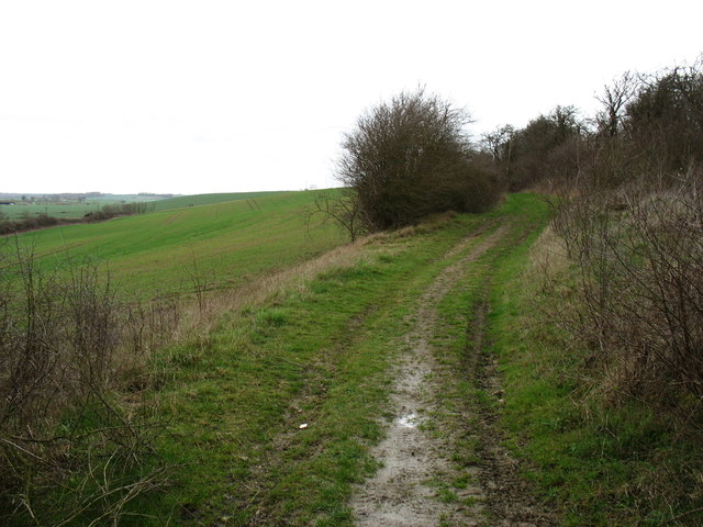
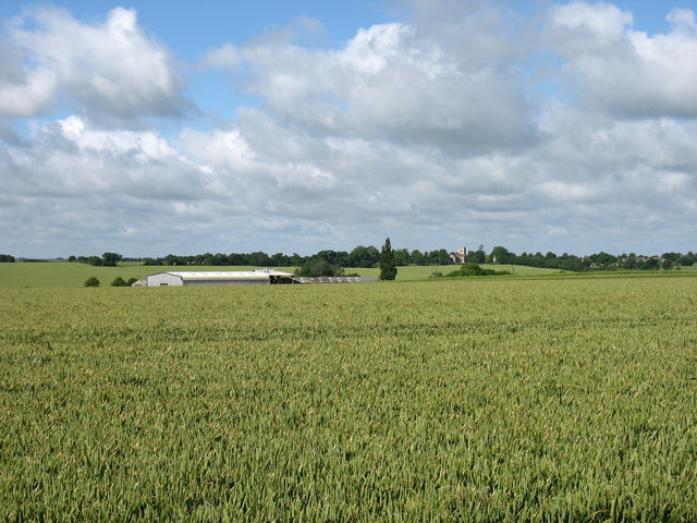
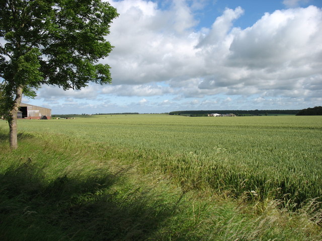
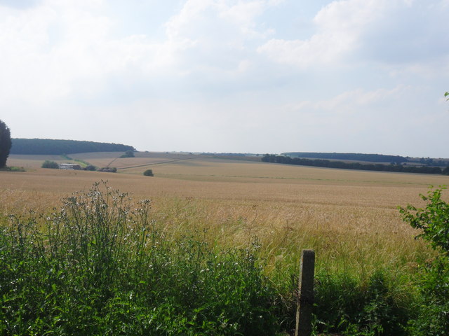
The countryside surrounding Barham provides ample opportunities for outdoor activities. The village is surrounded by rolling fields, woodlands, and meandering streams, making it an ideal location for walking, hiking, and exploring nature. The peaceful and tranquil setting also attracts visitors from neighboring areas, who come to enjoy the scenic beauty and escape the hustle and bustle of city life.

In conclusion, Barham is a quaint and historic village in Huntingdonshire that offers a peaceful and close-knit community, surrounded by beautiful countryside. Its rich history, local amenities, and natural beauty make it a desirable place to live or visit.

If you have any feedback on the listing, please let us know in the comments section below.
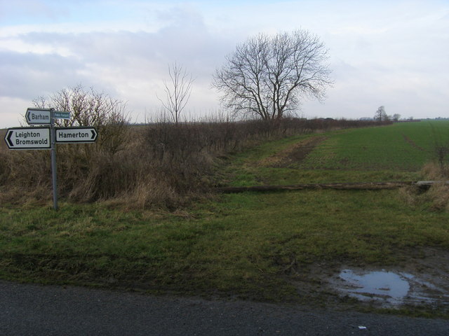
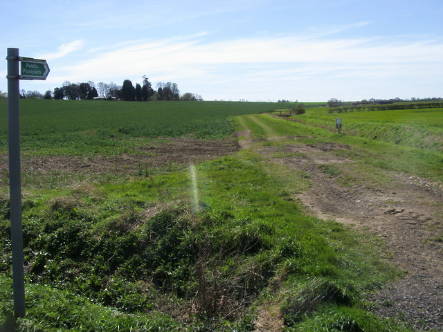
Barham Images

Images are sourced within 2km of 52.365488/-0.330986 or Grid Reference TL1375. Thanks to Geograph Open Source API. All images are credited.

Footpath to Old Weston Off the road to Leighton Bromswold the footpath to Old Weston
Footpath to Old Weston
Off the road to Leighton Bromswold the footpath to Old Weston
Footpath to Black Lodge Footpath to Black Lodge by the ditch
Footpath to Black Lodge
Footpath to Black Lodge by the ditch
All Saints church All Saints church Buckworth
All Saints church
All Saints church Buckworth
Lane to Barham From Buckworth the lane to Barham
Lane to Barham
From Buckworth the lane to Barham
St Giles church St Giles church Barham
St Giles church
St Giles church Barham
Lane heading to Belton's Hill Lane from Barham heading to Belton's Hill
Lane heading to Belton's Hill
Lane from Barham heading to Belton's Hill
Minor bridge and road junction in Woolley
Deer fighting! These rather strange sculptures are in the grounds of Manor House Farm, Woolley.
Deer fighting!
These rather strange sculptures are in the grounds of Manor House Farm, Woolley.
Fields near Tenerry Farm
St Giles church, Barham The bell which had been removed in <a href="https://www.geograph.org.uk/photo/339430">TL1375 : Barham Church</a> seems to have been reinstated.
St Giles church, Barham
The bell which had been removed in TL1375 : Barham Church seems to have been reinstated.
The road from Barham to Spaldwick
Bridleway and fields west of Belton's Hill
East Lodge Farm St Mary’s church, Leighton Bromswold, is on the horizon just right of centre.
East Lodge Farm
St Mary’s church, Leighton Bromswold, is on the horizon just right of centre.
Farmland near Top Lodge Farm
All Saints, Buckworth
Over the hills and far away... Fields and woodland, taken from All Saints churchyard.
Over the hills and far away...
Fields and woodland, taken from All Saints churchyard.
All Saints, Buckworth Close up perspective of the tower and broach spire.
All Saints, Buckworth
Close up perspective of the tower and broach spire.
All Saints, Buckworth
Show me another place!

Barham is located at Grid Ref: TL1375 (Lat: 52.365488, Lng: -0.330986)

Administrative County: Cambridgeshire

District: Huntingdonshire

Police Authority: Cambridgeshire

What 3 Words

///harshest.dignity.grape. Near Alconbury, Cambridgeshire

Nearby Locations

Barham

Related Wikis

Barham and Woolley

Barham and Woolley is a civil parish in the Huntingdonshire district of Cambridgeshire, England. The parish includes the villages of Barham and Woolley...

Barham, Huntingdonshire

Barham is a village and former civil parish, now in the parish of Barham and Woolley, in Cambridgeshire, England. Barham lies approximately 7 miles (11...

Huntingdon Rural District

Huntingdon was a rural district in Huntingdonshire from 1894 to 1974, lying to the north and west of urban Huntingdon. It was formed in 1894 under the...

Leighton Bromswold

Leighton Bromswold (also known as Leighton) is a small village and civil parish in Cambridgeshire, England. Leighton lies approximately 10 miles (16 km...

Woolley, Cambridgeshire

Woolley is a hamlet and former civil parish, now in the parish of Barham and Woolley, in Cambridgeshire, England. Woolley lies approximately 5 miles (8...

Buckworth

Buckworth is a village and civil parish in Cambridgeshire, England. Buckworth lies approximately 7 miles (11 km) northwest of Huntingdon and covers an...

Spaldwick

Spaldwick is a village and civil parish in Cambridgeshire, England. Spaldwick lies approximately 6 miles (10 km) west of Huntingdon, near Catworth. Spaldwick...

Hamerton

Hamerton is a village in and former civil parish, now in the parish of Hamerton and Steeple Gidding, in Cambridgeshire, England. Hamerton lies approximately...

Nearby Amenities

Located within 500m of 52.365488,-0.330986
Created By: Merkaartor 0.12
Lat/Long: 52.361279/-0.3284679
Created By: Merkaartor 0.12
Lat/Long: 52.3620915/-0.3309201
Barham
Is In: Cambridgeshire, England, UK
Place: village
Wikidata: Q628677
Lat/Long: 52.364882/-0.3318583
Created By: Merkaartor 0.12
Lat/Long: 52.3616249/-0.3341509
Bus Stop
St Giles's Church
Bus: yes
Naptan AtcoCode: 0500HBARW001
Naptan Bearing: NE
Naptan BusStopType: CUS
Naptan CommonName: St Giles's Church
Naptan Crossing: Leighton Road
Naptan Indicator: near
Naptan Landmark: St Giles's Church
Naptan NaptanCode: cmbdmpmw
Naptan ShortCommonName: St Giles's Church
Naptan Street: Buckworth Road
Naptan Verified: no
Public Transport: platform
Source: naptan_import
Lat/Long: 52.3654745/-0.3310933
Bus Stop
The Grange
Bus: yes
Naptan AtcoCode: 0500HBARW002
Naptan Bearing: SW
Naptan BusStopType: CUS
Naptan CommonName: The Grange
Naptan Indicator: opp
Naptan Landmark: The Grange
Naptan NaptanCode: cmbdmpta
Naptan ShortCommonName: The Grange
Naptan Street: Buckworth Road
Naptan Verified: no
Public Transport: platform
Source: naptan_import
Lat/Long: 52.3641965/-0.3322585
Bus Stop
The Grange
Bus: yes
Naptan AtcoCode: 0500HBARW003
Naptan Bearing: NE
Naptan BusStopType: CUS
Naptan CommonName: The Grange
Naptan Indicator: near
Naptan Landmark: The Grange
Naptan NaptanCode: cmbdmptd
Naptan ShortCommonName: The Grange
Naptan Street: Buckworth Road
Naptan Verified: no
Public Transport: platform
Source: naptan_import
Lat/Long: 52.3642337/-0.3323452
Bus Stop
St Giles's Church
Bus: yes
Naptan AtcoCode: 0500HBARW006
Naptan Bearing: SW
Naptan BusStopType: CUS
Naptan CommonName: St Giles's Church
Naptan Crossing: Leighton Road
Naptan Indicator: opp
Naptan Landmark: St Giles's Church
Naptan NaptanCode: cmbgjpwa
Naptan ShortCommonName: St Giles's Church
Naptan Street: Buckworth Road
Naptan Verified: no
Public Transport: platform
Source: naptan_import
Lat/Long: 52.3655343/-0.3308987
Post Box
Post Box Type: wall
Ref: PE28 27
Lat/Long: 52.3642848/-0.3323394
Waste Basket
Lat/Long: 52.3643243/-0.3323245
Telephone
Defibrillator
Booth: K6
Defibrillator Location: inside red phone box, Barham
Emergency: defibrillator
Man Made: telephone_box
Old Phone: +44 1480 890312
Lat/Long: 52.3642484/-0.3323716
Power: pole
Lat/Long: 52.3643682/-0.3282971
Power: pole
Lat/Long: 52.3636836/-0.3292037
Power: pole
Lat/Long: 52.3671304/-0.3247941
Power: pole
Lat/Long: 52.3656867/-0.3269452
Power: pole
Lat/Long: 52.3664335/-0.3260815
Power: pole
Lat/Long: 52.3650201/-0.3276801
Power: pole
Lat/Long: 52.3628254/-0.3297589
Power: pole
Lat/Long: 52.362429/-0.3283453
Power: pole
Lat/Long: 52.3620375/-0.3269157
The data included in this document is from www.openstreetmap.org. The data is made available under ODbL.

Have you been to Barham?

Leave your review of Barham below (or comments, questions and feedback).