Bargrennan

Settlement in Kirkcudbrightshire

Scotland

Bargrennan

Arriving at Bargrennan On the A714.
Arriving at Bargrennan Credit: Billy McCrorie

Bargrennan is a small village located in the historic county of Kirkcudbrightshire, Scotland. Situated in the southern part of the country, it lies on the eastern bank of the River Cree, near the Galloway Forest Park. With a population of around 100 residents, Bargrennan is known for its tranquil setting and picturesque surroundings.

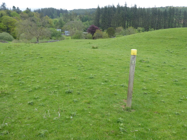
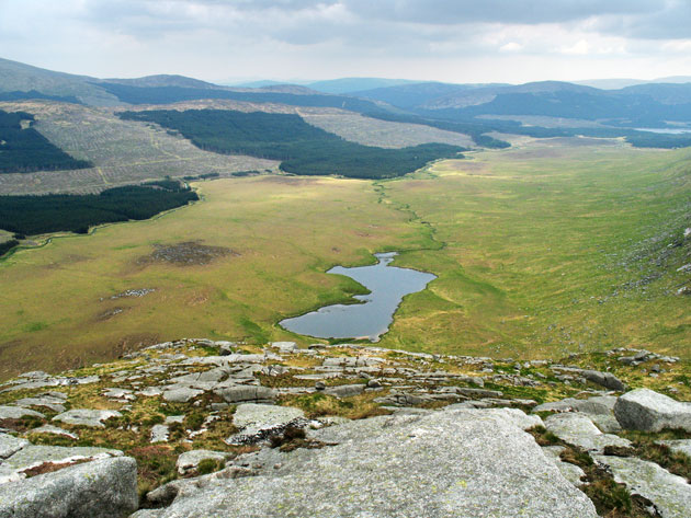
The village is surrounded by lush green hills and dense woodlands, making it a popular destination for nature lovers and outdoor enthusiasts. The nearby Galloway Forest Park offers ample opportunities for hiking, cycling, and wildlife spotting. The park is also home to the UK's first Dark Sky Park, making it an excellent spot for stargazing.

Despite its small size, Bargrennan has a rich history. The village was once a bustling hub for the nearby mining and forestry industries. Today, remnants of these industries can still be found, with old mining buildings and railway tracks scattered throughout the area.

Bargrennan is served by a few amenities, including a local pub and a small convenience store. However, for more extensive services, residents and visitors often travel to nearby towns such as Newton Stewart or Gatehouse of Fleet.

Overall, Bargrennan offers a peaceful retreat for those seeking a break from the hustle and bustle of city life. Its natural beauty and historical significance make it an attractive destination for tourists looking to explore the Scottish countryside.

If you have any feedback on the listing, please let us know in the comments section below.

Bargrennan Images

Images are sourced within 2km of 55.060919/-4.58291 or Grid Reference NX3577. Thanks to Geograph Open Source API. All images are credited.

Arriving at Bargrennan On the A714.
Arriving at Bargrennan
On the A714.
Bridge over the River Cree The A714 to Newton Stewart.
Bridge over the River Cree
The A714 to Newton Stewart.
Southern Upland Way Near Bargrennan, just off the A714
Southern Upland Way
Near Bargrennan, just off the A714
Southern Upland Way Through the woods beside the River Cree near Bargrennan, just off the A714.
Southern Upland Way
Through the woods beside the River Cree near Bargrennan, just off the A714.
The River Cree On the left in the woods is the Southern Upland Way Path.
The River Cree
On the left in the woods is the Southern Upland Way Path.
The River Cree Viewed from the A714 near Bargrennan.
The River Cree
Viewed from the A714 near Bargrennan.
Bridge over the River Cree The A714 to Barrhill and then Girvan.
Bridge over the River Cree
The A714 to Barrhill and then Girvan.
The A714 to Newton Stewart Near Bargrennan.
The A714 to Newton Stewart
Near Bargrennan.
Southern Upland Way On its way to Knowe, from the A714.
Southern Upland Way
On its way to Knowe, from the A714.
Southern Upland Way Signs Just off the A714 near Bargrennan.
Southern Upland Way Signs
Just off the A714 near Bargrennan.
House O' Hill Hotel, Bargrennan On the way to Glentrool Village.
House O' Hill Hotel, Bargrennan
On the way to Glentrool Village.
House O' Hill Hotel, Bargrennan On the road to Glentrool Village.
House O' Hill Hotel, Bargrennan
On the road to Glentrool Village.
Bridge over River Cree Linking A714 with the Galloway Forest
Bridge over River Cree
Linking A714 with the Galloway Forest
Sheep with lambs On flat flood plain beside River Cree
Sheep with lambs
On flat flood plain beside River Cree
The Southern Upland Way near Bargrennan
Show me another place!

Bargrennan is located at Grid Ref: NX3577 (Lat: 55.060919, Lng: -4.58291)

Unitary Authority: Dumfries and Galloway

Police Authority: Dumfries and Galloway

What 3 Words

///sweep.snowboard.wizards. Near Newton Stewart, Dumfries & Galloway

Nearby Locations

Bargrennan

Related Wikis

Bargrennan

Bargrennan (Scottish Gaelic: Bar Grianain, meaning height of the summer house or sunny spot) is a village in Dumfries and Galloway, in the south west of...

Glentrool

Glentrool is a collection of mountain biking routes through the heart of Galloway in southwest Scotland. The mountain bike routes are part of the 7Stanes...

Cairnderry chambered cairn

Cairnderry chambered cairn is a chambered cairn in Dumfries and Galloway. It is a Bargrennan cairn, a type of Neolithic or early Bronze Age monument only...

Glen Trool

Glen Trool (Scottish Gaelic: Gleann an t-Sruthail) is a glen in the Southern Uplands, Galloway, Scotland. It contains Loch Trool which is fed by several...

Loch Dornal

Loch Dornal is an irregular shaped, shallow, freshwater loch in south Ayrshire, in the Southern Uplands of Scotland. It lies approximately eight miles...

Loch Trool

Loch Trool is a narrow, freshwater loch in Galloway, in the Southern Uplands in south-west Scotland. It lies in an elevated position in Glen Trool in the...

Silver Flowe-Merrick Kells

Situated in south-west Scotland, the Silver Flowe-Merrick Kells biosphere reserve is composed of two separate sites. Silver Flowe is a unique bog formation...

Battle of Glen Trool

The Battle of Glen Trool was a minor engagement in the First War of Scottish Independence, fought in April 1307. Glen Trool is a narrow glen in the Southern...

Nearby Amenities

Located within 500m of 55.060919,-4.58291
Bus Stop
Glentrool Village, Road End
Naptan AtcoCode: 680000877111
Naptan Bearing: N
Naptan BusStopType: CUS
Naptan CommonName: Road End
Naptan Indicator: A714
Naptan Landmark: C46
Naptan NaptanCode: 34236759
Naptan Notes: none
Naptan Street: A714
Naptan Verified: no
Public Transport: platform
Source: naptan_import
Lat/Long: 55.0568751/-4.5852278
Bus Stop
Glentrool Village, Road End
Naptan AtcoCode: 680000877222
Naptan Bearing: S
Naptan BusStopType: CUS
Naptan CommonName: Road End
Naptan Indicator: A714
Naptan Landmark: C46
Naptan NaptanCode: 34236762
Naptan Notes: none
Naptan Street: A714
Naptan Verified: no
Public Transport: platform
Source: naptan_import
Lat/Long: 55.0568563/-4.584986
Bargrennan
Name En: Bargrennan
Name Gd: Bàrr a' Ghrianain
Place: hamlet
Lat/Long: 55.0572674/-4.5835949
Post Box
Operator: Royal Mail
Post Box Mounting: pier
Post Box Type: lamp
Ref: DG8 67
Royal Cypher: scottish_crown
Lat/Long: 55.0593554/-4.583458
Power: pole
Lat/Long: 55.0649681/-4.5801725
Power: pole
Lat/Long: 55.0644181/-4.5802792
Power: pole
Lat/Long: 55.065027/-4.5822388
Power: pole
Lat/Long: 55.0648225/-4.5815636
Power: pole
Lat/Long: 55.0638848/-4.5833796
Power: pole
Lat/Long: 55.0644737/-4.5843594
Power: pole
Lat/Long: 55.0650703/-4.5853373
Power: pole
Lat/Long: 55.0593069/-4.588102
Power: pole
Lat/Long: 55.0595825/-4.5871824
Power: pole
Lat/Long: 55.059897/-4.5867264
Power: pole
Lat/Long: 55.060257/-4.586158
Power: pole
Lat/Long: 55.0607993/-4.585863
Power: pole
Lat/Long: 55.0614137/-4.5855429
Power: pole
Lat/Long: 55.0621526/-4.58512
Power: pole
Lat/Long: 55.0627315/-4.584534
Power: pole
Lat/Long: 55.0632837/-4.5839752
Power: pole
Lat/Long: 55.0644548/-4.5827995
Power: pole
Lat/Long: 55.0602648/-4.5872639
Power: pole
Lat/Long: 55.0602837/-4.5886472
Power: pole
Lat/Long: 55.0602948/-4.5894252
Power: pole
Lat/Long: 55.0598014/-4.5903778
Power: pole
Lat/Long: 55.0602314/-4.5851297
Power: pole
Lat/Long: 55.0602403/-4.5849395
Power: pole
Lat/Long: 55.0606448/-4.5844894
Power: pole
Lat/Long: 55.0598803/-4.5844894
Power: pole
Lat/Long: 55.0594992/-4.5839966
The data included in this document is from www.openstreetmap.org. The data is made available under ODbL.

Have you been to Bargrennan?

Leave your review of Bargrennan below (or comments, questions and feedback).