Kemsing

Settlement in Kent Sevenoaks

England

Kemsing

Footpath and stile near Otford A public footpath and a stile near Otford in Kent.
Footpath and stile near Otford Credit: Malc McDonald

Kemsing is a picturesque village located in the Sevenoaks district of Kent, England. Situated approximately 25 miles southeast of London, it lies on the northern slope of the North Downs, offering stunning views of the surrounding countryside. With a population of around 2,500, Kemsing retains a charming rural character while still being within easy reach of urban amenities.

The village is steeped in history, dating back to Roman times, and boasts several listed buildings. One prominent landmark is the 12th-century St. Mary's Church, which features a striking Norman tower. Additionally, Kemsing is home to an old manor house called Kemsing Court, which dates back to the 16th century.

The community in Kemsing is tight-knit, with a range of local amenities. The High Street is lined with charming shops, including a post office, a village store, and several independent businesses. There are also several pubs and restaurants offering a variety of cuisines for residents and visitors to enjoy.

Nature lovers will appreciate the village's proximity to the North Downs, providing ample opportunities for scenic walks and outdoor activities. Moreover, Kemsing is surrounded by beautiful countryside, making it a popular destination for hikers and cyclists.

Kemsing benefits from good transportation links, with access to the A25 road and nearby railway stations providing connections to London and other major towns in the county.

In conclusion, Kemsing offers a tranquil escape from city life, with its rich history, stunning landscapes, and close-knit community, making it an attractive place to live or visit in Kent.

If you have any feedback on the listing, please let us know in the comments section below.
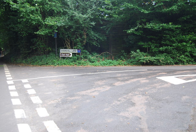
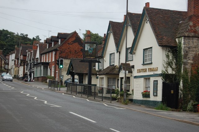
Kemsing Images

Images are sourced within 2km of 51.306135/0.22927 or Grid Reference TQ5558. Thanks to Geograph Open Source API. All images are credited.

Footpath and stile near Otford A public footpath and a stile near Otford in Kent.
Footpath and stile near Otford
A public footpath and a stile near Otford in Kent.
Tinker Pot Lane Four roads meet at the crossroads here - Clarkes Green Road, Goodbury Road, Cotman's Ash Lane and this one Tinker Pot Lane. This view looks along Tinker Pot Lane away from the crossroads and in the direction of Woodlands. Tinker Pot Lane extends beyond the village of Woodlands and winds its way to School Lane and West Kingsdown.
Tinker Pot Lane
Four roads meet at the crossroads here - Clarkes Green Road, Goodbury Road, Cotman's Ash Lane and this one Tinker Pot Lane. This view looks along Tinker Pot Lane away from the crossroads and in the direction of Woodlands. Tinker Pot Lane extends beyond the village of Woodlands and winds its way to School Lane and West Kingsdown.
Fox Farm This collection of historic items can be seen from the footpath near Cotman's Ash Lane.
Fox Farm
This collection of historic items can be seen from the footpath near Cotman's Ash Lane.
Fox Farm This collection of historic items can be seen from the footpath near Cotman's Ash Lane.
Fox Farm
This collection of historic items can be seen from the footpath near Cotman's Ash Lane.
Autumn's End The last leaves cling to the trees in this forest scene as winter's grip takes hold of the forest.
Autumn's End
The last leaves cling to the trees in this forest scene as winter's grip takes hold of the forest.
Signposts  above the North Downs Way near Kemsing This is an area known as Clarke's Bottom between Kemsing and West Kingsdown. The lane in the picture is called Cotmans Ash Lane.
Signposts above the North Downs Way near Kemsing
This is an area known as Clarke's Bottom between Kemsing and West Kingsdown. The lane in the picture is called Cotmans Ash Lane.
Shorehill Lane
Shorehill Lane
Road junction on top of the North Downs
Footpath & stile One of many stiles & footpaths in this area of the North Downs
Footpath & stile
One of many stiles & footpaths in this area of the North Downs
Horses in front of Fernbank Farm Lots of horses in this area.
Horses in front of Fernbank Farm
Lots of horses in this area.
Horses in a field One of the many "horsey" fields in this part of the North Downs.
Horses in a field
One of the many "horsey" fields in this part of the North Downs.
Cross roads on the North Downs
Stile at the beginning of a footpath
Dry valley on the North Downs A classic piece of downland scenery.
Dry valley on the North Downs
A classic piece of downland scenery.
Horses grazing on the North Downs
Cross roads on the North Downs
Large house on top of the North Downs
Paines Farm On Rowdown Lane.
Paines Farm
On Rowdown Lane.
Show me another place!

Kemsing is located at Grid Ref: TQ5558 (Lat: 51.306135, Lng: 0.22927)

Administrative County: Kent

District: Sevenoaks

Police Authority: Kent

What 3 Words

///crib.brand.deputy. Near Kemsing, Kent

Related Wikis

Kemsing

Kemsing is a village and civil parish in the Sevenoaks district of Kent, England. The parish lies on the scarp face of the North Downs, 20 miles south...

Kemsing Down

Kemsing Down is a 16-hectare (40-acre) nature reserve north of Sevenoaks in Kent. It is managed by the Kent Wildlife Trust. It is in the Kent Downs Area...

Kemsing railway station

Kemsing railway station serves Kemsing in Kent, England, although the station is located on the other side of the M26 motorway to the village. It is 26...

Heaverham

Heaverham is a hamlet in the Sevenoaks district, in the county of Kent, England. Nearby is the country estate of St Clere. == Location == It is located...

St Michael's Prep School, Otford

St Michael's Prep School is a coeducational preparatory school in Otford, located in a 100-acre (400,000 m2) site in the North Downs, Kent, England....

Seal, Kent

Seal is a village and civil parish in the Sevenoaks district of Kent, England. The parish is located in the valley between the North Downs and the Greensand...

Greatness Brickworks

Greatness Brickworks is a 7.8-hectare (19-acre) geological Site of Special Scientific Interest in Sevenoaks in Kent. It is a Geological Conservation Review...
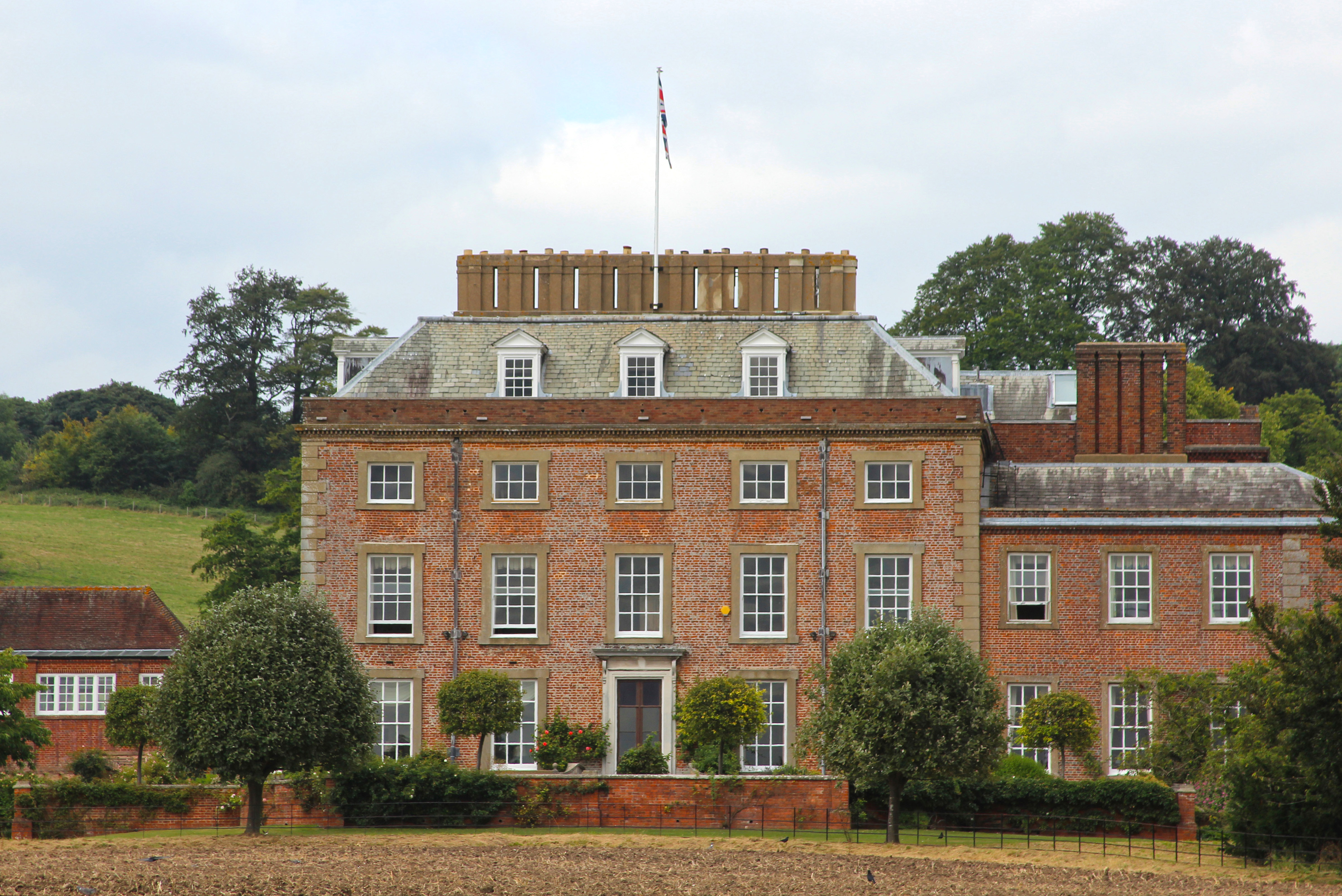
St Clere, Kent

St Clere is a Grade I listed 17th-century country house in Kemsing, Kent, England. The house is built in brick in three storeys plus basement and attic...

Nearby Amenities

Located within 500m of 51.306135,0.22927
Kemsing
Place: village
Lat/Long: 51.3060009/0.228448
Toilets
Lat/Long: 51.3061546/0.2305557
Recycling
Lat/Long: 51.3061549/0.2302199
Telephone
Booth: K6
Covered: booth
Listed Status: Grade II
Lat/Long: 51.3058684/0.2291479
Turning Circle
Lat/Long: 51.3041306/0.2295184
Turning Circle
Lat/Long: 51.3081242/0.2237174
Bus Stop
Park Lane
Local Ref: adj
Naptan AtcoCode: 2400A029840A
Naptan Bearing: N
Naptan BusStopType: MKD
Naptan CommonName: Park Lane
Naptan Indicator: adj
Naptan Landmark: Park Lane
Naptan NaptanCode: kntdgwdm
Naptan RevisionNumber: 3
Naptan Status: act
Naptan Street: St Edith's Road
Naptan Verified: yes
Public Transport: platform
Ref: kntdgwdm
Source: naptan_import
Source Date: 2018-02-12
Lat/Long: 51.3040444/0.2287523
Bus Stop
School
Bus Routes: 404;431;432
Local Ref: opp
Naptan AtcoCode: 2400A029850A
Naptan Bearing: W
Naptan BusStopType: MKD
Naptan CommonName: School
Naptan Indicator: opp
Naptan Landmark: Kemsing School
Naptan NaptanCode: kntdgwdp
Naptan RevisionNumber: 2
Naptan Status: act
Naptan Street: West End
Naptan Verified: yes
Public Transport: platform
Ref: kntdgwdp
Shelter: no
Source: naptan_import
Source Date: 2010-06-03
Lat/Long: 51.3063193/0.2279311
Bus Stop
Post Office
Local Ref: adj
Naptan AtcoCode: 2400A029820A
Naptan Bearing: S
Naptan BusStopType: MKD
Naptan CommonName: Post Office
Naptan Indicator: adj
Naptan Landmark: Post Office
Naptan NaptanCode: kntdgwdg
Naptan RevisionNumber: 2
Naptan Status: act
Naptan Street: St Edith's Road
Naptan Verified: no
Public Transport: platform
Ref: kntdgwdg
Source: naptan_import
Source Date: 2018-02-12
Lat/Long: 51.3058741/0.2291148
Bus Stop
The Landway
Local Ref: opp
Naptan AtcoCode: 2400A029860A
Naptan Bearing: W
Naptan BusStopType: MKD
Naptan CommonName: The Landway
Naptan Indicator: opp
Naptan Landmark: The Landway
Naptan NaptanCode: kntdgwdt
Naptan RevisionNumber: 1
Naptan Status: act
Naptan Street: West End
Naptan Verified: no
Public Transport: platform
Ref: kntdgwdt
Shelter: no
Source: naptan_import
Source Date: 2010-06-03
Lat/Long: 51.3062652/0.2259564
Bench
Backrest: yes
Colour: brown
Material: wood
Seats: 3
Lat/Long: 51.3058626/0.2293542
Historic: memorial
Lat/Long: 51.3059883/0.2294762
Bench
Lat/Long: 51.3058735/0.2292684
Post Box
Collection Times: Mo-Fr 17:00; Sa 10:45; Su off
Colour: red
Post Box Type: pillar
Ref: TN15 146
Royal Cypher: GR
Royal Cypher Wikidata: Q33102273
Lat/Long: 51.3057317/0.229183
Bench
Lat/Long: 51.3104227/0.2308905
Barrier: kissing_gate
Bicycle: no
Foot: yes
Material: wood
Lat/Long: 51.3105258/0.2307869
Barrier: stile
Lat/Long: 51.302892/0.2314926
Pharmacy
Kemsing Pharmacy
Lat/Long: 51.3062424/0.2268934
best-one
Brand Wikidata: Q4896532
Contact Website: https://stores.best-one.co.uk/jay-balaji-ltd-best-one-a7d351085165
Notice Board: yes
Shop: convenience
Lat/Long: 51.3062436/0.2270416
Board Type: notice
Information: board
Tourism: information
Lat/Long: 51.3063128/0.2268611
Cafe
Kemsing Tea Room
Cuisine: tea_room
Lat/Long: 51.3057137/0.2292551
Leisure: picnic_table
Lat/Long: 51.3057503/0.2292616
Leisure: picnic_table
Lat/Long: 51.3057701/0.2292455
Veterinary
Lat/Long: 51.3057671/0.229881
Barrier: kissing_gate
Bicycle: no
Foot: yes
Material: wood
Lat/Long: 51.3086406/0.2298809
Barrier: kissing_gate
Bicycle: no
Foot: yes
Material: wood
Lat/Long: 51.308851/0.2299383
Bus Stop
The Landway
Local Ref: adj
Naptan AtcoCode: 2400103945
Naptan Bearing: E
Naptan BusStopType: CUS
Naptan CommonName: The Landway
Naptan Indicator: adj
Naptan Landmark: The Landway
Naptan NaptanCode: kntjmpgp
Naptan RevisionNumber: 2
Naptan Status: act
Naptan Street: West End
Naptan Verified: no
Public Transport: platform
Ref: kntjmpgp
Source: naptan_import
Source Date: 2018-02-12
Lat/Long: 51.3063144/0.2253483
Kemsing Cricket Club
Addr City: Kemsing
Addr Housename: Sir Mark Collet Pavilion
Addr Postcode: TN15 6NE
Addr Street: Heaverham Road
Leisure: park
Website: kemsing.play-cricket.com
Lat/Long: 51.3069833/0.2360525
The data included in this document is from www.openstreetmap.org. The data is made available under ODbL.

Have you been to Kemsing?

Leave your review of Kemsing below (or comments, questions and feedback).