Middle Hill

Hill, Mountain in Wiltshire

England

Middle Hill

Battlesbury Hill, Wiltshire Battlesbury Hill is the site of an Iron Age bivallate hill fort near the town of Warminster.
Battlesbury Hill, Wiltshire Credit: Rebecca A Wills

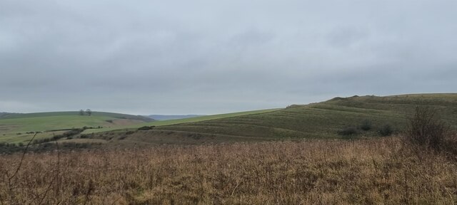
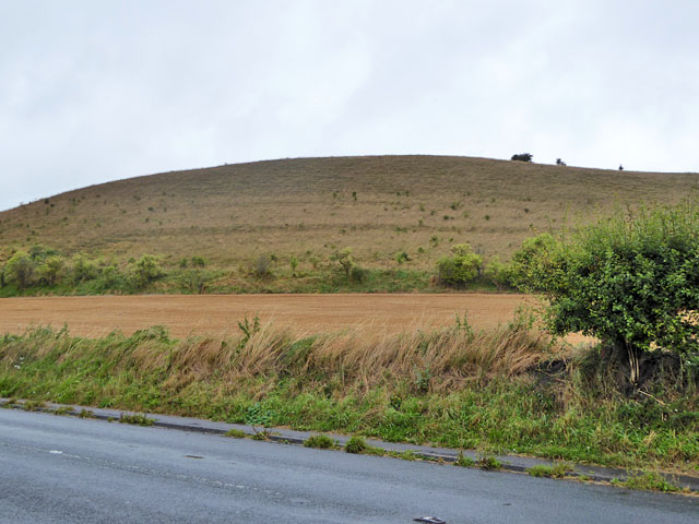
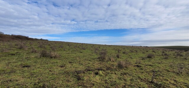
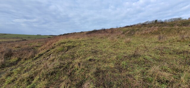
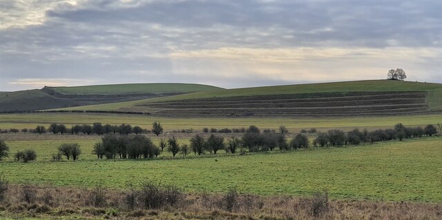
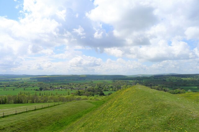
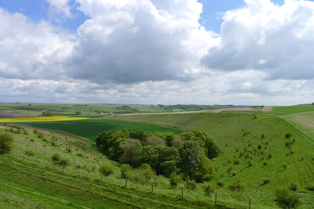
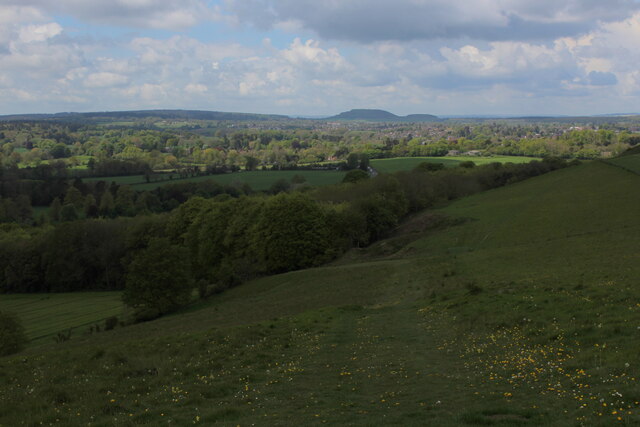
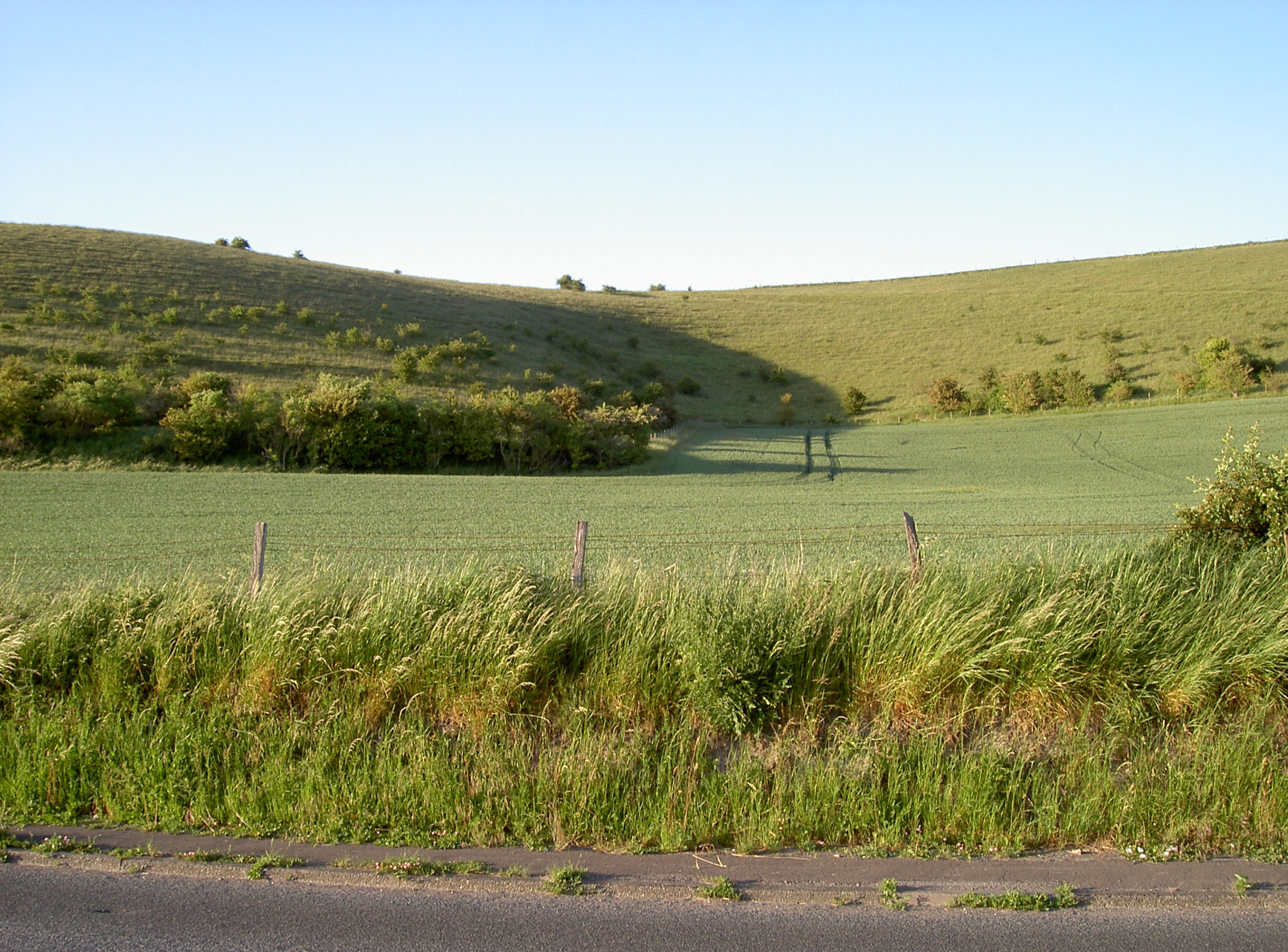
Middle Hill is a prominent geographical feature located in the county of Wiltshire, England. It is a hill that forms part of the picturesque Marlborough Downs, a range of rolling chalk hills situated in the southern region of the county. Middle Hill is positioned between the villages of Aldbourne and Ramsbury, offering stunning views over the surrounding countryside.

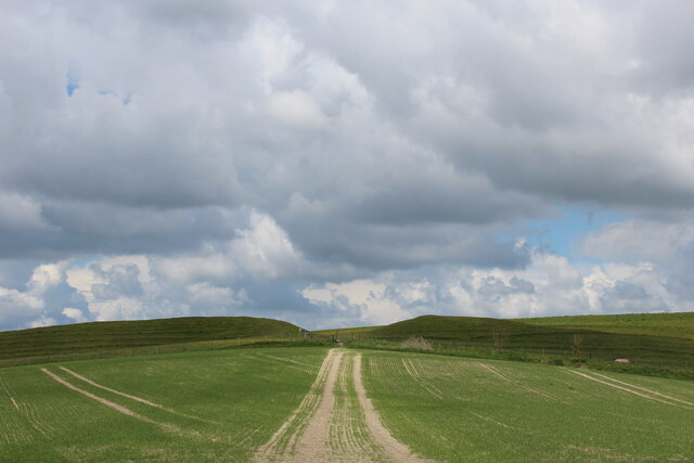
This hill is characterized by its gentle slopes and expansive grasslands, which are often adorned with an array of wildflowers during the spring and summer months. It stands at an elevation of approximately 239 meters (785 feet), making it a notable landmark in the area.

Middle Hill is a popular destination for hikers, nature enthusiasts, and those seeking peaceful walks amidst the idyllic Wiltshire countryside. The hill is crisscrossed by several footpaths, providing opportunities for exploration and connecting with nature. As visitors ascend the hill, they can enjoy panoramic views of the surrounding landscape, including the nearby valleys and neighboring hills.

The area surrounding Middle Hill is rich in historical significance. It is believed that the hill was once home to prehistoric settlements and burial mounds, offering glimpses into the region's ancient past. The hill also boasts a diverse range of wildlife, including various bird species, small mammals, and insects.

Overall, Middle Hill in Wiltshire provides visitors with the chance to immerse themselves in the natural beauty and tranquility of the Marlborough Downs, while also offering a glimpse into the area's rich historical heritage.

If you have any feedback on the listing, please let us know in the comments section below.

Middle Hill Images

Images are sourced within 2km of 51.203371/-2.1329219 or Grid Reference ST9044. Thanks to Geograph Open Source API. All images are credited.

Battlesbury Hill, Wiltshire Battlesbury Hill is the site of an Iron Age bivallate hill fort near the town of Warminster.
Battlesbury Hill, Wiltshire
Battlesbury Hill is the site of an Iron Age bivallate hill fort near the town of Warminster.
Cotley Hill Looking up from the B3414.
Cotley Hill
Looking up from the B3414.
Salisbury Plain [10] At the edge of the military training area is an installation for cleaning vehicles before they leave and traverse public roads.
For a few days each year the public are allowed into the military training area on Salisbury Plain.
Salisbury Plain [10]
At the edge of the military training area is an installation for cleaning vehicles before they leave and traverse public roads. For a few days each year the public are allowed into the military training area on Salisbury Plain.
Salisbury Plain [11] At the edge of the military training area is an installation for cleaning vehicles. Some are then parked in this large compound.
For a few days each year the public are allowed into the military training area on Salisbury Plain.
Salisbury Plain [11]
At the edge of the military training area is an installation for cleaning vehicles. Some are then parked in this large compound. For a few days each year the public are allowed into the military training area on Salisbury Plain.
Salisbury Plain [12] At the edge of the military training area is an installation for cleaning vehicles. This area is where the soil from the vehicles is temporarily stored.
For a few days each year the public are allowed into the military training area on Salisbury Plain.
Salisbury Plain [12]
At the edge of the military training area is an installation for cleaning vehicles. This area is where the soil from the vehicles is temporarily stored. For a few days each year the public are allowed into the military training area on Salisbury Plain.
Salisbury Plain [13] At the edge of the military training area is an installation for cleaning vehicles before they leave and traverse public roads.
For a few days each year the public are allowed into the military training area on Salisbury Plain.
Salisbury Plain [13]
At the edge of the military training area is an installation for cleaning vehicles before they leave and traverse public roads. For a few days each year the public are allowed into the military training area on Salisbury Plain.
Recreation ground at Norton Bavant
Old Milepost by the B3414, Warminster Road, Norton Bavant Cast iron post by the B3414, in parish of Norton Bavant (West Wiltshire District), Warminster Road; 800m East of entrance to Bishopstrow Farm, by the road, on Southwest side of road. C&M Classical iron casting, erected by the Warminster turnpike trust in the 19th century. 

Inscription reads:-
SALISBURY
19
WARMINSTER
2

Grade II listed.  
List Entry Number: 1364340 <span class="nowrap"><a title="https://historicengland.org.uk/listing/the-list/list-entry/1364340" rel="nofollow ugc noopener" href="https://historicengland.org.uk/listing/the-list/list-entry/1364340">Link</a><img style="margin-left:2px;" alt="External link" title="External link - shift click to open in new window" src="https://s1.geograph.org.uk/img/external.png" width="10" height="10"/></span>

Milestone Society National ID: WI_SAWM19
Old Milepost by the B3414, Warminster Road, Norton Bavant
Cast iron post by the B3414, in parish of Norton Bavant (West Wiltshire District), Warminster Road; 800m East of entrance to Bishopstrow Farm, by the road, on Southwest side of road. C&M Classical iron casting, erected by the Warminster turnpike trust in the 19th century. Inscription reads:- SALISBURY 19 WARMINSTER 2 Grade II listed. List Entry Number: 1364340 LinkExternal link Milestone Society National ID: WI_SAWM19
North Farm, Wiltshire Looking from the Imber Range Perimeter Path in the direction of strip lynchets on Middle Hill. Strip lynchets are earth terraces found on the side of a hill, and are a feature of ancient field systems.
North Farm, Wiltshire
Looking from the Imber Range Perimeter Path in the direction of strip lynchets on Middle Hill. Strip lynchets are earth terraces found on the side of a hill, and are a feature of ancient field systems.
Bishopstrow Down, Wiltshire Looking north east, up hill, in the direction of Bishopstrow Down, from the vicinity of strip lynchets located to the south of Bigbury Wood.
Bishopstrow Down, Wiltshire
Looking north east, up hill, in the direction of Bishopstrow Down, from the vicinity of strip lynchets located to the south of Bigbury Wood.
Bigbury Wood, Wiltshire Looking northwest along a series of strip lynchets to the south of Bigbury Wood. Strip lynchets are earth terrace found on the side of a hill and are a feature of ancient field systems.
Bigbury Wood, Wiltshire
Looking northwest along a series of strip lynchets to the south of Bigbury Wood. Strip lynchets are earth terrace found on the side of a hill and are a feature of ancient field systems.
Middle Hill, Wiltshire Looking south from the vicinity of the Imber Range Perimeter Path towards the strip lynchets on Middle Hill. Strip lynchets are earth terraces found on the side of a hill and are a feature of ancient field systems.
Middle Hill, Wiltshire
Looking south from the vicinity of the Imber Range Perimeter Path towards the strip lynchets on Middle Hill. Strip lynchets are earth terraces found on the side of a hill and are a feature of ancient field systems.
Wessex Ridgeway on Cotley Hill Pleasant wide green tracks mark the route onwards to Scratchbury Hill
Wessex Ridgeway on Cotley Hill
Pleasant wide green tracks mark the route onwards to Scratchbury Hill
Stall waste by the Wessex Ridgeway path on Cotley Hill
On the rampart at the south end of Scratchbury Hill A 'univallate' iron age hillfort. The single rampart is nevertheless an impressive structure. Looking over the village of Norton Bavant in the Wylye valley
On the rampart at the south end of Scratchbury Hill
A 'univallate' iron age hillfort. The single rampart is nevertheless an impressive structure. Looking over the village of Norton Bavant in the Wylye valley
'The Copse' from Scratchbury Hill
Bridleway descending towards Norton Plantation
Wessex Ridgeway approaching Scratchbury Camp Heading east over an arable field towards the earthen ramparts of Scratchbury Camp, an Iron Age Hillfort on the edge of Salisbury Plain
Wessex Ridgeway approaching Scratchbury Camp
Heading east over an arable field towards the earthen ramparts of Scratchbury Camp, an Iron Age Hillfort on the edge of Salisbury Plain
Show me another place!

Middle Hill is located at Grid Ref: ST9044 (Lat: 51.203371, Lng: -2.1329219)

Unitary Authority: Wiltshire

Police Authority: Wiltshire

What 3 Words

///start.festivity.barrel. Near Bishopstrow, Wiltshire

Nearby Locations

Bishopstrow Middle Hill

Related Wikis

Scratchbury Camp

Scratchbury Camp is the site of an Iron Age univallate hillfort on Scratchbury Hill, overlooking the Wylye valley about 1 km northeast of the village of...

Battlesbury Camp

Battlesbury Camp is the site of an Iron Age bivallate hill fort on Battlesbury Hill near the town of Warminster in Wiltshire, South West England. Excavations...

Bishopstrow House

Bishopstrow Hotel & Spa is a late-Georgian English country house standing near the B3414 (Salisbury road) in the parish of Bishopstrow, about a mile east...

Scratchbury and Cotley Hills SSSI

Scratchbury & Cotley Hills SSSI (grid reference ST915437) is a 53.5 hectare biological Site of Special Scientific Interest at Norton Bavant in Wiltshire...

Norton Bavant

Norton Bavant is a small village and civil parish in Wiltshire, England, 2 miles (3.2 km) southeast of Warminster. == Geography == The village is on the...

Bishopstrow

Bishopstrow is a small village and civil parish in Wiltshire, England, on the southeastern edge of the town of Warminster. The village is about 1.5 miles...

Battlesbury Barracks

Battlesbury Barracks is a British Army installation in Warminster, Wiltshire, England. It is the permanent base of the Royal Dragoon Guards, serving as...

Warminster Garrison

Warminster Garrison is a military garrison of the British Army, on the edge of Salisbury Plain in Wiltshire, England. == History == The history of Warminster...

Nearby Amenities

Located within 500m of 51.203371,-2.1329219
Middle Hill
Ele: 179
Natural: peak
Lat/Long: 51.2034369/-2.1331188
The data included in this document is from www.openstreetmap.org. The data is made available under ODbL.

Have you been to Middle Hill?

Leave your review of Middle Hill below (or comments, questions and feedback).