Combe Hill

Hill, Mountain in Wiltshire

England

Combe Hill

White Horse Farm, Bratton
White Horse Farm, Bratton Credit: Dylan Moore

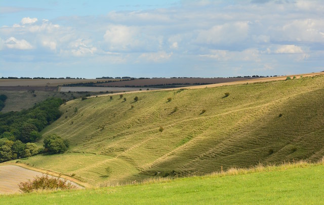
Combe Hill is a prominent landmark located in Wiltshire, England. It is a hill that rises to a height of 260 meters (850 feet) above sea level and is part of the Marlborough Downs. Combe Hill is situated near the village of Broad Hinton and is easily accessible for visitors and locals alike.

The hill offers stunning panoramic views of the surrounding countryside, making it a popular spot for hikers, nature enthusiasts, and photographers. On a clear day, visitors can see as far as the Cotswolds to the north and the Salisbury Plain to the south. The gentle slopes of Combe Hill are covered in lush green grass and are home to a variety of flora and fauna, including wildflowers and grazing sheep.

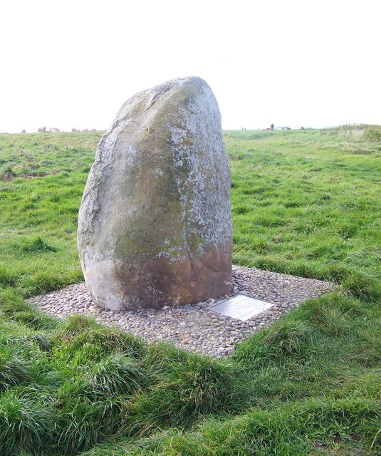
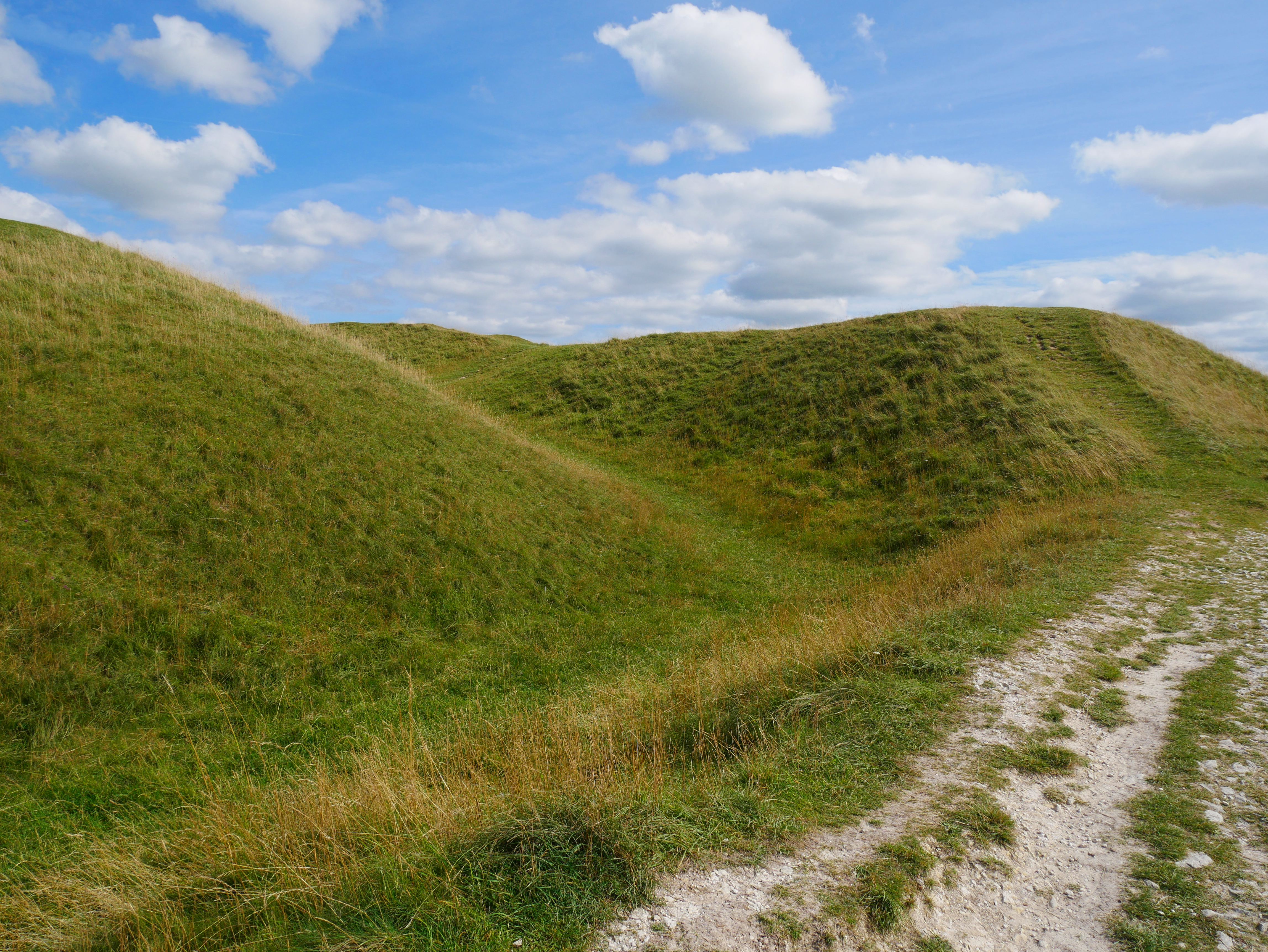
At the summit of Combe Hill, there is an Iron Age hill fort known as Barbury Castle. The fort dates back to around 700 BC and is a significant archaeological site. It consists of several circular earthworks and ditches, which were once used as defensive measures. Today, visitors can explore the remains of Barbury Castle and learn about its historical significance.

Combe Hill is also a popular spot for paragliding and hang gliding due to its favorable wind conditions. The hill's elevated position and unobstructed views make it an ideal location for these activities.

Overall, Combe Hill is a natural and historical gem in Wiltshire, offering breathtaking views, outdoor recreational opportunities, and a glimpse into the region's rich past.

If you have any feedback on the listing, please let us know in the comments section below.

Combe Hill Images

Images are sourced within 2km of 51.260206/-2.1355366 or Grid Reference ST9051. Thanks to Geograph Open Source API. All images are credited.

White Horse Farm, Bratton
View From Bratton Camp towards Bratton
The Mid Wilts Way climbing towards Bratton Camp
On the Mid-Wilts Way looking towards Well Ground Farm The Mid Wilts Way runs immediately left of the hedgerow
On the Mid-Wilts Way looking towards Well Ground Farm
The Mid Wilts Way runs immediately left of the hedgerow
View Across Newly Planted Field Towards the Cement Works
White Horse Hill, Westbury Trig looking lonely in the White Horse Farm yard with limited views on this very popular hill.
Name: White Horse Hill
Hill number: 5425
Height: 230m / 755ft
Area: 41: South Central England
Class: Hu
Grid ref: ST 90114 51141
Summit feature: trig point: OS measurement
Drop: 108m
Col: 122m  ST858478
White Horse Hill, Westbury
Trig looking lonely in the White Horse Farm yard with limited views on this very popular hill. Name: White Horse Hill Hill number: 5425 Height: 230m / 755ft Area: 41: South Central England Class: Hu Grid ref: ST 90114 51141 Summit feature: trig point: OS measurement Drop: 108m Col: 122m ST858478
B3098 between Edington and Bratton
Bratton; Packed and ready to go!
Combe Hill, Bratton, Wiltshire
Trowbridge Road Houses in Bratton.
Trowbridge Road
Houses in Bratton.
Lower Westbury Road Stables near The Hollow.
Lower Westbury Road
Stables near The Hollow.
"The Duke of Bratton" Public house in Bratton.
"The Duke of Bratton"
Public house in Bratton.
Footpath near Bratton Bratton appears to be a thriving village (its proximity to Westbury probably guarantees a supply of residents who live there 7 days a week) and has quite a network of footpaths leading out of it in different directions.  This one on the north side is one of the better-kept ones, unlike, say, <a href="https://www.geograph.org.uk/photo/5781093">ST9052 : Mid Wilts Way and White Horse Trail</a>.
Footpath near Bratton
Bratton appears to be a thriving village (its proximity to Westbury probably guarantees a supply of residents who live there 7 days a week) and has quite a network of footpaths leading out of it in different directions. This one on the north side is one of the better-kept ones, unlike, say, ST9052 : Mid Wilts Way and White Horse Trail.
Path up to Bratton Church St James Church, Bratton <span class="nowrap"><a title="https://bratton.beciebenefice.org/" rel="nofollow ugc noopener" href="https://bratton.beciebenefice.org/">Link</a><img style="margin-left:2px;" alt="External link" title="External link - shift click to open in new window" src="https://s1.geograph.org.uk/img/external.png" width="10" height="10"/></span> is situated outside the village and to reach it one uses either a lane or this path which goes steeply down and up (note the steps with a flagstone on each one).  I would imagine most people use the lane, even if walking to the church, as the path was very overgrown with nettles lower down.  At this point it enters the churchyard.  More history: <a href="https://www.geograph.org.uk/photo/4720744">ST9151 : Looking down Church Steps from the north side of the combe, Bratton</a>
Path up to Bratton Church
St James Church, Bratton LinkExternal link is situated outside the village and to reach it one uses either a lane or this path which goes steeply down and up (note the steps with a flagstone on each one). I would imagine most people use the lane, even if walking to the church, as the path was very overgrown with nettles lower down. At this point it enters the churchyard. More history: ST9151 : Looking down Church Steps from the north side of the combe, Bratton
Old Milestone by the B3098, Melbourne Street, Bratton Metal plate attached to stone post by the B3098, in parish of Bratton (West Wiltshire District), Melbourne Street, by Reeves Farmhouse, in front of wall, on South side of road. Westbury plate, erected by the Westbury Turnpike Trust in the 19th century.

Inscription reads:-
TO
WESTBURY
3 MILES
DEVIZES
11 MILES

Grade II listed. List Entry Number: 1193866
<span class="nowrap"><a title="https://historicengland.org.uk/listing/the-list/list-entry/1193866" rel="nofollow ugc noopener" href="https://historicengland.org.uk/listing/the-list/list-entry/1193866">Link</a><img style="margin-left:2px;" alt="External link" title="External link - shift click to open in new window" src="https://s1.geograph.org.uk/img/external.png" width="10" height="10"/></span>

Milestone Society National ID: WI_DZWY11.
Old Milestone by the B3098, Melbourne Street, Bratton
Metal plate attached to stone post by the B3098, in parish of Bratton (West Wiltshire District), Melbourne Street, by Reeves Farmhouse, in front of wall, on South side of road. Westbury plate, erected by the Westbury Turnpike Trust in the 19th century. Inscription reads:- TO WESTBURY 3 MILES DEVIZES 11 MILES Grade II listed. List Entry Number: 1193866 LinkExternal link Milestone Society National ID: WI_DZWY11.
Bratton Church and woodland
White Horse Farm A view looking northwest across the Imber Range Perimeter Path towards White Horse Farm.
White Horse Farm
A view looking northwest across the Imber Range Perimeter Path towards White Horse Farm.
Flowers Farm, Lower Westbury Road The chimney in the background is at the cement works at Westbury (ST8852).
Flowers Farm, Lower Westbury Road
The chimney in the background is at the cement works at Westbury (ST8852).
Show me another place!

Combe Hill is located at Grid Ref: ST9051 (Lat: 51.260206, Lng: -2.1355366)

Unitary Authority: Wiltshire

Police Authority: Wiltshire

What 3 Words

///brothers.cyber.against. Near Bratton, Wiltshire

Related Wikis

Battle of Edington

At the Battle of Edington, an army of the kingdom of Wessex under Alfred the Great defeated the Great Heathen Army led by the Dane Guthrum on a date between...

Bratton Castle

Bratton Castle (also known as Bratton Camp) is a bivallate (two ramparts) Iron Age built hill fort on Bratton Down, at the western edge of the Salisbury...

Westbury White Horse

Westbury White Horse or Bratton White Horse is a hill figure on the escarpment of Salisbury Plain, approximately 1.5 mi (2.4 km) east of Westbury in Wiltshire...

Bratton, Wiltshire

Bratton is a village and civil parish in the English county of Wiltshire, about 2.5 miles (4 km) east of Westbury. The village lies under the northern...

Nearby Amenities

Located within 500m of 51.260206,-2.1355366
The data included in this document is from www.openstreetmap.org. The data is made available under ODbL.

Have you been to Combe Hill?

Leave your review of Combe Hill below (or comments, questions and feedback).