Barrow Hill
Hill, Mountain in Northumberland
England
Barrow Hill

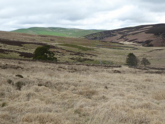
Barrow Hill, located in Northumberland, England, is a prominent hill that stands at an elevation of approximately 260 meters (850 feet) above sea level. It is situated near the village of Rothbury, within the stunning Northumberland National Park. Known for its picturesque landscapes and natural beauty, the hill offers breathtaking panoramic views of the surrounding countryside.
Barrow Hill is a popular destination for outdoor enthusiasts, particularly hikers and walkers, due to its accessibility and well-maintained trails. There are several routes that lead up to the summit, catering to various fitness levels and preferences. The hill's diverse flora and fauna, including heather, grasses, and various bird species, make it an ideal location for nature lovers and birdwatchers.
The hill's historical significance adds to its appeal. It is home to a Bronze Age burial cairn, known as the "Barrow Cairn," which dates back thousands of years. This ancient monument provides insight into the area's rich history and offers a glimpse into the lives of those who once lived in the region.
Barrow Hill is a place of tranquility and serenity, offering visitors a chance to escape the hustle and bustle of everyday life. Its peaceful surroundings and stunning views make it a popular spot for picnics and relaxation. The hill provides a unique opportunity to experience the raw beauty of Northumberland's countryside and immerse oneself in its natural wonders. Whether it's a leisurely stroll or a challenging hike, Barrow Hill is a destination that promises an unforgettable outdoor experience.
If you have any feedback on the listing, please let us know in the comments section below.
Barrow Hill Images
Images are sourced within 2km of 55.334205/-2.1576069 or Grid Reference NT9004. Thanks to Geograph Open Source API. All images are credited.


Barrow Hill is located at Grid Ref: NT9004 (Lat: 55.334205, Lng: -2.1576069)
Unitary Authority: Northumberland
Police Authority: Northumbria
What 3 Words
///abolish.stitch.cakewalk. Near Rochester, Northumberland
Nearby Locations
Related Wikis

Barrow Meadow
Barrow Meadow is a Site of Special Scientific Interest (SSSI) in north Northumberland, England. The site is a species-rich hay meadow of a sort now rare...

River Alwin
The River Alwin is a short, steep upland river that drains the Kidland Forest on the southern flanks of the Cheviot Hills, in the Northumberland National...

Alwinton
Alwinton (previously named "Allenton" and sometimes still referred to as this) is a village and former parish in Northumberland, England. Alwinton is named...

Harbottle Castle
Harbottle Castle is a ruined medieval castle situated at the west end of the village of Harbottle, Northumberland, England, 9 miles (14 km) west-north...

Harbottle
Harbottle is a village and civil parish in Northumberland, England about 10 miles (16 km) south-east of the Scottish border, in the southeastern part of...

Usway Burn
The Usway Burn is an upland river on the southern flanks of the Cheviot Hills, in the Northumberland National Park, England. It is a tributary of the River...
Clennell, Northumberland
Clennell is a small village and as Clennel, a former civil parish, now in the parish of Alwinton, in Northumberland, England. It is about 1 mile (1.6 km...

Clennell Hall
Clennell Hall is an historic manor house, now operated as a country hotel, situated at Clennell, near Alwinton, Northumberland, England. It is a Grade...
Nearby Amenities
Located within 500m of 55.334205,-2.1576069Have you been to Barrow Hill?
Leave your review of Barrow Hill below (or comments, questions and feedback).