Saltridge Hill

Hill, Mountain in Gloucestershire Stroud

England

Saltridge Hill

Stone stile near Bramble Cottage, Cranham GS1081 Stone slab stile off lane Cranham to B4070 near Bramble Cottage, Cranham. On public right of way MCR12
Stone stile near Bramble Cottage, Cranham GS1081 Credit: Hugh Tarran

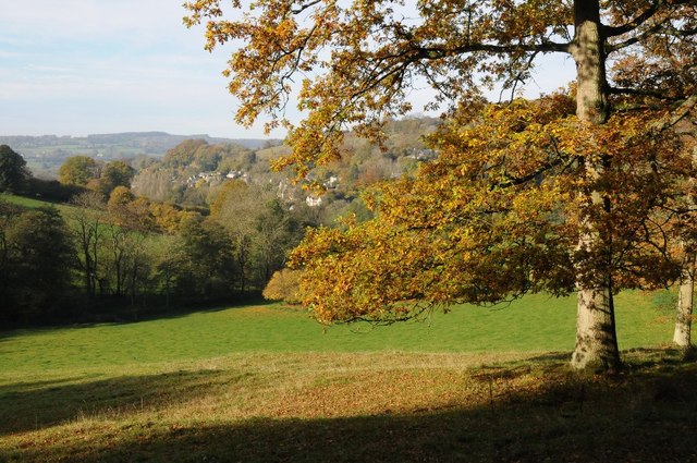
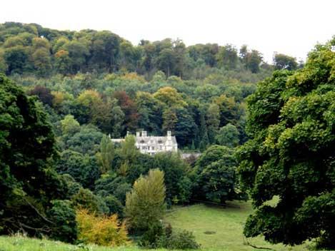
Saltridge Hill is a prominent geographical feature located in the county of Gloucestershire, England. Situated in the picturesque Cotswolds region, this hill is renowned for its stunning natural beauty and panoramic views of the surrounding countryside.

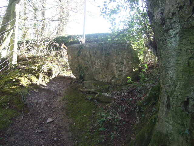
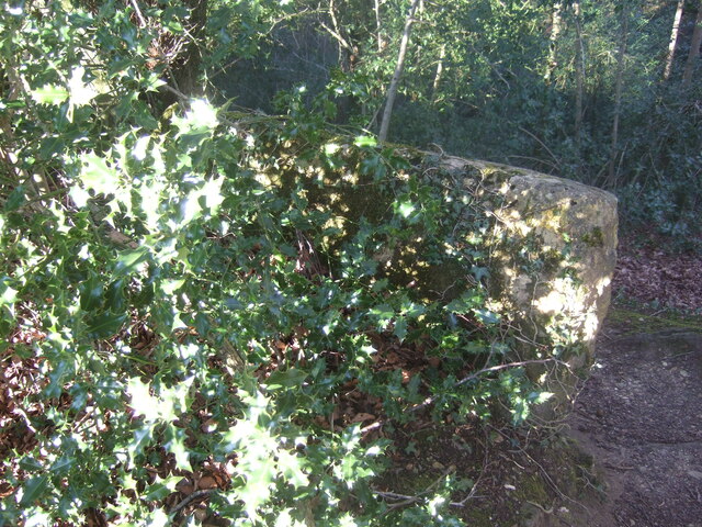
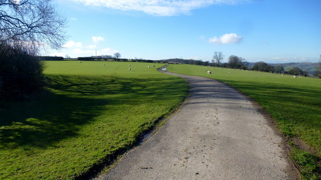
Standing at an elevation of approximately 240 meters (790 feet), Saltridge Hill is a prominent landmark that offers visitors a chance to immerse themselves in the tranquil and idyllic landscapes of Gloucestershire. The hill is composed primarily of limestone, a characteristic feature of the Cotswolds, which gives it a distinct appearance.

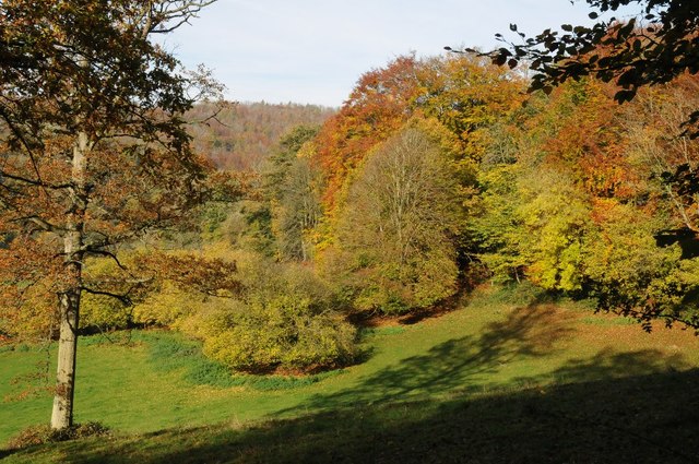
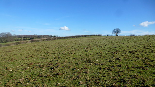
Covered in lush greenery, Saltridge Hill is home to a diverse range of flora and fauna, including wildflowers, oak trees, and various bird species. Its slopes provide a habitat for numerous wildlife species, making it a popular destination for nature enthusiasts and birdwatchers.

Visitors to Saltridge Hill can enjoy a range of recreational activities, such as hiking and walking along the well-maintained paths that wind their way up the hill. These trails offer breathtaking views of the surrounding countryside, including the nearby villages of Winchcombe and Toddington.

Saltridge Hill is also steeped in history, with evidence of human habitation dating back to prehistoric times. The area has yielded archaeological finds, including ancient tools and pottery fragments, indicating its significance as a settlement in the past.

Overall, Saltridge Hill is a captivating destination for those seeking natural beauty, outdoor pursuits, and a connection to the rich history of Gloucestershire. Whether it's a leisurely walk or an exploration of its archaeological significance, Saltridge Hill offers a memorable experience for visitors of all ages.

If you have any feedback on the listing, please let us know in the comments section below.

Saltridge Hill Images

Images are sourced within 2km of 51.800728/-2.1618655 or Grid Reference SO8811. Thanks to Geograph Open Source API. All images are credited.

Stone stile near Bramble Cottage, Cranham GS1081 Stone slab stile off lane Cranham to B4070 near Bramble Cottage, Cranham. On public right of way MCR12
Stone stile near Bramble Cottage, Cranham GS1081
Stone slab stile off lane Cranham to B4070 near Bramble Cottage, Cranham. On public right of way MCR12
Stone stile near Bramble Cottage, Cranham GS1081 Stone slab stile off lane Cranham to B4070 near Bramble Cottage, Cranham. On public right of way MCR12. View from road side
Stone stile near Bramble Cottage, Cranham GS1081
Stone slab stile off lane Cranham to B4070 near Bramble Cottage, Cranham. On public right of way MCR12. View from road side
House on the corner of the B4070  and the Miserden junction
House on the corner of the B4070 and the Miserden junction
Sheepscombe valley Autumn colours in the Sheepscombe valley, viewed from the footpath through the woodland on Elder Hill.
Sheepscombe valley
Autumn colours in the Sheepscombe valley, viewed from the footpath through the woodland on Elder Hill.
Autumn colours on Elder Hill Autumn colours on Elder Hill at the head of the Sheepscombe.
Autumn colours on Elder Hill
Autumn colours on Elder Hill at the head of the Sheepscombe.
Pasture near Overtown Farm The cottages seen are on the Cranham Lane with their backs to Cranham Wood.
Pasture near Overtown Farm
The cottages seen are on the Cranham Lane with their backs to Cranham Wood.
Track and footpath The track leads west towards Overtown; the public path branches off at the end of this field.
Track and footpath
The track leads west towards Overtown; the public path branches off at the end of this field.
Flocking by These animals seemed to be on a mission. they ignored me and passed by very closely.
Beyond is the stone barn described brilliantly in Derek's photo from 2010; <a href="https://www.geograph.org.uk/photo/2219521">SO9012 : Barn and cattle shed, Overtown</a>.
Flocking by
These animals seemed to be on a mission. they ignored me and passed by very closely. Beyond is the stone barn described brilliantly in Derek's photo from 2010; SO9012 : Barn and cattle shed, Overtown.
Pasture above Overtown, 2 Five steps east of <a href="https://www.geograph.org.uk/photo/4827938">SO8911 : Pasture above Overtown, 1</a> and facing east into the adjacent gridsquare.
There is a glimpse of Overtown Farm.
Pasture above Overtown, 2
Five steps east of SO8911 : Pasture above Overtown, 1 and facing east into the adjacent gridsquare. There is a glimpse of Overtown Farm.
Pasture above Overtown, 3 Looking south-east into the sun on the Cotswolds plateau.
Five steps east of <a href="https://www.geograph.org.uk/photo/4827938">SO8911 : Pasture above Overtown, 1</a>.
Pasture above Overtown, 3
Looking south-east into the sun on the Cotswolds plateau. Five steps east of SO8911 : Pasture above Overtown, 1.
Exercising the hounds The local hunt is above Overtown on this glorious winter morning.
Exercising the hounds
The local hunt is above Overtown on this glorious winter morning.
An interesting manoeuvre on the B4070, 1 A fast stretch of road with a deceptively close bend up ahead.
See <a href="https://www.geograph.org.uk/photo/4865641">SO9010 : An interesting manoeuvre on the B4070, 2</a> taken 2 seconds later.
An interesting manoeuvre on the B4070, 1
A fast stretch of road with a deceptively close bend up ahead. See SO9010 : An interesting manoeuvre on the B4070, 2 taken 2 seconds later.
An interesting manoeuvre on the B4070, 2 Photo taken 2 seconds after <a href="https://www.geograph.org.uk/photo/4865639">SO9010 : An interesting manoeuvre on the B4070, 1</a>.
An interesting manoeuvre on the B4070, 2
Old Milestone by the B4070, east of Sheepscombe Metal plate attached to stone post by the B4070, in parish of MISERDEN (STROUD District), Sheepscombe; 250m West of crossroads to Sheepscombe and Miserden, on the verge, on South side of road. Lightpill plate, erected by the Lightpill & Birdlip turnpike trust in the 19th century. 

Inscription reads:-
CHELTM.
9
STROUD
5  
Carved benchmark and rivet on top.

Milestone Society National ID: GL_SDCM05.
Old Milestone by the B4070, east of Sheepscombe
Metal plate attached to stone post by the B4070, in parish of MISERDEN (STROUD District), Sheepscombe; 250m West of crossroads to Sheepscombe and Miserden, on the verge, on South side of road. Lightpill plate, erected by the Lightpill & Birdlip turnpike trust in the 19th century. Inscription reads:- CHELTM. 9 STROUD 5 Carved benchmark and rivet on top. Milestone Society National ID: GL_SDCM05.
Stone Stile off B4070 between Sheepscombe/Camp junctions  GS9252 Stone slab stile off B4070 between Sheepscombe and Camp junctions. On public right of way MMN52. View from field to road
Stone Stile off B4070 between Sheepscombe/Camp junctions GS9252
Stone slab stile off B4070 between Sheepscombe and Camp junctions. On public right of way MMN52. View from field to road
Stone Stile off B4070 between Sheepscombe/Camp junctions  GS9252 Stone slab stile off B4070 between Sheepscombe and Camp junctions. On public right of way MMN52
Stone Stile off B4070 between Sheepscombe/Camp junctions GS9252
Stone slab stile off B4070 between Sheepscombe and Camp junctions. On public right of way MMN52
Valley to the east of Painswick View across the valley to the east of Painswick to Longridge and Backstable Wood.
Valley to the east of Painswick
View across the valley to the east of Painswick to Longridge and Backstable Wood.
Footpath and stile at Cockshoot Painswick Lodge can be seen just to the right of the signpost.
Footpath and stile at Cockshoot
Painswick Lodge can be seen just to the right of the signpost.
Show me another place!

Saltridge Hill is located at Grid Ref: SO8811 (Lat: 51.800728, Lng: -2.1618655)

Administrative County: Gloucestershire

District: Stroud

Police Authority: Gloucestershire

What 3 Words

///observes.domain.polite. Near Painswick, Gloucestershire

Related Wikis

Painswick Lodge

Painswick Lodge is a grade I listed house in Painswick, Gloucestershire, England. The rubble stone building, which has been extensively reworked and remodelled...

Sheepscombe

Sheepscombe is a small village in the civil parish of Painswick, in the Stroud district, in the county of Gloucestershire, England. Sheepscombe is located...

Workmans Wood, Sheepscombe

Workmans Wood (grid reference SO900109) is a wood just to the east of the village of Sheepscombe, in the Cotswolds, Gloucestershire. It is a biological...

Cranham, Gloucestershire

Cranham is a village in the English county of Gloucestershire. Forming part of the district of Stroud it is to be found a mile or so east of the A46 road...

Cotswold Commons and Beechwoods

Cotswold Commons and Beechwoods (grid reference SO900130) is a 665.5-hectare (1,644-acre) biological Site of Special Scientific Interest in Gloucestershire...

Kimsbury hill fort

Kimsbury hill fort, also known as Castle Godwyn, Kimsbury Camp, Painswick Beacon or Painswick hill fort is an Iron Age hill fort on Painswick Beacon near...

Prinknash Abbey

Prinknash Abbey (pronounced locally variously as "Prinidge/Prinnish") (IPA: ) is a Roman Catholic monastery in the Vale of Gloucester in the Diocese of...

Painswick House

Painswick House is a grade I listed house in Painswick, Gloucestershire, England. It is surrounded by a Grade II* listed rococo garden.The house and a...

Nearby Amenities

Located within 500m of 51.800728,-2.1618655
Saltridge Hill
Created By: Potlatch 0.10f
Ele: 260
Natural: peak
Note: Ele guestimated from NPE 862 ft
Source: NPE+local knowledge
Lat/Long: 51.8005134/-2.1621895
Batch Farm
Landuse: farm
Note Retag: CS #48756035
Source: OS OpenData StreetView
Lat/Long: 51.8050307/-2.1625209
Bench
Backrest: no
Lat/Long: 51.7973171/-2.1656924
Bench
Backrest: no
Lat/Long: 51.7972396/-2.1651289
Tourism: viewpoint
Lat/Long: 51.7972289/-2.1650044
The data included in this document is from www.openstreetmap.org. The data is made available under ODbL.

Have you been to Saltridge Hill?

Leave your review of Saltridge Hill below (or comments, questions and feedback).