Sinkside Hill

Hill, Mountain in Northumberland

England

Sinkside Hill

Water Mint, Wide Open There are about 14 or 15 species of mint growing in the UK, most of which have very aromatic leaves. Water Mint unsurprisingly prefers damp habitats and grows in water, as is demonstrated by this example which was close to where the watercourse through Wide Open meets with the Trowup Burn. The leaves can be used in the same way as other mints, flavouring cooking and drinks. It flowers from July to October and spreads vigorously using its creeping runners. For a selection of detailed free to download walking routes in the area visit <span class="nowrap"><a title="www.cheviotwalks.co.uk" rel="nofollow ugc noopener" href="http://www.cheviotwalks.co.uk">Link</a><img style="margin-left:2px;" alt="External link" title="External link - shift click to open in new window" src="https://s1.geograph.org.uk/img/external.png" width="10" height="10"/></span>
Water Mint, Wide Open Credit: Geoff Holland

Sinkside Hill is a prominent hill located in Northumberland, England. It stands at an elevation of approximately 345 meters above sea level and offers stunning views of the surrounding countryside. The hill is characterized by its gentle slopes and grassy terrain, making it a popular destination for hikers and nature enthusiasts.

Sinkside Hill is part of the Northumberland National Park, which is known for its rugged landscapes and diverse wildlife. The hill is home to a variety of plant and animal species, including heather, gorse, and various bird species.

Visitors to Sinkside Hill can enjoy a leisurely walk or hike along its well-marked trails, taking in the picturesque scenery along the way. On a clear day, it is possible to see as far as the Cheviot Hills and the Scottish border.

The hill is easily accessible by car, with parking available at the base of the hill. There are also nearby amenities, such as picnic areas and restrooms, making it a convenient location for a day out in nature.

Overall, Sinkside Hill offers a peaceful and scenic retreat for those looking to explore the natural beauty of Northumberland.

If you have any feedback on the listing, please let us know in the comments section below.

Sinkside Hill Images

Images are sourced within 2km of 55.530123/-2.1850048 or Grid Reference NT8826. Thanks to Geograph Open Source API. All images are credited.

Water Mint, Wide Open There are about 14 or 15 species of mint growing in the UK, most of which have very aromatic leaves. Water Mint unsurprisingly prefers damp habitats and grows in water, as is demonstrated by this example which was close to where the watercourse through Wide Open meets with the Trowup Burn. The leaves can be used in the same way as other mints, flavouring cooking and drinks. It flowers from July to October and spreads vigorously using its creeping runners. For a selection of detailed free to download walking routes in the area visit <span class="nowrap"><a title="www.cheviotwalks.co.uk" rel="nofollow ugc noopener" href="http://www.cheviotwalks.co.uk">Link</a><img style="margin-left:2px;" alt="External link" title="External link - shift click to open in new window" src="https://s1.geograph.org.uk/img/external.png" width="10" height="10"/></span>
Water Mint, Wide Open
There are about 14 or 15 species of mint growing in the UK, most of which have very aromatic leaves. Water Mint unsurprisingly prefers damp habitats and grows in water, as is demonstrated by this example which was close to where the watercourse through Wide Open meets with the Trowup Burn. The leaves can be used in the same way as other mints, flavouring cooking and drinks. It flowers from July to October and spreads vigorously using its creeping runners. For a selection of detailed free to download walking routes in the area visit LinkExternal link
Cairn on Shorthope Shank This is the same cairn as is shown at <a title="https://www.geograph.org.uk/photo/1923026" href="https://www.geograph.org.uk/photo/1923026">Link</a> but looking in the opposite direction. For a selection of detailed free to download walking routes in the area visit <span class="nowrap"><a title="www.cheviotwalks.co.uk" rel="nofollow ugc noopener" href="http://www.cheviotwalks.co.uk">Link</a><img style="margin-left:2px;" alt="External link" title="External link - shift click to open in new window" src="https://s1.geograph.org.uk/img/external.png" width="10" height="10"/></span>
Cairn on Shorthope Shank
This is the same cairn as is shown at Link but looking in the opposite direction. For a selection of detailed free to download walking routes in the area visit LinkExternal link
Forest Track, Sinkside Hill This track connects the College Valley with the isolated farm of Trowupburn with onward access to the border ridge. The hill in the background is The Cheviot with the raised fist of Braydon Crag prominent. For a selection of detailed free to download walking routes in the area visit <span class="nowrap"><a title="www.cheviotwalks.co.uk" rel="nofollow ugc noopener" href="http://www.cheviotwalks.co.uk">Link</a><img style="margin-left:2px;" alt="External link" title="External link - shift click to open in new window" src="https://s1.geograph.org.uk/img/external.png" width="10" height="10"/></span>
Forest Track, Sinkside Hill
This track connects the College Valley with the isolated farm of Trowupburn with onward access to the border ridge. The hill in the background is The Cheviot with the raised fist of Braydon Crag prominent. For a selection of detailed free to download walking routes in the area visit LinkExternal link
Old power line poles, Hethpool By the College Valley carpark.  An illustration of what lies under the ground.
A new 11kV line is being installed after the old one was destroyed by the November 26th 2021 "Arwen" storm. All the properties were on generators at the time of visit.
Old power line poles, Hethpool
By the College Valley carpark. An illustration of what lies under the ground. A new 11kV line is being installed after the old one was destroyed by the November 26th 2021 "Arwen" storm. All the properties were on generators at the time of visit.
Building a new power line, College Valley A new 11kV line is being installed after the old one was destroyed by the November 26th 2021 "Arwen" storm. All the properties were on generators at the time of visit.
Building a new power line, College Valley
A new 11kV line is being installed after the old one was destroyed by the November 26th 2021 "Arwen" storm. All the properties were on generators at the time of visit.
College Burn The College Burn amongst some of the new native woodlands planted in and around the College Valley.
College Burn
The College Burn amongst some of the new native woodlands planted in and around the College Valley.
Sinkside Hill The woodland was devastated by the 26th November 2021 "Arwen" storm. As a result of the windthrow here and elsewhere the power line up the College Valley was destroyed. Work was still taking place building a new line as well as forestry work, clearing the windthrow.
Sinkside Hill
The woodland was devastated by the 26th November 2021 "Arwen" storm. As a result of the windthrow here and elsewhere the power line up the College Valley was destroyed. Work was still taking place building a new line as well as forestry work, clearing the windthrow.
The road up the College Valley
Screes, Great Hetha
Screes, Great Hetha
Southern slopes of Great Hetha, College Valley The vehicles are used by the team replacing the power lines up the College which were destroyed in a storm in November 2021.
Southern slopes of Great Hetha, College Valley
The vehicles are used by the team replacing the power lines up the College which were destroyed in a storm in November 2021.
Sinkside Hill The woodland was devastated by the 26th November 2021 "Arwen" storm. As a result of the windthrow here and elsewhere the power line up the College Valley was destroyed. Work was still taking place building a new line as well as forestry work, clearing the windthrow.
Sinkside Hill
The woodland was devastated by the 26th November 2021 "Arwen" storm. As a result of the windthrow here and elsewhere the power line up the College Valley was destroyed. Work was still taking place building a new line as well as forestry work, clearing the windthrow.
Clearing up after Arwen, Sinkside Hill The woodland was devastated by the 26th November 2021 "Arwen" storm. As a result of the windthrow here and elsewhere the power line up the College Valley was destroyed. Work was still taking place building a new line as well as forestry work, clearing the windthrow.  A new pole is being put up after the windthrow has been cleared.
Clearing up after Arwen, Sinkside Hill
The woodland was devastated by the 26th November 2021 "Arwen" storm. As a result of the windthrow here and elsewhere the power line up the College Valley was destroyed. Work was still taking place building a new line as well as forestry work, clearing the windthrow. A new pole is being put up after the windthrow has been cleared.
Clearing windthrow, Sinkside Hill After the fallen timber has been cleared away the new poles for the power line will go up. The old power line was destroyed in a storm in November 2021 ("Arwen") and work was taking place on the replacement. The inhabitants of the College Valley were using generators.
Clearing windthrow, Sinkside Hill
After the fallen timber has been cleared away the new poles for the power line will go up. The old power line was destroyed in a storm in November 2021 ("Arwen") and work was taking place on the replacement. The inhabitants of the College Valley were using generators.
Road, College Valley A private road, in excellent condition. Just about everything is excellent here (other than the storm devastated power supply which was being replaced)
Road, College Valley
A private road, in excellent condition. Just about everything is excellent here (other than the storm devastated power supply which was being replaced)
Cottage with generators, College Valley The power lines, brought down in a storm in November 2021 were being replaced. Emergency diesel generators were being used.
Cottage with generators, College Valley
The power lines, brought down in a storm in November 2021 were being replaced. Emergency diesel generators were being used.
Foot of Blackhaggs Rigg College Valley. We are in the land of the double "g" here.
Foot of Blackhaggs Rigg
College Valley. We are in the land of the double "g" here.
Stell, College Valley The usual round sheepfold with the rapidly growing new native woodlands beyond.
Stell, College Valley
The usual round sheepfold with the rapidly growing new native woodlands beyond.
Young woodland, College Valley Native woodland planted own the lower slopes of Hare Law.
Young woodland, College Valley
Native woodland planted own the lower slopes of Hare Law.
Show me another place!

Sinkside Hill is located at Grid Ref: NT8826 (Lat: 55.530123, Lng: -2.1850048)

Unitary Authority: Northumberland

Police Authority: Northumbria

What 3 Words

///somewhere.burden.colonies. Near Kirknewton, Northumberland

Related Wikis

College Valley

The College Valley is one of five cuttings into the Cheviot Hills. The valley is owned by College Valley Estates which in turn is funded by a trust created...
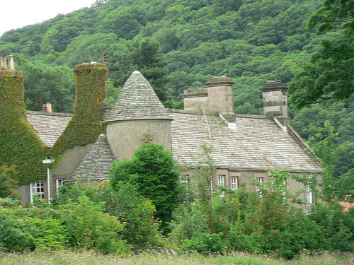
Hethpool House

Hethpool House is an Edwardian house in Hethpool, in the civil parish of Kirknewton, near Wooler, Northumberland, England which has Grade II listed building...

Newton Tors

The Newton Tors are large, free-standing residual masses (rock outcrop) that form the western rim of the Great Moor which runs from the market town of...

Westnewton, Northumberland

Westnewton is a small hamlet comprising around 8 houses and a manse to the west of the village of Kirknewton, in the civil parish of Kirknewton, in the...

Nearby Amenities

Located within 500m of 55.530123,-2.1850048
Whitehall
Place: locality
Lat/Long: 55.5284885/-2.1784567
Sinkside Hill Hillfort
Archaeological Site: fortification
Historic: archaeological_site
Lat/Long: 55.5302652/-2.1850551
Power: pole
Lat/Long: 55.5264887/-2.1803844
Power: pole
Lat/Long: 55.5273557/-2.1802104
Power: pole
Lat/Long: 55.5280397/-2.180069
Power: pole
Lat/Long: 55.5288538/-2.1798924
Power: pole
Lat/Long: 55.529684/-2.1797289
Power: pole
Lat/Long: 55.5304965/-2.1795627
Power: pole
Lat/Long: 55.5321404/-2.1791961
The data included in this document is from www.openstreetmap.org. The data is made available under ODbL.

Have you been to Sinkside Hill?

Leave your review of Sinkside Hill below (or comments, questions and feedback).