Chatterley Whitfield Hill

Hill, Mountain in Staffordshire

England

Chatterley Whitfield Hill

Foaming Quart Taken during a walk so position could be wrong. I remember the area being a flat river valley (very small Trent just South). There is a climb to the pub marked on the map which is at the crossroads.
Foaming Quart Credit: Stephen Darlington

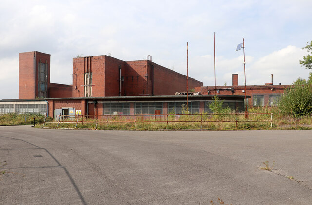
Chatterley Whitfield Hill is a prominent landmark located in Staffordshire, England. It is not a typical hill or mountain but rather a spoil heap that was created as a result of extensive coal mining activities in the area. The hill is named after the nearby Chatterley Whitfield Colliery, which was once one of the largest and most productive coal mines in the country.

The spoil heap, also known as a slag heap or spoil tip, is a large mound of waste material, including rocks, soil, and coal dust, that was left behind after the mining operations ceased. Over time, the heap has become covered in vegetation, giving it a green and somewhat natural appearance.

Chatterley Whitfield Hill stands at an elevation of approximately 100 meters (330 feet) and covers a considerable area. Its distinctive shape and size make it a recognizable feature of the local landscape. The hill offers panoramic views of the surrounding countryside and provides a unique insight into the region's industrial heritage.

Although Chatterley Whitfield Colliery closed in 1977, the hill remains as a reminder of the once-thriving coal mining industry that was instrumental in the development of Staffordshire. Today, the site is designated as a Scheduled Ancient Monument and is open to the public as a heritage attraction. Visitors can explore the hill, learn about the history of the colliery, and gain an understanding of the importance of coal mining in the region.

If you have any feedback on the listing, please let us know in the comments section below.

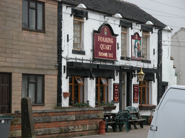
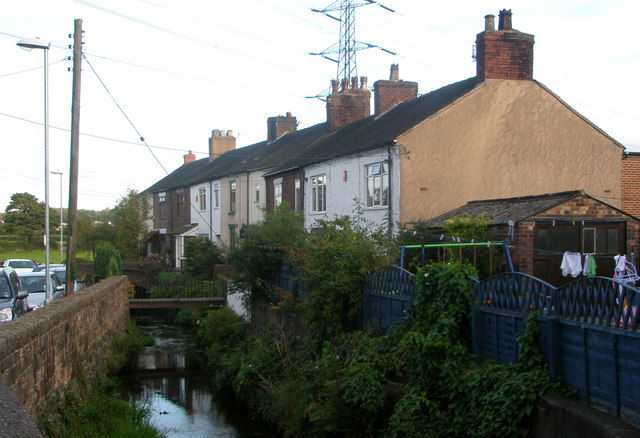
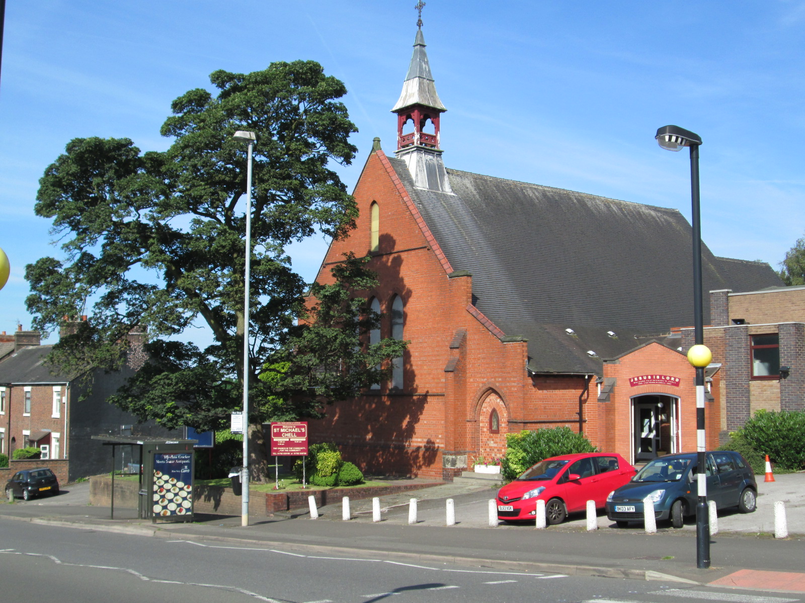
Chatterley Whitfield Hill Images

Images are sourced within 2km of 53.073472/-2.1758889 or Grid Reference SJ8852. Thanks to Geograph Open Source API. All images are credited.

Foaming Quart Taken during a walk so position could be wrong. I remember the area being a flat river valley (very small Trent just South). There is a climb to the pub marked on the map which is at the crossroads.
Foaming Quart
Taken during a walk so position could be wrong. I remember the area being a flat river valley (very small Trent just South). There is a climb to the pub marked on the map which is at the crossroads.
Trent Terrace, Norton Green Aptly named as that is the River Trent that the residents have to cross to get their cottages.
Trent Terrace, Norton Green
Aptly named as that is the River Trent that the residents have to cross to get their cottages.
Foaming Quart, Norton Green This inn is the setting off point for April Cruises on the Caldon Canal. In 1982/83 its darts team was represented by Eric Bristow, winning the 'News of the World' tournament.
Foaming Quart, Norton Green
This inn is the setting off point for April Cruises on the Caldon Canal. In 1982/83 its darts team was represented by Eric Bristow, winning the 'News of the World' tournament.
Bridge over the River Trent
River Trent downstream of Trent Terrace - Norton Green Curiously the river takes a sharp turn to flow in a channel in front of these properties and then takes another sharp turn at the end of the terrace. The river was probably diverted to operate a forge and maybe this was originally a bypass channel.
River Trent downstream of Trent Terrace - Norton Green
Curiously the river takes a sharp turn to flow in a channel in front of these properties and then takes another sharp turn at the end of the terrace. The river was probably diverted to operate a forge and maybe this was originally a bypass channel.
Chatterley Whitfield Colliery - boiler house This is the most complete colliery site in the UK and is a Scheduled Ancient Monument. It was run as a museum but went bust and has been deteriorating ever since despite the best efforts of a Friends group. This building that looks like a small wood from above is the roofless boiler house. This boiler house was built in 1938 and contained ten large Lancashire boilers that provided steam for winding engines, compressors and mixed pressure turbines to generate electricity. On the right is part of an old power house building where electricity for surface use was first generated in 1900.
Chatterley Whitfield Colliery - boiler house
This is the most complete colliery site in the UK and is a Scheduled Ancient Monument. It was run as a museum but went bust and has been deteriorating ever since despite the best efforts of a Friends group. This building that looks like a small wood from above is the roofless boiler house. This boiler house was built in 1938 and contained ten large Lancashire boilers that provided steam for winding engines, compressors and mixed pressure turbines to generate electricity. On the right is part of an old power house building where electricity for surface use was first generated in 1900.
Chatterley Whitfield Colliery - endless rope haulage house This building contains an electrically driven endless rope haulage that operated down the Middle Pit. The rope passed down the shaft, along the underground roadways and back again. The rope moved continuously and mine cares were connected on and off as required. The Middle Pit was closed and the headgear demolished in 1968. This is a surprising survivor.

Since its closure as a museum the site has become an overgrown wreck and the volunteer Friends group are allowed access to very few buildings. This was a special Heritage Open Days guided tour around the accessible parts of the pit surface.
Chatterley Whitfield Colliery - endless rope haulage house
This building contains an electrically driven endless rope haulage that operated down the Middle Pit. The rope passed down the shaft, along the underground roadways and back again. The rope moved continuously and mine cares were connected on and off as required. The Middle Pit was closed and the headgear demolished in 1968. This is a surprising survivor. Since its closure as a museum the site has become an overgrown wreck and the volunteer Friends group are allowed access to very few buildings. This was a special Heritage Open Days guided tour around the accessible parts of the pit surface.
Chatterley Whitfield Colliery - Institute Shaft winding engine house Unfortunately the undergrowth, restricted access and the location of the sun all made photography of the various shaft headgears very awkward and unrewarding. The profusion of Heras fencing on the site didn't help. The shaft was originally known as the Bellringer as it was sunk to the Bellringer coal seam at a depth of 80 yards in 1860. It was deepened to 440 yards in 1874. It originally had a wooden headframe and a vertical steam winding engine but now has an electric winding house and steel lattice girder headframe.

This site is a Scheduled Ancient Monument and the most complete collection of colliery surface building in the UK but its future looks bleak despite the hard work of a Friends group.
Chatterley Whitfield Colliery - Institute Shaft winding engine house
Unfortunately the undergrowth, restricted access and the location of the sun all made photography of the various shaft headgears very awkward and unrewarding. The profusion of Heras fencing on the site didn't help. The shaft was originally known as the Bellringer as it was sunk to the Bellringer coal seam at a depth of 80 yards in 1860. It was deepened to 440 yards in 1874. It originally had a wooden headframe and a vertical steam winding engine but now has an electric winding house and steel lattice girder headframe. This site is a Scheduled Ancient Monument and the most complete collection of colliery surface building in the UK but its future looks bleak despite the hard work of a Friends group.
Chatterley Whitfield Colliery - Winstanley Shaft This was once used by visitors to the former museum to access the underground experience some 700 feet down. Unfortunately the closure of Wolstanton Colliery flooded this experience and a new 'fake' underground was created by the Institute shaft. Following the closure of the mine this was demolished although a small part remained hidden in the fan drift.

The Winstanley Shaft was sunk in 1914 and was 235 yards deep. It was only ever used for men and material and is an unusual continental design with the headgear enclosed in brick. This view was against the light and is better in monochrome with some adjustment.

This was a special guided tour for Heritage Open Days. These always book up as there is still plenty of interest in this gradually deteriorating site.
Chatterley Whitfield Colliery - Winstanley Shaft
This was once used by visitors to the former museum to access the underground experience some 700 feet down. Unfortunately the closure of Wolstanton Colliery flooded this experience and a new 'fake' underground was created by the Institute shaft. Following the closure of the mine this was demolished although a small part remained hidden in the fan drift. The Winstanley Shaft was sunk in 1914 and was 235 yards deep. It was only ever used for men and material and is an unusual continental design with the headgear enclosed in brick. This view was against the light and is better in monochrome with some adjustment. This was a special guided tour for Heritage Open Days. These always book up as there is still plenty of interest in this gradually deteriorating site.
Chatterley Whitfield Enterprise Centre This is run by Stoke City Council and is in the former Art Deco offices of the Chatterley Whitfield Colliery. The ground floor is in good order and we assembled there for a Heritage Open Days tour of the surface structures of the colliery. This had been a museum site until 1993 but the deterioration since has been unrelenting and the Friends group have access to very few buildings indeed and there is much Heras fencing to keep people out (less successfully for urban explorers, thieves and vandals). The first floor of this building is apparently not used due to water ingress.
Chatterley Whitfield Enterprise Centre
This is run by Stoke City Council and is in the former Art Deco offices of the Chatterley Whitfield Colliery. The ground floor is in good order and we assembled there for a Heritage Open Days tour of the surface structures of the colliery. This had been a museum site until 1993 but the deterioration since has been unrelenting and the Friends group have access to very few buildings indeed and there is much Heras fencing to keep people out (less successfully for urban explorers, thieves and vandals). The first floor of this building is apparently not used due to water ingress.
Chatterley Whitfield Colliery - pit head baths These were built as recently as 1938 and miners had to pay to use them before nationalisation. These contained showers and over 4000 lockers split between clean and dirty. The single storey section to the right of the door is the canteen. The section to the left is where miners went to be allocated tasks for the day. It is now a display area with some artefacts and many maps and plans. It is not possible to enter the shower and locker area due to deterioration. Some limited repairs have been made to the entrance area so that visitors can at least get a glimpse.
Chatterley Whitfield Colliery - pit head baths
These were built as recently as 1938 and miners had to pay to use them before nationalisation. These contained showers and over 4000 lockers split between clean and dirty. The single storey section to the right of the door is the canteen. The section to the left is where miners went to be allocated tasks for the day. It is now a display area with some artefacts and many maps and plans. It is not possible to enter the shower and locker area due to deterioration. Some limited repairs have been made to the entrance area so that visitors can at least get a glimpse.
Chatterley Whitfield Colliery - lamp house This once held sufficient batteries and cap lamps for up to 3,500 men. Just a few racks remain in the background. This used to be the entrance building for the site when it was museum from 1978 to 1993. This was a guided tour for Heritage Open Days and our guide was explaining the purpose of the lamp room along with safety lamps, contraband and pit checks or tallies. When the museum included an underground visit (700' down), visitors had to be supplied with a lamp and a self-rescuer. They were heavy items too. 

Seeing the state of this site was saddening and it is hard to see it surviving in the long-term without an injection of cash in the hundreds of millions of pounds.
Chatterley Whitfield Colliery - lamp house
This once held sufficient batteries and cap lamps for up to 3,500 men. Just a few racks remain in the background. This used to be the entrance building for the site when it was museum from 1978 to 1993. This was a guided tour for Heritage Open Days and our guide was explaining the purpose of the lamp room along with safety lamps, contraband and pit checks or tallies. When the museum included an underground visit (700' down), visitors had to be supplied with a lamp and a self-rescuer. They were heavy items too. Seeing the state of this site was saddening and it is hard to see it surviving in the long-term without an injection of cash in the hundreds of millions of pounds.
Chatterley Whitfield Colliery This view from the Enterprise Centre car park shows a few significant features of this large site. The building left background is the Hesketh powerhouse. The building centre with the north-light roof is the lamp room that used to also be the museum's main entrance and shop area. Rising above that are the roofs of some workshops. The building on the right is in front of the very derelict, roofless and overgrown boiler house. Three of the four pit head gears are visible and from left to right they are Hesketh, Platt and Institute. Also rising up between the two left hand head gears is the fan evasee of the Institute shaft fan.
Chatterley Whitfield Colliery
This view from the Enterprise Centre car park shows a few significant features of this large site. The building left background is the Hesketh powerhouse. The building centre with the north-light roof is the lamp room that used to also be the museum's main entrance and shop area. Rising above that are the roofs of some workshops. The building on the right is in front of the very derelict, roofless and overgrown boiler house. Three of the four pit head gears are visible and from left to right they are Hesketh, Platt and Institute. Also rising up between the two left hand head gears is the fan evasee of the Institute shaft fan.
Chatterley Whitfield Colliery This shows a corner of this large and derelict site that is beset with Heras fencing. The large sheds are workshop buildings and on the left is the brick enclosed Winstanley Shaft head gear with foliage among the sheaves.
Chatterley Whitfield Colliery
This shows a corner of this large and derelict site that is beset with Heras fencing. The large sheds are workshop buildings and on the left is the brick enclosed Winstanley Shaft head gear with foliage among the sheaves.
Chatterley Whitfield Colliery - Hesketh head gear This shaft was sunk 1914-17 and is 640 yards deep, the deepest on site. The shaft is now sealed by a concrete cap. The ropes lead down to the drum of a steam winding engine. Urban explorers have been up here and reported it swaying in the wind.

Seen on a Heritage open Day guided tour by the Friends group. The site is very overgrown and unsafe with very little access to the buildings (except for urban explorers, thieves and vandals).
Chatterley Whitfield Colliery - Hesketh head gear
This shaft was sunk 1914-17 and is 640 yards deep, the deepest on site. The shaft is now sealed by a concrete cap. The ropes lead down to the drum of a steam winding engine. Urban explorers have been up here and reported it swaying in the wind. Seen on a Heritage open Day guided tour by the Friends group. The site is very overgrown and unsafe with very little access to the buildings (except for urban explorers, thieves and vandals).
Chatterley diesel power station Operated by Conrad Energy, Chatterley is an 8 generator 20 MW plant located on the former Chatterley Whitfield Colliery on land owned by Stoke City Council. The generators were built by Rolls Royce subsidiary MTU and containerised in the UK.
Chatterley diesel power station
Operated by Conrad Energy, Chatterley is an 8 generator 20 MW plant located on the former Chatterley Whitfield Colliery on land owned by Stoke City Council. The generators were built by Rolls Royce subsidiary MTU and containerised in the UK.
Chatterley Whitfield Colliery - Institute shaft head gear This is an upcast shaft with a modern lattice girder construction. The shaft was sunk in 1860 to 80 yards and deepened to 440 yards in 1874. A substantial platform was built in the shaft at 235 yards to isolate the museum underground from the deeper redundant levels. This view well shows how nature is reclaiming the site. Trailing brambles are a real issue underfoot.
Chatterley Whitfield Colliery - Institute shaft head gear
This is an upcast shaft with a modern lattice girder construction. The shaft was sunk in 1860 to 80 yards and deepened to 440 yards in 1874. A substantial platform was built in the shaft at 235 yards to isolate the museum underground from the deeper redundant levels. This view well shows how nature is reclaiming the site. Trailing brambles are a real issue underfoot.
Chatterley Whitfield Colliery - Institute Shaft fan Behind the three men is the fan drift that conducts air from the fan drift to the electric fan. The rusty chimney-like structure is the exhaust evasee from the fan. The fan drift was later adapted to contain part of the 'fake underground'. Most of this was in an area that was subsequently demolished but urban explorers have rediscovered the remnant, much to the surprise of the Friends group that is trying to save the site. 

Seen during a Heritage Open Day guided tour. These are very popular and are always fully booked. The Heras Fencing was a nuisance to the photographers and the lighting was also variably trying.
Chatterley Whitfield Colliery - Institute Shaft fan
Behind the three men is the fan drift that conducts air from the fan drift to the electric fan. The rusty chimney-like structure is the exhaust evasee from the fan. The fan drift was later adapted to contain part of the 'fake underground'. Most of this was in an area that was subsequently demolished but urban explorers have rediscovered the remnant, much to the surprise of the Friends group that is trying to save the site. Seen during a Heritage Open Day guided tour. These are very popular and are always fully booked. The Heras Fencing was a nuisance to the photographers and the lighting was also variably trying.
Show me another place!

Chatterley Whitfield Hill is located at Grid Ref: SJ8852 (Lat: 53.073472, Lng: -2.1758889)

Unitary Authority: Stoke-on-Trent

Police Authority: Staffordshire

What 3 Words

///habit.target.vote. Near Tunstall, Staffordshire

Nearby Locations

Chatterley Whitfield Hill

Related Wikis

Chatterley Whitfield

Chatterley Whitfield Colliery is a disused coal mine on the outskirts of Chell, Staffordshire in Stoke on Trent, England. It was the largest mine working...

Whitfield Valley

Whitfield Valley is a local nature reserve on the northern fringe of Stoke-on-Trent, England. == Description == The reserve, of area 91.15 hectares (225...

Ridgeway, Staffordshire

Ridgeway is a hamlet on the boundary of Brown Edge and Stoke-on-Trent in Staffordshire, England. == References ==

Chell, Staffordshire

Chell is a suburb of the city of Stoke-on-Trent in the ceremonial county of Staffordshire, England, that can be subdivided into Little Chell, Great Chell...

Nearby Amenities

Located within 500m of 53.073472,-2.1758889
Turning Circle
Lat/Long: 53.070504/-2.179925
Barrier: cycle_barrier
Lat/Long: 53.0730945/-2.1823475
Barrier: bollard
Bicycle: yes
Foot: yes
Lat/Long: 53.070081/-2.1806079
Barrier: kissing_gate
Lat/Long: 53.0775029/-2.1773728
Tourism: viewpoint
Lat/Long: 53.0732412/-2.1765814
Generator Method: photovoltaic
Generator Output Electricity: yes
Generator Source: solar
Generator Type: solar_photovoltaic_panel
Location: roof
Power: generator
Lat/Long: 53.0717958/-2.1818483
Generator Method: photovoltaic
Generator Output Electricity: yes
Generator Source: solar
Generator Type: solar_photovoltaic_panel
Location: roof
Power: generator
Lat/Long: 53.0718297/-2.1815908
Generator Method: photovoltaic
Generator Output Electricity: yes
Generator Source: solar
Generator Type: solar_photovoltaic_panel
Location: roof
Power: generator
Lat/Long: 53.0718522/-2.181277
Generator Method: photovoltaic
Generator Output Electricity: yes
Generator Source: solar
Generator Type: solar_photovoltaic_panel
Location: roof
Power: generator
Lat/Long: 53.0718474/-2.1811831
Generator Method: photovoltaic
Generator Output Electricity: yes
Generator Source: solar
Generator Type: solar_photovoltaic_panel
Location: roof
Power: generator
Lat/Long: 53.0716508/-2.180703
Generator Method: photovoltaic
Generator Output Electricity: yes
Generator Source: solar
Generator Type: solar_photovoltaic_panel
Location: roof
Power: generator
Lat/Long: 53.0711577/-2.179386
Generator Method: photovoltaic
Generator Output Electricity: yes
Generator Source: solar
Generator Type: solar_photovoltaic_panel
Location: roof
Power: generator
Lat/Long: 53.0709143/-2.1797106
Generator Method: photovoltaic
Generator Output Electricity: yes
Generator Source: solar
Generator Type: solar_photovoltaic_panel
Location: roof
Power: generator
Lat/Long: 53.070895/-2.1797991
Generator Method: photovoltaic
Generator Output Electricity: yes
Generator Source: solar
Generator Type: solar_photovoltaic_panel
Location: roof
Power: generator
Lat/Long: 53.0704276/-2.1786109
Generator Method: photovoltaic
Generator Output Electricity: yes
Generator Source: solar
Generator Type: solar_photovoltaic_panel
Location: roof
Power: generator
Lat/Long: 53.0697153/-2.1793565
Generator Method: photovoltaic
Generator Output Electricity: yes
Generator Source: solar
Generator Type: solar_photovoltaic_panel
Location: roof
Power: generator
Lat/Long: 53.0697169/-2.1792707
Generator Method: photovoltaic
Generator Output Electricity: yes
Generator Source: solar
Generator Type: solar_photovoltaic_panel
Location: roof
Power: generator
Lat/Long: 53.0697008/-2.178914
Barrier: bollard
Lat/Long: 53.0707882/-2.1791608
The data included in this document is from www.openstreetmap.org. The data is made available under ODbL.

Have you been to Chatterley Whitfield Hill?

Leave your review of Chatterley Whitfield Hill below (or comments, questions and feedback).