Barrow Law

Hill, Mountain in Northumberland

England

Barrow Law

Public Bridleway, Barrowburn This track, which is a public bridleway, descends towards the former Barrowburn farmhouse, seen straight ahead, and after crossing a ford joins the old road through the valley. In the distance, mainly obscured by trees, is Windyhaugh farmhouse. For a selection of detailed free to download walking routes in the area visit <span class="nowrap"><a title="www.cheviotwalks.co.uk" rel="nofollow ugc noopener" href="http://www.cheviotwalks.co.uk">Link</a><img style="margin-left:2px;" alt="External link" title="External link - shift click to open in new window" src="https://s1.geograph.org.uk/img/external.png" width="10" height="10"/></span>
Public Bridleway, Barrowburn Credit: Geoff Holland

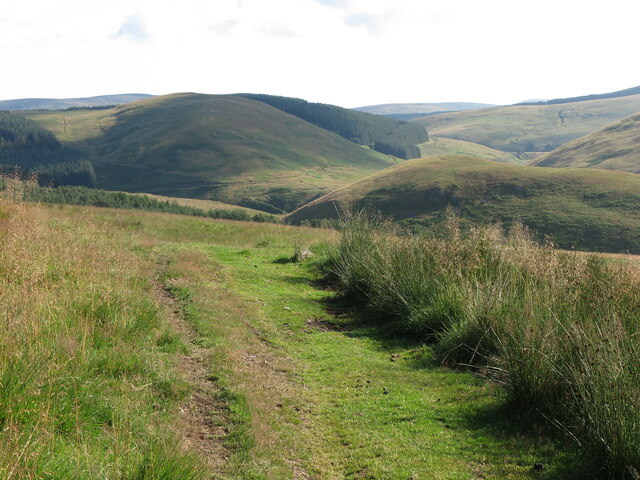
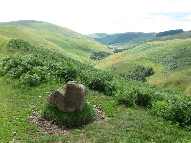
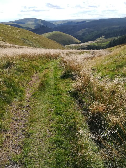
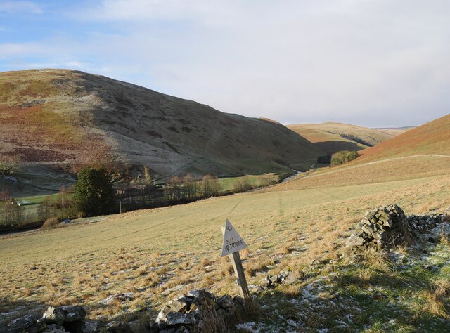
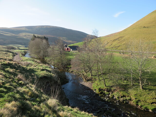
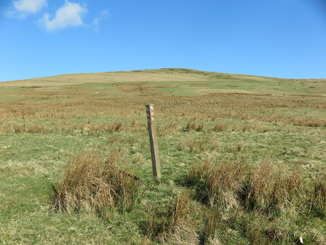
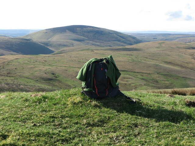
Barrow Law is a prominent hill located in Northumberland, England. Situated near the village of Wooler, it forms part of the Cheviot Hills range, renowned for its stunning landscapes and natural beauty. Rising to an elevation of approximately 455 meters (1,493 feet), Barrow Law offers commanding views of the surrounding countryside, making it a popular destination for hikers, nature enthusiasts, and photographers.

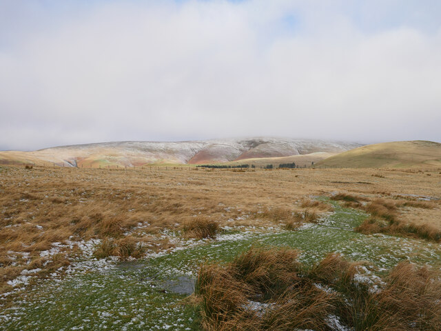
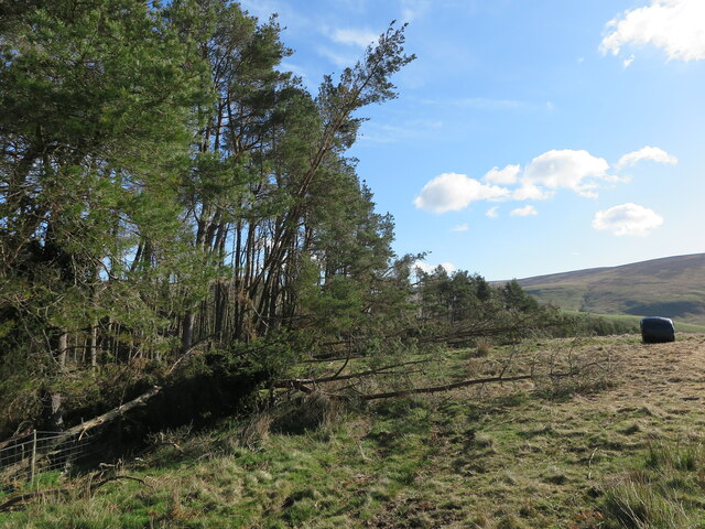
The hill is primarily composed of volcanic rock, giving it a distinctive rugged appearance. Its slopes are covered in heather and grasses, providing a habitat for a variety of wildlife, including birds such as curlews, lapwings, and skylarks. The area is also home to a diverse range of plant species, lending vibrant colors to the landscape throughout the year.

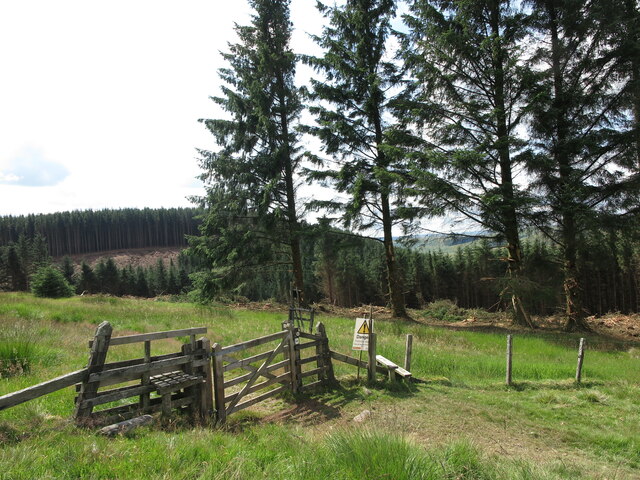
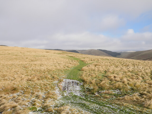
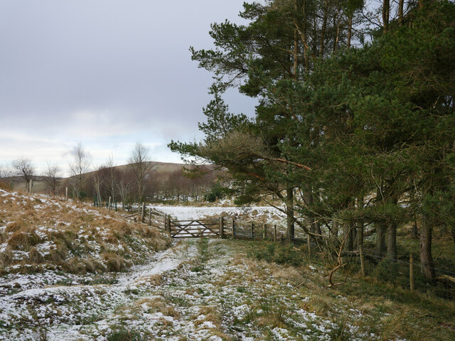
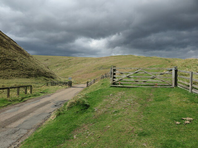
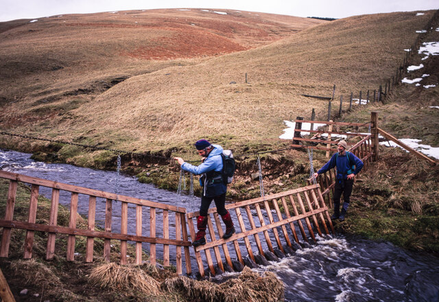
Barrow Law is easily accessible via footpaths that lead from Wooler or nearby roads, and there is ample parking available for visitors. The well-maintained trails offer a range of difficulty levels, allowing both experienced hikers and casual walkers to enjoy the hill's offerings. The summit of Barrow Law rewards climbers with breathtaking panoramic views of the Cheviot Hills, the Northumberland National Park, and the Scottish borders.

In addition to its natural beauty, Barrow Law also holds historical significance. The hill features the remains of an Iron Age hillfort, with earthworks and ramparts that once served as a defensive structure. These archaeological features add an intriguing element to the hill's allure, attracting history enthusiasts and archaeologists alike.

Overall, Barrow Law in Northumberland is a captivating hill that boasts stunning landscapes, rich biodiversity, and a glimpse into the region's ancient past. It is a must-visit destination for anyone seeking to immerse themselves in the natural and cultural heritage of the area.

If you have any feedback on the listing, please let us know in the comments section below.

Barrow Law Images

Images are sourced within 2km of 55.398731/-2.2158735 or Grid Reference NT8611. Thanks to Geograph Open Source API. All images are credited.

Public Bridleway, Barrowburn This track, which is a public bridleway, descends towards the former Barrowburn farmhouse, seen straight ahead, and after crossing a ford joins the old road through the valley. In the distance, mainly obscured by trees, is Windyhaugh farmhouse. For a selection of detailed free to download walking routes in the area visit <span class="nowrap"><a title="www.cheviotwalks.co.uk" rel="nofollow ugc noopener" href="http://www.cheviotwalks.co.uk">Link</a><img style="margin-left:2px;" alt="External link" title="External link - shift click to open in new window" src="https://s1.geograph.org.uk/img/external.png" width="10" height="10"/></span>
Public Bridleway, Barrowburn
This track, which is a public bridleway, descends towards the former Barrowburn farmhouse, seen straight ahead, and after crossing a ford joins the old road through the valley. In the distance, mainly obscured by trees, is Windyhaugh farmhouse. For a selection of detailed free to download walking routes in the area visit LinkExternal link
Public Bridleway near Barrow Law This public bridleway connects Barrowburn with the track leading to the remote farm of Uswayford. The hill straight ahead in cloud shadow is Hazely Law whilst the hill, right of centre in the middle distance, is known as The Middle. For a selection of detailed free to download walking routes in the area visit <span class="nowrap"><a title="www.cheviotwalks.co.uk" rel="nofollow ugc noopener" href="http://www.cheviotwalks.co.uk">Link</a><img style="margin-left:2px;" alt="External link" title="External link - shift click to open in new window" src="https://s1.geograph.org.uk/img/external.png" width="10" height="10"/></span>
Public Bridleway near Barrow Law
This public bridleway connects Barrowburn with the track leading to the remote farm of Uswayford. The hill straight ahead in cloud shadow is Hazely Law whilst the hill, right of centre in the middle distance, is known as The Middle. For a selection of detailed free to download walking routes in the area visit LinkExternal link
Gate into the Kidland Forest This gate lies on the northern edge of the vast Kidland Forest, as well as on the route of the ancient cross-border track of Clennell Street. The trees in the background are in the process of being harvested and by this time next year the scene will have somewhat changed. For a selection of detailed free to download walking routes in the area visit <span class="nowrap"><a title="www.cheviotwalks.co.uk" rel="nofollow ugc noopener" href="http://www.cheviotwalks.co.uk">Link</a><img style="margin-left:2px;" alt="External link" title="External link - shift click to open in new window" src="https://s1.geograph.org.uk/img/external.png" width="10" height="10"/></span>
Gate into the Kidland Forest
This gate lies on the northern edge of the vast Kidland Forest, as well as on the route of the ancient cross-border track of Clennell Street. The trees in the background are in the process of being harvested and by this time next year the scene will have somewhat changed. For a selection of detailed free to download walking routes in the area visit LinkExternal link
Large Stone and Public Bridleway near Barrowburn This stone enjoys superb views towards Upper Coquetdale and the bulk of Shillhope Law. The bridleway links Fairhaugh with Barrowburn. For a selection of detailed free to download walking routes in the area visit <span class="nowrap"><a title="www.cheviotwalks.co.uk" rel="nofollow ugc noopener" href="http://www.cheviotwalks.co.uk">Link</a><img style="margin-left:2px;" alt="External link" title="External link - shift click to open in new window" src="https://s1.geograph.org.uk/img/external.png" width="10" height="10"/></span>
Large Stone and Public Bridleway near Barrowburn
This stone enjoys superb views towards Upper Coquetdale and the bulk of Shillhope Law. The bridleway links Fairhaugh with Barrowburn. For a selection of detailed free to download walking routes in the area visit LinkExternal link
The Middle (in the centre ground) The Middle separates the Usway Burn from the Hepden Burn and provides a high level route out of the hills down to the road at Barrowburn in Upper Coquetdale. This land is MOD land but less intensively used than the main range. The photograph was taken from the descent off Hazely Law at the top of Hazely Slack.

Behind The Middle is its partner, Middle Hill now crowned with a few remaining trees having had most felled in the late 2010's.

Behind Middle Hill are the hills of Upper Coquetdale including the main military ranges.
The Middle (in the centre ground)
The Middle separates the Usway Burn from the Hepden Burn and provides a high level route out of the hills down to the road at Barrowburn in Upper Coquetdale. This land is MOD land but less intensively used than the main range. The photograph was taken from the descent off Hazely Law at the top of Hazely Slack. Behind The Middle is its partner, Middle Hill now crowned with a few remaining trees having had most felled in the late 2010's. Behind Middle Hill are the hills of Upper Coquetdale including the main military ranges.
Out of bounds to troops A small warning sign in Upper Coquetdale near Barrowburn.  Tindale Law is the prominent hill to the left of shot.

This photograph was taken during the Coronavirus (COVID-19) pandemic of 2020/21/22.
Out of bounds to troops
A small warning sign in Upper Coquetdale near Barrowburn. Tindale Law is the prominent hill to the left of shot. This photograph was taken during the Coronavirus (COVID-19) pandemic of 2020/21/22.
Bridleway on Barrow Law Firm, frosted terrain encountered passing the lower slopes of Barrow Law.

This photograph was taken during the Coronavirus (COVID-19) pandemic of 2020/21/22.
Bridleway on Barrow Law
Firm, frosted terrain encountered passing the lower slopes of Barrow Law. This photograph was taken during the Coronavirus (COVID-19) pandemic of 2020/21/22.
Bridleway bound for Murder Cleugh Passing sleet showers were encountered on this stretch, with the distant Border Ridge being subject to such showers as shown in this photograph.

This photograph was taken during the Coronavirus (COVID-19) pandemic of 2020/21/22.
Bridleway bound for Murder Cleugh
Passing sleet showers were encountered on this stretch, with the distant Border Ridge being subject to such showers as shown in this photograph. This photograph was taken during the Coronavirus (COVID-19) pandemic of 2020/21/22.
Gateway by Murder Cleugh The gateway by Murder Cleugh, a small afforested gully.  The commemorative stone <a href="https://www.geograph.org.uk/photo/1926980">NT8613 : Murder Cleugh</a> has been narrowly missed by a falling tree, most likely downed during Storm Arwen (26/27 November 2021) which can be seen to the right, straddling the fence.

This photograph was taken during the Coronavirus (COVID-19) pandemic of 2020/21/22.
Gateway by Murder Cleugh
The gateway by Murder Cleugh, a small afforested gully. The commemorative stone NT8613 : Murder Cleugh has been narrowly missed by a falling tree, most likely downed during Storm Arwen (26/27 November 2021) which can be seen to the right, straddling the fence. This photograph was taken during the Coronavirus (COVID-19) pandemic of 2020/21/22.
River Coquet near Windyhaugh The River Coquet is considered to be one of Northumberland's finest rivers, and at this point passes the remote farm of Windyhaugh which is visible on the opposite side of the river. The hill in the background is Shillhope Law which overlooks the farm of Barrowburn, obscured by the riverside trees. For a selection of detailed free to download walking routes in the area visit <span class="nowrap"><a title="www.cheviotwalks.co.uk" rel="nofollow ugc noopener" href="http://www.cheviotwalks.co.uk">Link</a><img style="margin-left:2px;" alt="External link" title="External link - shift click to open in new window" src="https://s1.geograph.org.uk/img/external.png" width="10" height="10"/></span>
River Coquet near Windyhaugh
The River Coquet is considered to be one of Northumberland's finest rivers, and at this point passes the remote farm of Windyhaugh which is visible on the opposite side of the river. The hill in the background is Shillhope Law which overlooks the farm of Barrowburn, obscured by the riverside trees. For a selection of detailed free to download walking routes in the area visit LinkExternal link
Barrowburn, Upper Coquetdale The remote farm of Barrowburn enjoys one of the most idyllic locations in Northumberland, nestling beneath the slopes of Shillhope Law and Barrow Law and close to the River Coquet. For a selection of detailed free to download walking routes in the area visit <span class="nowrap"><a title="www.cheviotwalks.co.uk" rel="nofollow ugc noopener" href="http://www.cheviotwalks.co.uk">Link</a><img style="margin-left:2px;" alt="External link" title="External link - shift click to open in new window" src="https://s1.geograph.org.uk/img/external.png" width="10" height="10"/></span>
Barrowburn, Upper Coquetdale
The remote farm of Barrowburn enjoys one of the most idyllic locations in Northumberland, nestling beneath the slopes of Shillhope Law and Barrow Law and close to the River Coquet. For a selection of detailed free to download walking routes in the area visit LinkExternal link
Plantation at Murder Cleugh The name Murder Cleugh derives from a gruesome deed which took place near here in 1610.This photo shows some of the devastation to this plantation caused by Storm Arwen in November 2021. The damage caused by the storm was compounded by the fact that "sustained winds with gusts in excess of 90 mph were, unusually, from the north-east, affecting trees that do not normally have to yield to those winds."  For a selection of detailed free to download walking routes in the area visit <span class="nowrap"><a title="www.cheviotwalks.co.uk" rel="nofollow ugc noopener" href="http://www.cheviotwalks.co.uk">Link</a><img style="margin-left:2px;" alt="External link" title="External link - shift click to open in new window" src="https://s1.geograph.org.uk/img/external.png" width="10" height="10"/></span>
Plantation at Murder Cleugh
The name Murder Cleugh derives from a gruesome deed which took place near here in 1610.This photo shows some of the devastation to this plantation caused by Storm Arwen in November 2021. The damage caused by the storm was compounded by the fact that "sustained winds with gusts in excess of 90 mph were, unusually, from the north-east, affecting trees that do not normally have to yield to those winds." For a selection of detailed free to download walking routes in the area visit LinkExternal link
Directional Marker Post near Murder Cleugh This marker post, which appears to pre-date the narrow trackside plantation which lies immediately to the south of the post, appears to relate to two converging Public Bridleways. Neither is visible on the ground. The hill in the background is Ward Law. For a selection of detailed free to download walking routes in the area visit <span class="nowrap"><a title="www.cheviotwalks.co.uk" rel="nofollow ugc noopener" href="http://www.cheviotwalks.co.uk">Link</a><img style="margin-left:2px;" alt="External link" title="External link - shift click to open in new window" src="https://s1.geograph.org.uk/img/external.png" width="10" height="10"/></span>
Directional Marker Post near Murder Cleugh
This marker post, which appears to pre-date the narrow trackside plantation which lies immediately to the south of the post, appears to relate to two converging Public Bridleways. Neither is visible on the ground. The hill in the background is Ward Law. For a selection of detailed free to download walking routes in the area visit LinkExternal link
Ward Law Summit The sac marks the top of the 482 metre high Ward Law with the bulk of Shillhope Law in the background. For a selection of detailed free to download walking routes in the area visit <span class="nowrap"><a title="www.cheviotwalks.co.uk" rel="nofollow ugc noopener" href="http://www.cheviotwalks.co.uk">Link</a><img style="margin-left:2px;" alt="External link" title="External link - shift click to open in new window" src="https://s1.geograph.org.uk/img/external.png" width="10" height="10"/></span>
Ward Law Summit
The sac marks the top of the 482 metre high Ward Law with the bulk of Shillhope Law in the background. For a selection of detailed free to download walking routes in the area visit LinkExternal link
Bridleway and Public Road Converge near Slymefoot The ancient cross-border route called The Street (right), which can be followed from this point in England to Hownam in Scotland, converges here with the narrow single track public road (left) which runs through Upper Coquetdale from the tiny village of Alwinton to just short of Chew Green close to the English/Scottish border. It is one of the most scenic journeys in Northumberland. For a selection of detailed free to download walking routes in the area visit <span class="nowrap"><a title="www.cheviotwalks.co.uk" rel="nofollow ugc noopener" href="http://www.cheviotwalks.co.uk">Link</a><img style="margin-left:2px;" alt="External link" title="External link - shift click to open in new window" src="https://s1.geograph.org.uk/img/external.png" width="10" height="10"/></span>
Bridleway and Public Road Converge near Slymefoot
The ancient cross-border route called The Street (right), which can be followed from this point in England to Hownam in Scotland, converges here with the narrow single track public road (left) which runs through Upper Coquetdale from the tiny village of Alwinton to just short of Chew Green close to the English/Scottish border. It is one of the most scenic journeys in Northumberland. For a selection of detailed free to download walking routes in the area visit LinkExternal link
Crossing the Usway Burn It was in March 1996 that it became necessary to make a late afternoon crossing of the Usway Burn which was eased greatly by the convenience and condition of a stream gate across the modest flow of water. Well Cleugh is the groove beyond.
Crossing the Usway Burn
It was in March 1996 that it became necessary to make a late afternoon crossing of the Usway Burn which was eased greatly by the convenience and condition of a stream gate across the modest flow of water. Well Cleugh is the groove beyond.
Boundary fence on Shillhope Law This fence passes close to the summit of Shillhope Law (behind the photographer) before descending to and across Inner Hill. In the middle distance lies Kyloe Shin and in the distance the huge sweep of the Uswayford Forest. For a selection of detailed free to download walking routes in the area visit <span class="nowrap"><a title="www.cheviotwalks.co.uk" rel="nofollow ugc noopener" href="http://www.cheviotwalks.co.uk">Link</a><img style="margin-left:2px;" alt="External link" title="External link - shift click to open in new window" src="https://s1.geograph.org.uk/img/external.png" width="10" height="10"/></span>
Boundary fence on Shillhope Law
This fence passes close to the summit of Shillhope Law (behind the photographer) before descending to and across Inner Hill. In the middle distance lies Kyloe Shin and in the distance the huge sweep of the Uswayford Forest. For a selection of detailed free to download walking routes in the area visit LinkExternal link
Ordnance Survey Cut Mark This OS cut mark can be found at Rowhope Farm. It marks a point 277.283m above mean sea level.
Ordnance Survey Cut Mark
This OS cut mark can be found at Rowhope Farm. It marks a point 277.283m above mean sea level.
Show me another place!

Barrow Law is located at Grid Ref: NT8611 (Lat: 55.398731, Lng: -2.2158735)

Unitary Authority: Northumberland

Police Authority: Northumbria

What 3 Words

///replays.permanent.navigate. Near Rochester, Northumberland

Nearby Locations

Barrow Law Barrow Cleugh

Related Wikis

Nearby Amenities

Located within 500m of 55.398731,-2.2158735
Barrow Law
Ele: 419
Natural: peak
Lat/Long: 55.3990074/-2.2146337
The data included in this document is from www.openstreetmap.org. The data is made available under ODbL.

Have you been to Barrow Law?

Leave your review of Barrow Law below (or comments, questions and feedback).