Bagden Hillocks

Hill, Mountain in Lancashire

England

Bagden Hillocks

Location of Cut Mark - Boarsgreave, Rooley Moor Road Gatepost (SE)
Location of Cut Mark - Boarsgreave, Rooley Moor Road Gatepost (SE) Credit: thejackrustles

Bagden Hillocks is a picturesque hill located in the county of Lancashire, England. With an elevation of approximately 297 meters (974 feet), it is considered a notable landmark within the region. This natural formation is situated near the village of Bagden, which is part of the borough of Pendle.

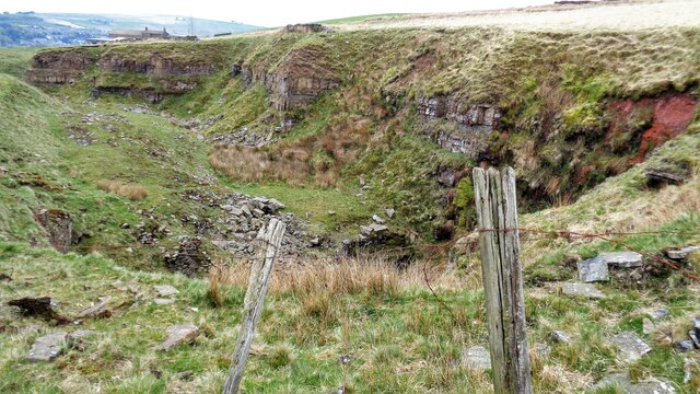
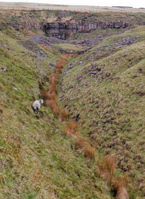
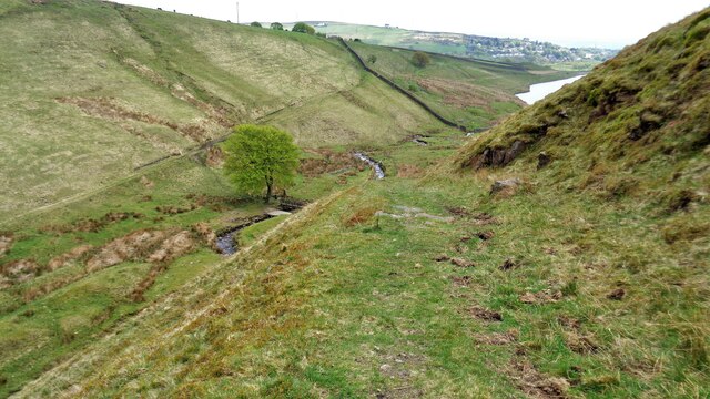
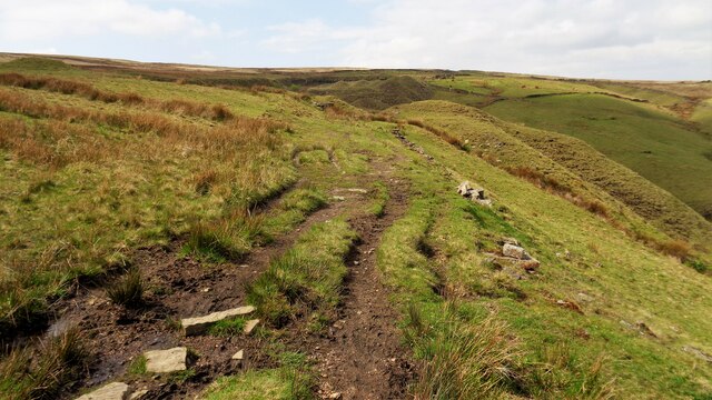
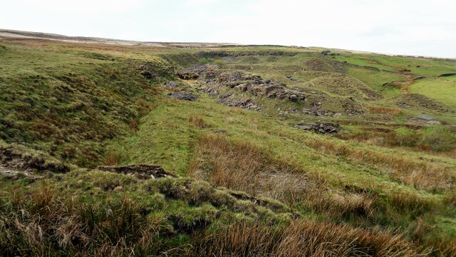
The hill is characterized by its gently sloping terrain and is predominantly covered with lush green vegetation, offering a scenic and tranquil environment for visitors. The summit provides panoramic views of the surrounding countryside, including the rolling hills and expansive farmlands that stretch as far as the eye can see.

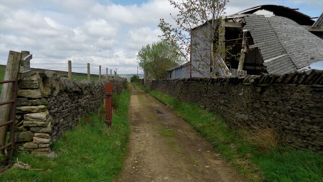
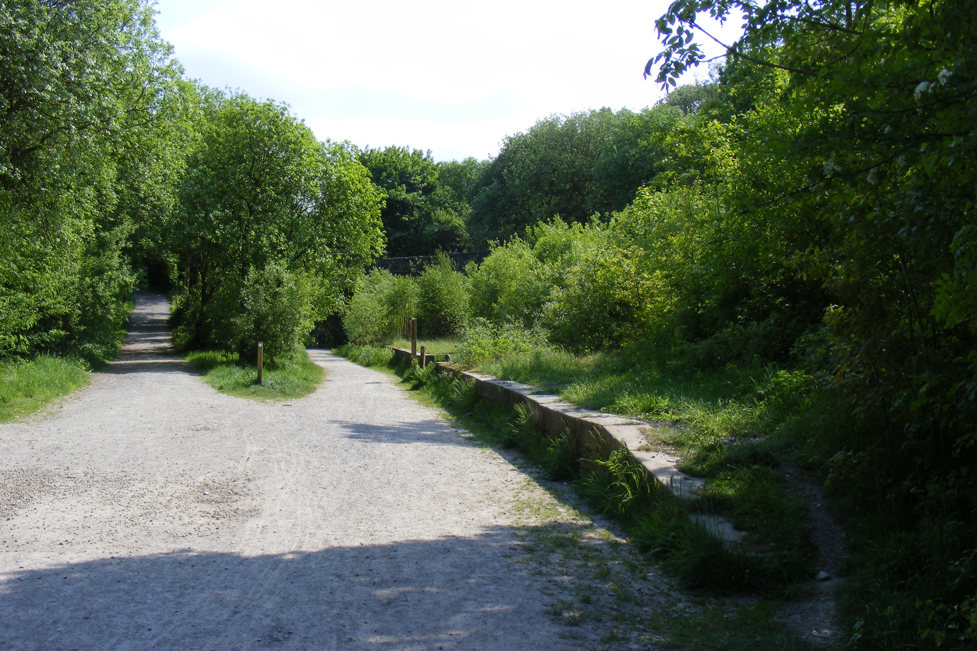
Bagden Hillocks is a popular destination for nature enthusiasts and hikers, who are attracted by its well-maintained footpaths and trails. These pathways offer opportunities for leisurely walks and more challenging hikes, catering to a range of fitness levels. Along the way, visitors may encounter a variety of wildlife, such as birds, rabbits, and occasionally deer.

In addition to its natural beauty, the hill has historical significance, with remnants of ancient settlements and burial mounds found in its vicinity. These archaeological sites provide evidence of human activity in the area dating back to prehistoric times, adding to the allure of Bagden Hillocks.

Overall, Bagden Hillocks offers visitors a chance to immerse themselves in the beauty of Lancashire's countryside, with its breathtaking views, peaceful ambiance, and rich historical heritage.

If you have any feedback on the listing, please let us know in the comments section below.

Bagden Hillocks Images

Images are sourced within 2km of 53.657797/-2.213481 or Grid Reference SD8517. Thanks to Geograph Open Source API. All images are credited.

Location of Cut Mark - Boarsgreave, Rooley Moor Road Gatepost (SE)
Cut Mark - Boarsgreave, Rooley Moor Road Gatepost (SE) <span class="nowrap"><a title="https://www.bench-marks.org.uk/bm48544" rel="nofollow ugc noopener" href="https://www.bench-marks.org.uk/bm48544">Link</a><img style="margin-left:2px;" alt="External link" title="External link - shift click to open in new window" src="https://s1.geograph.org.uk/img/external.png" width="10" height="10"/></span>
Cut Mark - Boarsgreave, Rooley Moor Road Gatepost (SE)
Section of moorland tramway Think it was near here we reunited a lamb with its Mum.

<span class="nowrap"><a title="http://www.valleyofstone.org.uk/journey/historyofquarrying/moorlandtramways" rel="nofollow ugc noopener" href="http://www.valleyofstone.org.uk/journey/historyofquarrying/moorlandtramways">Link</a><img style="margin-left:2px;" alt="External link" title="External link - shift click to open in new window" src="https://s1.geograph.org.uk/img/external.png" width="10" height="10"/></span>
Section of moorland tramway
Think it was near here we reunited a lamb with its Mum. LinkExternal link
Rossendale Way Sign <span class="nowrap"><a title="https://ldwa.org.uk/ldp/members/show_path.php?path_name=Rossendale+Way" rel="nofollow ugc noopener" href="https://ldwa.org.uk/ldp/members/show_path.php?path_name=Rossendale+Way">Link</a><img style="margin-left:2px;" alt="External link" title="External link - shift click to open in new window" src="https://s1.geograph.org.uk/img/external.png" width="10" height="10"/></span>
Rossendale Way Sign
OS Rivet - Boarsgreave, Top of Leach <span class="nowrap"><a title="https://www.bench-marks.org.uk/bm104926" rel="nofollow ugc noopener" href="https://www.bench-marks.org.uk/bm104926">Link</a><img style="margin-left:2px;" alt="External link" title="External link - shift click to open in new window" src="https://s1.geograph.org.uk/img/external.png" width="10" height="10"/></span>
OS Rivet - Boarsgreave, Top of Leach
Location of OS Rivet - Boarsgreave, Top of Leach
Top of Leach
Top of Leach
Top of Leach Direction Indicator
Top of Direction Indicator Top of Leach
Hailstorm Ridge Trig Point Flush Bracket S4615
Hey Lane Quarry
Hey Lane Quarry
Tramway Route at Thurns End Quarry The former tramway was at the bottom of the cutting
Tramway Route at Thurns End Quarry
The former tramway was at the bottom of the cutting
Walled Track at Houses o'th'Hill The track is a bridleway and part of Rossendale Way
Walled Track at Houses o'th'Hill
The track is a bridleway and part of Rossendale Way
Prickshaw Brook Valley View from the Rossendale Way track along the course of the brook to Spring Mill Reservoir
Prickshaw Brook Valley
View from the Rossendale Way track along the course of the brook to Spring Mill Reservoir
Former Railway Trackbed to Bagden Quarry Viewed from near what was believed to be an engine shed (remains behind the camera)
Former Railway Trackbed to Bagden Quarry
Viewed from near what was believed to be an engine shed (remains behind the camera)
Bagden Quarry remains View from Rossendale Way
Bagden Quarry remains
View from Rossendale Way
End of Bridleway At the gate is Fern Isle Brook and the end of the bridleway and access land. The bridleway is from Rooley Moor Road but only a footpath is beyond the gate!
End of Bridleway
At the gate is Fern Isle Brook and the end of the bridleway and access land. The bridleway is from Rooley Moor Road but only a footpath is beyond the gate!
Approaching Meadows At Meadows are ruins and what appears to be a rebuilt well maintained flat roofed barn. The fields centred on Meadows are not access land but they are surrounded by access land.
Approaching Meadows
At Meadows are ruins and what appears to be a rebuilt well maintained flat roofed barn. The fields centred on Meadows are not access land but they are surrounded by access land.
Show me another place!

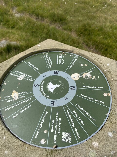
Bagden Hillocks is located at Grid Ref: SD8517 (Lat: 53.657797, Lng: -2.213481)

Unitary Authority: Rochdale

Police Authority: Greater Manchester

What 3 Words

///solids.origin.tripling. Near Whitworth, Lancashire

Related Wikis

Greenbooth Reservoir

Greenbooth Reservoir is a reservoir to the north of Heywood and close to Norden in the Metropolitan Borough of Rochdale, within Greater Manchester, England...

Whitworth railway station

Whitworth railway station served the town of Whitworth, Rossendale, Lancashire, England, from 1870 until closure in 1947. == References == Lost Railways...

Whitworth, Lancashire

Whitworth is a town and civil parish in Rossendale, Lancashire, England, amongst the foothills of the Pennines between Bacup, to the north, and Rochdale...

Scout Moor Wind Farm

Scout Moor Wind Farm is the second largest onshore wind farm in England. The wind farm, which was built for Peel Wind Power Ltd, produces electricity from...

Broadley railway station

Broadley railway station served Broadley in Rochdale, England, from 1870 until closure in 1947. It was situated at Healey Dell. == References == Lost Railways...

Hail Storm Hill

Hail Storm Hill, also known as Cowpe Moss, is the highest point of the Rossendale Valley, England, an area of moorland and hill country situated between...
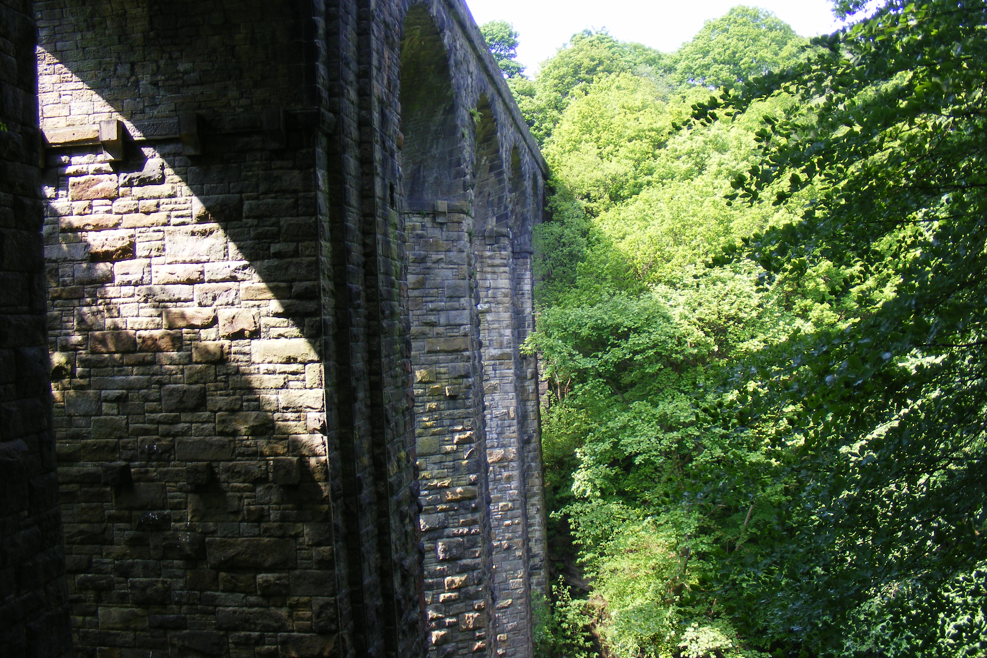
Healey Dell Viaduct

Healey Dell Viaduct is a viaduct situated in Healey Dell Nature Reserve in the Spodden Valley, on the outskirts of Rochdale in Greater Manchester, England...

Facit railway station

Facit railway station served Facit near Whitworth, Rossendale, Lancashire, England, from 1870 until closure to passengers in 1947 and freight in 1963....

Have you been to Bagden Hillocks?

Leave your review of Bagden Hillocks below (or comments, questions and feedback).