Bent Hill

Hill, Mountain in Lancashire Burnley

England

Bent Hill

Old Boundary Marker on Bacup Old Road Municipal Boundary Marker on the east side of Bacup Old Road, southeast of its junction with the A671 Burnley Road. On the boundary of Cliviger parish and the former Newchurch parish. One of a series marking the boundary of Bacup Borough.

Milestone Society National ID: LA_BACCLI02pb
Old Boundary Marker on Bacup Old Road Credit: C Chatham

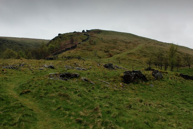
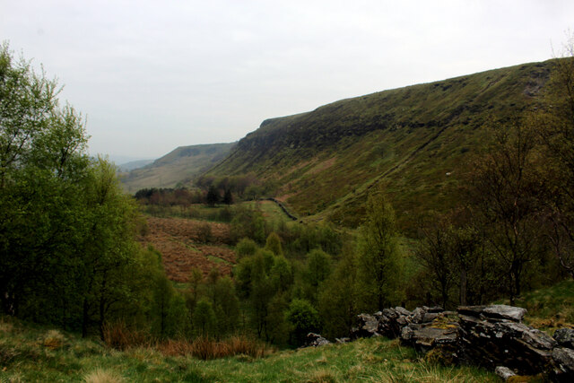
Bent Hill is a prominent hill located in the county of Lancashire, England. Situated in the southern part of the county, it is part of the larger Pennine Range, which extends across several counties in Northern England. With an elevation reaching approximately 417 meters (1,368 feet), Bent Hill offers breathtaking panoramic views of the surrounding countryside.

The hill is known for its distinctive shape, which gives it its name. The peak of Bent Hill is characterized by a slight curve, resembling a bend or a crescent shape when viewed from certain angles. This unique feature has made it a recognizable landmark in the area.

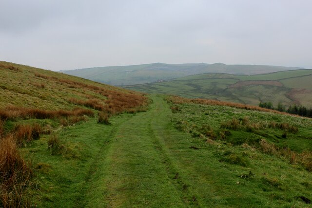
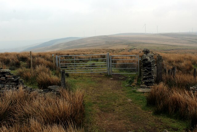
Bent Hill is a popular destination for outdoor enthusiasts and nature lovers. It offers several walking and hiking trails that cater to all levels of fitness, making it accessible for both experienced hikers and casual walkers. The well-maintained paths provide opportunities to explore the diverse flora and fauna that thrive in the region.

In addition to its natural beauty, Bent Hill is also known for its historical significance. The hill has been the site of archaeological discoveries, including ancient burial grounds and remnants of prehistoric settlements. These findings suggest that the area has been inhabited for thousands of years.

Visitors to Bent Hill can enjoy a tranquil escape from the hustle and bustle of city life. Whether it's a leisurely stroll or a challenging hike, this picturesque hill offers a serene environment and stunning vistas that make it a must-visit destination in Lancashire.

If you have any feedback on the listing, please let us know in the comments section below.
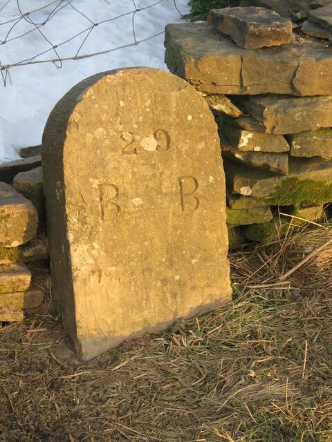
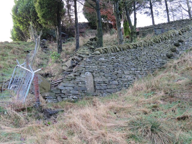
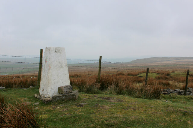
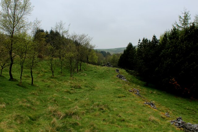
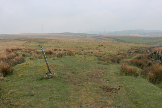
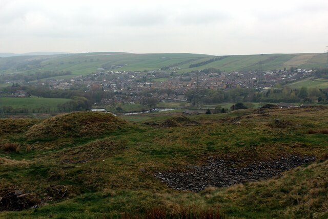
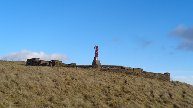
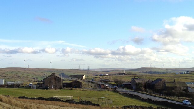
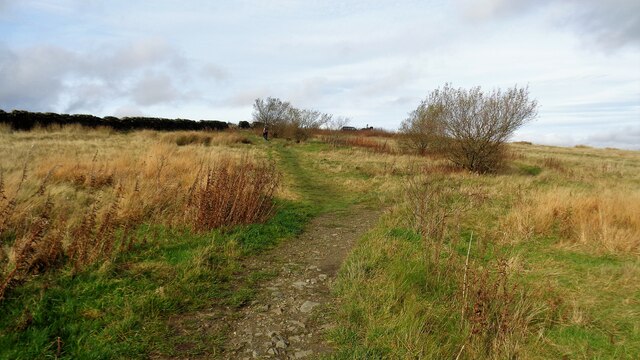
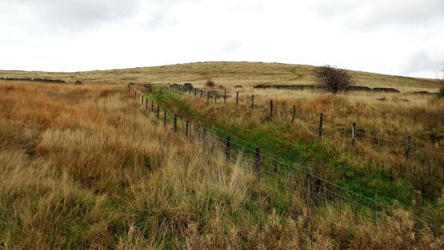
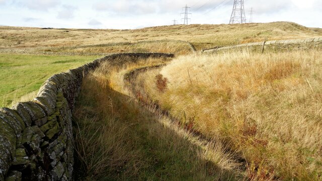
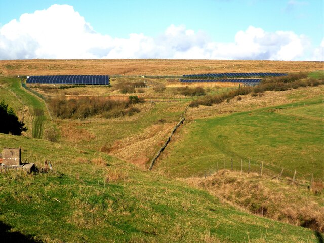
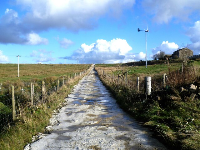
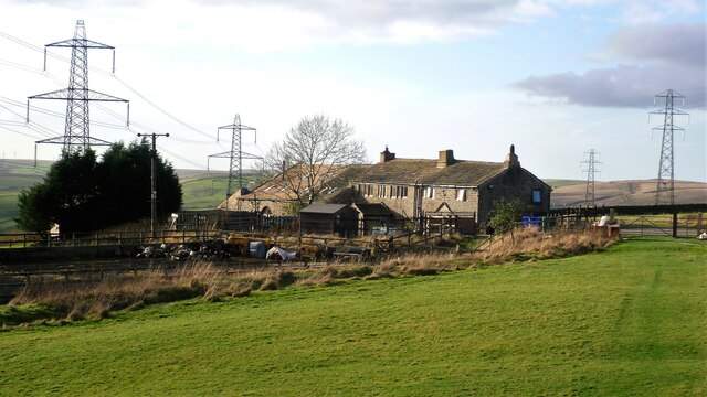
Bent Hill Images

Images are sourced within 2km of 53.737858/-2.2164642 or Grid Reference SD8526. Thanks to Geograph Open Source API. All images are credited.

Old Boundary Marker on Bacup Old Road Municipal Boundary Marker on the east side of Bacup Old Road, southeast of its junction with the A671 Burnley Road. On the boundary of Cliviger parish and the former Newchurch parish. One of a series marking the boundary of Bacup Borough.

Milestone Society National ID: LA_BACCLI02pb
Old Boundary Marker on Bacup Old Road
Municipal Boundary Marker on the east side of Bacup Old Road, southeast of its junction with the A671 Burnley Road. On the boundary of Cliviger parish and the former Newchurch parish. One of a series marking the boundary of Bacup Borough. Milestone Society National ID: LA_BACCLI02pb
Old Boundary Marker west of Burnley Road Municipal Boundary Marker set in a drystone wall beside the disused tramway of Deerplay Colliery, 75 metres west of the B671 Burnley Road. On the boundary of Cliviger parish and the former Newchurch parish. One of a series marking the boundary of Bacup Borough. Inscribed 31 / B B.

Milestone Society National ID: LA_BACCLI03pb
Old Boundary Marker west of Burnley Road
Municipal Boundary Marker set in a drystone wall beside the disused tramway of Deerplay Colliery, 75 metres west of the B671 Burnley Road. On the boundary of Cliviger parish and the former Newchurch parish. One of a series marking the boundary of Bacup Borough. Inscribed 31 / B B. Milestone Society National ID: LA_BACCLI03pb
Trig Point on Thieveley Pike Highest point on Deerplay Moor at 449 metres.
The trig point now supports a fresh coat of white paint.
Trig Point on Thieveley Pike
Highest point on Deerplay Moor at 449 metres. The trig point now supports a fresh coat of white paint.
Footpath on the Southern Edge of Buckley Wood Woods on the flanks of Deerplay Moor
Footpath on the Southern Edge of Buckley Wood
Woods on the flanks of Deerplay Moor
Burnley Way ascending Deerplay Moor The long distance footpath climbs steeply beside Dean Scout
Burnley Way ascending Deerplay Moor
The long distance footpath climbs steeply beside Dean Scout
Flanks of Thieveley Scout
Grass Track on the Flanks of Deerplay Moor
Burnley Way heading South East towards Heald Moor Following the ridge from Deerplay Moor to Heald Moor on a misty morning
Burnley Way heading South East towards Heald Moor
Following the ridge from Deerplay Moor to Heald Moor on a misty morning
Fork in the Paths on Heald Moor The Burnley Way runs straight ahead over the moor, while a bridleway veers to right beside the wall towards the village of Weir
Fork in the Paths on Heald Moor
The Burnley Way runs straight ahead over the moor, while a bridleway veers to right beside the wall towards the village of Weir
Village of Weir As seen from the edge of Heald Moor
Village of Weir
As seen from the edge of Heald Moor
Weir and District War Memorial On Deerplay Hill
Weir and District War Memorial
On Deerplay Hill
Farms on Burnley Road View towards Bacup from Weir War Memorial on Deerplay Hill
Farms on Burnley Road
View towards Bacup from Weir War Memorial on Deerplay Hill
White Hill Circular Walk Part of the marked path near Crown Point Road which meanders such that short cuts have been made. The gravel path which is not being used is becoming overgrown and the short cuts a source of surface erosion.
White Hill Circular Walk
Part of the marked path near Crown Point Road which meanders such that short cuts have been made. The gravel path which is not being used is becoming overgrown and the short cuts a source of surface erosion.
Farmer's Track to White Hill This track links the hill and Burnley Road (B6238) and is used by the Pennine Bridleway for part of the route
Farmer's Track to White Hill
This track links the hill and Burnley Road (B6238) and is used by the Pennine Bridleway for part of the route
Reservoir Catchwater For Clough Bottom Reservoir
Reservoir Catchwater
For Clough Bottom Reservoir
Solar Panels at former Deerplay Colliery Site Around the lagoons that are cleaning the mine water coming from the former colliery
Solar Panels at former Deerplay Colliery Site
Around the lagoons that are cleaning the mine water coming from the former colliery
Harrow Stiles Lane Used by Rossendale Way. At this point by Sod Hey Farm the farm track surface appears to have been laid using a very wet cement mix with little aggregate
Harrow Stiles Lane
Used by Rossendale Way. At this point by Sod Hey Farm the farm track surface appears to have been laid using a very wet cement mix with little aggregate
Approaching Clifton On the Rossendale Way
Approaching Clifton
On the Rossendale Way
Show me another place!

Bent Hill is located at Grid Ref: SD8526 (Lat: 53.737858, Lng: -2.2164642)

Administrative County: Lancashire

District: Burnley

Police Authority: Lancashire

What 3 Words

///daring.cookbooks.notice. Near Bacup, Lancashire

Nearby Locations

Clough Bottom Bent Hill

Related Wikis

Water, Lancashire

Water is a hamlet in the borough of Rossendale, in Lancashire, England. Located north of the village of Lumb. It is mostly made of a few homes, farms,...

Holme railway station (Lancashire)

Holme railway station served Holme Chapel on the Copy Pit line. The station closed in July 1930 and the line now serves as a non-stop route between Hebden...

Weir, Lancashire

Weir is a village to the north of Bacup in the Rossendale borough of Lancashire, England, and immediately south of the boundary with the Borough of Burnley...

Singing Ringing Tree, Burnley

The Singing Ringing Tree is a wind powered sound sculpture resembling a tree set in the landscape of the Pennine hill range overlooking Burnley, in Lancashire...

Nearby Amenities

Located within 500m of 53.737858,-2.2164642
Weir War Memorial
Historic: monument
Source: Bing
Lat/Long: 53.7366221/-2.2097468
Barrier: swing_gate
Lat/Long: 53.7344714/-2.2160973
Bench
Lat/Long: 53.7366745/-2.2096935
Barrier: swing_gate
Lat/Long: 53.7359762/-2.2098697
The data included in this document is from www.openstreetmap.org. The data is made available under ODbL.

Have you been to Bent Hill?

Leave your review of Bent Hill below (or comments, questions and feedback).