Rumford Hill

Hill, Mountain in Staffordshire South Staffordshire

England

Rumford Hill

Enville windmill The tower mill on the edge of Enville Common built in 1800-1801 remained in use until 1870. The mill had four sails, boat cap and fantail. Little remains inside the shell except for sections of the turning ring for the boat cap. 

See <span class="nowrap"><a title="http://www.search.staffspasttrack.org.uk/engine/resource/default.asp?resource=11298" rel="nofollow ugc noopener" href="http://www.search.staffspasttrack.org.uk/engine/resource/default.asp?resource=11298">Link</a><img style="margin-left:2px;" alt="External link" title="External link - shift click to open in new window" src="https://s1.geograph.org.uk/img/external.png" width="10" height="10"/></span>
Enville windmill Credit: John M

Rumford Hill is a prominent geographical feature located in the county of Staffordshire, England. It is classified as a hill rather than a mountain due to its relatively modest height, yet it stands as a notable landmark in the area. Situated near the village of Rumford, the hill is part of the picturesque countryside that characterizes this region.

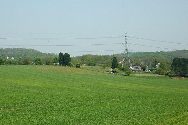
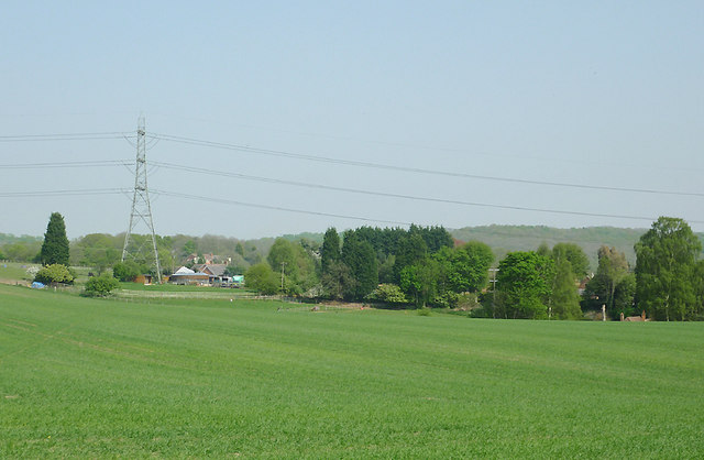
Rumford Hill boasts an elevation of approximately 200 meters (656 feet) above sea level, offering visitors and locals alike breathtaking panoramic views of the surrounding landscape. Its gentle slopes are covered in lush greenery, providing a habitat for various plant and animal species. The hill is particularly known for its diverse range of wildflowers that bloom during the spring and summer months, creating a vibrant and colorful scene.

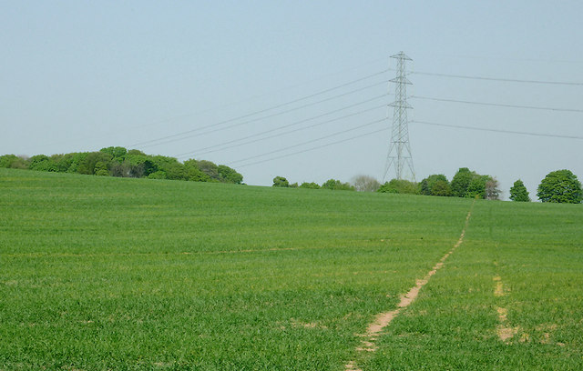
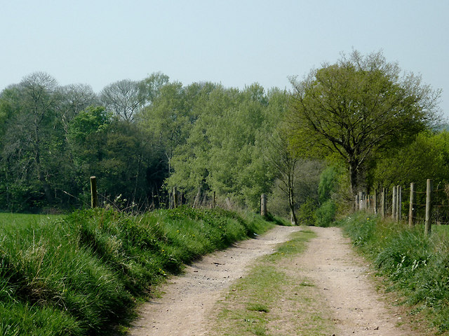
The hill is easily accessible, with footpaths and trails winding their way to the top. These routes are popular among hikers, walkers, and nature enthusiasts who are drawn to the tranquility and natural beauty of the area. On clear days, the summit of Rumford Hill offers an uninterrupted vista, allowing observers to see as far as the Staffordshire Moorlands and even the distant peaks of the Peak District.

Rumford Hill holds historical significance as well. It is believed to have been used as a vantage point during medieval times, providing a strategic lookout for local settlements. Today, it serves as a recreational spot for outdoor activities such as picnicking, birdwatching, and photography.

Overall, Rumford Hill is a captivating and idyllic destination in Staffordshire, offering a serene escape from the hustle and bustle of everyday life. Its natural beauty, accessibility, and historical significance make it a cherished landmark in the region.

If you have any feedback on the listing, please let us know in the comments section below.
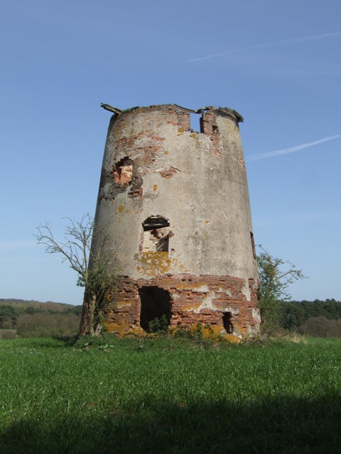
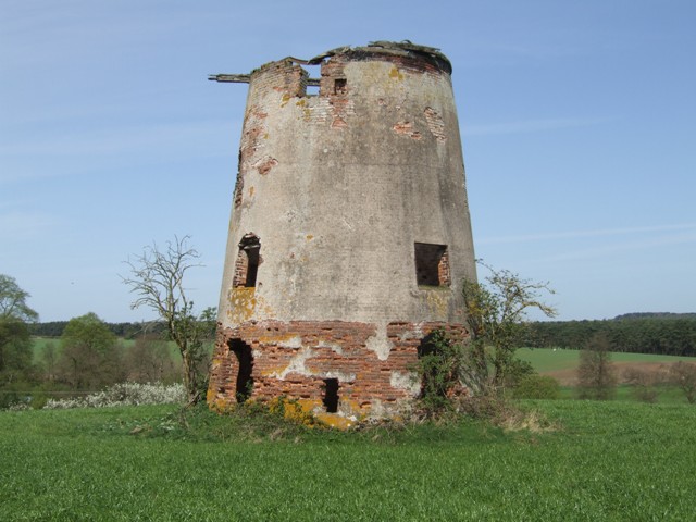
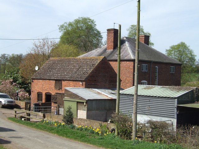
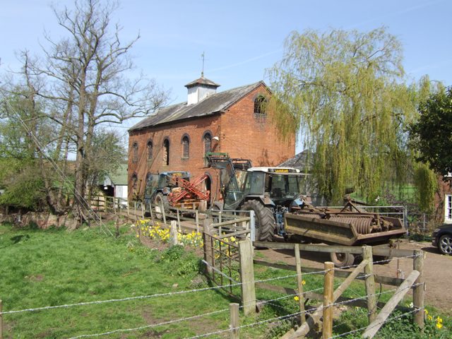
Rumford Hill Images

Images are sourced within 2km of 52.484185/-2.2123275 or Grid Reference SO8587. Thanks to Geograph Open Source API. All images are credited.

Enville windmill The tower mill on the edge of Enville Common built in 1800-1801 remained in use until 1870. The mill had four sails, boat cap and fantail. Little remains inside the shell except for sections of the turning ring for the boat cap. 

See <span class="nowrap"><a title="http://www.search.staffspasttrack.org.uk/engine/resource/default.asp?resource=11298" rel="nofollow ugc noopener" href="http://www.search.staffspasttrack.org.uk/engine/resource/default.asp?resource=11298">Link</a><img style="margin-left:2px;" alt="External link" title="External link - shift click to open in new window" src="https://s1.geograph.org.uk/img/external.png" width="10" height="10"/></span>
Enville windmill
The tower mill on the edge of Enville Common built in 1800-1801 remained in use until 1870. The mill had four sails, boat cap and fantail. Little remains inside the shell except for sections of the turning ring for the boat cap. See LinkExternal link
Enville windmill The tower mill on the edge of Enville Common built in 1800-1801 remained in use until 1870. The mill had four sails, boat cap and fantail. Little remains inside the shell except for sections of the turning ring for the boat cap. 

<span class="nowrap"><a title="http://www.search.staffspasttrack.org.uk/engine/resource/default.asp?resource=11298" rel="nofollow ugc noopener" href="http://www.search.staffspasttrack.org.uk/engine/resource/default.asp?resource=11298">Link</a><img style="margin-left:2px;" alt="External link" title="External link - shift click to open in new window" src="https://s1.geograph.org.uk/img/external.png" width="10" height="10"/></span>
Enville windmill
The tower mill on the edge of Enville Common built in 1800-1801 remained in use until 1870. The mill had four sails, boat cap and fantail. Little remains inside the shell except for sections of the turning ring for the boat cap. LinkExternal link
Mill farm Estate farm in Mill Lane.
Mill farm
Estate farm in Mill Lane.
Spittlebrook Mill Estate property on the Enville Estate.
Spittlebrook Mill
Estate property on the Enville Estate.
Cave at Prestwood near Stourton, Staffordshire This cave in the Triassic sandstone is on land belonging to Prestwood Cave Nursery. The nursery grows a limited range of hardy shrubs and other plants. Quality is high, and the prices are very reasonable. The hard winter of 2010-2011 killed many plants in nurseries all over the West Midlands, but enough remains here to continue trading.
Cave at Prestwood near Stourton, Staffordshire
This cave in the Triassic sandstone is on land belonging to Prestwood Cave Nursery. The nursery grows a limited range of hardy shrubs and other plants. Quality is high, and the prices are very reasonable. The hard winter of 2010-2011 killed many plants in nurseries all over the West Midlands, but enough remains here to continue trading.
Prestwood Cave Nursery near Stourton, Staffordshire The nursery grows a limited range of hardy shrubs and other plants. Quality is high, and the prices are very reasonable. The hard winter of 2010-2011 killed many plants in nurseries all over the West Midlands, but enough remains here to continue trading.
Prestwood Cave Nursery near Stourton, Staffordshire
The nursery grows a limited range of hardy shrubs and other plants. Quality is high, and the prices are very reasonable. The hard winter of 2010-2011 killed many plants in nurseries all over the West Midlands, but enough remains here to continue trading.
Bridleway near Stourton, Staffordshire The bridleway links Wolverhampton Road (A449) at Prestwood with Greensforge Lane and Gothersley Farm.
Bridleway near Stourton, Staffordshire
The bridleway links Wolverhampton Road (A449) at Prestwood with Greensforge Lane and Gothersley Farm.
Bridleway near Stourton, Staffordshire The bridleway links Wolverhampton Road (A449) at Prestwood with Greensforge Lane and Gothersley Farm.
Bridleway near Stourton, Staffordshire
The bridleway links Wolverhampton Road (A449) at Prestwood with Greensforge Lane and Gothersley Farm.
Bridleway near Stourton, Staffordshire The bridleway links Wolverhampton Road (A449) at Prestwood with Greensforge Lane and Gothersley Farm.
Bridleway near Stourton, Staffordshire
The bridleway links Wolverhampton Road (A449) at Prestwood with Greensforge Lane and Gothersley Farm.
Staffordshire and Worcestershire Canal near Prestwood, Staffordshire Seen from the bridleway crossing Prestwood Bridge (No 34). The canal was opened in 1772, engineered by James Brindley. It joins the River Severn at Stourport to the Trent and Mersey Canal at Great Haywood Junction in Staffordshire. There are 43 locks (45 if you don't fancy the deep wide locks at Stourport) and the canal is 46 miles in length.
Staffordshire and Worcestershire Canal near Prestwood, Staffordshire
Seen from the bridleway crossing Prestwood Bridge (No 34). The canal was opened in 1772, engineered by James Brindley. It joins the River Severn at Stourport to the Trent and Mersey Canal at Great Haywood Junction in Staffordshire. There are 43 locks (45 if you don't fancy the deep wide locks at Stourport) and the canal is 46 miles in length.
Public footpath and stile near Prestwood, Staffordshire The path across this crop field seems little used. The bridleway from the Coach House which is mapped as being behind the camera does not exist at all now.
Public footpath and stile near Prestwood, Staffordshire
The path across this crop field seems little used. The bridleway from the Coach House which is mapped as being behind the camera does not exist at all now.
Farmland near Prestwood, Staffordshire Seen from the bridleway near Prestwood Cave Nursery.
Farmland near Prestwood, Staffordshire
Seen from the bridleway near Prestwood Cave Nursery.
Farmland near Prestwood, Staffordshire Looking across the fields from the bridleway between Prestwood and Greensforge Lane.
Farmland near Prestwood, Staffordshire
Looking across the fields from the bridleway between Prestwood and Greensforge Lane.
Crop field near Prestwood, Staffordshire What appear to be tractor wheel tracks actually follow almost exactly the course of a public footpath across the field to Foley Lane.
Crop field near Prestwood, Staffordshire
What appear to be tractor wheel tracks actually follow almost exactly the course of a public footpath across the field to Foley Lane.
Arable Land near Prestwood, Staffordshire Looking across the fields from the bridleway between Prestwood and Greensforge Lane. The tall dark green conifers in the centre of the image are by the A449 near Yew Tree Farm.
Arable Land near Prestwood, Staffordshire
Looking across the fields from the bridleway between Prestwood and Greensforge Lane. The tall dark green conifers in the centre of the image are by the A449 near Yew Tree Farm.
Bridleway north of Stourton, Staffordshire The bridleway links Wolverhampton Road (A449) at Prestwood with Greensforge Lane and Gothersley Farm. The woodland ahead is on the slope down to the Smestow River. To the right of the bridleway there is Gothersley Rough, and to the left, Colbourn's Rough.
Bridleway north of Stourton, Staffordshire
The bridleway links Wolverhampton Road (A449) at Prestwood with Greensforge Lane and Gothersley Farm. The woodland ahead is on the slope down to the Smestow River. To the right of the bridleway there is Gothersley Rough, and to the left, Colbourn's Rough.
Bridleway north of Stourton, Staffordshire The bridleway links Gothersley Farm and Greensforge Lane with the Wolverhampton Road (A449) at Prestwood. On the skyline are Lousy Wood and Crabtree Rough.
Bridleway north of Stourton, Staffordshire
The bridleway links Gothersley Farm and Greensforge Lane with the Wolverhampton Road (A449) at Prestwood. On the skyline are Lousy Wood and Crabtree Rough.
Show me another place!

Rumford Hill is located at Grid Ref: SO8587 (Lat: 52.484185, Lng: -2.2123275)

Administrative County: Staffordshire

District: South Staffordshire

Police Authority: Staffordshire

What 3 Words

///perfected.haircuts.obliging. Near Kingswinford, West Midlands

Related Wikis

Ashwood, Staffordshire

Ashwood is a small area of Staffordshire, England. It is situated in the South Staffordshire district, approximately two miles west of the West Midlands...

Greensforge

Greensforge is a scattered hamlet on the boundary of Kinver and Swindon parishes, in South Staffordshire, England. It is noted for its Roman associations...

Prestwood (Kinver)

Prestwood is a hamlet now in the parish of Kinver, but in the Kingswinford until the creation of Brierley Hill Urban District in the 1930s. == History... ==

Smestow Brook

The Smestow Brook, sometimes called the River Smestow, is a small river that plays an important part in the drainage of Wolverhampton, South Staffordshire...

Stourton, Staffordshire

Stourton is a hamlet in Staffordshire, England a few miles to the northwest of Stourbridge. There is a fair amount of dispute over the pronunciation, being...

Summerhill School, Kingswinford

Summerhill School is a mixed community secondary school located in Kingswinford, West Midlands, England. == History == The school was built by Brierley...

Kingswinford Rural District

Kingswinford Rural District was a rural district in Staffordshire, England from 1894 to 1934. It was created by the Local Government Act 1894, and originally...

West Midlands (region)

The West Midlands is one of nine official regions of England at the first level of International Territorial Level for statistical purposes. It covers...

Nearby Amenities

Located within 500m of 52.484185,-2.2123275
Power: tower
Lat/Long: 52.4813572/-2.2174067
Power: tower
Lat/Long: 52.4826644/-2.2153274
Power: tower
Lat/Long: 52.4844505/-2.2125134
Power: tower
Lat/Long: 52.4862513/-2.2109394
Power: tower
Lat/Long: 52.4872417/-2.2101328
The data included in this document is from www.openstreetmap.org. The data is made available under ODbL.

Have you been to Rumford Hill?

Leave your review of Rumford Hill below (or comments, questions and feedback).