Beans Hill

Hill, Mountain in Aberdeenshire

Scotland

Beans Hill

Shallow Concrete Trough in a Wall This peculiar low long block is incorporated into a stone wall between fields outside Milltimber, an outer suburb of Aberdeen at its Western side. Whether this was its original purpose is unclear, though it was certainly used as a trough at some point judging by the blue pipes embedded within it. Could it have originally been a section of a long channel designed for water or blood and has been repurposed? Or was it specifically designed to hold water and maintained the water level by some clever cistern tank-like system? It would be interesting to know how long large metal water troughs have been around for at affordable prices. If this is an older version it holds a fraction of the water of today's ones.
Shallow Concrete Trough in a Wall Credit: Ian Dodds

Beans Hill is a prominent hill located in Aberdeenshire, Scotland. It is situated approximately 10 miles southwest of the town of Huntly. With a summit height of 1,129 feet (344 meters), it offers breathtaking panoramic views of the surrounding countryside.

This hill is a popular destination for outdoor enthusiasts, hikers, and nature lovers. The ascent to the summit is relatively easy, with well-marked trails that guide visitors through heather-covered moorlands and dense forests. The journey to the top takes approximately an hour, making it a manageable hike for people of all fitness levels.

At the summit of Beans Hill, visitors are rewarded with stunning vistas across Aberdeenshire's rolling hills, fertile farmlands, and picturesque villages. On clear days, it is even possible to see as far as the Cairngorms National Park, which lies to the southwest.

The hill's unique ecosystem is home to a variety of flora and fauna, including heather, bilberries, and various species of birds. In spring, the hillside bursts into a vibrant display of colorful wildflowers, creating a picturesque backdrop for nature enthusiasts.

Beans Hill offers a tranquil and peaceful escape from the hustle and bustle of city life. Its accessibility, combined with its stunning views and natural beauty, make it a popular destination for locals and tourists alike. Whether it is for a leisurely hike, wildlife spotting, or simply enjoying the serenity of nature, Beans Hill is a must-visit attraction in Aberdeenshire.

If you have any feedback on the listing, please let us know in the comments section below.
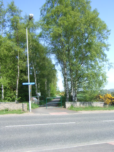
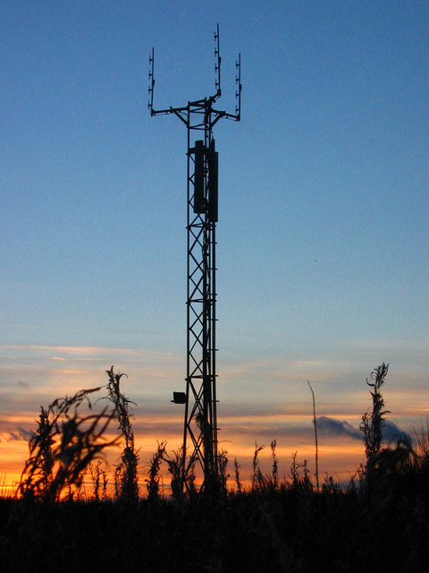
Beans Hill Images

Images are sourced within 2km of 57.122395/-2.2569933 or Grid Reference NJ8403. Thanks to Geograph Open Source API. All images are credited.

Shallow Concrete Trough in a Wall This peculiar low long block is incorporated into a stone wall between fields outside Milltimber, an outer suburb of Aberdeen at its Western side. Whether this was its original purpose is unclear, though it was certainly used as a trough at some point judging by the blue pipes embedded within it. Could it have originally been a section of a long channel designed for water or blood and has been repurposed? Or was it specifically designed to hold water and maintained the water level by some clever cistern tank-like system? It would be interesting to know how long large metal water troughs have been around for at affordable prices. If this is an older version it holds a fraction of the water of today's ones.
Shallow Concrete Trough in a Wall
This peculiar low long block is incorporated into a stone wall between fields outside Milltimber, an outer suburb of Aberdeen at its Western side. Whether this was its original purpose is unclear, though it was certainly used as a trough at some point judging by the blue pipes embedded within it. Could it have originally been a section of a long channel designed for water or blood and has been repurposed? Or was it specifically designed to hold water and maintained the water level by some clever cistern tank-like system? It would be interesting to know how long large metal water troughs have been around for at affordable prices. If this is an older version it holds a fraction of the water of today's ones.
The Aberdeen Western Peripheral Route Construction work on the AWPR near Nether Beanshill farm.
The Aberdeen Western Peripheral Route
Construction work on the AWPR near Nether Beanshill farm.
North gateway to Westfield Lodge
Aberdeen Western Peripheral Route crossing Countesswells Road
Aberdeen Western Peripheral Route under construction
Solitary cottage at Ord
Mid Ord Farm Wester Ord Plantation.
Mid Ord Farm
Wester Ord Plantation.
Aberdeen Western Peripheral Route (AWPR) near Milltimber This week (w/c 12 March 2018) it was suggested the AWPR would be open this Summer.
Aberdeen Western Peripheral Route (AWPR) near Milltimber
This week (w/c 12 March 2018) it was suggested the AWPR would be open this Summer.
Aberdeen Western Peripheral Route (AWPR) The bridge carries the AWPR over the Wester Ord to Blacktop road
Aberdeen Western Peripheral Route (AWPR)
The bridge carries the AWPR over the Wester Ord to Blacktop road
Path through Gairnhill Wood (very muddy in places...)
Path through Gairnhill Wood
(very muddy in places...)
Colourful landscape looking west from Gairnhill Wood... ...with Bennachie in the distance, some 25 km away.
Colourful landscape looking west from Gairnhill Wood...
...with Bennachie in the distance, some 25 km away.
View of Treetops House and the Dee valley
View from Gairnhill Wood
New house, Milltimber
Fields west of Milltimber
Footpath in Rotten o'Gairn Wood Improved footpath part funded by Aberdeen Greenspace
Footpath in Rotten o'Gairn Wood
Improved footpath part funded by Aberdeen Greenspace
Kingcausie House / estate A telephoto view to Grid ref <a href="https://www.geograph.org.uk/gridref/NJ+863+000">NJ 863 000</a> Kingcausie house is a grade B listed house, occupied by today's laird, Henry Irvine-Fortescue, whose family has owned the estate since its origin in 1535. <span class="nowrap"><a title="http://www.leopardmag.co.uk/feats/230/kingcausie-secret-charms-of-an-old-deeside-estate" rel="nofollow ugc noopener" href="http://www.leopardmag.co.uk/feats/230/kingcausie-secret-charms-of-an-old-deeside-estate">Link</a><img style="margin-left:2px;" alt="External link" title="External link - shift click to open in new window" src="https://s1.geograph.org.uk/img/external.png" width="10" height="10"/></span>. The monument on the hill behind is to commemorate John Irvine Boswell <a href="https://www.geograph.org.uk/gridref/NO+8897">NO 8897</a>
Kingcausie House / estate
A telephoto view to Grid ref NJ 863 000 Kingcausie house is a grade B listed house, occupied by today's laird, Henry Irvine-Fortescue, whose family has owned the estate since its origin in 1535. LinkExternal link. The monument on the hill behind is to commemorate John Irvine Boswell NO 8897
Grassland, Blacktop Set amongst woodland.
Grassland, Blacktop
Set amongst woodland.
Show me another place!

Beans Hill is located at Grid Ref: NJ8403 (Lat: 57.122395, Lng: -2.2569933)

Unitary Authority: City of Aberdeen

Police Authority: North East

What 3 Words

///trending.narrating.milky. Near Milltimber, Aberdeen

Nearby Locations

Beans Hill

Related Wikis

Nearby Amenities

Located within 500m of 57.122395,-2.2569933
Power: tower
Lat/Long: 57.1249612/-2.2547211
Power: tower
Lat/Long: 57.1250661/-2.2606005
Generator Method: wind_turbine
Generator Output Electricity: yes
Generator Source: wind
Generator Type: horizontal_axis
Power: generator
Lat/Long: 57.1221253/-2.2630297
24 ABD
Designation: March Stone
Historic: archaeological_site
Source: GPS
Lat/Long: 57.1261504/-2.2590746
23 ABD
Designation: March Stone
Historic: archaeological_site
Source: GPS
Lat/Long: 57.12258/-2.254731
Power: pole
Lat/Long: 57.1265683/-2.2598816
Power: pole
Lat/Long: 57.126478/-2.258483
Power: pole
Lat/Long: 57.1264124/-2.2573736
Power: pole
Lat/Long: 57.1263511/-2.2564108
Power: pole
Lat/Long: 57.126307/-2.2556064
Power: pole
Lat/Long: 57.1261758/-2.25439
Power: pole
Lat/Long: 57.1260317/-2.2531222
Power: pole
Lat/Long: 57.1259608/-2.2525338
Power: pole
Lat/Long: 57.1257575/-2.2554737
Power: pole
Lat/Long: 57.1254521/-2.2561948
Power: pole
Lat/Long: 57.1254898/-2.2570922
Power: pole
Lat/Long: 57.1255134/-2.2580214
Power: pole
Lat/Long: 57.1254113/-2.2550537
Power: pole
Lat/Long: 57.1261371/-2.2558818
Power: pole
Lat/Long: 57.1261586/-2.2532272
Power: pole
Lat/Long: 57.1262533/-2.2540176
Power: pole
Lat/Long: 57.1264199/-2.255543
Power: pole
Lat/Long: 57.1265715/-2.2570031
Power: pole
Lat/Long: 57.1267092/-2.2582036
Generator Method: wind_turbine
Generator Output Electricity: yes
Generator Source: wind
Generator Type: horizontal_axis
Power: generator
Lat/Long: 57.1204032/-2.2576207
Generator Method: wind_turbine
Generator Output Electricity: yes
Generator Source: wind
Generator Type: horizontal_axis
Power: generator
Lat/Long: 57.119911/-2.2564513
Generator Method: wind_turbine
Generator Output Electricity: yes
Generator Source: wind
Generator Type: horizontal_axis
Power: generator
Lat/Long: 57.1191262/-2.2582242
The data included in this document is from www.openstreetmap.org. The data is made available under ODbL.

Have you been to Beans Hill?

Leave your review of Beans Hill below (or comments, questions and feedback).